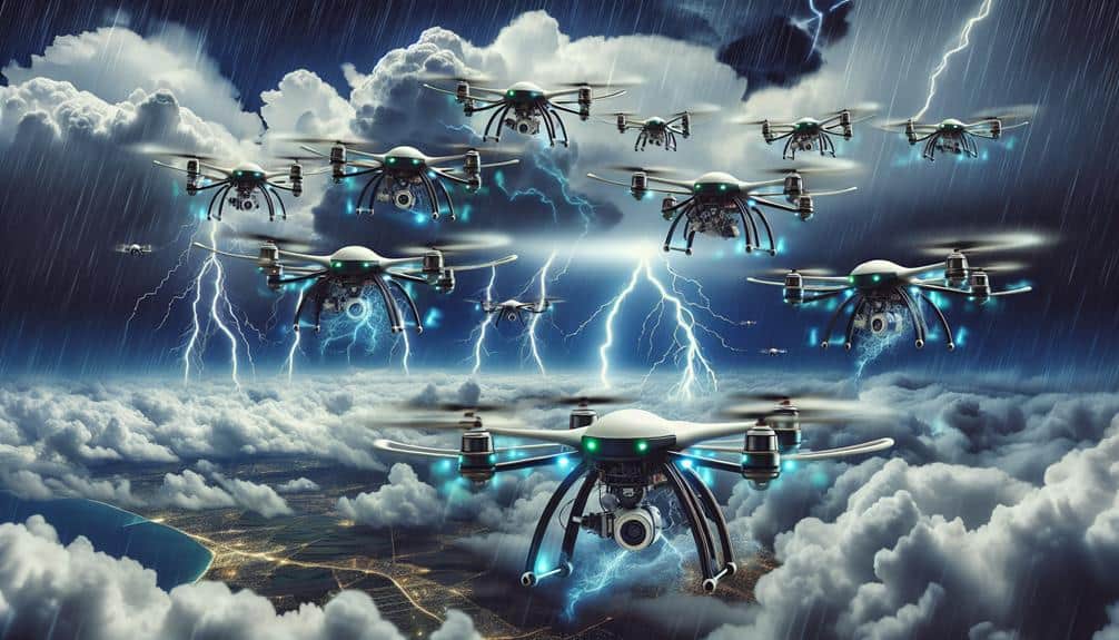
We harness drones' advanced technology to track storm movements with precision. By deploying fixed-wing and rotary-wing drones, we gather high-resolution images, wind measurements, and atmospheric samples in real time, enhancing storm tracking accuracy and safety. These drones' high-definition cameras and real-time data transmission capabilities allow us to detect minute changes in storm structure and zoom in on critical zones. Our adherence to stringent safety regulations and predictive analytics helps mitigate risks. With innovations in drone battery life and AI data analysis, we aim to revolutionize storm monitoring, offering a glimpse into more effective and efficient weather tracking solutions ahead.
Key Points
- Drones provide real-time data collection, enhancing the accuracy of storm tracking and prediction.
- Specialized drones are designed for extreme weather conditions, ensuring reliable data capture even in severe storms.
- High-resolution cameras and sensors enable detailed imagery and precise monitoring of storm structures and changes.
- Drones can measure wind speed, direction, temperature, and humidity, offering comprehensive atmospheric data.
Benefits of Drone Technology
Leveraging drone technology offers numerous advantages, including real-time data collection and enhanced storm tracking accuracy. As we deploy drones into storm systems, we achieve improved accuracy and faster response times.
These unmanned aerial vehicles (UAVs) collect critical meteorological data—such as temperature, humidity, and wind speed—at various altitudes. This granularity allows us to create more precise models, leading to better forecasts and timely warnings.
Our ability to gather data without putting human lives at risk translates to enhanced safety. Traditional storm chasing methods involve significant danger, but UAVs can operate in extreme conditions without endangering personnel. By ensuring our teams remain at a safe distance, we prioritize human life while still obtaining the necessary information.
Cost-effective monitoring is another benefit. Drones reduce the need for manned aircraft, which are expensive to operate and maintain. The lower operational costs of UAVs allow us to allocate resources more efficiently, maximizing our storm tracking capabilities without breaking the budget.
Types of Drones for Storm Chasing
When selecting drones for storm chasing, we consider various models that offer specialized capabilities to withstand extreme weather conditions and capture high-resolution data. Our focus is on maximizing storm interception and drone maneuverability, crucial for maneuvering through turbulent environments.
Fixed-wing drones, for example, provide extended flight durations and can cover larger areas, making them ideal for remote sensing and storm analysis over broad regions.
Rotary-wing drones, like quadcopters, excel in maneuverability and can hover in place, allowing for detailed examination of specific storm structures. These drones are particularly useful for capturing dynamic changes in storm intensity and structure, giving us real-time data critical for predictive modeling.
Hybrid drones, which combine the benefits of fixed-wing and rotary-wing designs, are also gaining traction. These models offer both extended range and high maneuverability, making them highly adaptable for diverse storm environments. Their dual capabilities enhance our ability to gather thorough data sets, facilitating more accurate storm analysis.
We must meticulously choose drone types based on their specific attributes to ensure robust data collection and operational efficiency. This strategic selection empowers us to harness the full potential of drone technology for storm chasing, ultimately granting us the freedom to explore and understand storm dynamics more profoundly.
Essential Drone Features
To effectively track storm movements, we need drones equipped with high-resolution cameras that can capture detailed imagery of weather patterns.
Real-time data transmission is essential for providing up-to-the-minute information, ensuring timely decision-making.
High-Resolution Cameras
High-definition cameras, capturing detailed imagery with precision, are vital for drones to effectively monitor and analyze storm movements. With high definition imaging, we can obtain detailed data on cloud formations, precipitation patterns, and wind movements. These cameras provide the clarity needed for accurate aerial surveillance, enabling us to track storm evolution in real-time and predict its path with greater precision.
By leveraging high-definition cameras, we're able to detect minute changes in the storm's structure that could indicate intensification or weakening. For instance, a camera with a resolution of 20 megapixels can capture details that are essential for meteorological analysis, such as the size and shape of storm cells. This data-driven approach ensures that our predictions aren't only timely but also scientifically robust.
Moreover, the ability to zoom in on specific areas allows us to focus on critical zones without losing the broader context. This is crucial for identifying potential hazards and issuing timely warnings to affected areas.
Essentially, high-definition cameras empower us to conduct more effective aerial surveillance, providing the freedom to make informed decisions that can save lives and property.
Real-Time Data Transmission
Real-time data transmission is an essential feature that enables drones to send live updates of storm conditions back to ground stations, ensuring timely and accurate analysis. By leveraging this capability, we can integrate satellite imagery with the drone's live feed, providing a detailed view of the storm's development and trajectory.
With real-time data transmission, drones transmit meteorological data like wind speed, humidity, and temperature instantaneously. This constant stream of information allows meteorologists to refine storm prediction models on the fly. The integration of real-time drone data with satellite imagery enhances the precision of these models, making predictions more reliable and actionable.
Our drones' ability to provide real-time updates means we can react quickly to changing storm conditions. This agility is vital for issuing timely warnings and implementing evacuation plans. The real-time data transmission also enables us to track the storm's movement and intensity in a dynamic and responsive manner, vastly improving our situational awareness.
Moreover, the use of real-time data transmission minimizes the latency between data collection and analysis, ensuring that our storm prediction efforts are both current and accurate. In an era where information speed equates to safety, this capability is essential.
Data Collection Techniques
Utilizing advanced drone technology, we collect meteorological data with precision instruments to track storm movements accurately. Our drones' maneuverability allows us to navigate through the most turbulent storm conditions, ensuring data accuracy. By penetrating dense cloud formations, we gather invaluable real-time insights that help predict storm trajectories.
To illustrate our data collection techniques, consider the following:
- High-Definition Imaging: We employ high-definition cameras and LiDAR systems to capture detailed images of cloud structures and storm formations. This visual data aids in analyzing storm intensity and development patterns.
- Wind Measurements: Our drones are equipped with anemometers and ultrasonic sensors to measure wind speed and direction at various altitudes. This data is essential for understanding storm dynamics and potential impact zones.
- Atmospheric Sampling: We use onboard sensors to collect samples of temperature, humidity, and pressure within storm systems. These atmospheric parameters are crucial for building accurate weather models.
- Spatial Mapping: By integrating GPS and GIS technology, we produce precise geospatial maps that track storm movement. This spatial data enhances our ability to predict future storm paths and issue timely warnings.
In leveraging these advanced techniques, we empower communities to make informed decisions, enhancing their freedom to prepare and respond effectively to storm threats.
Ensuring Drone Safety
While our data collection techniques provide invaluable insights, ensuring drone safety during storm tracking operations is crucial. We adhere to stringent safety regulations to minimize the inherent risks associated with volatile weather conditions. Pilots undergo rigorous training, enhancing their proficiency in handling emergency procedures and real-time risk mitigation.
Utilizing predictive analytics, we can forecast potential hazards and adjust flight paths accordingly, ensuring both drone integrity and data continuity. Our drones are equipped with fail-safe systems that automatically return to a safe location if communication is lost or battery levels drop critically.
In compliance with FAA guidelines, we maintain a no-fly zone around populated areas during storm tracking, prioritizing public safety. Regular maintenance checks are essential; every component is scrutinized for wear and tear to prevent mid-flight failures.
Emergency procedures are drilled into our team, ensuring rapid response to any unforeseen circumstances. This includes pre-defined protocols for immediate landing and real-time communication with ground control to coordinate rescue operations if necessary.
Future of Drones in Meteorology
The future of drones in meteorology promises advanced capabilities in data acquisition, leading to more accurate and timely weather forecasting models. By leveraging drone efficiency in meteorological applications, we'll be at the forefront of revolutionizing how we monitor and predict storms.
These sophisticated aerial technologies enable us to collect real-time data from previously inaccessible areas, enhancing our ability to track storm movements with unprecedented precision.
Here are four key advancements we can anticipate:
- Enhanced Data Precision: Drones equipped with high-resolution sensors will provide granular atmospheric data, improving the accuracy of weather predictions.
- Extended Operational Range: Innovations in drone battery life and energy efficiency will allow for longer missions, facilitating thorough storm monitoring over vast areas.
- Rapid Deployment: As drone technology evolves, their rapid deployment capabilities will enable meteorologists to quickly gather critical data during emergent weather events.
- AI Integration: The incorporation of artificial intelligence will streamline data analysis, allowing for faster interpretation and actionable insights.
Frequently Asked Questions
How Do Drones Communicate Their Data Back to Meteorologists?
We utilize real-time monitoring and data transmission technologies to relay drone data back to meteorologists. Drones send atmospheric measurements via satellite or cellular networks, enabling immediate analysis and informed decision-making for storm tracking and forecasting.
What Are the Legal Regulations for Flying Drones During Storms?
Remember Icarus? Safety regulations are strict for flying drones during storms. We must adhere to FAA guidelines, ensuring our drones aid emergency response without risking lives. Data-driven decisions prioritize both operational efficiency and public safety.
Can Drones Operate Effectively in Extreme Weather Conditions?
We need to evaluate drone durability and weather resistance to determine if drones can operate effectively in extreme conditions. Data shows advanced models withstand high winds and rain, but long-term operation in severe storms remains challenging.
How Do Drones Compare to Traditional Storm Tracking Methods in Terms of Accuracy?
In analyzing the current question, we find drones offer superior data comparison and precision. By integrating advanced technology, they enhance storm tracking efficiency, outperforming traditional methods. This innovation empowers us with accurate, real-time information for greater freedom and preparedness.
What Training Is Required for Operators Using Drones in Storm Tracking?
Did you know 70% of storm tracking enhancements are due to drones? To guarantee drone safety, operators need extensive meteorological knowledge and hands-on training. We must master weather patterns and emergency protocols to achieve peak accuracy and freedom.

