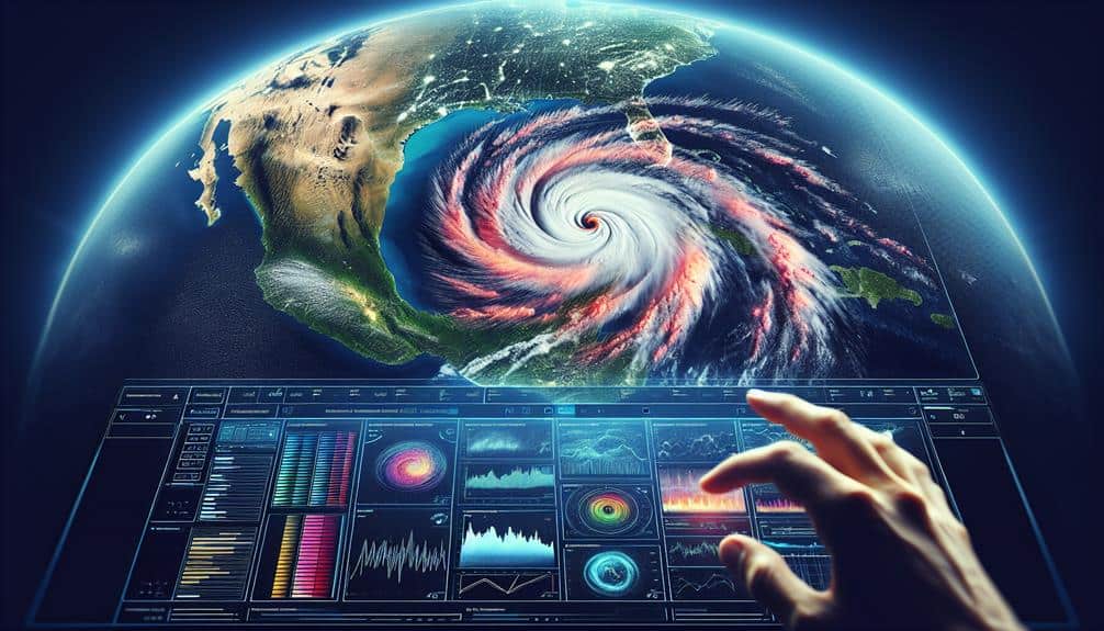
We can effectively track storm paths using advanced satellite imagery tools. NOAA Weather Radar uses Doppler technology to provide a dynamic, real-time view of weather patterns. GOES Satellite Imagery offers high-resolution, continuous monitoring of cloud formations and temperature gradients. Windy.com enhances this data with an interactive platform for visualizing wind speeds and precipitation in real-time. NASA's Worldview Tool allows customizable overlays and detailed examination of geographic areas. EUMETSAT provides extensive, high-quality satellite data for precise storm path tracking. Together, these tools guarantee accurate and timely weather predictions; let's explore how each one contributes to storm monitoring.
Key Points
- NOAA Weather Radar: Utilizes Doppler radar for real-time precipitation velocity and direction, essential for predicting severe weather events.
- GOES Satellite Imagery: Provides high-resolution, continuous monitoring with geostationary satellites, detecting minute atmospheric changes critical for storm forecasting.
- Windy.com Visualization: Offers an interactive platform combining multiple data sources to visualize storm paths and real-time wind and precipitation data.
- NASA Worldview Tool: Allows real-time and historical satellite imagery with customizable layers, enabling detailed examination of specific geographic areas.
NOAA Weather Radar
NOAA weather radar provides crucial real-time data that helps us track and predict storm paths with high accuracy. By utilizing Doppler radar technology, we can measure the velocity and direction of precipitation, offering insights into storm development and movement. This capability is necessary for effective weather prediction and storm tracking, as it allows us to anticipate severe weather events and take timely protective measures.
The radar system works by emitting pulses of microwave energy that bounce off precipitation particles. By analyzing the returned signals, we can determine the location, intensity, and velocity of the storm. This data is continuously updated, giving us a dynamic, real-time view of evolving weather patterns.
For those of us who value freedom, having access to accurate weather prediction tools is essential. We can plan our activities, whether it's sailing, hiking, or simply commuting, with greater confidence and safety. NOAA weather radar empowers us to make informed decisions, avoiding hazardous conditions and protecting our well-being.
GOES Satellite Imagery
Leveraging advanced technology, GOES satellite imagery provides extensive and continuous monitoring of storm systems from space. This system, part of the Geostationary Operational Environmental Satellites (GOES) series, is essential for real-time storm detection and satellite tracking. By maintaining a geostationary orbit, GOES satellites offer a constant view of the same region, allowing us to observe the development and progression of storm systems with unmatched detail.
GOES satellites employ advanced sensors to capture high-resolution images in multiple spectral bands, including visible, infrared, and water vapor channels. These capabilities enable us to detect minute changes in cloud formations, temperature gradients, and moisture levels, which are necessary for accurate storm detection. The real-time data collected is critical in forecasting severe weather events, issuing timely warnings, and mitigating potential damages.
Moreover, GOES satellite tracking facilitates the monitoring of storm paths over vast geographical areas. By continuously updating imagery, we can analyze storm intensity, speed, and direction. This dynamic tracking is essential for emergency preparedness and response.
The precision and reliability of GOES satellite imagery make it an indispensable tool for meteorologists and emergency management teams, providing the freedom to make informed decisions and safeguard communities effectively.
Windy.com Visualization
Complementing the high-resolution data from GOES satellites, Windy.com offers an intuitive and interactive platform for visualizing storm paths and weather patterns in real time. By integrating various datasets, including satellite data analysis, Windy.com enhances our storm tracking techniques, allowing us to stay ahead of severe weather events.
Windy.com provides a dynamic map interface that displays real-time data on wind speeds, precipitation, and other critical meteorological parameters. Users can manipulate layers, zoom into specific regions, and view animated models of storm developments. This level of interactivity enables us to analyze satellite data effectively, translating raw information into actionable insights.
One standout feature of Windy.com is its ability to superimpose multiple data sources, such as radar imagery and global forecast models, on a single map. This multifaceted approach enhances our ability to predict storm trajectories with greater accuracy.
Moreover, real-time alerts and notifications guarantee that we're promptly aware of any changes in storm conditions, giving us the freedom to act swiftly and decisively.
NASA Worldview Tool
The NASA Worldview tool offers a sophisticated platform for accessing and analyzing real-time satellite imagery, enabling us to track storm paths with high precision. It leverages cutting-edge satellite tracking technology to provide thorough weather analysis and global coverage. As a result, we can make accurate storm predictions by observing the latest satellite data.
With NASA Worldview, we gain access to a multitude of features:
- Real-Time Data: Offers near real-time satellite imagery, guaranteeing we're always up-to-date with the latest weather conditions.
- Customizable Layers: Allows us to overlay various data types, such as cloud cover, precipitation rates, and surface temperatures, providing a holistic view of weather patterns.
- Interactive Maps: Facilitates detailed examination of specific geographic areas, enabling precise storm path tracking.
- Historical Data: Provides access to archived satellite imagery, allowing us to analyze past storm events for better future predictions.
EUMETSAT Data Access
EUMETSAT provides us with extensive satellite data that enhances our ability to track storm paths across Europe with exceptional accuracy. Leveraging state-of-the-art technology, EUMETSAT guarantees that the data quality we receive is unparalleled, allowing us to make informed decisions and precise predictions.
The satellite tracking accuracy offered by EUMETSAT is pivotal in monitoring storm developments in real-time. Their data streams include high-resolution imagery, meteorological observations, and environmental data, which are essential for analyzing storm behavior and movement. By accessing this detailed dataset, we can pinpoint storm locations, predict their trajectories, and anticipate potential impacts with remarkable precision.
EUMETSAT's data access is designed to be user-friendly, enabling us to retrieve and utilize the necessary information efficiently. The organization also provides various tools and platforms to facilitate seamless data integration into our tracking systems. This capability guarantees that we can react swiftly to emerging weather threats, thereby enhancing our preparedness and response strategies.
Frequently Asked Questions
How Do Satellite Images Differentiate Between Different Types of Storms?
Using satellite technology, we differentiate storm types through storm classification by analyzing weather patterns. Image analysis techniques identify specific features, such as cloud formations and temperature variations, helping us accurately classify different storms.
What Are the Limitations of Using Satellite Imagery for Tracking Storm Paths?
We recognize the limitations of satellite imagery, such as forecast accuracy affected by technology limitations and data interpretation challenges. Atmospheric conditions can skew results, requiring constant updates and expert analysis to maintain reliable storm path predictions.
How Often Are Satellite Images Updated for Storm Tracking Purposes?
Imagine a symphony of data, constantly playing. We often see satellite images updated every 10-15 minutes. This high frequency of updates guarantees the accuracy of data, giving us the freedom to make informed decisions swiftly.
Are There Any Mobile Apps Available for Real-Time Storm Tracking Using Satellite Data?
Yes, there are mobile apps providing real-time storm tracking using satellite data. These apps offer accurate storm alerts and notifications, ensuring we stay informed. Mobile app accuracy greatly enhances our ability to prepare and respond effectively.
How Can Satellite Imagery Data Be Integrated Into Emergency Planning and Response Systems?
We can improve emergency response by integrating satellite imagery data into our planning systems. The integration benefits include real-time updates, precise analytics, and enhanced situational awareness, empowering us to act swiftly and efficiently during crises.

