We analyze storm trajectories using advanced tools like Doppler radar, satellites, and computer models to enhance weather prediction accuracy. By integrating ground-based observations and remote sensing data, we refine predictive models that forecast storm paths and intensity. Airborne reconnaissance provides vital in-situ measurements, while machine learning algorithms detect recurring patterns to predict storm movement. Effective storm chasing, supported by GPS tracking and real-time communication, enables high-resolution data collection and guarantees safety. Understanding these methodologies and tools can greatly enhance our storm tracking capabilities and predictive accuracy, revealing more about the future of weather forecasting.
Key Points
- Understanding storm trajectories improves predictive models and informs accurate forecasts for landfall and storm intensity.
- Tools like Doppler radar, satellites, and computer models track and predict storm paths effectively.
- Data collection from ground-based observations, satellites, and airborne missions provides comprehensive storm information.
- Machine learning algorithms analyze integrated satellite and radar data to detect storm patterns and predict trajectories.
Importance of Storm Trajectories
Understanding storm trajectories is fundamental as it allows us to predict their paths with greater accuracy, thus reducing potential risks to life and property. When we analyze storm behavior, we can gather vital data that informs our predictive models. These models assist in forecasting outcomes such as where a storm is likely to make landfall and its potential intensity. By doing so, we can provide communities with more time to prepare.
Emergency preparedness is directly linked to our ability to anticipate storm trajectories. Accurate predictions enable local authorities to develop effective evacuation planning, ensuring that residents can move to safety well before a storm hits. This isn't just about saving lives; it's about preserving the freedom to act proactively rather than reactively.
Our analytical approach necessitates combining historical data with real-time observations to comprehend patterns in storm behavior. This data-driven method enhances our forecasting capabilities, making it possible to issue timely warnings. Hence, the significance of understanding storm trajectories can't be emphasized enough. It empowers individuals and communities to take the necessary precautions, reducing the devastation caused by extreme weather events and safeguarding our collective well-being.
Tools for Tracking Storms
Advanced meteorological tools, including Doppler radar, satellites, and computer models, enable us to track storm trajectories with remarkable accuracy. Using radar technology, we can measure precipitation intensity, wind speed, and direction within storms. This real-time data helps us predict the storm's path and potential impact areas.
Doppler radar, in particular, provides detailed velocity data, allowing us to identify rotation within severe thunderstorms, which is essential for tornado warnings.
Satellite imagery offers a panoramic view from space, capturing the storm's structure and movement over vast areas. High-definition images allow us to analyze cloud formations, temperature variations, and moisture content. This data is essential for tracking hurricanes and large-scale weather systems, giving us the ability to see their development and predict landfall with greater precision.
Computer models integrate this radar and satellite data, employing algorithms to simulate storm behavior. These models can forecast storm trajectories days in advance, enhancing our preparedness and response strategies.
Data Collection Methods
We gather storm data through a combination of ground-based observations, airborne reconnaissance, and remote sensing technologies to ensure thorough analysis. By employing radar technology, we can obtain real-time information on storm structures and their movements. Doppler radar systems provide us with cross-sectional views of storm cells, allowing us to measure wind speeds, rainfall intensity, and potential hail size. This data is essential for immediate decision-making and long-term research.
Remote sensing plays a vital role in our data collection strategy. Satellites equipped with advanced sensors capture high-resolution images and thermal readings of storm systems from space. These images help us track storm development over large areas, especially in regions where ground-based equipment is sparse or non-existent. By analyzing infrared and visible light spectra, we can determine cloud formations, storm intensity, and even predict potential paths.
Airborne reconnaissance missions further enhance our data accuracy. Specialized aircraft equipped with weather instruments fly into storm systems to gather in-situ measurements. These missions provide us with important data on pressure, temperature, and humidity levels within the storm, offering a three-dimensional perspective that complements our ground and satellite observations.
Analyzing Storm Patterns
By leveraging extensive datasets from various sources, we can identify recurring storm patterns and predict their future trajectories with greater accuracy. Our analysis hinges on understanding the mechanisms behind storm movement, which involves complex interactions between atmospheric conditions, geographical features, and oceanic influences. Utilizing advanced computational models, we can dissect these interactions and derive actionable insights.
To systematically analyze weather patterns and storm movement, we focus on the following key steps:
- Data Integration: Combining satellite imagery, ground-based radar, and historical weather data to create a all-inclusive dataset.
- Pattern Recognition: Applying machine learning algorithms to detect recurring weather patterns that precede storm formation and movement.
- Trajectory Prediction: Using predictive analytics to forecast the path and intensity of storms based on identified patterns.
- Validation: Cross-referencing our predictions with real-time data to refine our models and improve accuracy.
Case Studies of Storm Chasing
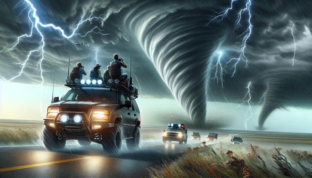
Storm chasing offers a unique opportunity to gather real-time data, providing valuable insights into storm dynamics and validating our predictive models. Our case studies reveal how varying chase strategies impact the quality and scope of data collected.
For instance, in the Tornado Alley expedition, we employed a multi-vehicle approach to maximize coverage. This allowed us to capture high-resolution data on storm encounters, enhancing our understanding of tornado genesis and progression.
Chase strategies are pivotal in ensuring both data integrity and researcher safety. We must balance the adrenaline rush of close encounters with stringent safety precautions. During the Supercell Initiative, we implemented GPS tracking and real-time communication to coordinate vehicle positions, minimizing risks while maximizing observational opportunities.
These precautions were particularly effective during our intercept of an EF3 tornado, where real-time data from Doppler radar and visual observations were seamlessly integrated.
Our experiences underscore the importance of adaptive strategies. For example, the Dynamic Response Team adapted routes based on evolving storm conditions, leading to critical breakthroughs in storm structure analysis.
These case studies demonstrate that effective storm chasing is a blend of rigorous planning, real-time adaptability, and a relentless pursuit of data, always within the bounds of safety.
Future of Storm Tracking
Building on our storm chasing experiences, the future of storm tracking will increasingly rely on advanced technologies and predictive analytics to enhance our understanding and response to severe weather events. As storm chasers, we recognize the transformative potential of these developments. Technological advancements are enabling more accurate predictive modeling, which can forecast storm trajectories with greater precision.
Here are key areas where we see significant progress:
- Predictive Modeling: Leveraging AI and machine learning to analyze historical data, enabling us to predict storm paths more precisely.
- Real-Time Monitoring: Using satellites, drones, and ground-based sensors to provide up-to-the-minute data, improving situational awareness.
- Emergency Response: Enhancing communication networks to deliver timely warnings and coordinate responses more efficiently.
- Data Integration: Combining data from various sources to form a thorough picture, aiding in more informed decision-making.
These innovations will grant us the freedom to better anticipate and respond to severe weather, potentially saving lives and reducing damage.
Frequently Asked Questions
How Do Storm Chasers Ensure Their Safety During Severe Weather Events?
We prioritize our safety by adhering to strict safety protocols, using GPS tracking and communication devices. We constantly monitor storm data and have emergency shelters mapped out, ensuring swift action if conditions worsen.
What Qualifications Are Required to Become a Professional Storm Chaser?
To be professional storm chasers, we need rigorous training requirements, extensive experience, and necessary certifications. Equipment essentials include radar, GPS, and safety gear. Meeting these guarantees we stay safe while collecting valuable data during severe weather events.
How Do Insurance Policies Cover Storm Chasing Activities and Equipment?
Isn't it ironic that while we chase storms for the thrill, insurance coverage focuses on the risks? Our equipment protection policies must account for high-risk activities, ensuring our gear's safety in extreme conditions.
What Are the Psychological Impacts of Storm Chasing on Researchers?
The psychological impacts of storm chasing on researchers include mental health challenges and stress management issues. However, we develop emotional resilience and utilize coping strategies, which enhance our ability to handle intense situations effectively.
How Do Storm Chasers Communicate and Coordinate With Local Authorities?
We adhere to emergency response protocols, utilizing real-time data to communicate with local authorities. Our coordination involves standardized communication protocols, ensuring timely updates and efficient information flow to safeguard both researchers and the public.

