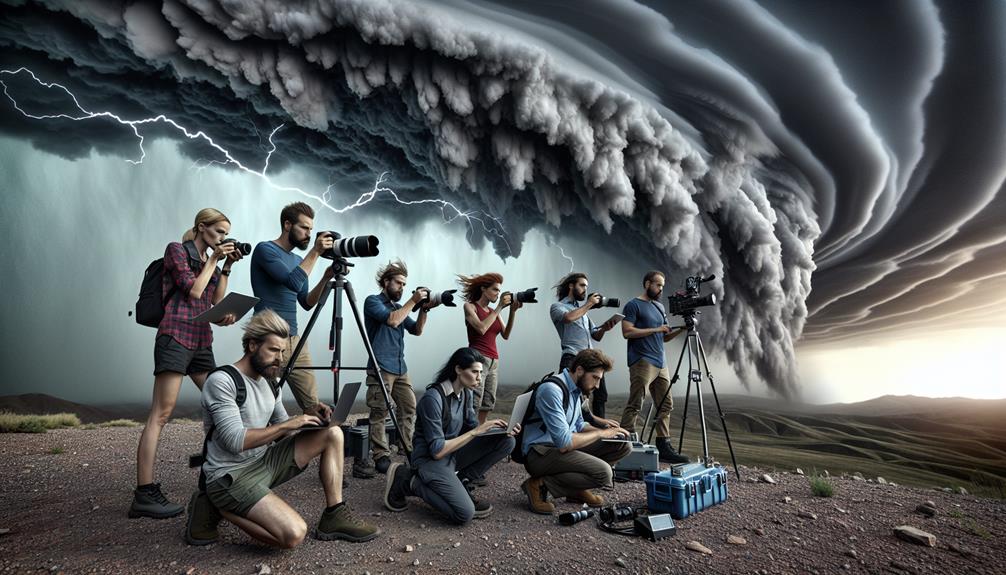
Tracking storms in rugged terrain requires sturdy, well-maintained gear and mastery of advanced weather tools. We rely on high-definition satellite imagery and Doppler radar for accurate storm data, while topographic maps and GPS systems guide us across challenging landscapes. Steep inclines, dense vegetation, and water crossings test our navigation skills, making traditional map and compass techniques vital. Emergency communication devices like satellite phones are essential for safety. By analyzing meteorological models and radar images, we predict storm behavior and make informed decisions in real-time. For a detailed understanding of storm chasing in harsh environments, there's much more to grasp.
Key Points
- Utilize advanced GPS systems and topographic maps for accurate navigation in rough terrain.
- Equip with reliable communication tools like satellite phones and two-way radios for emergency contact.
- Regularly inspect and maintain all gear to ensure reliability during storm tracking.
- Analyze high-resolution satellite imagery and Doppler radar to predict storm paths and behavior.
Choosing the Right Gear
Selecting the appropriate gear is necessary for storm chasers, as it directly influences our ability to navigate and gather data in challenging environments. Our gear must be robust, reliable, and meticulously maintained to ensure operational efficiency. Gear maintenance isn't just a routine; it's an important safety measure. Regular inspections of our equipment, such as cameras, anemometers, and GPS devices, prevent malfunctions during crucial moments.
We also need to prioritize emergency communication tools. Reliable two-way radios and satellite phones are indispensable, providing us with real-time updates and the ability to call for help if necessary. These tools guarantee that we remain connected, even when cellular networks fail.
Storm shelters are another crucial component. Portable storm shelters offer a quick refuge from hazardous conditions, allowing us to continue our work without compromising safety. Compact yet durable, these shelters should be easy to deploy.
Effective navigation skills are fundamental to our success. Advanced GPS systems, coupled with topographic maps, help us chart the safest and most efficient routes. Proficiency with these tools enables us to maneuver through unpredictable terrains while minimizing risks.
Understanding Terrain Challenges
Traversing rough terrain demands an in-depth understanding of geological features, topographical variations, and environmental hazards that could impact our storm tracking efforts. When we chase storms in challenging landscapes, we must anticipate and adapt to the complexities of the terrain. Accurate navigation relies on our ability to interpret topographic maps, identify obstacles, and plan our routes effectively.
Elevation changes notably affect our movement and visibility. It's pivotal to analyze elevation profiles to predict how terrain will influence storm paths and our ability to follow them. We need to be prepared for:
- Steep inclines and declines: These can slow down our progress and increase the risk of vehicle instability.
- Water crossings: Unpredictable stream and river levels can create barriers that impede our routes.
- Dense vegetation: This can obscure our view and make navigation more challenging.
Advanced Weather Tools
In today's storm chasing landscape, utilizing advanced weather tools is vital for accurately predicting storm behavior and making informed decisions in real-time. Leveraging high-resolution satellite imagery improves our forecast accuracy by providing detailed views of storm systems from space. These satellite images allow us to track cloud formations, wind patterns, and precipitation levels, granting us unparalleled insights into storm development and movement.
Radar technology is another crucial component in our toolkit. Modern Doppler radar systems offer precise data on storm intensity, speed, and direction. By analyzing radar returns, we can identify storm cells, measure their velocity, and predict their future path with remarkable precision. This information is essential for timely storm prediction and for planning our routes through rough terrain.
Incorporating these advanced tools into our storm-chasing strategy not only enhances our ability to forecast storms but also guarantees we can navigate complex landscapes safely and effectively. By combining satellite imagery with radar data, we create a detailed picture of the storm environment, allowing for data-driven decision-making. This approach maximizes our operational efficiency and enriches our overall storm chasing experience, providing us the freedom to explore and document nature's most powerful phenomena.
Safety Precautions in Remote Areas
Exploring remote regions requires meticulous planning and a thorough comprehension of the potential dangers to guarantee our safety during storm chasing expeditions. Let's dig into key precautions we must take:
- Emergency Communication: Reliable communication systems are crucial. We need satellite phones and GPS devices to maintain contact with emergency services and team members. Redundancy in our communication setup ensures we aren't left without assistance.
- Survival Skills: Proficiency in fundamental survival skills is essential. Knowing how to ignite a fire, purify water, and construct a shelter can be life-preserving. We should also carry a well-equipped first aid kit tailored to the specific risks of storm-chasing in remote regions.
- Wildlife Encounters and Navigation Techniques: Remote areas often entail wildlife encounters. We must comprehend the local fauna and carry deterrents if necessary. Mastering navigation techniques, including traditional map and compass skills, ensures we can find our way even when electronic devices fail.
Analyzing Storm Data
Having established our safety protocols, we now turn our attention to the detailed process of analyzing storm data, which involves scrutinizing meteorological models, radar images, and satellite data to predict storm behavior accurately.
Our first step is data interpretation. We examine storm patterns, identifying key features such as wind speed, pressure gradients, and precipitation rates. This allows us to forecast the storm's path and intensity, essential for making informed decisions in the field.
Remote monitoring plays a pivotal role in our analysis. Using advanced satellite technology, we receive real-time data, providing a thorough view of the storm's development and movement. Satellite imagery helps us detect changes in cloud formation, temperature anomalies, and moisture levels, which are vital for understanding the storm's dynamics.
Radar images complement our satellite data by offering high-resolution snapshots of precipitation and storm cell movement. By integrating these data sources, we create a multi-dimensional model of the storm, enhancing our predictive accuracy.
This rigorous analytical process empowers us to act with precision and confidence, ensuring we're always one step ahead of the storm, ready to adapt to its unpredictable nature while embracing the freedom of the chase.
Frequently Asked Questions
How Do I Find Local Guides Experienced in Storm Tracking?
We can find local guides skilled in storm tracking by consulting local resources and verifying their expertise and equipment requirements. They should prioritize safety precautions to guarantee our freedom to experience storms without undue risk.
What Are the Best Times of Year for Storm Chasing?
We should chase storms mainly from late spring to early summer when weather patterns are most active. Let's prioritize safety precautions, use reliable storm chasing equipment, and follow photography tips for capturing best, data-driven images.
Can I Join Storm Chasing Tours With Professionals?
We can join storm chasing tours with professionals. These experts prioritize safety precautions and provide us with gear essentials. Their data-driven approach guarantees we experience the thrill of storm chasing while minimizing risks and maximizing freedom.
How Do I Fund a Storm Chasing Expedition?
How do we fund a storm chasing expedition? Imagine the thrill! We start with detailed budget planning, considering equipment costs. Next, explore fundraising ideas and sponsorship opportunities to secure the necessary funds. Let's make it happen!
What Are Legal Considerations for Storm Chasing in Different Regions?
When storm chasing, we must assess liability risks and implement safety measures. We need to verify permission requirements and avoid restricted areas to secure compliance. Detailed planning and adherence to regulations maximize our freedom and safety.

