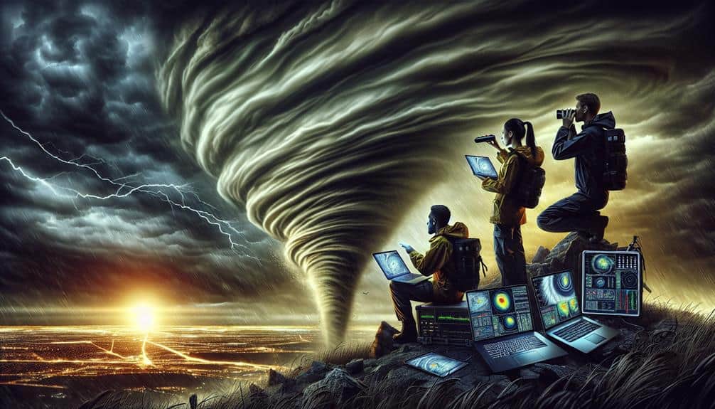
We focus on key cloud formations like cumulonimbus, supercell, shelf, wall, mammatus, and anvil clouds for precise storm tracking. Cumulonimbus clouds indicate vertical growth and lightning potential; supercells feature rotating updrafts, driven by wind shear. Shelf clouds at thunderstorms' leading edges and wall clouds indicate mesocyclone strength. Mammatus clouds highlight turbulence and instability, while anvil clouds indicate strong updrafts reaching the tropopause. Each cloud type offers critical insights into atmospheric conditions, enhancing our ability to predict severe weather. Understanding these formations can markedly improve our storm tracking and forecasting abilities. Discover more about their roles in weather prediction.
Key Points
- Cumulonimbus Clouds are primary drivers of severe weather and indicate potential for thunderstorms and lightning.
- Supercell Clouds have rotating updrafts and are crucial for identifying and tracking severe storms.
- Shelf Clouds are seen at the leading edge of thunderstorms and signal powerful storm systems.
- Wall Clouds form in the updraft region of thunderstorms and indicate the strengthening of mesocyclones.
Cumulonimbus Clouds
Why do cumulonimbus clouds play such an important role in storm tracking?
These towering giants are vital because they're the primary drivers of severe weather phenomena, including lightning formation and storm development. When we observe cumulonimbus clouds, we're essentially witnessing the atmosphere's most dynamic processes at work. Their vertical growth is a key indicator of their potential to produce severe weather, including intense precipitation and thunderstorms.
Data shows that as cumulonimbus clouds develop, their vertical extent can reach heights of up to 12 kilometers.
This vertical growth doesn't just signify the cloud's grandeur; it directly correlates with the intensity of the storms they produce. The more robust the upward motion, the more likely the cloud will generate significant precipitation and powerful lightning.
Lightning formation within these clouds is primarily due to the interaction of ice crystals, supercooled water droplets, and updrafts. These interactions create electrical charges, leading to the discharge we observe as lightning.
Supercell Clouds
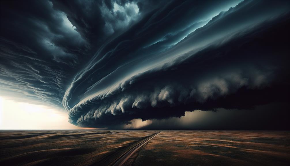
Supercell clouds are characterized by a persistent, rotating updraft known as a mesocyclone. They exhibit a distinct anvil-shaped cloud formation that typically spreads out at the storm's top. These clouds are important indicators of severe weather, often associated with large hail and tornadoes.
Rotating Updraft Dynamics
Supercell clouds, characterized by their rotating updrafts, are the most severe type of thunderstorm and play an essential role in storm tracking and prediction. The dynamics of rotating updrafts, or mesocyclones, are driven by wind shear effects and cloud rotation. Wind shear, the variation of wind speed and direction with altitude, induces horizontal vorticity. When this horizontal vorticity tilts into the vertical due to an updraft, it initiates cloud rotation.
The development of supercell storms hinges on atmospheric instability. Warm, moist air at the surface and cooler, drier air aloft create a buoyant environment conducive to powerful updrafts. This instability, combined with sufficient wind shear, supports the prolonged and organized nature of supercells.
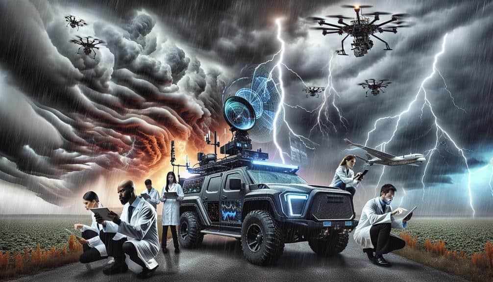
Our ability to track these storms depends heavily on understanding the interplay between wind shear and storm development. Enhanced radar technology allows us to observe the internal structure of supercells, particularly the rotating updrafts, providing vital data for predicting severe weather events.
Anvil Cloud Formation
Understanding the dynamics of rotating updrafts sets the stage for examining the formation of anvil clouds within supercell structures. Anvil clouds, or cumulonimbus incus, signify the mature phase of storm development. Their formation hinges on atmospheric instability, where warm, moist air rapidly ascends and cools, creating a towering cloud mass. As the updraft reaches the tropopause, it spreads horizontally, forming the characteristic anvil shape.
We observe that the anvil cloud's flat, expansive top is due to the temperature inversion layer at the tropopause, which halts further vertical growth. This feature is critical for storm tracking as it indicates a highly organized storm system. Anvil cloud characteristics, such as their extensive horizontal reach and well-defined edges, help us predict the storm's potential severity and trajectory.
Data shows that supercells with prominent anvil clouds often lead to significant weather events. Monitoring these formations allows us to anticipate not just the immediate storm, but also its potential for severe weather.
Hail and Tornado Indicators
As we explore hail and tornado indicators within supercell clouds, we recognize the pivotal role that mesocyclones and wall clouds play in forecasting severe weather events.
Mesocyclones, which are rotating updrafts within supercells, serve as essential harbingers for potential tornado formation. The presence of a mesocyclone can indicate a highly unstable atmospheric condition, ripe for tornado genesis.
Wall clouds, typically found below the rain-free base of supercells, provide further evidence of such volatility. These formations often precede tornado development by minutes to hours, offering a significant window for storm tracking.
When it comes to hail, the intense updrafts within supercells are key. These updrafts suspend water droplets at high altitudes, allowing them to freeze and accumulate layers of ice before gravity forces them down as hailstones.
The larger the hail, the stronger the updraft, and consequently, the more severe the weather conditions.
Shelf Clouds
Shelf clouds, characterized by their dramatic, horizontal formations, often indicate the presence of a powerful storm system. These low, wedge-shaped clouds are typically seen at the leading edge of a thunderstorm. When we observe a shelf cloud, we often see it as a precursor to severe weather conditions such as high winds, heavy rain, and even potential tornadoes.
Shelf clouds form due to the interaction between the cool, downdraft air of a storm and the warmer, updraft air ahead of it. This interaction results in a visually striking boundary that's essential for storm tracking. Understanding shelf cloud characteristics aids us significantly in predicting the storm's path and intensity. Their formation usually heralds a shift in weather patterns, bringing about rapid temperature drops and gusty winds.
For those of us dedicated to storm tracking, recognizing these clouds is vital. They serve as visual indicators, allowing us to anticipate and prepare for sudden weather changes.
Wall Clouds
Wall clouds, with their distinct, lowering formations beneath the main storm cloud, often signal the potential for severe weather, including tornadoes. These clouds form in the updraft region of a thunderstorm, where warm, moist air is drawn upwards, causing condensation and the subsequent lowering of the cloud base. The presence of a wall cloud can indicate the mesocyclone's strengthening, a precursor to tornado formation.
For storm chasers, wall clouds present thrilling photography opportunities due to their dramatic and often ominous appearance. However, prioritizing safety precautions while storm chasing is crucial. The close proximity needed to capture these formations can place us in the path of extreme weather conditions, including heavy rainfall, hail, and high winds.
Clear identification of wall clouds can aid in storm tracking and timely warnings. These formations typically rotate and exhibit a pronounced lowering from the main cloud base, distinguishing them from other cloud types. By understanding the dynamics of wall clouds, we can better anticipate the storm's behavior and make informed decisions about positioning and movement.
Ultimately, knowledge and respect for these powerful natural phenomena allow us to safely pursue our passion for storm chasing.
Mammatus Clouds

Mammatus clouds, characterized by their distinctive pouch-like protrusions hanging from the cloud base, often signal the presence of severe turbulence and instability within a storm system. These formations occur as a result of intense downdrafts of cold air descending into warmer air. Typically, mammatus clouds form beneath cumulonimbus clouds, making them critical indicators for storm warnings.
Their unique appearance not only serves as a warning but also presents amazing weather photography opportunities. Documenting these clouds can be as thrilling as it's informative. Mammatus clouds are particularly fascinating during sunset when the light enhances their dramatic structure.
Here are four key points to keep in mind:
- Formation Process: Mammatus cloud formation involves cold air downdrafts mixing with warmer air, resulting in the characteristic pouch-like structures.
- Storm Significance: They indicate severe atmospheric instability and are often precursors to extreme weather events, such as thunderstorms or tornadoes.
- Photographic Potential: The mammatus cloud appearance, especially during the golden hour, provides stunning visuals for weather enthusiasts and professional photographers.
- Safety Implications: Recognizing these clouds can serve as an early storm warning, allowing individuals to take necessary precautions against potential severe weather.
Anvil Clouds
Let's examine anvil clouds. These clouds form when rising air in a thunderstorm reaches the tropopause and spreads out horizontally. Anvil clouds often indicate the presence of strong updrafts and can signal the development of severe weather patterns. By analyzing their structure and behavior, we can enhance our ability to predict severe storms accurately.
Formation and Structure
Often observed at the top of severe thunderstorms, anvil clouds form when powerful updrafts reach the stable layer of the stratosphere, spreading out horizontally to create their distinctive flat, expansive shape. In meteorology studies, this cloud classification is essential for understanding atmospheric dynamics and storm formation. Anvil clouds, also known as cumulonimbus incus, signify the mature stage of a thunderstorm, where the storm's vertical development is capped by the stratosphere's stability.
By studying these clouds, we gain insights into the intensity and potential duration of severe weather events. Their formation isn't random; it's driven by the following factors:
- Updraft Strength: Strong updrafts, which are vertical columns of rising air, propel moisture and energy upwards until they hit the stable stratosphere.
- Temperature Inversions: The stratosphere's temperature inversion creates a barrier that forces the cloud to spread horizontally.
- Shear Forces: Wind shear, the change in wind speed and direction with altitude, can influence the shape and extent of the anvil cloud.
- Moisture Availability: Adequate atmospheric moisture is essential to sustain the cloud's expansive structure.
Understanding these components helps us track storms more accurately, enhancing our ability to predict severe weather and maintain our freedom to plan and act accordingly.
Weather Patterns Indication
Anvil clouds, with their expansive horizontal spread, serve as critical indicators of weather patterns, revealing the presence and potential severity of convective storm systems. These cumulonimbus incus formations often result from updrafts that reach the tropopause, where they stabilize and spread laterally. By observing anvil clouds, we can infer essential meteorological variables such as lightning patterns and wind direction, which are pivotal for storm tracking.
When anvil clouds appear, they often signify high atmospheric instability. The associated lightning patterns provide data on storm intensity and electrical activity, helping us predict potential impacts on ground infrastructure. Additionally, the direction and shape of the anvil can reveal wind direction at higher altitudes, offering insights into broader atmospheric circulations. Simultaneously, we must assess atmospheric pressure and humidity levels, as these factors influence cloud formation and storm development.
Predicting Severe Storms
Predicting severe storms necessitates closely monitoring anvil clouds, as these formations provide critical data on storm development and potential escalation. These distinctive cloud tops, shaped like anvils, indicate vigorous convection within thunderstorms. By analyzing anvil clouds, we can assess storm severity and better understand atmospheric conditions that contribute to severe weather.
Anvil clouds form when strong updrafts push moist air to the stratosphere, where it spreads out horizontally due to temperature inversion. Here's why they matter:
- Indication of Storm Maturity: Anvil clouds signify that a storm has reached a mature stage, which often correlates with increased intensity and potential for severe weather events such as hail, tornadoes, and heavy rainfall.
- Wind Shear Analysis: The direction and spread of anvil clouds help us determine wind shear at different atmospheric levels. Strong wind shear can enhance storm severity by tilting storm cells and promoting rotation.
- Temperature Gradients: By measuring temperature gradients at the anvil level, we gain insights into atmospheric instability, a key factor in storm development.
- Radar and Satellite Correlation: Anvil cloud observations, combined with radar and satellite data, provide a thorough view of storm structure and trajectory, aiding in accurate storm tracking.
Frequently Asked Questions
How Do Meteorologists Measure the Altitude of Clouds?
We measure cloud altitude using weather balloons for direct data and radar technology for precision. Cloud tracking becomes efficient with these methods, providing accurate altitude measurement critical for predicting weather patterns and ensuring our freedom from unexpected storms.
What Tools Are Used to Track Cloud Movements?
We utilize radar technology and weather balloons to track cloud movements. Radar provides precise data on precipitation and cloud structure, while weather balloons measure atmospheric conditions, ensuring we accurately predict weather patterns and maintain our freedom to plan ahead.
Can Satellite Imagery Detect All Types of Storm Clouds?
Satellite technology, achieving 85% accuracy in storm prediction, can't detect all types of storm clouds. However, it's essential for weather forecasting by enhancing our cloud identification capabilities, ensuring we stay prepared and free from unexpected weather disruptions.
Are Certain Cloud Formations More Common in Specific Regions?
Yes, regional differences influence cloud formations. Certain cloud types are more prevalent in specific areas, aiding storm prediction. For example, cumulonimbus clouds in tropical regions often signal thunderstorms, while stratocumulus clouds are common in temperate zones.
How Do Different Cloud Types Affect Aviation Safety?
We analyze how different cloud types impact aviation safety by examining weather patterns and turbulence, visibility and precipitation. Turbulent cumulonimbus clouds pose significant threats, while stratus clouds affect visibility. Accurate data drives our strategies for safe aviation.