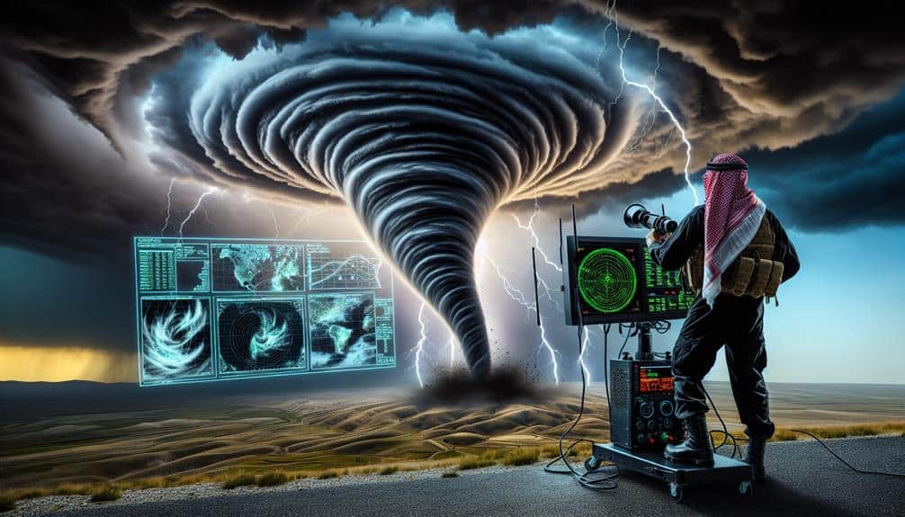
We've harnessed the power of Doppler radar, a cornerstone of modern meteorology, to elevate storm chasing to a science fueled by precision and real-time data. Using the Doppler effect, our radar systems measure phase shifts and frequency changes to detect storm movement and intensity. Pulse-Doppler, continuous-wave, and dual-polarization radars each serve specific roles, from pinpointing weather patterns to distinguishing precipitation types. This not only boosts safety by tracking storm paths and speeds but also guarantees accurate communication with emergency services. By mastering these advanced radar techniques, we can better predict and respond to severe weather events—there's so much to explore.
Key Points
- Understand Doppler effect principles to interpret radar data accurately.
- Utilize dual-polarization radar for precise identification of precipitation types and storm severity.
- Leverage real-time velocity and reflectivity data to track storm movements and intensities.
- Interpret storm-relative motion to isolate and predict specific storm paths.
Basics of Doppler Radar
To fully grasp the basics of Doppler radar, we need to understand how it measures the velocity and movement of precipitation particles within a storm. Doppler radar principles revolve around the Doppler effect, where the frequency of radar waves changes as they bounce off moving objects. By transmitting a signal and analyzing its return, we can determine the speed and direction of precipitation particles.
Radar signal processing is a vital step in interpreting these returns. When radar waves hit precipitation, they scatter in various directions. The radar system collects these scattered signals, and through sophisticated algorithms, processes them to extract velocity data. This processing allows us to distinguish between particles moving towards or away from the radar, giving us a detailed picture of storm dynamics.
We rely on precise measurements and calculations to guarantee accuracy. The radar system measures the phase shift between transmitted and received signals, converting this data into velocity readings. This data-driven approach empowers us to predict storm movements more precisely, enhancing our freedom to make informed decisions during storm chasing activities.
Doppler radar principles and advanced radar signal processing techniques are fundamental in our quest to master storm dynamics.
How Doppler Radar Works
Understanding how Doppler radar works involves delving into the mechanics of radar wave transmission and reception, coupled with sophisticated data analysis techniques. At its core, Doppler radar technology sends out microwave signals that bounce off objects like raindrops and return to the radar device. This returned signal is then analyzed to determine both the distance and velocity of the object, utilizing the doppler effect.
The doppler effect is essential for storm tracking as it measures changes in frequency or wavelength of the returned radar waves, indicating motion towards or away from the radar. This helps us discern the speed and direction of weather patterns, critical for accurate weather predictions.
Here's a concise breakdown:
- Transmission and Reception: Radar sends out microwaves and listens for their echoes.
- Doppler Effect: Measures frequency shifts in returned waves to determine motion.
- Data Analysis: Sophisticated algorithms interpret the data for actionable insights.
- Weather Patterns: Identifies rain, snow, or hail by analyzing returned signals.
Types of Doppler Radar
When delving into the types of Doppler radar, we encounter diverse systems like pulse-Doppler, continuous-wave, and dual-polarization radar, each designed for specific meteorological applications.
Pulse-Doppler radar is a cornerstone in radar technology, emitting short bursts of energy and measuring the time it takes for the energy to return after reflecting off objects. This radar type excels at pinpointing weather patterns, such as precipitation intensity and storm velocity.
Continuous-wave radar, on the other hand, transmits a constant signal and measures the frequency shift of the returned signal. While it provides accurate velocity data, it lacks the range-finding capability of pulse-Doppler systems. This makes it less suitable for detecting distant weather events but highly effective for short-range applications.
Dual-polarization radar is a significant advancement, transmitting and receiving both horizontal and vertical waves. This enables it to differentiate between types of precipitation, such as rain, snow, and hail. By providing more detailed data on weather patterns, dual-polarization radar enhances our ability to predict severe weather events.
Interpreting Radar Data
Interpreting radar data requires a vital understanding of various radar signatures to accurately assess weather conditions and predict storm behavior. As storm chasers, we need to decipher radar echoes to gauge storm intensity, structure, and movement. By analyzing these data points, we can make informed decisions in the field.
When we look at radar data, we focus on several key elements:
- Reflectivity: This measures the amount of energy returned to the radar, indicating precipitation intensity. Higher reflectivity values usually signify heavier rainfall or hail.
- Velocity: This shows the motion of precipitation particles toward or away from the radar, allowing us to assess wind patterns and storm rotation.
- Dual-polarization: This provides information on the size and shape of precipitation particles, helping us distinguish between rain, snow, and hail.
- Storm-relative motion: This isolates the movement of the storm itself, giving us a clearer picture of storm rotation and direction.
Benefits for Storm Chasers
By leveraging Doppler radar technology, we as storm chasers gain vital insights that enhance our ability to predict and track severe weather events. This sophisticated tool provides real-time data on precipitation, wind speed, and storm rotation, enabling us to accurately identify storm cells and their trajectories. The precision in storm tracking allows us to monitor the development of tornadoes, hail, and other severe weather phenomena with unmatched accuracy.
Having access to such detailed information greatly improves our safety measures. Doppler radar allows us to determine the intensity and movement of storms, which is essential for planning our routes and positioning ourselves at safe distances. Additionally, the ability to predict sudden changes in weather patterns helps us avoid hazardous situations, thereby minimizing risks during our expeditions.
Moreover, the data-driven insights from Doppler radar facilitate better communication with emergency services and the public. By providing timely and accurate storm warnings, we can contribute to community safety and preparedness. This technology not only empowers us to pursue our passion for storm chasing but also guarantees that we do so with a heightened sense of responsibility and safety.
Advanced Radar Techniques
In exploring advanced radar techniques, we'll focus on interpreting velocity data and leveraging dual-polarity benefits. By analyzing velocity data, we can identify rotational signatures and wind speeds with greater accuracy.
Additionally, dual-polarity radar enhances our ability to distinguish between precipitation types, improving storm classification and prediction.
Velocity Data Interpretation
Velocity data interpretation in Doppler radar allows us to analyze wind speed and direction within a storm, providing essential insights for accurate storm tracking and prediction. By examining these velocity data, we can identify wind patterns that reveal the storm's structure and intensity, which is vital for making informed decisions in real-time.
When interpreting velocity data, we focus on specific radar products:
- Radial Velocity: Measures the component of the wind moving directly towards or away from the radar.
- Velocity Signatures: Identifies critical features like mesocyclones and tornado vortex signatures.
- Divergence and Convergence: Highlights areas where wind speeds are increasing or decreasing, indicating storm development.
- Shear: Detects rapid changes in wind speed and direction, often linked to severe weather phenomena.
Our goal is to decode these patterns to enhance storm tracking and improve safety. By leveraging advanced radar techniques, we gain a deeper understanding of storm dynamics, empowering us to forecast weather events more precisely.
This data-driven approach not only aids in predicting storm paths but also in mitigating potential impacts, giving us the freedom to act swiftly and effectively.
Dual-Polarity Benefits
Building on our understanding of velocity data interpretation, dual-polarity radar techniques offer a significant enhancement in identifying precipitation types, storm structures, and even detecting airborne debris from tornadoes. By transmitting both horizontal and vertical pulses, dual-polarity radar provides us with detailed information about the shape, size, and orientation of precipitation particles.
When it comes to precipitation identification, this advanced radar technique differentiates between rain, snow, sleet, and hail with high accuracy. This capability is vital for storm chasers as it allows us to anticipate and prepare for the specific conditions we might encounter.
Additionally, dual-polarity radar enhances our storm tracking abilities by providing clearer insights into the internal dynamics of storm cells, enabling us to predict their evolution and potential hazards more effectively.
One of the standout features of dual-polarity radar is its ability to detect non-meteorological targets, such as debris lofted by tornadoes. This feature, known as the tornado debris signature (TDS), is invaluable for confirming tornado presence, especially in low-visibility conditions.
Frequently Asked Questions
What Are the Safety Precautions When Using Doppler Radar in Severe Weather Conditions?
Dancing through severe weather is like moving with a storm. We prioritize emergency procedures and diligent equipment maintenance to make sure we stay safe and informed. Our freedom depends on precise actions and reliable data, keeping us ahead of danger.
How Can Storm Chasers Efficiently Maintain Their Doppler Radar Equipment?
For efficient maintenance, we follow these upkeep strategies: regular cleaning, timely software updates, and component checks. Our calibration methods guarantee accuracy, while efficiency techniques like system diagnostics and preventive inspections keep our Doppler radar in top shape.
What Are the Legal Regulations for Storm Chasers Using Doppler Radar?
What regulations govern our use of Doppler radar? It's essential to navigate privacy concerns, data sharing, licensing requirements, and insurance coverage. We must guarantee compliance while maximizing our freedom to chase storms effectively and responsibly.
Can Mobile Apps Provide Accurate Doppler Radar Data for Storm Chasers?
We depend on mobile apps for precise Doppler radar information. Their app accuracy and reliability are essential for real-time updates and notifications, aiding us in making quick, well-informed decisions during storm chases. Precise data guarantees our safety and effectiveness.
What Are the Common Troubleshooting Steps for Doppler Radar Malfunctions?
To troubleshoot Doppler radar malfunctions, we first check radar calibration accuracy. Next, we identify and mitigate signal interference sources. Finally, we perform system diagnostics to make sure all hardware and software components function at their best.


