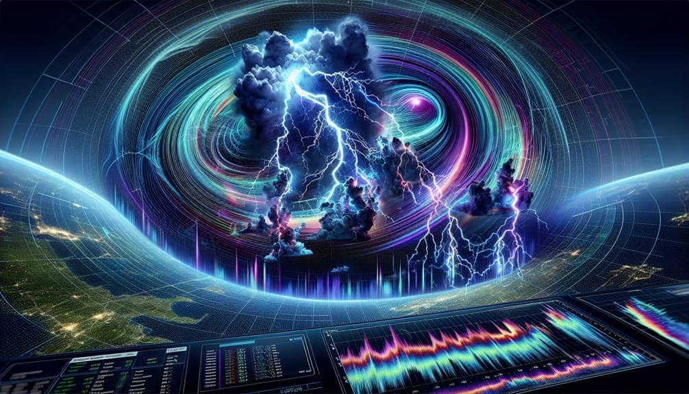
We've compiled seven essential tips to help understand lightning strike patterns: First, analyze historical weather data and cloud formations. Second, recognize seasonal and geographical strike trends with summer peaks and regional hotspots. Third, monitor storm movements using radar and satellite tech. Fourth, employ real-time lightning data and advanced algorithms for analysis. Fifth, assess terrain impacts, noting risks at high elevations and near water bodies. Sixth, leverage advanced tools like lightning mapping arrays. Finally, collaborate with experts such as meteorologists and electrical engineers. Let's explore each tip to uncover the intricacies and enhance lightning prediction accuracy.
Key Points
- Analyze seasonal trends to identify peak lightning activity during summer.
- Use radar and satellite systems for real-time storm and lightning monitoring.
- Study geographic hotspots to implement regional safety measures.
- Leverage statistical models and machine learning for accurate lightning trend analysis.
Study Weather Patterns
To understand lightning strike patterns, we must first analyze historical weather data to identify recurring weather conditions that precede such events. By examining the cloud formations and utilizing storm tracking technologies, we can begin to discern the environmental precursors to lightning. Historical data helps us build a database of typical weather scenarios that often culminate in lightning strikes.
Radar interpretation plays an essential role in this analysis. By leveraging radar data, we can monitor storm development and intensity in real-time. This allows us to track cloud formations and identify the stages of storm growth that are most likely to produce lightning.
Climate change adds another layer of complexity. As global temperatures rise, weather patterns are shifting, which influences the frequency and intensity of storms. Understanding how these shifts affect lightning activity requires us to continuously update our models with new data.
Learn Strike Frequencies
Let's examine lightning strike frequencies by focusing on three critical aspects: seasonal occurrence trends, geographic strike distribution, and time of day patterns.
We can analyze data to identify peak seasons for lightning, understand how strikes vary across different regions, and determine which hours of the day are most prone to lightning activity.
This approach will help us predict and mitigate the risks associated with lightning strikes effectively.
Seasonal Occurrence Trends
Analyzing lightning strike patterns reveals that certain seasons, particularly summer, experience significantly higher frequencies due to increased atmospheric instability and convective activity. This seasonal surge can be attributed to the warm, moist air that fosters thunderstorm development. By understanding these trends, we can enhance our climate change impacts assessments and refine our risk assessments for better preparedness.
Historical data shows that lightning strikes peak during the summer months. Here are some factors that contribute to this:
- Increased surface heating: The sun's intense rays during summer heat the Earth's surface, causing the air to rise and form thunderstorms.
- Higher humidity levels: Warm temperatures elevate moisture content in the air, which is essential for thunderstorm formation.
Geographic Strike Distribution
While seasonal trends highlight when lightning is most likely to occur, examining geographic strike distribution helps us understand where these events are most frequent. By identifying lightning hotspots through global comparisons, we gain valuable insights into regional patterns.
For instance, regions like Central Africa, Southeast Asia, and parts of South America consistently rank as high-frequency zones. These areas experience more thunderstorms due to specific climatic and topographical factors, making them primary lightning hotspots.
Understanding these geographic distributions allows us to implement targeted lightning safety measures. In regions prone to high strike frequencies, individuals and communities should adopt regional precautions, such as installing lightning rods, avoiding open fields during storms, and educating the public on safe practices. For example, in the United States, Florida and the Gulf Coast states are particularly vulnerable, requiring heightened awareness and preparedness.
Data-driven analyses help us predict strike occurrences with greater accuracy. By examining historical data and current conditions, we can create detailed maps that highlight the risk areas. These tools empower us to make informed decisions, enhancing safety and reducing risk.
Analyzing geographic strike distribution isn't just about mapping—it's about using data to protect lives and property effectively.
Time of Day Patterns
Identifying the time of day when lightning strikes are most frequent enables us to predict and mitigate risks more effectively. By understanding these patterns, we can make informed decisions that enhance our safety and freedom. Let's delve into the data.
Lightning strikes tend to follow specific daily patterns, with peak activity often occurring in the afternoon and evening. This trend is primarily driven by the heating of the Earth's surface, which promotes thunderstorm development.
Here's a snapshot of when we can expect the most lightning activity:
- Afternoon Peaks: Between 2 PM and 6 PM, the ground heats up, leading to increased thunderstorm formation and, consequently, more lightning strikes.
- Evening Spikes: As the day progresses into night, typically between 6 PM and 9 PM, we often observe a secondary increase in lightning activity.
Monitor Storm Movements

To effectively monitor storm movements, we use advanced radar systems and satellite technology to track the development and progression of weather patterns in real time. By integrating lightning tracking with these tools, we enhance our storm prediction capabilities, allowing us to anticipate lightning strikes with greater precision. This thorough weather monitoring approach is essential for guaranteeing lightning safety and reducing risks associated with severe weather.
We depend on radar systems like Doppler radar to measure storm intensity, detect wind patterns, and identify possible lightning activity. By examining radar data, we can pinpoint the location and movement of thunderstorms.
Satellite technology gives us a broader perspective, capturing real-time images and data on cloud formation, temperature fluctuations, and atmospheric conditions. This combined approach enables us to evaluate storm development from both ground level and space.
Merging these technologies, we develop detailed storm models that guide our lightning tracking efforts. These models are consistently updated, providing instant insights into storm behavior. By utilizing this data-driven approach, we can forecast storm paths and potential lightning hotspots, empowering individuals to make well-informed decisions about their safety.
Ultimately, thorough weather monitoring ensures that we stay ahead of the storm, preserving our ability to navigate the world with confidence.
Analyze Lightning Data
By leveraging our thorough storm monitoring systems, we can now analyze lightning data to identify patterns and predict future strikes with remarkable accuracy. Accurate lightning data interpretation requires sophisticated analysis techniques, allowing us to make sense of vast datasets and derive actionable insights.
Here's how we break down the process:
- Data Collection: We gather real-time data from lightning detection networks, which provide information on strike location, frequency, and intensity.
- Pattern Recognition: By employing advanced algorithms, we can identify recurring patterns in lightning activity, which are pivotal for predicting lightning occurrences.
Our analysis techniques hinge on robust statistical models and machine learning algorithms. These tools help us understand the underlying factors driving lightning patterns, from atmospheric conditions to seasonal variations. By doing so, we can offer more reliable forecasting trends, enabling communities to take preemptive measures against potential lightning threats.
Through meticulous lightning data interpretation, we not only enhance our predictive capabilities but also empower individuals and organizations with the knowledge needed to navigate the uncertainties of storm-related phenomena.
Understand Terrain Impact

Let's examine how terrain influences lightning strike patterns, focusing on high elevation risks and the impact of water bodies.
Data indicates that elevated regions, like mountains, experience more frequent strikes due to their proximity to storm clouds.
Additionally, water bodies can increase strike probability by altering atmospheric conductivity and local weather conditions.
High Elevation Risks
When analyzing lightning strike patterns, it's important to recognize that high elevation areas are much more susceptible due to their closeness to storm clouds and the electrical conductivity of certain terrain types. High altitude risks are intensified by the reduced distance between storm clouds and the ground, making peaks and ridges prime targets for lightning.
Altitude dangers are significantly higher in mountainous regions. We need to take into account how these factors impact mountain safety:
- Closeness to Clouds: The reduced distance between the ground and storm clouds at high elevations increases the likelihood of lightning strikes.
- Terrain Conductivity: Certain rock types, such as granite, can conduct electricity more efficiently, increasing the risk of peak lightning.
Data-driven studies indicate that the incidence of lightning strikes increases notably with altitude. For example, the Rocky Mountains experience an average of 25 lightning strikes per square mile each year.
Understanding these risks allows us to better prepare and mitigate potential dangers. By being aware of these high altitude risks, we can make informed decisions to ensure our safety in mountainous regions.
Water Bodies Influence
Water bodies greatly influence lightning strike patterns by altering local atmospheric conditions and providing conductive surfaces for electrical discharge. When we consider coastal impacts, we see that the interface between land and sea generates unique microclimates. These areas often experience a higher frequency of lightning due to the convergence of different air masses. Coastal regions have higher humidity levels, which elevate the likelihood of thunderstorm formation, thereby increasing lightning activity.
Lake effects also play a significant role. Large lakes can moderate temperatures and humidity levels, creating localized weather systems that can enhance thunderstorm development. For instance, the Great Lakes in North America are known for intense lightning activity due to these lake-induced weather patterns.
Rivers influence lightning strike patterns by acting as natural conductors of electricity. They often follow the path of least resistance, attracting more lightning strikes. Additionally, river valleys can channel wind patterns, leading to increased storm activity in these regions.
Ocean currents impact lightning by regulating sea surface temperatures, which in turn affect atmospheric stability. Warm ocean currents can intensify storm systems, leading to more frequent and severe lightning events.
Utilize Advanced Tools
Leveraging cutting-edge technology, we can analyze lightning strike patterns with unparalleled accuracy and depth. By integrating advanced tools like weather radar and lightning mapping systems, our understanding of these natural phenomena becomes more nuanced and precise, enabling us to predict and react to lightning strikes more effectively.
Using weather radar, we can track storm developments in real-time. These systems provide high-resolution data on precipitation, storm intensity, and movement, which are essential for identifying potential lightning hotspots. Additionally, lightning mapping arrays capture the exact location and intensity of lightning strikes, offering detailed data that complements radar observations.
Here's how these tools enhance our analytical capabilities:
- Weather radar: Tracks storm cells and predicts lightning-prone areas by analyzing precipitation and storm dynamics.
- Lightning mapping arrays: Pinpoint strike locations and intensities, providing detailed spatial and temporal data.
With these advanced tools, we not only gain a better understanding of lightning patterns but also empower ourselves to act with greater freedom and confidence. This data-driven approach allows us to mitigate risks, protect assets, and ultimately enhance our resilience against nature's electrifying displays.
Collaborate With Experts

Collaborating with experts in meteorology, climatology, and electrical engineering allows us to deepen our understanding of lightning strike patterns through interdisciplinary insights and specialized knowledge. By conducting expert interviews, we access a wealth of data and perspectives that would be difficult to obtain otherwise. These professionals engage in cutting-edge lightning research, providing us with the most current findings and models.
Our collaboration with meteorologists helps us analyze weather patterns and atmospheric conditions conducive to lightning formation. Climatologists contribute by examining long-term trends and variations in lightning activity across different regions. Electrical engineers, on the other hand, offer insights into the electrical properties of lightning and the mechanisms behind its striking behavior.
By integrating this expertise, we can develop more accurate predictive models and improve lightning safety measures. For instance, expert collaboration has led to advancements in early warning systems, which are essential for minimizing risks to life and property during lightning events. Data-driven approaches, informed by specialists, enable us to understand and mitigate the hazards associated with lightning strikes more effectively.
In essence, our collective efforts with these experts not only enhance our knowledge but also empower us to make informed decisions, fostering a safer and more resilient environment.
Frequently Asked Questions
How Does Lightning Form in the Atmosphere?
We observe lightning formation when atmospheric conditions create charge separation within clouds. This leads to lightning behavior characterized by electrical discharge. These discharges balance the electrical differences between cloud regions or between clouds and the ground.
What Safety Measures Should Be Taken During a Lightning Storm?
Did you know lightning strikes the U.S. 25 million times annually? We should seek emergency shelters immediately and guarantee buildings have lightning rods installed. These measures dramatically reduce risks and protect our freedom to explore safely.
Can Lightning Strike the Same Place Twice?
Yes, lightning can strike the same place twice. It's a common lightning myth that it can't. Lightning conductors, like those on tall buildings, often get hit multiple times, proving the myth wrong with data and observations.
How Can I Protect My Electronic Devices From Lightning Damage?
To protect our electronic devices from lightning damage, we should use surge protectors and guarantee proper grounding. Additionally, employing power strips with built-in shielding can further safeguard our equipment by diverting harmful surges away from sensitive electronics.
What Are the Signs That a Lightning Storm Is Approaching?
Did you know 70% of lightning strikes occur in the afternoon? We can spot an approaching storm by observing unusual cloud formations, sudden temperature drops, altered animal behavior, and hearing distant thunder. Stay alert and free!


