Storm chaser radar shows you real-time storm structure, intensity, and motion through Doppler technology that measures frequency shifts in returned radio pulses. You’ll use composite reflectivity to track peak intensity, VIL to confirm updraft strength, and echo tops to gauge vertical development. Super-resolution Level II data sharpens hook echo signatures, while automated algorithms flag rotation and hail threats instantly. Master these tools, and the rest of this guide reveals every layer of storm intelligence you need.
Key Takeaways
- Doppler radar measures storm motion by transmitting radio pulses and detecting frequency shifts, providing critical velocity data for identifying dangerous rotation.
- Composite Reflectivity consolidates data from all elevation angles, giving storm chasers a complete picture of maximum storm intensity at a glance.
- Mobile apps like RadarScope deliver near-real-time Level II radar data with dual-polarization variables, enabling fast, data-driven decisions in the field.
- Automated algorithms like TDA and SCIT automatically flag tornado signatures and track storm cells, transforming complex radar data into immediate threat awareness.
- Super-Resolution Level II data provides higher pixel density, clarifying hook echo signatures and velocity couplets for precise storm positioning decisions.
What Storm Chaser Radar Actually Shows You in Real Time
When you pull up a radar feed mid-chase, you’re looking at a composite of microwave pulse returns translated into actionable storm data.
Composite Reflectivity consolidates all elevation angles, delivering real-time insights into maximum storm intensity without gaps.
Composite Reflectivity sweeps every elevation angle, leaving no storm feature hidden and no intensity peak undetected.
Vertically Integrated Liquid quantifies total column water content, directly reflecting updraft strength.
Echo Tops reveal storm height, signaling intensification trends critical to chaser strategies.
You’re interpreting Doppler-shifted returns that measure precipitation motion toward or away from the radar site, exposing storm dynamics like rotation and wind shear.
Radar interpretation demands that you cross-reference these layers simultaneously rather than rely on any single product.
Each dataset updates near-real-time, so your situational awareness stays current as storm structure evolves rapidly ahead of your position.
Doppler Radar Fundamentals Every Storm Chaser Needs First
Before you interpret a single radar return, you’ve got to understand how Doppler radar actually works at its core. The system transmits radio wave pulses, then analyzes return signals using Doppler principles to measure target motion toward or away from the radar. That shift in frequency tells you wind velocity and helps distinguish precipitation types.
You’ll need to understand beam patterns, because elevation angles determine what the radar actually samples. Low beams capture near-surface data; higher beams oversample storm tops.
Signal processing converts raw returns into usable data, but radar limitations exist. Velocity aliasing distorts readings when wind speeds exceed the radar’s measurable range, corrupting data interpretation entirely.
Recognize these constraints before you trust any display. Accurate situational awareness depends on understanding what the radar can’t show you.
How Composite Reflectivity and VIL Expose Storm Strength
With Doppler fundamentals locked in, you can start pulling real storm intelligence from derived products—and composite reflectivity is where that begins. It merges data across all elevation angles, giving you peak reflectivity values regardless of beam height.
You’re seeing the storm’s full intensity signature, not just a single slice.
Vertically Integrated Liquid (VIL) takes that further by quantifying total liquid water in the storm column, directly indicating updraft strength.
Use these two products together to assess threats quickly:
- High composite reflectivity signals dangerous storm intensity at any altitude
- Elevated VIL values confirm strong updrafts capable of sustaining large hail
- Sudden VIL drops often indicate hail fallout or storm weakening
Together, they give you actionable, real-time storm structure intelligence.
What Echo Tops and Storm Height Warn You About
Echo Tops and Enhanced Echo Tops give you two critical vertical storm metrics that composite reflectivity and VIL can’t fully capture on their own.
Echo tops significance lies in tracking the highest altitude of detectable radar returns within a storm. When tops push above 50,000 feet, you’re looking at explosive updraft intensity and a structurally dangerous system.
Echo tops reveal storm height—when they exceed 50,000 feet, explosive updrafts and serious structural danger are already underway.
Storm height implications directly affect your positioning decisions—rapidly rising tops signal accelerating storm development, giving you a narrow window to reposition safely.
Enhanced Echo Tops refine those height estimates, delivering sharper vertical storm profiling than standard echo tops alone.
Together, these products let you gauge storm maturity, updraft vigor, and intensification rate in near-real-time, keeping you informed and mobile without depending solely on reflectivity or liquid water measurements.
Super-Resolution Data and What It Reveals in Hook Echoes
When you access Super-Resolution Level II data, you’re working with higher pixel density that sharpens the fine structural details standard radar products obscure.
You can identify hook echo signatures with greater clarity, distinguishing the curved precipitation appendage that signals a mesocyclone’s rotating inflow from surrounding noise.
This enhanced resolution also updates faster, giving you near-real-time storm evolution that matches the speed at which dangerous features develop.
Super-Resolution Data Explained
Super-resolution Level II data cuts radar sampling to 0.5° azimuthal and 250-meter gate spacing, doubling the spatial detail you get from standard resolution products.
These super resolution benefits give you sharper storm structure without waiting on degraded imagery. Hook echo analysis becomes considerably more actionable when you’re working with finer pixel density.
Key operational advantages include:
- Faster updates: Rapid scan cycles deliver near-real-time reflectivity shifts during explosive storm development
- Tighter feature discrimination: You’ll resolve subtle velocity couplets and debris signatures that coarser data masks entirely
- Enhanced edge definition: Hook echo boundaries appear crisper, letting you position more precisely relative to the mesocyclone
Software like RadarScope and GR2Analyst fully exploit Level II data, putting forecaster-grade resolution directly in your hands.
Hook Echo Detail Revealed
That sharper spatial resolution pays off most visibly when you’re analyzing hook echoes—the comma-shaped appendages that wrap around a supercell’s rear-flank downdraft and signal potential tornado development.
Super-Resolution Level II data renders the hook echo’s boundary with tighter pixel density, letting you distinguish the inflow notch, bounded weak echo region, and debris signature with greater confidence.
Your hook echo analysis benefits directly because finer beam sampling reduces smearing that previously obscured critical gradients.
When you’re conducting radar signature interpretation, you’ll notice tighter reflectivity gradients indicating stronger rotation and possible tornadic circulation.
The high-resolution returns also expose subtle debris balls embedded within the hook—confirming an active tornado on the ground before storm reports reach you.
That operational advantage translates into faster, more independent decision-making during a chase.
Algorithms That Detect Tornadoes, Hail, and Rotation
Beyond raw reflectivity and velocity data, modern radar systems run automated algorithms that identify specific meteorological threats in real time. These tools give you actionable intelligence without manual interpretation delays.
Key algorithms actively working for you include:
- Tornado Detection Algorithm (TDA): Flags tornado signatures embedded within mesocyclones, accelerating your threat assessment.
- Hail Detection Algorithm (HDA): Calculates hail probability, severe hail likelihood, and maximum hail size—performing effectively between 35–70 miles range.
- Mesocyclone Detection Algorithm: Handles rotation identification by pinpointing rotating storm features critical to tornado development.
The Storm Cell Identification and Tracking (SCIT) algorithm labels each storm cell, computes its attributes, and forecasts motion up to 60 minutes ahead.
Together, these systems transform complex radar data into precise, real-time threat awareness.
Mobile Storm Chaser Radar Systems and How to Read Them
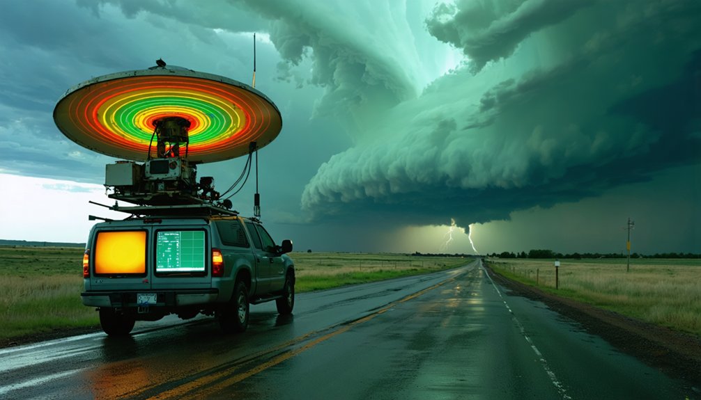
Mobile radar systems extend your situational awareness far beyond what fixed WSR-88D networks can deliver at close range.
You’ll operate truck-mounted units using longer wavelengths for broad storm tracking at distance, while shorter-wavelength systems positioned near tornadoes capture fine-scale structural details.
NSSL’s NOXP and the Doppler on Wheels give you scanning techniques that probe below distant network beams, resolving features standard radar misses.
For accurate data interpretation, maintain radar calibration before each deployment—signal errors compound quickly under field conditions.
Position your unit to minimize terrain blockage and optimize beam angles.
Storm visualization tools then translate raw returns into actionable intelligence, revealing rotation signatures, precipitation cores, and boundary interactions.
Master these systems, and you control your own independent storm analysis without relying solely on centralized infrastructure.
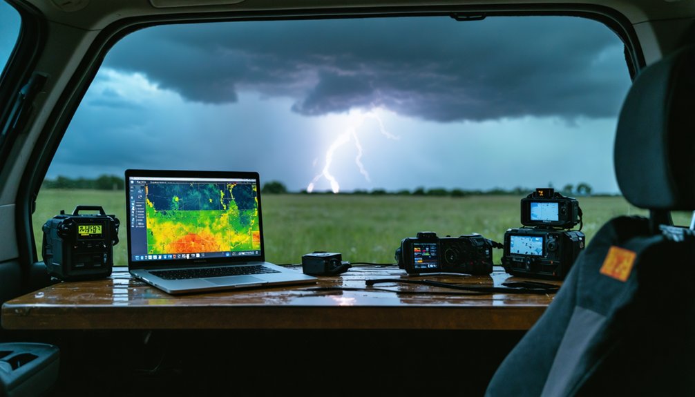
Best Radar Apps and Software for Storm Chasers
When you’re chasing storms, your software and app choices directly impact the quality and speed of your radar data.
GRLevel3 and GR2Analyst from the GRLevelX suite give you raw radar in vector format with GIS layering, while GR2Analyst handles higher bandwidth for more advanced analysis.
On mobile, RadarScope leverages Level II data to deliver near-forecaster-speed access, making it one of the most reliable tools you can run in the field.
Top Radar Software Options
Choosing the right radar software can define how effectively you interpret storm data in the field. Each platform offers distinct radar software features tailored to different operational needs, so you’ll want to match the tool to your workflow.
User friendly interfaces reduce cognitive load during high-pressure situations, letting you focus on storm behavior rather than navigation.
Consider these primary options:
- GRLevel3 – Displays raw radar in vector format with GIS layering on Windows, ideal for desktop analysis.
- GR2Analyst – Handles higher bandwidth demands for advanced multi-elevation storm profiling.
- RadarScope – Delivers Level II data on mobile platforms at near-forecaster speeds, optimized for field use.
Each tool grants you independent access to near-real-time storm intelligence without depending on external interpretation.
Mobile Apps For Chasers
Field conditions demand radar access that moves with you, and that’s where mobile apps close the gap between desktop analysis and real-time storm engagement.
RadarScope stands as your primary tool, pulling Level II data directly onto mobile platforms at near-forecaster speeds. Its app features include dual-polarization variables, storm tracking overlays, and velocity products that keep you operationally sharp while repositioning.
For satellite-delivered updates, XM Weather pushes 5-minute radar and observation refreshes without cellular dependency—critical when you’re operating in coverage dead zones.
You can layer Spotter Network GPS positions over radar returns, integrating real-time spotter reports into your situational picture. Together, these platforms eliminate the gap between desktop-grade analysis and field execution, giving you autonomous, data-driven decision-making wherever the storm leads.
Field Tools That Pair With Your Storm Chaser Radar
Several field tools work alongside your storm chaser radar to build a complete observational picture. Vehicle-mounted field sensors capture ground-level wind speed, pressure, temperature, and humidity, feeding critical data integration layers into your broader radar picture.
The CLAMPS trailer adds boundary layer profiling through Doppler lidar and microwave radiometry.
Key tools you’ll want deployed:
- Spotter Network (SN): Plots your real-time GPS position with GIS overlay for positioning and reporting
- NOAA Weather Radio: Delivers continuous watches and warnings without interrupting your chase workflow
- Instrument pods: Positioned directly in tornado paths to capture surface-level measurements radar can’t retrieve
Together, these systems eliminate observational blind spots, giving you ground-truth verification that strengthens every radar interpretation you make.
How to Read Storm Chaser Radar Faster Under Pressure
Reading storm chaser radar fast under pressure isn’t about scanning everything—it’s about knowing exactly where to look first.
Prioritize composite reflectivity for immediate storm tracking awareness, then shift to velocity data to detect rotation. Trust the Mesocyclone Detection Algorithm and Tornado Detection Algorithm alerts—they’re processing what your eyes can’t catch quickly enough.
For sharper radar interpretation, lock onto hook echo signatures using Super-Resolution Level II data in RadarScope or GR2Analyst.
Check VIL spikes and echo tops to gauge updraft intensity instantly. SCIT tracking forecasts cell motion up to 60 minutes ahead, giving you positioning freedom before conditions deteriorate.
Eliminate noise by filtering hydrometeor classifications through HCA.
Build a repeatable scan sequence before the chase begins, so under pressure, your workflow runs automatically.
Frequently Asked Questions
How Do Storm Chasers Legally Operate Mobile Radar Equipment on Public Roads?
You’ll need to meet legal requirements and equipment regulations by securing proper radar permissions, registering truck-mounted systems, and prioritizing public safety while operating mobile radar units on public roads during storm chases.
What Training Certifications Do Professional Storm Chasers Need Before Using Radar Systems?
Over 90% of chasers self-train. You don’t need mandatory certification programs, but mastering radar interpretation through courses like Skywarn or NWS training sharpens your skills and keeps you operationally effective and independent.
How Does Weather Radar Technology Differ Between the United States and Other Countries?
You’ll find international radar systems vary in wavelength, resolution, and update frequency. The U.S. leads technological advancements through WSR-88D networks, dual-polarization upgrades, and NSSL innovations, giving you superior storm-tracking capabilities compared to many other nations.
Can Amateur Storm Chasers Afford Professional-Grade Radar Systems on Limited Budgets?
You can’t always afford professional-grade systems, but you’ll find affordable alternatives like RadarScope and GRLevel3 fit limited budgets precisely. Leverage community resources such as Spotter Network to access near-forecaster-quality data independently.
How Do Storm Chaser Radar Readings Impact Official National Weather Service Warning Decisions?
Like a puzzle piece clicking into place, your storm detection feeds real-time data accuracy into NWS systems, actively sharpening warning decisions, cutting false alarms, and empowering meteorologists to issue faster, more precise tornado and severe weather alerts.
References
- https://www.youtube.com/watch?v=my2_C1gBFkI
- https://www.preventionweb.net/news/what-do-storm-chasers-really-do-two-tornado-scientists-take-us-inside-chase-and-tools-studying
- https://www.stormtours.com/information/storm-chasing-technology/
- https://www.nsf.gov/impacts/doppler
- https://www.nssl.noaa.gov/tools/observation/
- https://en.wikipedia.org/wiki/Storm_chasing


