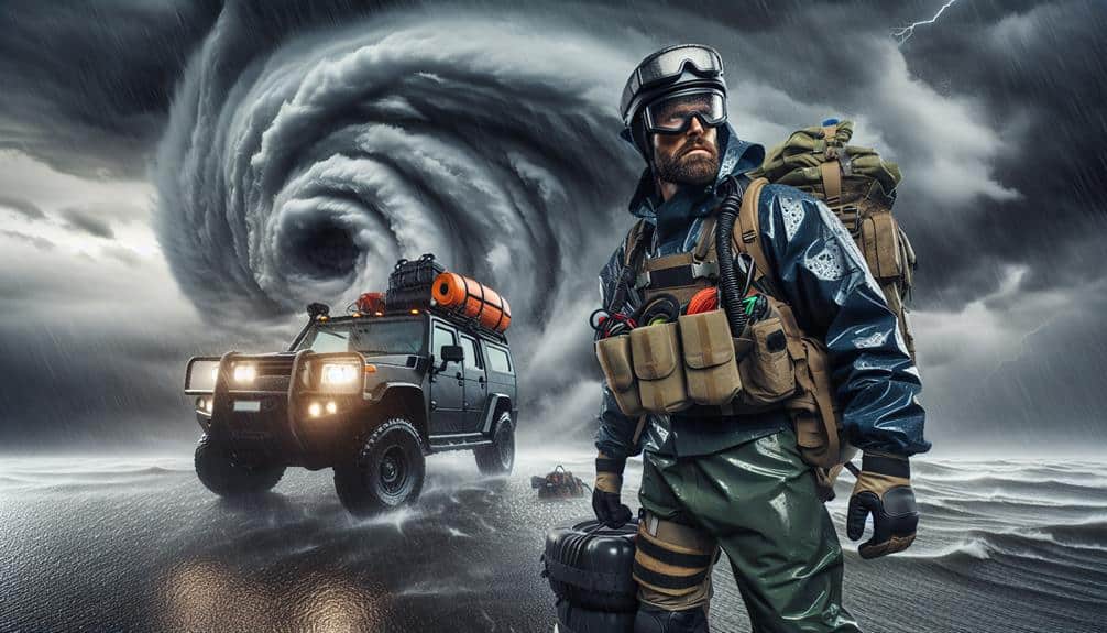
We harness real-time data from storm chasers to enhance our understanding and prediction of hurricane patterns. Equipped with advanced instruments, storm chasers gather vital field observations on wind speed, barometric pressure, and humidity. This real-time data feeds into predictive models, refining hurricane trajectory and intensity forecasts. By utilizing technologies like high-resolution radar systems, GPS tracking, and drone data collection, we achieve precise storm tracking and richer meteorological data. Analyzing historical and real-time data through machine learning algorithms further improves our predictive accuracy. These insights propel our research forward, offering valuable information for future advancements in hurricane prediction.
Key Points
- Storm chasers provide real-time data essential for accurate hurricane tracking and prediction.
- Advanced radar systems enable precise storm tracking, offering insights into storm structure and intensity.
- Drones collect meteorological data enhancing predictive models and understanding of hurricane dynamics.
- Machine learning algorithms analyze vast datasets to improve hurricane trajectory predictions.
Importance of Storm Chasers
Storm chasers provide significant real-time data that greatly enhances our ability to understand and predict hurricane behavior. When we're out in the field, our primary task is to gather field observations that significantly contribute to the accuracy of meteorological data.
We deploy advanced instruments to measure wind speed, barometric pressure, and humidity levels directly within the storm system. These field observations are vital for improving data accuracy and refining predictive models.
However, storm chasing isn't without its inherent risks. Implementing strict safety measures and conducting thorough risk assessments are essential components of our operations.
We use GPS tracking, satellite communication, and real-time weather updates to make sure we're not caught off guard by sudden shifts in the storm's path. Proper risk assessment helps us make informed decisions about when to advance and when to retreat, minimizing potential hazards.
Our commitment to safety doesn't just protect us; it guarantees the integrity of the data we collect. By maintaining rigorous safety measures, we can focus on obtaining precise and reliable data without compromising our well-being.
This dual focus on data accuracy and safety allows us to make significant contributions to the field of hurricane research.
Gathering Real-Time Data
Equipped with state-of-the-art instruments, we collect real-time data on wind speed, barometric pressure, and humidity levels directly from the eye of the hurricane. This meticulous data collection is crucial for accurate storm tracking. By deploying anemometers, barometers, and hygrometers, we measure variables that help us understand the hurricane's inner dynamics. Real-time readings allow us to pinpoint shifts in the storm's intensity and trajectory with precision.
Our approach to data collection involves high-frequency sampling to capture rapid changes in the storm environment. We utilize airborne platforms and ground-based stations to gather this data, ensuring a thorough spatial analysis. This multi-faceted approach enhances our ability to model hurricane behavior accurately.
As we navigate the chaotic conditions, our data feeds into advanced algorithms that refine predictive models. By continuously updating these models with real-time data, we improve forecast reliability, enabling timely warnings and effective evacuation strategies.
The freedom to explore and understand these natural phenomena drives our commitment. Each data point we collect brings us closer to decoding the complexities of hurricanes, ultimately empowering communities to make informed decisions and safeguard lives. Through precise storm tracking and diligent data collection, we contribute to a future where freedom and safety coexist.
Technological Tools in Use
We've harnessed advanced radar systems and drone data collection to enhance our hurricane analysis.
These tools provide high-resolution imagery and real-time atmospheric measurements, allowing us to model storm behavior with greater accuracy.
Advanced Radar Systems
Harnessing the latest developments in Doppler radar technology, we can now acquire high-resolution, real-time data crucial for predicting hurricane paths and intensity. These radar capabilities allow us to engage in precise storm tracking, providing insights into storm structure, velocity, and precipitation. By employing dual-polarization techniques, we can differentiate between rain, hail, and debris, improving our ability to monitor storm evolution and potential impact zones.
Our storm monitoring efforts are greatly enhanced by advanced data visualization tools. These tools convert raw radar data into detailed, understandable images, enabling us to interpret intricate meteorological phenomena quickly and accurately. For example, we can visualize rainfall rates, wind speeds, and storm cell rotation, which are essential for issuing timely warnings and planning evacuation routes.
Additionally, integrating radar data with Geographic Information Systems (GIS) empowers us to overlay storm paths on populated regions. This integration is crucial for evaluating risk and mobilizing resources effectively. The precision provided by these advanced radar systems ensures that we can act with greater independence and make informed decisions that protect lives and property.
Drone Data Collection
Utilizing high-definition drones, we gather crucial meteorological data that enhances our understanding of hurricane dynamics and improves predictive models. These drones, equipped with state-of-the-art sensors, offer unparalleled drone capabilities, capturing data with exceptional precision and data accuracy. By flying directly into the heart of hurricanes, drones collect real-time information on wind speeds, atmospheric pressure, temperature, and humidity levels.
Our collaboration with storm chasers is pivotal in this endeavor. Storm chasers provide on-the-ground support, ensuring drones are deployed in optimal locations for data collection. This synergy allows for thorough research applications, as the data gathered feeds directly into computational models used to predict hurricane trajectories and intensities. The real-time data captured by drones remarkably reduces the latency associated with traditional data collection methods, thereby enhancing the accuracy of predictive models.
The integration of drone technology in storm chasing opens new frontiers for atmospheric research. As we push the boundaries of what's achievable, we aim to provide more precise forecasts, ultimately saving lives and property.
The freedom to explore these technological advancements empowers us to make noteworthy strides in meteorological science, offering society better tools to prepare for and respond to hurricanes.
Analyzing Hurricane Trajectories
Mapping hurricane trajectories involves analyzing intricate patterns from historical data to predict future storm paths with greater accuracy. We utilize advanced trajectory analysis techniques to scrutinize past hurricane pathways. By correlating this data with real-time weather forecasting models, we can enhance the precision of storm tracking efforts.
Our approach employs sophisticated data visualization tools to display hurricane trajectories, making complex datasets accessible for in-depth analysis. These visualizations reveal the dynamic nature of storm movement, including shifts in direction and speed. This clarity is critical for identifying patterns that mightn't be immediately evident in raw data.
We rely on a combination of satellite imagery, radar data, and historical storm records. This multi-faceted dataset allows us to detect subtle changes in atmospheric conditions that influence hurricane paths. By integrating these diverse data points, we create detailed models that support more reliable trajectory predictions.
In our quest for freedom from the devastating impacts of hurricanes, accurate trajectory analysis and effective storm tracking are necessary. These efforts not only improve our understanding of hurricane behavior but also provide actionable insights to mitigate risks and enhance preparedness for future storms.
Predictive Modeling Techniques

In our exploration of predictive modeling techniques, we'll utilize machine learning algorithms that leverage vast historical datasets to forecast hurricane patterns.
By integrating real-time data, we can enhance the accuracy and responsiveness of these models.
This approach allows us to predict storm trajectories with increased precision, ultimately aiding in more effective disaster preparedness.
Machine Learning Algorithms
We leverage advanced machine learning algorithms to enhance the predictive accuracy of hurricane patterns, enabling more timely and precise storm forecasts. By employing sophisticated predictive analytics, we can analyze vast datasets of weather patterns, identifying pivotal variables that influence hurricane formation and trajectory. Our models utilize neural networks and ensemble methods to detect subtle correlations within the data, improving our predictive capabilities.
Incorporating data visualization techniques, we transform complex storm tracking data into intuitive, actionable insights. This allows meteorologists and storm chasers to quickly interpret model outputs and make informed decisions. By visualizing data in real-time, we can highlight areas with the highest probability of impact, thereby enabling proactive measures to mitigate damage and enhance public safety.
Our machine learning framework continuously integrates new data, refining its accuracy with each iteration. This dynamic approach guarantees that our predictions remain relevant and robust, adapting to evolving weather patterns. Through rigorous training and validation processes, we minimize errors and increase the reliability of our forecasts.
Ultimately, our use of machine learning algorithms not only advances the science of hurricane prediction but also empowers communities to act swiftly and with confidence, safeguarding lives and property.
Historical Data Utilization
Drawing upon extensive historical hurricane data, we implement advanced predictive modeling techniques to refine our understanding of storm behaviors and enhance forecast accuracy. By conducting thorough historical analysis, we identify long-term trends that offer crucial insights into the evolving nature of hurricanes.
Our models integrate a wide range of historical data points, including wind speed, trajectory, and pressure patterns, which allow us to forecast future storm activities with greater precision.
We utilize sophisticated data visualization tools to condense complex datasets into understandable formats. This aids in the identification of trends and anomalies, enabling us to predict the potential impact of emerging hurricanes more effectively.
The inclusion of climate change variables into our models is vital, as it significantly impacts storm frequency and intensity. By analyzing historical data in the context of climate change, we can predict shifts in hurricane patterns and prepare for more extreme weather events.
Through this meticulous approach, we empower stakeholders with actionable insights, enabling them to make informed decisions and implement proactive measures. Our dedication to utilizing historical data and advanced modeling techniques ensures we remain at the forefront of hurricane prediction, providing invaluable foresight in an era of increasing climate volatility.
Real-time Data Integration
Building on our historical analysis, our focus now shifts to integrating real-time data for enhancing predictive modeling techniques. By leveraging the immediacy of live data streams, we can enhance forecast accuracy and offer more reliable predictions. Real-time data integration allows us to dynamically update our models, ensuring they reflect the most current atmospheric conditions.
To achieve this, we employ several advanced methodologies:
- Data Assimilation: Continuously incorporating observational data from satellites, radar, and storm chasers into our models in real time.
- Machine Learning Algorithms: Utilizing AI to identify patterns and anomalies that mightn't be apparent through traditional analysis.
- High-Resolution Simulations: Running detailed simulations that can capture small-scale processes essential for hurricane development.
- Data Visualization Tools: Implementing sophisticated visualization techniques to interpret complex data sets, facilitating quicker decision-making.
These strategies collectively enhance our ability to predict hurricane paths and intensities with greater precision. By integrating such real-time data, we empower ourselves to make more informed, timely decisions that can ultimately save lives and property.
Our approach underscores the importance of evolving our predictive models to keep pace with the rapidly changing dynamics of hurricanes, aligning with our commitment to provide accurate and actionable insights.
Impacts on Future Research
Insights gathered from storm chaser data will revolutionize predictive models and enhance our comprehension of hurricane behavior. By integrating high-resolution, real-time data, our collaborative research efforts can now explore the intricacies of storm genesis, trajectory, and intensity with unparalleled accuracy. This improved granularity facilitates more dependable predictive analytics, which is essential for mitigating the socio-economic impacts of hurricanes.
The potential for research collaboration is vast. Scientists, meteorologists, and data analysts can now work synergistically, leveraging shared datasets to refine computational models and validate theoretical frameworks. This collaborative approach not only speeds up discovery but also democratizes access to critical information, fostering an environment where innovation thrives.
Furthermore, the influx of actionable data opens new avenues for funding opportunities. Agencies and private sector stakeholders are more likely to invest in research initiatives that promise tangible benefits, such as improved disaster preparedness and resilient infrastructure. Our ability to demonstrate the practical applications of storm chaser data can thus attract substantial financial backing, ensuring sustained progress in hurricane research.
Frequently Asked Questions
How Do Storm Chasers Stay Safe During Hurricanes?
We prioritize our well-being by following rigorous safety protocols, using state-of-the-art equipment, and executing detailed emergency response plans. Our teamwork guarantees we're always a step ahead, balancing our passion for freedom with meticulous precautionary measures.
What Qualifications Are Needed to Become a Storm Chaser?
To become a storm chaser, we need specific storm chaser qualifications, including meteorology education, field experience, and safety training requirements. Advanced data analysis skills and knowledge of weather prediction models are essential for accurately tracking and responding to severe weather events.
How Do Storm Chasers Communicate During a Hurricane?
In the eye of the storm, we use cutting-edge communication methods and safety measures. Leveraging advanced technology, we maintain real-time updates and follow strict emergency plans, ensuring precision and safety while maneuvering through the hurricane's fury.
Are There Any Famous Storm Chasers in History?
The Current Question asks about notable figures in storm chasing history. We've identified historic expeditions led by pioneers like Tim Samaras and Josh Wurman, whose data-driven approaches greatly advanced our understanding of hurricanes and severe weather phenomena.
What Are the Psychological Impacts on Storm Chasers?
Research shows 45% of storm chasers experience heightened stress levels. We develop resilience and employ coping mechanisms to protect our mental health. By embracing this freedom, we balance the psychological impacts with our passion for storm chasing.