Storm chasers aid in disaster coordination in seven key ways: deploying mobile radar to capture low-level wind data, relaying ground-truth observations that fixed radar can’t verify, confirming tornado touchdowns in real-time, transmitting path shifts to forecasters, filling radar blind zones with direct visual data, triggering faster NWS warnings through structured reporting, and validating mesocyclone signatures to sharpen warning polygons. Each function compresses the warning-to-action timeline — and the full mechanics behind each role reveal just how deep this operational layer runs.
Key Takeaways
- Storm chasers deploy mobile radars and instrument pods to collect precise, low-level wind data that fixed radar systems cannot independently capture.
- Real-time chaser reports compress the warning-to-action timeline, giving communities critical extra minutes to evacuate before a tornado arrives.
- Chasers provide ground-truth visual confirmations, eliminating forecaster hesitation and transforming uncertain radar signatures into confident, actionable warnings.
- Direct chaser observations fill radar blind zones, maintaining accurate warning continuity when technology reaches its geometric and operational limits.
- Verified chaser data enables forecasters to rapidly refine warning polygons, improving emergency resource allocation and reducing public misdirection.
What Storm Chasers Actually Do in the Field
When storm chasers head into the field, they’re executing a precise set of coordinated tasks that go far beyond simply watching tornadoes form. Understanding storm chaser motivations reveals a dual purpose: advancing scientific knowledge while actively supporting National Weather Service operations.
You’ll find chasers deploying mobile radars, positioning instrument pods near tornado paths, and collecting low-level wind data that stationary networks can’t capture.
Field equipment usage is equally strategic. Chasers relay real-time visual confirmations of wall clouds, shelf clouds, and tornado formations directly to forecasters. They transmit structural storm details immediately, report evolving ground impacts, and alert meteorologists to new tornado cycles developing downstream.
Every deployment decision balances calculated risk against data quality, ensuring chasers remain operationally effective while maintaining the escape route discipline that keeps them in the field.
How Storm Chasers Report Directly to the National Weather Service
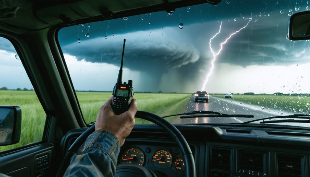
Direct reporting to the National Weather Service follows 3 primary channels: phone hotlines, radio communication, and digital data transmission platforms.
You’ll use storm observer techniques to relay ground-truth data that radar systems can’t capture independently. Visual reporting methods let you confirm shelf clouds, wall clouds, and active tornado structures in real-time.
Key reporting protocols you’ll follow include:
- Phone hotlines: Contact your regional NWS office directly with structured storm details, including location, movement, and intensity.
- Radio communication: Transmit evolving conditions through amateur or spotter networks for immediate NWS integration.
- Digital platforms: Submit geo-tagged photos and structured reports through apps like mPING or Spotter Network.
These channels give you direct influence over warning accuracy, keeping communities ahead of dangerous, fast-moving storm systems.
Real-Time Storm Chaser Reports That Trigger Faster Warnings
Real-time reports from storm chasers compress the gap between storm development and issued warnings, giving NWS forecasters ground-truth confirmation they can’t extract from radar alone.
When you’re positioned beneath a rotating wall cloud, your direct observations of storm dynamics deliver critical variables—condensation funnel development, debris signatures, and rotation intensity—that radar interpretation alone can’t always resolve at low altitudes.
Tornado detection accelerates when chasers transmit structured, precise reports rather than vague descriptions.
You’re fundamentally validating or invalidating what forecasters see on their screens, allowing them to pull warning triggers minutes earlier. Those minutes translate directly into evacuation time for communities in a storm’s path.
Accurate, timely field reports eliminate forecaster hesitation, producing confident warnings that reach the public faster and with greater specificity than radar-dependent analysis alone provides.
Why Storm Chasers Matter When Radar Loses the Picture
Radar has hard geometric limits that create dangerous blind zones beneath the beam’s lowest tilt angle, and storm chasers fill exactly that gap. When beam overshooting hides low-level rotation, your ground-level visual observation techniques become the most reliable data source available.
Storm chaser collaboration with the National Weather Service delivers confirmed tornado presence, structural changes, and ground-truth measurements that no remote sensor can replicate.
- Detect sub-beam circulation that radar physically can’t resolve at distant ranges
- Confirm mesocyclone tightening and wall cloud descent through direct sightlines
- Transmit real-time tornado position when radar coverage collapses entirely
You’re operating where instruments stop working and human eyes start. That independence from infrastructure isn’t reckless—it’s strategically essential for maintaining accurate warning continuity when technology reaches its hard boundaries.
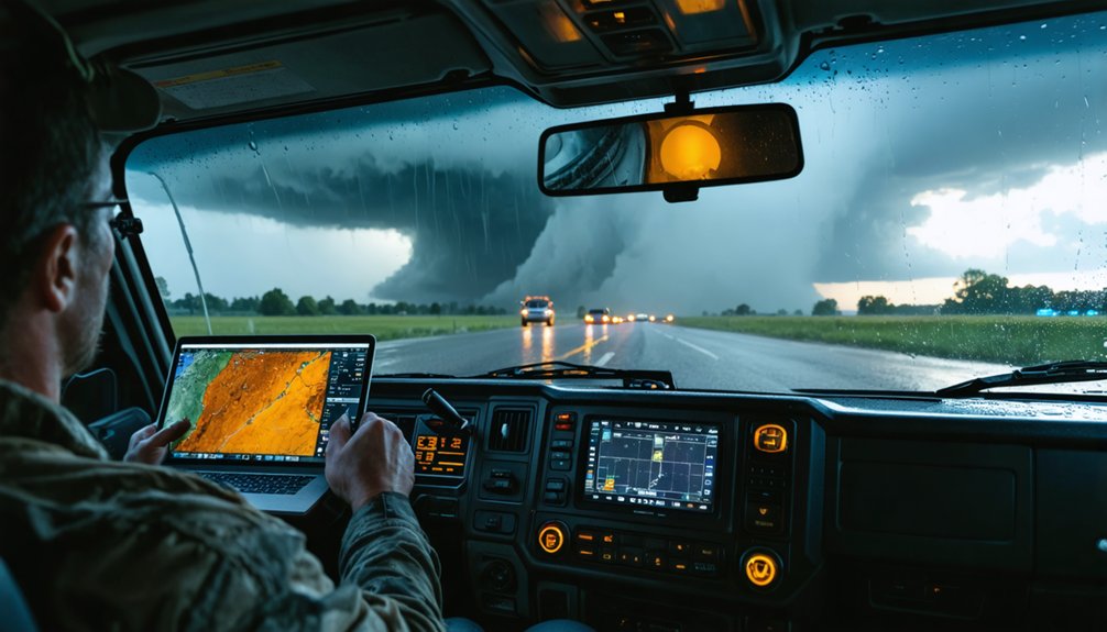
How Storm Chasers Use Mobile Radar to Sharpen Warnings
When you watch a storm chaser position a mobile radar unit ahead of a maturing supercell, you’re seeing a calculated deployment designed to capture low-level wind data that fixed networks can’t reach.
You transmit that data in real-time to the National Weather Service, tightening warning lead times by grounding probabilistic forecasts in direct measurement.
The result sharpens both the precision and credibility of issued warnings, giving emergency managers the validated evidence they need to act decisively.
Mobile Radar Deployment Tactics
Mobile radar deployment transforms raw storm data into actionable intelligence for the National Weather Service.
You’re positioning instruments strategically, intercepting storms before they mature, and capturing low-level wind data that fixed radar systems simply can’t reach.
Mobile sensor strategies depend on reading storm motion, road networks, and atmospheric shifts simultaneously. Tornado tracking techniques require you to stay ahead of the mesocyclone while maintaining clear radar angles.
- Deploy instrument pods perpendicular to the storm’s forward motion for peak wind field penetration
- Reposition proactively when storm direction shifts to maintain ideal data collection angles
- Synchronize mobile radar positioning with team members to eliminate coverage gaps
Every deployment decision directly sharpens warning precision, giving communities the critical lead time they need to act independently and decisively.
Real-Time Warning Enhancement
Strategic radar positioning means nothing without translating captured data into warnings that reach people in time to act. When you’re analyzing storm dynamics from mobile platforms, you’re feeding real-time velocity and reflectivity data directly to National Weather Service forecasters. That transmission compresses the gap between detection and public alert.
You’re identifying tornado signatures—rotation depth, hook echo tightening, debris signatures—before fixed radar resolves them clearly. That advantage buys minutes, and minutes determine outcomes.
You’re also confirming whether a warned storm is actually producing, eliminating false alarm fatigue that erodes public trust.
Your ground-level reports validate radar interpretation, sharpening warning polygon precision. Tighter polygons mean fewer people receive unnecessary alerts while ensuring those in genuine danger receive accurate, actionable information.
That’s measurable operational impact.
Low-Level Wind Data Collection
Fixed radar networks scan at minimum beam angles that leave the lowest 1,000 feet of the atmosphere largely unsampled—exactly where tornado-scale circulations intensify and where wind shear data matters most.
Storm chasers deploy mobile radars and instrument pods directly into that data gap, capturing wind data that stationary systems can’t reach.
This close-range collection transforms what we recognize about tornado behavior:
- Mobile Doppler units measure rotational velocities within meters of the surface
- Instrument pods record pressure, temperature, and wind shifts as tornadoes pass directly overhead
- Real-time transmission delivers these measurements to forecasters during active warning cycles
You’re fundamentally filling a critical observational blind spot, giving meteorologists the low-level atmospheric picture that drives sharper, faster, more defensible warnings.
How Live Chaser Reports Help Communities Respond Faster
When a tornado-warned storm moves toward a populated area, live chaser reports compress the warning-to-action timeline by delivering ground-truth data that radar alone can’t provide. You get real-time confirmation of tornado formation, direction shifts, and multiple circulation cycles that automated systems often miss.
That precision directly strengthens community preparedness by giving emergency managers actionable intelligence rather than probabilistic estimates.
Storm response improves measurably when dispatchers receive chaser-relayed observations alongside radar signatures. You’re no longer waiting for damage reports to confirm a tornado touched down — you know before impact.
Chasers transmit structural changes in rotating wall clouds, report ground-level debris, and flag new tornado cycles developing downstream. Each data point tightens the coordination window, letting communities activate emergency protocols earlier and protect more lives with fewer wasted resources.
Why Chaser-Confirmed Warnings Are More Accurate Than Radar Alone
Radar interprets atmospheric data from a distance, but it can’t tell you whether rotation has actually produced a tornado on the ground. Ground truth fills that gap. Chaser accuracy transforms probabilistic radar signatures into confirmed, actionable intelligence.
When chasers validate what radar suggests, warnings become sharper and more credible:
- Touchdown confirmation — Chasers visually verify whether a tornado has actually touched down, eliminating false alarm uncertainty.
- Storm maturity assessment — Trained observers identify wall clouds and structural changes radar algorithms can’t classify reliably.
- Real-time path correction — Chasers detect direction shifts immediately, allowing forecasters to refine warning polygons before populations are misdirected.
You deserve warnings built on verified data, not educated algorithmic guesses.
Frequently Asked Questions
How Do Storm Chasers Coordinate Positions to Avoid Overlapping Coverage Areas?
Like chess pieces on a board, you’ll use position tracking and coverage mapping to strategically spread across storm zones, ensuring your team doesn’t overlap, maximizing data collection efficiency, and maintaining clear, coordinated communication throughout deployments.
What Meteorological Training Do Storm Chasers Need Before Chasing Severe Storms?
You’ll need strong meteorological knowledge covering atmospheric dynamics, radar interpretation, and storm tracking techniques. Master reading supercell structures, understanding wind shear, and analyzing real-time data so you’re making calculated, informed decisions when pursuing severe storms safely.
How Do Storm Chasers Maintain Safety While Operating Near Dangerous Tornadoes?
You maintain safety by applying strict safety protocols and continuous risk assessment. You’ll monitor radar, plan escape routes based on storm motion, and use your meteorological training to make calculated, data-driven decisions near dangerous tornadoes.
Can Storm Chaser Data Improve Long-Term Tornado Prediction Models Over Time?
Yes, you can improve tornado prediction models by leveraging storm chasers’ historical data and data analytics. Their documented storm patterns enhance model accuracy, helping you better understand climate variability and refine long-term tornado prediction capabilities over time.
How Do Storm Chasers Alert Communities About New Tornado Cycles Forming Downstream?
As new tornado patterns emerge downstream, you’re racing against time. Storm chasers transmit real-time reports directly to the National Weather Service, triggering community alerts that warn residents before the next deadly cycle strikes their path.
References
- https://www.preventionweb.net/news/what-do-storm-chasers-really-do-two-tornado-scientists-take-us-inside-chase-and-tools-studying
- https://abc7amarillo.com/news/local/the-pros-and-cons-of-storm-chasing-and-its-dangers
- https://www.youtube.com/watch?v=ggO0a6qk9Go
- https://phys.org/news/2020-05-storm-chasers-life-saving.html
- https://science.howstuffworks.com/nature/climate-weather/storms/storm-chaser.htm