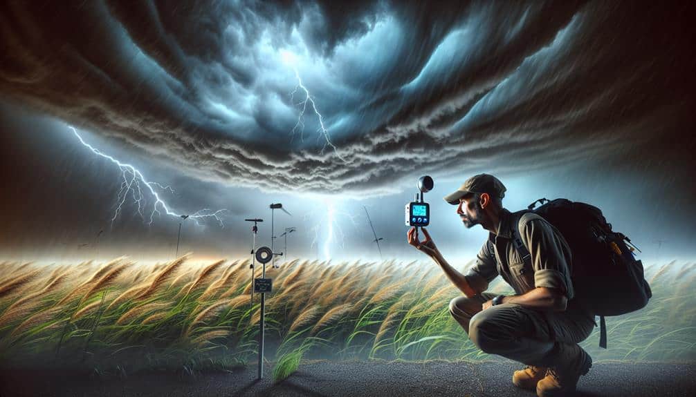
Mastering weather pattern recognition for storm chasers involves several key techniques. We should analyze satellite imagery to monitor storm development and temperature anomalies. Interpreting radar data helps us assess precipitation intensity and storm structure, using radar reflectivity and Doppler radar for accuracy. Identifying wind patterns and their changes can indicate storm development areas. Understanding atmospheric pressure dynamics and the influence of high and low-pressure systems is crucial. Recognizing cloud formations, such as cumulonimbus clouds, signals imminent severe weather. Reading temperature gradients and monitoring humidity levels aid in predicting storm behavior. These practices fine-tune our ability to forecast storms effectively and ensure successful chases.
Key Points
- Analyze satellite imagery to identify temperature anomalies and cloud formations signaling potential storm development.
- Utilize radar data to assess precipitation intensity, wind speeds, and storm structures like hook echoes and bow echoes.
- Study wind patterns, including gust fronts and boundary layer changes, to predict storm cell development.
- Recognize cloud types such as cumulonimbus for severe weather and altocumulus for mid-level moisture indicating potential storms.
Analyzing Satellite Imagery
Analyzing satellite imagery allows us to accurately monitor storm development and predict its trajectory through precise data interpretation. By leveraging advanced satellite data, we can identify temperature anomalies that indicate the early stages of storm formation. These anomalies, often detected in sea surface temperatures, provide essential insights into storm potential and intensity.
In our pursuit of freedom to chase storms, we utilize this data for effective storm tracking. High-resolution satellite images reveal cloud formations, wind patterns, and moisture levels, enabling us to forecast storm paths with remarkable accuracy. This information is crucial for developing robust weather models that simulate storm behavior under various atmospheric conditions.
As climate change impacts global weather patterns, understanding these changes becomes essential. Satellite imagery helps us observe long-term trends and shifts in storm frequency and intensity. By analyzing this data, we can refine our weather modeling techniques, ensuring more reliable predictions. This empowers us to navigate unpredictable weather systems safely and efficiently.
Interpreting Radar Data
Interpreting radar data allows us to detect and measure precipitation, wind speeds, and storm structure in real-time, providing critical information for accurate storm tracking and forecasting. By analyzing radar reflectivity, we can assess precipitation intensity, which helps determine whether we're dealing with light rain, heavy thunderstorms, or even hail. Higher reflectivity values typically indicate more severe weather events, guiding us to areas of potential storm severity.
We also rely on Doppler radar to evaluate storm motion. Doppler radar measures the velocity of precipitation particles, offering insights into wind speeds and storm dynamics. This data enables us to identify rotational features within a storm, such as mesocyclones, which are precursors to tornadoes. Recognizing these patterns gives us the freedom to make timely decisions and take necessary precautions.
Additionally, radar can reveal storm structure, highlighting features like hook echoes and bow echoes. These formations indicate different types of severe weather phenomena, from supercells to squall lines. By understanding these radar signatures, we can better predict storm paths and potential impacts.
Utilizing radar data empowers us to stay ahead of the storm, ensuring we make informed and strategic choices in our storm-chasing adventures.
Identifying Wind Patterns
Understanding wind patterns is essential for storm chasers, as it helps us pinpoint areas of potential storm development and intensity. By analyzing wind direction and speed, we can infer the movement and behavior of storm systems. Wind profiling allows us to detect changes in the boundary layer, which often precede severe weather events. Using tools like Doppler radar and anemometers, we measure wind speed and direction at various altitudes to identify shear zones—critical regions where wind changes abruptly with height.
One key element we focus on is identifying gust fronts. These are boundaries that mark the leading edge of cool air moving away from a thunderstorm. By recognizing these fronts, we can predict the potential for new storm cells to develop. Gust fronts are typically characterized by sudden shifts in wind direction and a noticeable increase in wind speed. Observing these shifts on radar or through direct measurement can provide us with valuable insights into storm dynamics.
As storm chasers, our goal is to harness this data to make real-time decisions. By mastering wind pattern recognition, we enhance our ability to predict storm paths, ensuring both our safety and the effectiveness of our pursuit.
Understanding Atmospheric Pressure
When we analyze atmospheric pressure, we need to distinguish between high and low-pressure systems, each influencing weather conditions distinctively.
High-pressure systems generally bring clear skies, while low-pressure systems can lead to severe weather, including storms.
High Vs. Low Pressure
High and low-pressure systems play an essential role in determining weather patterns and are fundamental concepts for storm chasers to master. These systems are defined by pressure differentials, which are critical in weather forecasting.
High-pressure systems, or anticyclones, feature descending air that inhibits cloud formation, leading to clear skies and stable conditions. Conversely, low-pressure systems, or cyclones, involve ascending air that cools and condenses, resulting in cloud formation and potentially severe weather.
We need to pay close attention to barometric changes when tracking these systems. Rapid drops in barometric pressure often signal the approach of a low-pressure system, bringing stormy weather. In contrast, rising barometric pressure indicates the presence of a high-pressure system, suggesting fair weather.
Understanding these barometric changes is essential for accurate meteorological science and effective storm chasing.
Pressure Systems Movement
Tracking the movement of pressure systems relies on analyzing atmospheric pressure gradients and wind patterns, which are essential for predicting weather changes. When we closely monitor these pressure changes, we gain insights into storm intensity and movement, essential for effective storm tracking and weather forecasting.
Understanding atmospheric pressure involves recognizing how high and low-pressure systems interact. High-pressure systems generally bring clear skies, while low-pressure systems are associated with stormy weather. By focusing on the pressure gradients, we can determine where and how fast storms might develop or dissipate.
Key elements to take into account include:
- Pressure Gradients: Steeper gradients indicate stronger winds, often correlating with increased storm intensity.
- Wind Patterns: Winds flow from high to low-pressure areas, and their behavior can signal forthcoming weather changes.
- Coriolis Effect: The Earth's rotation affects wind direction, curving it, which is essential for predicting storm paths.
Recognizing Cloud Formations

Let's analyze the common cloud types and their implications for storm development.
By identifying formations such as cumulonimbus and nimbostratus, we can better predict severe weather conditions.
Understanding these patterns enhances our ability to anticipate and respond to potential storm events effectively.
Common Cloud Types
Recognizing various cloud formations is vital for storm chasers, as each type provides valuable data about the atmosphere's current and future conditions. Let's explore the classification and characteristics of common cloud types, which can be pivotal in our storm-chasing endeavors.
First, Cumulonimbus clouds are towering giants, often associated with severe weather like thunderstorms and tornadoes. Their vertical development indicates strong updrafts, making them a significant focus for us.
Second, Stratus clouds form low, gray layers covering the sky, signaling stable air masses and often bringing drizzle or light rain. They're less thrilling but still informative for understanding current atmospheric stability.
Third, Cirrus clouds, high-altitude wisps made of ice crystals, usually indicate fair weather but can also precede a warm front, giving us early hints of changing weather patterns.
Lastly, Altocumulus clouds, mid-altitude puffy formations, suggest moisture at mid-levels and can be a precursor to thunderstorms, especially on warm, humid days.
Understanding these cloud types allows us to interpret the sky's narrative, assisting us in chasing storms with precision and freedom.
Predicting Storm Development
Accurately predicting storm development hinges on our ability to analyze cloud formations and interpret atmospheric dynamics. To master storm tracking techniques, we must first understand the anatomy of various cloud types, particularly cumulonimbus clouds. These towering giants often signal severe weather, including thunderstorms and tornadoes.
By observing the development stages of cumulonimbus clouds—from the cumulus stage to the mature stage—we can greatly enhance our weather prediction precision. For instance, the presence of an anvil-shaped top indicates that the cloud has reached the stratosphere, suggesting the potential for severe weather events.
Radar data and satellite imagery provide us with valuable insights into moisture content and temperature fluctuations within these cloud structures. Combining these tools with on-ground visual assessments enables us to develop a more thorough understanding of impending weather conditions.
Additionally, recognizing the role of atmospheric instability and wind shear in cloud formation helps us predict storm intensity and movement. Enhanced understanding of these elements allows us to refine our storm tracking techniques and make more informed decisions in the field.
Ultimately, our ability to predict storm development with high precision empowers us to chase storms more effectively and safely, embracing the freedom that comes with mastering these natural phenomena.
Reading Temperature Gradients
Understanding temperature gradients is essential for storm chasers as these variations can indicate the development and movement of severe weather systems. When we observe how temperature changes over a geographical area, we can correlate these shifts with wind directions and pressure gradients.
Rapid temperature variations often signal the formation of fronts, which are critical in storm prediction. By reading temperature gradients, we enhance our ability to anticipate where storms might form and how they'll behave.
Let's break this down into actionable points:
- Identify fronts: Sharp temperature changes typically indicate frontal boundaries, where different air masses meet.
- Analyze wind directions: Wind patterns shift at fronts, and recognizing these shifts helps confirm temperature gradient analysis.
- Understand pressure gradients: High pressure usually brings stable weather, while low pressure often leads to stormy conditions. Temperature gradients influence these pressure systems.
Monitoring Humidity Levels
Monitoring humidity levels is essential for storm chasers as it directly influences storm formation and intensity. To accurately track humidity, we rely on advanced weather instruments such as hygrometers and psychrometers. These tools provide precise data collection, enabling us to analyze dew points and relative humidity in real time. Understanding these measurements helps us predict whether the atmosphere can support severe weather events like thunderstorms or tornadoes.
We also need to take into account the broader context of climate change and its impact on humidity levels. Rising global temperatures are increasing the atmosphere's capacity to hold moisture, leading to more intense and frequent storms. By integrating climate change impact analysis into our monitoring practices, we can better anticipate shifts in weather patterns and adjust our strategies accordingly.
Frequently Asked Questions
What Essential Tools Should a Storm Chaser Always Have With Them?
When storm chasing, we should always carry an emergency kit and reliable navigation tools. The emergency kit safeguards our safety, while advanced navigation tools help us track storm paths accurately, maximizing our freedom to explore weather phenomena.
How Can Social Media Be Used Effectively During a Storm Chase?
We can leverage social media's impact for effective crisis communication, ensuring public awareness and safety. By engaging the community, we share real-time data and scientific analyses, helping everyone stay informed and make autonomous decisions during a storm chase.
What Are the Safety Protocols for Storm Chasers?
Think 'Twister' safety: We always conduct thorough risk assessments before chasing. We identify emergency shelters along our route, carry emergency kits, and stay updated with real-time data to guarantee we balance thrill-seeking with safety.
How Do Storm Chasers Communicate With Local Authorities?
We maintain law enforcement relations by using radio frequencies and GPS tracking to relay storm data. Our emergency procedures include direct communication with local authorities to guarantee real-time updates and coordinated efforts during severe weather events.
What Are the Best Apps for Real-Time Weather Updates?
We rely on apps like RadarScope and WeatherBug for real-time weather updates. These apps provide detailed weather radar and lightning alerts, ensuring we can make informed decisions and stay safe while chasing storms.