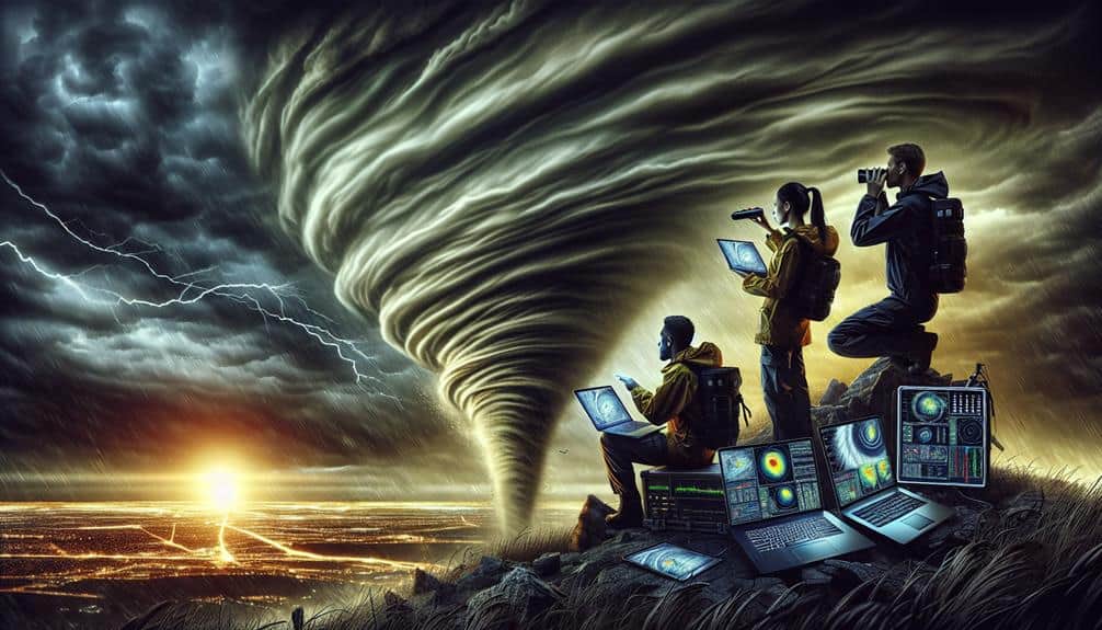
We need to master radar technology to pinpoint storm locations and assess intensity using reflectivity and dual-polarization data. Recognizing hook echoes and velocity couplets helps us identify tornado signatures. Tracking storm movement requires analyzing Doppler velocity and reflectivity patterns. Integrating radar data with models enhances our forecasting accuracy. We can detect hail and debris through differential reflectivity (Zdr) and correlation coefficient (CC) values. By understanding these radar fundamentals, we improve our storm prediction capabilities immensely. Learn more about essential tips for storm chasers and maximize your efficiency with radar analysis skills.
Key Points
- Identify hook echo patterns to detect potential tornado formations.
- Use Doppler velocity data to analyze wind shear and storm rotation.
- Monitor radar reflectivity to assess precipitation intensity and storm core locations.
- Utilize dual-polarization radar to enhance hail and debris detection.
Understanding Radar Basics
Understanding radar basics is essential for storm chasers to accurately interpret data and make informed decisions in the field. When we're out there, the radar coverage we rely on provides us with real-time information about weather patterns. High-quality radar technology enables us to dissect this data, helping us pinpoint storm locations, intensity, and movement.
Radar beams work by emitting pulses of radio waves that bounce off precipitation particles. This returns data that we can interpret to visualize storm structures. By examining reflectivity, velocity, and dual-polarization data, we can make precise assessments. Reflectivity reveals precipitation intensity, while velocity data helps us understand wind patterns and potential rotation. Dual-polarization enhances our ability to differentiate between types of precipitation, providing a fuller picture of the storm's characteristics.
Our ability to interpret this data efficiently hinges on understanding the limitations of radar coverage. Factors like beam spreading, range folding, and ground clutter can distort data interpretation. By recognizing these constraints, we can adjust our analysis accordingly, ensuring we make the most informed decisions possible.
Mastering radar technology and data interpretation is fundamental for our safety and effectiveness in tracking severe weather events.
Identifying Storm Signatures
When examining weather radar, we should focus on identifying key storm signatures such as:
- Hook echo patterns
- Velocity couplets
These features provide critical data for evaluating:
- Tornado potential
- Wind shear
Hook Echo Patterns
Identifying hook echo patterns on weather radar is necessary for storm chasers because these signatures often indicate the presence of a potentially dangerous tornado. We need to understand that a hook echo appears as a distinct, hook-shaped region of precipitation typically located on the southern or southwestern flank of a supercell thunderstorm. This feature forms due to the tornado's strong rotation, which wraps rain and debris around its core.
As storm chasers, prioritizing safety precautions is vital. When we spot a hook echo, it's a signal to maintain a safe distance and stay alert. A hook echo's presence often correlates with rapid storm development, leading to increased risks. By integrating our meteorological insights with real-time radar data, we can better predict the storm's path and potential impact zones.
To gain a thorough understanding, we should also monitor the reflectivity values and analyze the storm's structure. A well-defined hook echo, combined with high reflectivity, usually suggests a mature, intense storm. By focusing on these radar signatures, we enhance our ability to anticipate tornado formation, ensuring we can navigate safely and effectively while pursuing our passion for storm chasing.
Velocity Couplets
Besides recognizing hook echo patterns, we must also focus on velocity couplets, which are key storm signatures that indicate areas of strong rotation within a thunderstorm. Utilizing Doppler radar, we can detect these velocity couplets by identifying the distinct areas where inbound and outbound winds are in close proximity. This rotation detection is vital for pinpointing potential tornado formation zones.
When analyzing Doppler radar data, we need to look for tight gradients between red and green colors on the velocity display. Red represents winds moving away from the radar, while green indicates winds moving towards it. A clear juxtaposition of these two colors signifies a velocity couplet, suggesting strong rotation within the storm system.
For accurate rotation detection, we should monitor the storm's base velocity scans and look for couplets that persist over consecutive radar sweeps. Consistent, well-defined couplets are usually indicative of mesocyclones, which are the precursors to tornadoes. By focusing on these essential radar signatures, we're better equipped to anticipate severe weather, providing timely and accurate warnings.
In our pursuit of storm chasing, mastering the identification of velocity couplets enhances our ability to stay safe and make informed decisions on the move.
Hail Core Indicators
We can identify hail cores within a storm system by analyzing areas of high reflectivity on the radar, typically indicated by bright colors such as pink or purple. These reflectivity values often exceed 60 dBZ, a clear signal of large hydrometeors, likely hailstones. By examining these radar returns, we can estimate potential hail size and predict the likelihood of significant hail damage.
When we spot these high reflectivity regions, we should cross-reference with dual-polarization radar products like Differential Reflectivity (ZDR) and Correlation Coefficient (CC). Low ZDR values within high reflectivity areas suggest non-spherical particles, which are characteristic of hail. Similarly, CC values dropping below 0.90 in these zones further confirm the presence of hailstones.
We should also consider the height of these reflectivity cores. Echo tops reaching altitudes above the freezing level, typically around 20,000 to 30,000 feet, indicate strong updrafts capable of suspending large hailstones. This vertical structure data is essential for estimating hail size and potential ground impact.
Utilizing Reflectivity Data

Let's focus on utilizing reflectivity data to enhance our storm chasing capabilities.
By interpreting color gradients, we can accurately identify storm signatures and assess precipitation intensity.
This approach provides us with critical insights into storm structure and potential severity.
Interpreting Color Gradients
Understanding color shifts on weather radar is crucial for accurately interpreting reflectivity data and predicting storm intensity. By conducting a thorough shift analysis, we can determine areas of storm development and potential severe weather. The radar's color shifts indicate the intensity of precipitation, with colors ranging from light greens (light rain) to deep reds and purples (heavy rain or hail).
When we explore color interpretation, it's crucial to note that shifts provide real-time data about storm dynamics. For instance, a rapid change from green to yellow may signify intensifying rain, while a distinct shift from red to purple could indicate hail presence. This detailed reflectivity data helps us pinpoint areas that may experience severe weather, giving us the freedom to plan our chase routes effectively.
Moreover, understanding these color variations aids in estimating storm structure and movement. For example, a bowing segment in a line of red indicates strong winds pushing the storm forward, a hallmark of a bow echo. By mastering color shift interpretation, we enhance our decision-making and safety, ensuring we stay ahead of the storm's most violent aspects. This proactive approach empowers us to chase storms with both precision and confidence.
Identifying Storm Signatures
Building on our knowledge of color gradients, identifying storm signatures using reflectivity data allows us to recognize specific patterns that indicate severe weather phenomena. By interpreting these signatures, we can better predict the behavior of storms and guarantee our safety while chasing.
Hook Echo: This classic sign of a tornado shows up as a hook-shaped appendage on the radar, indicating strong updraft strength and storm rotation. It's vital to spot this to anticipate potential tornado formation.
Bow Echo: This outward curving line of reflectivity suggests high wind speeds and possible downbursts. When detected, we should prepare for sudden changes in storm dynamics and increased lightning frequency.
Bounded Weak Echo Region (BWER): A BWER appears as a low-reflectivity region surrounded by higher values, signaling intense updrafts. Recognizing this can help us identify the presence of a mesocyclone formation, which is often a precursor to severe weather.
V-Notch: This notch indicates strong divergence aloft and possible severe thunderstorm activity. It's a significant pattern to watch for when evaluating a storm's potential severity.
Assessing Precipitation Intensity
To accurately assess precipitation intensity, we rely on reflectivity data measured in decibels (dBZ) to quantify the strength of the radar signal returned from precipitation targets. Reflectivity values help us determine the intensity and type of precipitation, which is vital for understanding rainfall rates and the behavior of storm cells.
Higher dBZ values generally indicate heavier precipitation. For instance, values below 20 dBZ often represent light rain or drizzle, while values exceeding 55 dBZ could signify intense rainfall or hail. By interpreting these readings, we can track storm development and predict potential flooding.
Understanding weather patterns is important for storm chasers who seek the freedom to navigate safely through dynamic conditions. We analyze reflectivity data to identify areas of severe weather and assess the structure of storm cells. This allows us to anticipate changes in storm intensity and make informed decisions.
Accurate assessment of precipitation intensity through reflectivity data enables us to monitor storm development effectively. By correlating dBZ values with actual conditions on the ground, we refine our ability to predict hazardous weather events and optimize our storm-chasing strategies. This data-driven approach empowers us to chase storms with precision and safety.
Analyzing Velocity Patterns
When analyzing velocity patterns on weather radar, accurately interpreting the Doppler shift is vital to identify wind speed and direction. By understanding these patterns, we can improve our storm prediction capabilities and anticipate severe weather events. Our primary goal is to detect changes in wind speed and direction, which are key indicators of storm development.
To effectively analyze velocity patterns, consider these four key points:
- Identify Inbound and Outbound Velocities: Look for red and green patterns on the velocity radar. Red indicates winds moving away from the radar, while green shows winds moving towards it. This helps in pinpointing areas of rotation, a sign of potential tornado development.
- Assess Wind Shear: Examine the variations in wind speed and direction at different altitudes. Significant wind shear can lead to storm development and intensification. Vertical wind shear, in particular, is a crucial factor in predicting severe thunderstorms.
- Detect Mesocyclones: Look for areas of strong rotation within a storm. Mesocyclones are often precursors to tornado formation. High-resolution velocity data is vital for identifying these small-scale circulations.
- Monitor Divergence and Convergence: Identify areas where winds are spreading apart (divergence) or coming together (convergence). These patterns can indicate updrafts and downdrafts, important for understanding storm dynamics.
Interpreting Dual-Pol Products

When we interpret dual-pol products, we can differentiate between various precipitation types by analyzing reflectivity and correlation coefficient. Identifying debris signatures becomes feasible through the correlation coefficient and differential reflectivity, essential for spotting tornadoes.
Additionally, dual-pol data helps us analyze storm structures, enhancing our understanding of hail cores, updrafts, and downdrafts.
Reflectivity and Precipitation Types
Understanding reflectivity and precipitation types through dual-polarization radar products allows us to accurately identify and analyze severe weather phenomena. By leveraging these advanced tools, we can better predict and prepare for extreme weather conditions.
Here's how we can use dual-pol radar data to enhance our storm chasing strategies:
- Rainfall Rates: Reflectivity values help us determine rainfall rates by measuring the intensity of returned radar signals. Higher reflectivity indicates heavier rainfall and can pinpoint potential flooding areas.
- Snowfall Accumulation: Dual-pol products differentiate between snow and rain, allowing us to estimate snowfall accumulation more accurately. This is vital for anticipating road conditions and travel hazards.
- Wet Bulb Temperature: Understanding the wet bulb temperature is essential in identifying freezing rain scenarios. When the wet bulb temperature is around or below freezing, we can expect freezing rain to form, leading to ice accumulation on surfaces.
- Freezing Rain: Dual-pol radar can detect the presence of mixed precipitation types, including freezing rain. By analyzing differential reflectivity and correlation coefficient, we can distinguish between rain, snow, and ice pellets, improving our forecasts and safety measures.
Identifying Debris Signatures
By analyzing dual-pol radar products, we can pinpoint debris signatures that indicate tornadic activity with remarkable accuracy. Dual-pol radar provides both horizontal and vertical reflections, allowing us to perform advanced debris detection. Specifically, we look at Correlation Coefficient (CC) values. In a tornadic event, CC values often drop below 0.9, signaling the presence of non-meteorological objects like leaves, wood, and other debris lofted by the tornado.
Radial velocity data complements our radar analysis by highlighting rotational patterns within a storm. When combined with CC drops, we can confirm the presence of a tornado on the ground. This precise identification is crucial for real-time warnings and immediate tornado aftermath assessments. The debris signature, often termed a 'Tornado Debris Signature' (TDS), provides invaluable information on the extent and path of the damage.
Moreover, ZDR (Differential Reflectivity) adds another layer of detail. Low ZDR values corroborate the presence of debris, as they indicate mixed-phase hydrometeors or non-meteorological scatterers. By integrating these dual-pol radar products, we enhance our situational awareness and can make informed decisions quickly.
This capability empowers us to chase storms effectively while minimizing risk and maximizing data collection for damage assessment.
Analyzing Storm Structures
Interpreting dual-pol radar products allows us to dissect storm structures with a high degree of detail, enhancing our ability to identify features like mesocyclones, hail cores, and updrafts. As storm chasers, we need this level of detail for accurate storm structure analysis and radar interpretation. Dual-polarization technology provides both horizontal and vertical dimensions of radar returns, granting us a more inclusive view of storm dynamics.
Here are four key aspects to focus on when analyzing dual-pol weather radar data:
- Differential Reflectivity (ZDR): ZDR helps us distinguish between different precipitation types. Higher ZDR values indicate larger raindrops or hailstones, which are essential for pinpointing hail cores.
- Correlation Coefficient (CC): CC measures the similarity between horizontally and vertically polarized radar pulses. Low CC values often indicate mixed-phase precipitation or debris, aiding in identifying updrafts and mesocyclones.
- Specific Differential Phase (KDP): KDP is particularly useful for quantifying rainfall rates and identifying regions of intense precipitation, necessary for understanding storm intensity and structure.
- Hydrometeor Classification: This product categorizes precipitation types, helping us to quickly interpret storm structure and dynamics, from rain to hail to snow.
Utilizing these dual-pol products enhances our storm chasing efficiency, providing us with the precise and actionable data needed for real-time decision-making.
Recognizing Tornadic Activity
To recognize tornadic activity on weather radar, we must identify key features such as hook echoes, debris balls, and velocity couplets. These indicators are essential for understanding tornadic rotation within the storm structure.
Hook echoes appear as a hook-shaped radar signature, indicating the presence of a rotating updraft—often found in supercells. Debris balls, seen on dual-polarization radar, signify airborne debris within the tornado, providing direct evidence of tornado formation.
Next, we should focus on velocity couplets, which show contrasting wind speeds in close proximity. This is indicative of strong rotation and often precedes tornado formation. By analyzing these couplets, we can gauge the intensity and potential path of the tornado.
Supercell development is another vital element, as these storms are the primary producers of significant tornadoes. Identifying the mesocyclone, a rotating region within the supercell, helps us predict the likelihood of tornadic activity.
Using these radar features, we can effectively anticipate tornadic events and make informed decisions. The ability to interpret these data-driven indicators empowers us to navigate storm scenarios with greater safety and precision, ensuring that our pursuit of freedom in storm chasing is both thrilling and responsible.
Tracking Storm Movement

Accurate tracking of storm movement hinges on analyzing radar data to determine storm speed, direction, and potential changes in trajectory. By mastering storm tracking techniques and weather radar interpretation, we can anticipate a storm's path and stay safe while chasing.
Here are four essential steps to enhance our storm tracking skills:
- Identify Reflectivity Patterns: Use radar reflectivity data to pinpoint the storm's core. High reflectivity values indicate areas of intense precipitation, helping us locate the storm's most active regions.
- Analyze Doppler Velocity: Doppler radar gives us information on wind velocities within the storm. By examining inbound and outbound velocities, we can determine rotation and wind shear, critical for predicting storm direction and speed.
- Track Movement Over Time: Observe successive radar scans to track the storm's movement. Plotting the storm's position at regular intervals allows us to calculate its speed and direction accurately.
- Monitor Storm Evolution: Stay vigilant for changes in radar signatures that signal storm intensification or weakening. Recognizing these shifts helps us adjust our strategies, ensuring we remain in ideal positions.
Assessing Precipitation Intensity
We assess precipitation intensity by examining radar reflectivity values, which quantify the concentration of precipitation particles within a storm. Reflectivity is measured in decibels (dBZ), with higher values indicating more intense precipitation.
Typically, values between 20-30 dBZ suggest light rain, 30-40 dBZ indicate moderate rain, and values above 40 dBZ denote heavy rainfall. By monitoring these reflectivity values, we can accurately infer rainfall rates, essential for effective storm tracking.
To further refine our analysis, we consider Doppler effects, which provide velocity data on precipitation particles. This allows us to gauge wind speed and direction within a storm, helping us better understand precipitation patterns.
For instance, areas with high reflectivity and strong inbound or outbound velocities may indicate severe weather conditions, requiring immediate attention.
Detecting Hail and Debris

Beyond evaluating precipitation intensity, identifying hail and debris within a storm involves analyzing differential reflectivity (Zdr) and correlation coefficient (CC) values on weather radar. These metrics help us distinguish hail size and locate debris with precision, guaranteeing a thorough understanding of storm dynamics.
1. Differential Reflectivity (Zdr) Analysis:
Zdr values are essential for evaluating hail size. Positive Zdr values typically indicate raindrops, while values near zero suggest spherical objects like hailstones. Large hailstones often result in low Zdr values.
2. Correlation Coefficient (CC) Insights:
CC values assist in debris detection. Low CC values (below 0.8) signify non-meteorological targets such as debris, which is crucial during tornado events. Consistently low CC values across a broad area can indicate significant debris lofting.
3. Dual-Polarization Radar:
Dual-polarization radar enhances our ability to detect hail and debris by transmitting both horizontal and vertical pulses. This technology provides a more detailed view of the storm structure, aiding in precise hail size estimation and debris localization.
4. Integrated Data Analysis:
Combining Zdr and CC with other radar products like reflectivity (dBZ) and velocity data offers a robust method for identifying severe weather elements. This multi-faceted approach ensures we capture a comprehensive picture of the storm's impact.
Integrating Radar With Models
Integrating radar data with numerical weather prediction models enhances storm forecasting accuracy by providing real-time, high-resolution insights into atmospheric conditions. By fusing radar analysis with model integration, we can continuously update our storm prediction systems with the latest observational data. This synergy improves the precision of our forecasts, enabling us to track storm development, intensity, and movement with unparalleled detail.
We employ sophisticated algorithms to assimilate radar data into our predictive models. This process corrects initial conditions and refines our understanding of the atmospheric state. Radar analysis captures phenomena such as wind patterns, precipitation rates, and storm cell dynamics, which are indispensable for accurate forecasting. The integration of this data guarantees that our models reflect real-world conditions as closely as possible, reducing uncertainties and enhancing forecasting accuracy.
For storm chasers, the ability to rely on integrated radar and model data translates to more informed decision-making and increased safety. By leveraging these advanced tools, we can anticipate severe weather events with greater confidence. This fusion empowers us to act autonomously, making real-time adjustments to our strategies based on the most precise storm prediction data available.
Frequently Asked Questions
What Equipment Is Essential for Storm Chasing Besides Weather Radar?
Imagine being on the edge of a storm's fury; we need safety gear like helmets and reinforced jackets, and communication devices for real-time updates. These tools are essential for maneuvering and documenting nature's wildest moments effectively.
How Can I Ensure My Safety While Storm Chasing?
To guarantee our safety while storm chasing, we must follow strict safety precautions, have detailed emergency plans, and prioritize route planning. Identifying and memorizing escape routes is essential for navigating unpredictable weather conditions efficiently and safely.
What Are the Best Mobile Apps for Real-Time Radar Updates?
For radar accuracy and reliability, we recommend RadarScope and MyRadar. Both apps excel in storm tracking and predictions, providing precise, data-driven insights. With these tools, we can chase storms confidently and stay informed in real-time.
How Do I Communicate Effectively With Other Storm Chasers?
We guarantee effective communication with other storm chasers by prioritizing team coordination and safety protocols. Utilizing communication tools like radios and apps, we establish emergency plans, enabling us to adapt swiftly and maintain our freedom in the field.
What Are the Legal Considerations for Storm Chasing in Various Regions?
We must be aware of permit requirements and insurance coverage in different regions. Privacy laws and liability concerns also play an important role. Understanding these legalities guarantees we're prepared and protected while storm chasing.