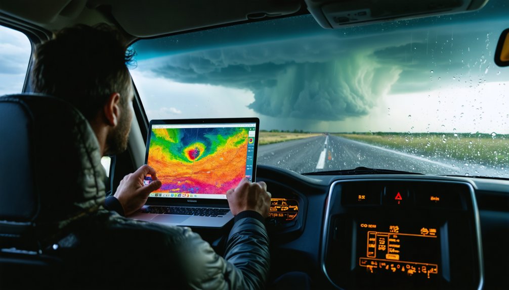
Doppler radar gives you something no standard weather app can match — real-time wind velocity data that exposes a storm’s internal rotation before a tornado ever touches down. It measures frequency shifts in microwave pulses to reveal both precipitation intensity and wind dynamics simultaneously. You can identify hook echoes, velocity couplets, and debris balls as they develop. Keep going to discover exactly how storm chasers use this data to stay alive in the field.
Key Takeaways
- Doppler radar measures frequency shifts in microwave pulses to simultaneously reveal precipitation intensity and wind velocity for real-time storm assessment.
- Automatic updates every 2-10 minutes provide timely storm data, enabling chasers to identify intensification, directional shifts, or sudden storm collapses.
- Distinct radar signatures like hook echoes, velocity couplets, and debris balls help chasers identify tornado formation and confirm activity.
- Dual-polarization radar distinguishes precipitation types and improves identification of severe weather features beyond what basic reflectivity alone provides.
- Velocity data isolates real-time rotation signatures, delivering critical situational awareness essential for identifying tornadoes and tracking storm movement safely.
How Doppler Radar Actually Works for Storm Chasers
When you’re chasing storms, understanding the mechanics behind Doppler radar transforms raw data into actionable intelligence. Doppler principles rely on measuring frequency shifts in returning microwave pulses, revealing both precipitation intensity and wind velocity simultaneously.
Doppler radar doesn’t just show storms — it decodes them, turning frequency shifts into life-saving intelligence.
These radar mechanics let you distinguish between a weakening rain shower and a strengthening supercell before visual confirmation is even possible.
Storm visualization becomes precise when you’re reading native radial format data, updated every 2-10 minutes directly from NWS sources. You’re seeing conditions as the radar actually captures them, without processing delays distorting critical details.
Effective data interpretation means recognizing what each return signal represents — reflectivity shows precipitation density while velocity products expose rotation.
You’re fundamentally decoding atmospheric physics in real-time, gaining the situational awareness needed to make independent, informed decisions in the field.
Why Raw NWS Radar Data Beats Every Standard Weather App
Understanding radar mechanics is one thing — but the quality of data feeding your display determines whether you’re making decisions based on reality or a sanitized approximation of it.
Standard weather apps process, compress, and delay NWS data before it reaches you. That’s where raw data advantages become mission-critical. RadarScope pulls native radial-format data directly from NWS servers, updating every 2-10 minutes without algorithmic interference. You’re seeing exactly what the radar sees.
App limitations aren’t trivial — smoothed reflectivity masks hook echo definition, compressed velocity data obscures rotation signatures, and delayed updates misrepresent a storm’s current position.
When you’re positioning a vehicle relative to a supercell’s forward flank, those distortions cost you precision. Raw data doesn’t negotiate with convenience — it gives you unfiltered atmospheric truth.
Real-Time Storm Tracking That Keeps Chasers One Step Ahead
Raw NWS radar data is only as useful as the speed at which it reaches you. For storm tracking, delays cost decisions. RadarScope’s automatic updates every 2–10 minutes in native radial format mean you’re reading conditions as the atmosphere writes them—not as a processed summary from hours ago.
Chaser strategies depend on precision timing. You need to know when a cell intensifies, shifts, or collapses.
- A hook echo sharpening on your screen signals rotation before it’s confirmed on the ground.
- Velocity couplets tightening in real-time indicate strengthening mesocyclone structure.
- Precipitation type changes appear across your route before you reach them.
- Single-site high-resolution data captures rapid storm evolution that broad-network radar misses.
You stay ahead because your data moves faster than the storm.
Doppler Radar Signatures That Reveal Dangerous Storms
Hook echoes, velocity couplets, hail spikes, debris balls—these aren’t just visual artifacts on a radar display. They’re diagnostic signatures that tell you exactly what a storm’s doing before it reaches you.
Mesocyclone detection identifies rotating updrafts within supercells, giving you structural intelligence on tornado potential. Velocity couplet interpretation reveals inbound and outbound wind shear, quantifying rotational intensity.
Hail spike identification uses three-body scatter artifacts to confirm large hail presence aloft. Debris ball analysis detects lofted ground-level material, confirming an active tornado.
Dual-pol products push your capabilities further—precipitation type classification distinguishes rain, hail, and mixed-phase hydrometeors with precision conventional reflectivity can’t match.
Combined with storm path forecasting, these signatures don’t just describe what’s happening. They give you the freedom to act decisively on verified, real-time atmospheric data.
What Dual-Pol Radar Shows Beyond Basic Reflectivity
Dual-pol radar transmits pulses on both horizontal and vertical axes simultaneously, giving you a three-dimensional hydrometeor profile that basic reflectivity simply can’t produce.
These dual pol benefits reveal advanced detection capabilities that single-polarization systems leave completely blind.
- Correlation coefficient drops near zero inside debris balls, confirming tornado ground contact instantly
- Differential reflectivity distinguishes large raindrops from hail by measuring particle shape and tumbling behavior
- Specific differential phase calculates precise rainfall rates independent of beam attenuation errors
- Hydrometeor classification automatically separates rain, wet snow, dry hail, and biological targets without manual interpretation
You’re no longer guessing what’s inside a storm cell.
Dual-pol products strip away ambiguity, delivering quantifiable particle-level data that sharpens your situational awareness and accelerates critical decisions during rapidly evolving severe weather.
How High-Resolution Radar Catches Fast-Moving Severe Weather
When a supercell rotates at 60+ mph, conventional radar updating every 6 minutes leaves you working with dangerously stale data. High-resolution single-site radar eliminates that gap, delivering native radial updates every 2-10 minutes so you’re analyzing conditions as they actually exist.
That high speed tracking capability isn’t just a convenience—it’s operationally critical. Severe storm signatures like mesocyclone hook echoes and velocity couplets can develop and intensify within minutes.
Standard apps processing and repackaging data introduce delays that cost you decision time.
Super-resolution reflectivity and velocity products display raw NWS data exactly as the radar captured it, preserving spatial detail that compressed formats discard.
When you’re positioning relative to a fast-moving storm, that precision determines whether your data empowers smart decisions or creates dangerous blind spots.
How Storm Chasers Use Radar to Make Life-or-Death Field Calls
Positioning a chase vehicle in relation to a supercell isn’t guesswork—it’s a sequence of rapid, data-driven decisions executed against a moving clock. Your storm strategy depends entirely on reading velocity couplets, hook echoes, and debris balls in real time. Miss a rotation signature, and your safety protocols collapse.
Here’s what you’re watching simultaneously:
Here’s what you’re watching simultaneously—hook echoes, velocity couplets, debris balls, storm vectors—all redefining your survival decisions in real time.
- Hook echo tightening on reflectivity, signaling tornado development
- Velocity couplets intensifying, confirming mesocyclone rotation strength
- Debris ball signatures appearing, indicating a tornado is already on the ground
- Storm motion vectors shifting, forcing immediate repositioning decisions
Every update cycle redefines your exit options. You’re not just observing weather—you’re calculating escape routes, road networks, and storm forward speed against live radar data refreshing every two minutes.
RadarScope Features That Let Chasers Read Data Like Meteorologists
Reading storm data at the level of a working meteorologist requires more than a basic radar app—it demands access to raw, unprocessed NWS feeds, and that’s exactly what RadarScope delivers.
You’re getting native radial-format data updated every 2–10 minutes, preserving accuracy that processed apps strip away. Advanced data visualization tools surface mesocyclone hook echoes, velocity couplets, hail spikes, and debris balls—signatures that define dangerous supercell structures.
Dual-pol products push radar interpretation techniques beyond basic reflectivity, letting you distinguish precipitation types and identify severe features with precision. VIL products quantify hail potential, while velocity data isolates rotation signatures in real time.
RadarScope’s AMS-award-winning interface puts professional-grade analysis directly in your hands, giving you the interpretive independence that defines serious storm chasing.
Frequently Asked Questions
How Does Doppler Radar Data Differ Between Mobile Devices and Desktop Platforms?
You’ll access the same raw NWS Doppler radar data across both platforms, but mobile app features optimize portability for field chasers, while desktop interface advantages deliver expanded screen real estate for deeper, multi-parameter analytical storm assessment.
What Weather Conditions Make Doppler Radar Signals Unreliable or Inaccurate?
Like a veil over your vision, signal interference from mountains, heavy precipitation types, and extreme atmospheric conditions can trigger radar limitations, skewing your data and producing inaccurate reflectivity readings you’ll need to critically evaluate.
How Much Does Professional Storm Chasing Radar Software Typically Cost Annually?
You’ll typically invest $9.99–$99.99 annually for professional storm chasing radar software, with annual costs varying based on software features like dual-pol products, super-resolution data, and real-time NWS radar access you’re choosing.
Can Doppler Radar Detect Underground Weather Phenomena or Subsurface Conditions?
Here’s the truth — Doppler radar can’t perform underground detection or subsurface analysis. It’s designed exclusively for atmospheric phenomena. You’ll find it captures airborne precipitation, wind velocity, and storm rotation data above ground only.
What Certifications Do Storm Chasers Need to Access Professional Radar Networks?
You don’t need formal certification requirements to access professional radar networks like RadarScope. However, pursuing radar training sharpens your analytical skills, helping you interpret velocity couplets, dual-pol products, and severe weather signatures with precision and confidence.
References
- https://stormcenter.app
- https://myradar.com
- https://www.radaromega.com
- https://play.google.com/store/apps/details?id=weatherradar.livemaps.free&hl=en_US
- https://apps.apple.com/is/app/radarscope/id288419283
- https://www.weatherwise.app
- https://www.stormtours.com/radarscope-weather-radar-app/
- https://play.google.com/store/apps/details?id=com.basevelocity.radarscope&hl=en_US


