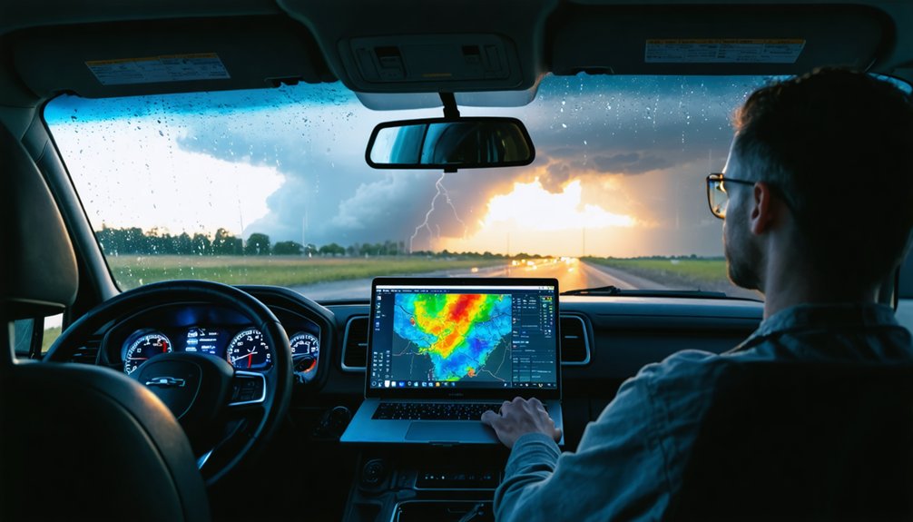
You’ll predict storm formations most effectively by combining weather balloon soundings that measure atmospheric instability, Doppler radar detecting rotational signatures and wind shear, geostationary satellites scanning conditions every 30 seconds, and convection-allowing numerical models that resolve storm-scale dynamics. Ensemble forecasting systems quantify uncertainty through perturbed initial conditions, while data assimilation integrates observations into model initializations. Historical analog patterns validate current atmospheric setups, and dual-polarization radar identifies precipitation types indicating severe potential. The synthesis of these complementary data streams reveals precisely where dangerous weather will develop.
Key Takeaways
- Weather balloons with radiosondes transmit direct atmospheric measurements and GPS wind data essential for initializing storm prediction models.
- Doppler radar systems detect real-time precipitation velocities and identify tornadic wind shear patterns through dual-polarization technology analysis.
- Geostationary satellites provide rapid 30-second atmospheric scans while low-orbit CubeSats deliver hourly tropical storm observations globally.
- Convection-allowing ensemble models explicitly resolve storm formations and quantify prediction uncertainty through probabilistic threshold exceedance outputs.
- Analog reanalysis compares current atmospheric conditions with historical storm patterns to validate predictions and calculate uncertainty levels.
Atmospheric Observations From Weather Balloons and Surface Networks
While satellites provide broad atmospheric coverage, weather balloons deliver the direct measurements that form the backbone of modern storm prediction systems. Radiosondes ascend at 300 meters per minute, reaching stratospheric altitudes of 20-30 kilometers while transmitting temperature, pressure, humidity, and wind data via radio signals.
This upper level atmospheric monitoring occurs twice daily from dozens of U.S. sites, with additional launches preceding severe weather events. GPS tracking reveals wind patterns critical for modeling storm movement. Unlike satellite remote sensing, these in situ measurements identify retrieval errors and validate indirect observations through surface observation quality assurance protocols.
Data assimilation occurs every six hours, initializing forecast models that predict tornado potential through hodograph analysis and hurricane trajectories—enabling you to make informed decisions when severe weather threatens.
Real-Time Radar Detection and Storm Tracking Capabilities
Doppler radar systems form the technological foundation of real-time storm detection, transmitting short pulses of radio waves that measure phase shifts when precipitation particles move toward or away from transmission sites. You’ll access velocity data that reveals rotation within thunderstorm clouds, providing unsmoothed analysis of developing severe weather.
Radar based hail detection algorithms identify dangerous precipitation types through dual-polarization technology, which distinguishes between rain, hail, and debris. Doppler measured wind shear becomes visible through phase shift analysis, allowing you to track tornadic circulation patterns and downburst formation.
Mobile radar units positioned during storm development scan atmospheric conditions below standard detection beams, delivering critical low-level data. Updates arrive every five minutes without third-party delays, giving you direct access to storm characteristics, movement vectors, and intensity measurements for independent weather assessment.
Satellite Monitoring Systems for Continuous Storm Surveillance
Geostationary satellites maintain fixed positions 22,236 miles above Earth’s equator, enabling continuous observation of the same atmospheric region without interruption. GOES-R Series satellites scan targeted areas every 30 seconds through Advanced Baseline Imager technology, delivering real-time monitoring you can’t obtain from ground-based systems alone.
GOES-R satellites deliver continuous 30-second scans from geostationary orbit, providing uninterrupted real-time atmospheric monitoring impossible to achieve through ground-based observation systems alone.
Low-Earth orbit constellations complement this coverage through rapid revisit rates. TROPICS CubeSats observe tropical storms hourly versus previous six-hour intervals, generating 11 billion observations across Earth’s tropical belt.
Multi sensor data fusion combines microwave sounders penetrating cloud cover with scatterometer wind vectors and polarimetric radiometers for exhaustive atmospheric profiling.
Orbital constellation design determines your monitoring capabilities. Tomorrow.io’s planned 12-CubeSat network achieves global coverage under 60-minute revisit rates, while INCUS spacecraft integrate Ka-band radar with cross-track radiometers for enhanced spatial resolution.
Numerical Weather Models and Data Assimilation Techniques
Convection-allowing models (CAMs) operate at grid spacing of 4 km or less, explicitly resolving deep convection without parameterization schemes that introduce uncertainty in storm initiation and evolution.
You’ll find ensemble systems like the High-Resolution Rapid Refresh Ensemble (HRRRE) capture forecast uncertainty by running multiple CAM configurations with perturbed initial conditions and physics schemes, generating probability distributions for severe weather parameters.
The ensemble spread-skill relationship, though typically correlating below 0.6, provides critical confidence metrics when predicting localized storm formations where deterministic models often fail to represent mesoscale variability.
Convection Allowing Model Physics
Numerical weather prediction models have broken through the traditional limitations of parameterized convection by operating at 1-4 km grid spacings, where they explicitly resolve convective development without relying on cumulus parameterization schemes. You’ll observe that these systems capture vertical velocity dynamics directly, eliminating bulk approximations of latent heating and precipitation.
This explicit representation delivers prognostic storm characteristics through key outputs: updraft helicity identifies supercells, simulated composite reflectivity forecasts convective mode, and vertically integrated liquid evaluates storm size. True convection-resolving demands sub-kilometer spacings for adequate storm resolution. You can track storm initiation and evolution without subjective environmental projections.
Systems like HRRR generate hourly maximum UH plots, while ensemble outputs produce neighborhood probabilities that quantify threshold exceedance likelihood—giving you actionable, objective intelligence for independent decision-making.
Ensemble Forecast Uncertainty Capture
- Initial condition errors from sparse observations and satellite limitations
- Model formulation imperfections requiring multi-physics approaches
- Soil moisture and land-surface parameter variations affecting short-range accuracy
Calibration against historical observations removes systematic biases, ensuring probabilistic outputs match observed frequency. You’ll extract maximum value during high-impact events where uncertainty quantification liberates decision-making from false deterministic confidence, particularly beyond the 6-day predictability horizon.
Ensemble Forecasting for Probability-Based Storm Predictions

When atmospheric models generate multiple forecasts from a single initialization, they transform deterministic predictions into probability distributions that capture the inherent uncertainty of storm systems. You’ll find these ensemble forecasts employ Monte Carlo approaches to simulate chaotic atmospheric behavior, producing probabilistic outputs rather than single-point predictions. For Hurricane Sandy, ensemble members 60 hours pre-landfall revealed tracks spanning Maryland to Maine, with concentration over New Jersey—giving you actionable probability ranges for high-impact decisions.
Bias correction techniques and Bayesian model averaging refine raw ensemble outputs, addressing systematic model errors and calibrating spread-skill relationships. The GEFS system generates 21 members accounting for data gaps and instrument biases, delivering probabilities for specific thresholds like 1-inch precipitation events. Post-processing enhances long-range predictability, ensuring your probabilistic forecasts align with verified outcomes.
Historical Weather Patterns and Analog Comparison Methods
Probabilistic forecasts gain strength when meteorologists compare current atmospheric configurations against documented historical patterns. You’ll find analog reanalysis techniques reconstruct past conditions by blending observations with numerical modeling, matching current setups to similar historical scenarios. These methods calculate uncertainty levels and validate predictions against known outcomes.
Historical storm pattern trends reveal critical insights:
- Precipitation intensity, frequency, and duration changes across regions and decades
- Evolution of storm frequency and severity over time
- Shifting atmospheric configurations that preceded significant weather events
The Norwegian Cyclone Model from 1919 established foundational pattern recognition, while modern ensemble Kalman filtering enables precise hindcasting at unmonitored locations. You’re examining continuous datasets that connect past storms to future predictions, giving you freedom to identify emerging threats before conventional models detect them.
Frequently Asked Questions
How Do Ocean Buoy Measurements Contribute to Storm Formation Predictions?
Like sentinels guarding the sea, you’ll find buoys tracking ocean temperature fluctuations and coastal wind patterns every 30 minutes, transmitting critical atmospheric pressure and wave data that strengthens your storm models by 50% through real-time satellite integration.
What Role Does Lightning Detection Data Play in Forecasting Severe Weather?
Lightning strike patterns reveal storm intensification in real-time, while atmospheric charge distribution data gives you 8-60 minutes advance warning. You’ll track severity changes independently, distinguishing dangerous cloud-to-ground strikes from intracloud activity before conventional radar confirms threats.
Can Social Media Reports Improve Real-Time Storm Tracking Accuracy?
You’ll enhance storm tracking accuracy by integrating crowd-sourced observations from millions of geo-located tweets daily. Real-time social media alerts provide ground-truth data across impact zones, enabling you to verify conditions independently and respond faster than traditional monitoring alone.
How Do Aircraft Reconnaissance Flights Enhance Tropical Cyclone Intensity Forecasts?
You’ll witness aircraft flight patterns piercing storm cores at 10,000 feet, where dropsondes capture storm interaction dynamics—measuring eyewall winds, sea-level pressure, and three-dimensional structure. This direct data reduces intensity forecast errors by 20%, empowering your preparedness decisions.
What Meteorological Thresholds Trigger Automated Storm Warning Systems?
You’ll find automated storm warning systems trigger when barometric pressure changes exceed 3-5 mb/hour, wind speed variations reach 48+ knots sustained, and precipitation rates surpass 15mm/hour. These thresholds enable rapid, independent decision-making for your safety.