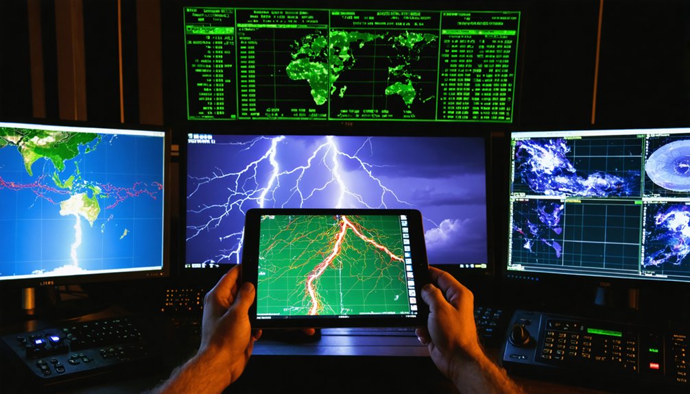
Radar technology transforms your severe thunderstorm interception by transmitting electromagnetic waves that detect precipitation intensity, measure Doppler-shifted wind velocities, and identify mesocyclone rotation signatures within supercells. You’ll gain critical warning windows as dual-polarization systems distinguish tornado debris from hydrometeors, while phased array radars complete 360° scans in just 6-10 seconds. Multi-sensor fusion with lightning detection networks improves your tornadic identification accuracy by 30%, converting minute-scale atmospheric changes into actionable intelligence. The following sections reveal how these integrated systems overcome physical limitations and extend your operational capabilities.
Key Takeaways
- Doppler radar maps precipitation intensity and wind patterns, creating 3D storm profiles through multi-elevation scans for comprehensive severe weather analysis.
- Dual-polarization technology distinguishes tornado debris from rain and hail, enhancing target identification accuracy during severe thunderstorm events.
- Mesocyclone detection reveals mid-level rotation patterns, providing critical warning time before potential tornado formation within supercell thunderstorms.
- Phased array systems complete full scans in 6-10 seconds, capturing rapid storm evolution and intensity changes for timely interception decisions.
- Multi-sensor fusion combines radar, lightning detection, and atmospheric data, improving tornadic thunderstorm identification accuracy by 30 percent.
How Doppler Radar Detects Precipitation and Wind Patterns in Storms
When Doppler radar transmits electromagnetic waves into the atmosphere, these microwave-frequency pulses propagate until they encounter precipitation particles—raindrops, ice crystals, or hail—that scatter the energy back toward the radar antenna. The returned signal’s intensity reveals reflectivity data, quantifying precipitation growth patterns and distinguishing heavy rain from hail cores.
Simultaneously, frequency shifts from moving particles—the Doppler effect—convert phase changes into velocity measurements, mapping wind speeds and directions within storms. You’ll observe adjacent inbound and outbound velocities indicating mesocyclonic rotation, while divergence signatures expose microbursts and downdrafts.
Multi-elevation scans from 0.5° to 15° construct three-dimensional storm profiles, though radar beam refraction effects can distort lower-altitude coverage. This dual-parameter approach—reflectivity coupled with velocity—provides autonomous storm analysis independent of visual conditions or institutional gatekeeping.
Dual-Polarization Technology for Identifying Tornado Debris and Hail
Traditional Doppler radar’s velocity measurements expose rotation and wind shear, yet they can’t distinguish a tornado’s composition—whether the return signal originates from rain, hail, or ground debris circulating within the vortex.
Standard Doppler radar detects velocity and shear but cannot identify whether spinning debris is rain, hail, or tornado-lofted ground material.
Dual-polarization radar transmits horizontal and vertical electromagnetic pulses simultaneously, enabling rapid debris mapping through polarimetric analysis. This technology identifies storm intensity signatures by detecting particle size, shape, and orientation variations.
Key Detection Capabilities:
- Polarimetric Tornado Debris Signature (PTDS) – Distinguishes lofted ground debris from hydrometeors through differential reflectivity patterns
- Large Hail Discrimination – Separates hail from rain using two-dimensional particle characteristics
- Updraft Identification – Reveals convective structure through particle distribution analysis
- False Echo Elimination – Filters non-meteorological targets, improving warning accuracy
You’ll receive enhanced situational awareness during severe weather events, as forecasters leverage these multi-dimensional data streams for precise threat assessment.
Early Warning Capabilities Through Supercell Rotation Detection
As Doppler radar interrogates supercell thunderstorms, phase-shift analysis in returned electromagnetic signals reveals mesocyclone rotation within the storm’s mid-levels, providing forecasters with critical lead time before tornado genesis. You’ll gain warning windows extending several minutes as velocity couplets identify rapid rotation intensification linked to strengthening updrafts.
Enhanced scanning strategies deliver higher-resolution data, enabling you to detect threatening conditions earlier through precise storm inflow dynamics monitoring. Persistent rotation signatures lasting 10-15 minutes signal elevated tornado potential, while integration with lightning flash rates confirms supercell evolution.
NSSL’s advanced radar applications combine rotation products with multi-sensor fusion, optimizing your forecaster decisions and extending public warning times. Phased array technology accelerates rotation monitoring, granting you unprecedented situational awareness during rapidly evolving severe weather events.
Mobile and Phased Array Radar Systems for Rapid Storm Analysis
While conventional mechanically-steered radars require several minutes to complete volumetric scans, phased array systems revolutionize storm surveillance through electronic beam steering that interrogates entire thunderstorm structures in under 10 seconds. You’ll find mobile platforms like PAIR’s C-band system and Horus S-band demonstrator delivering tailored weather surveillance through rapid 360° scans in 6-10 seconds, enabling precise storm scale forecasting unavailable with NEXRAD infrastructure.
These deployments provide critical advantages:
- Simultaneous multi-tasking: Track aircraft, profile winds, and scan weather concurrently without mechanical limitations
- Intensity fluctuation detection: Resolve minute-scale TVS evolution and debris signatures distinguishing dissipation phases
- Adaptive scanning: Direct beams exclusively toward storm cells, eliminating wasteful clear-air observations
- Enhanced sensitivity: Achieve -2.9 dBZ detection at 10 km, matching rotational velocity performance of naval SPY-1A arrays
Overcoming Geographic and Physical Limitations of Radar Coverage
Despite phased array systems‘ rapid scanning capabilities, fundamental physics constrains radar effectiveness through three interconnecting mechanisms: beam elevation geometry, Earth’s curvature, and signal attenuation.
Your NEXRAD network faces 71-mile horizontal coverage gaps, with radar beam refraction preventing ground-level tornado detection beyond 50 nautical miles. Atmospheric layer interference intensifies when precipitation absorbs signals, creating crescent-shaped artifacts that mask severe weather.
You’ll find detection rates currently reach only 30% for tornadoes, with 30% of fatalities occurring in coverage voids. Enhanced networks could double detection capability to 60%, particularly addressing high winds (34% to 62% improvement). Forecasters compensate by lowering warning thresholds when signatures become ambiguous, integrating multi-source data where single-station coverage proves insufficient for protecting vulnerable populations from sudden weather events.
Lightning Detection Integration for Confirming Thunderstorm Development
Lightning detection networks provide meteorologists with electrical storm signatures that appear 5 to 30 minutes before traditional cloud-to-ground strikes, creating critical early warning windows for severe weather development.
You’ll gain confirmation when shower clouds shift to thunderstorm status through these integration advantages:
- Intra-cloud flash monitoring tracks electrical activity patterns within developing convective cells, identifying storm severity before ground strikes occur
- VHF band systems operating around 60 MHz capture lightning progression through different storm regions with superior time resolution
- Time-of-arrival techniques using 6-7 ground stations pinpoint three-dimensional source locations with precision
- Dual-detection networks measure radio wave emissions (sferics) to distinguish precipitation evolution characteristics that weather radar alone can’t definitively identify
This complementary approach eliminates uncertainty about whether radar-detected shower clouds will intensify into dangerous thunderstorms.
Multi-System Data Fusion for Precise Severe Weather Pinpointing
Electrical activity monitoring alone can’t capture the complete picture of severe weather development. You’ll need enhanced environmental parameter integration from multiple detection systems working simultaneously.
The ProbSevere v3 model demonstrates this principle by fusing radar reflectivity, lightning strike data, satellite imagery, and numerical weather predictions into single next-hour probability forecasts. This multi sensor storm severity analysis achieves 30% improvement in tornadic detection compared to isolated systems.
MRMS technology mosaics network-wide radar data every two minutes at 500-meter resolution, automatically filling gaps when individual sensors fail. You’re leveraging predictor importance analysis to identify which data streams contribute most notably—above-anvil cirrus plumes and lightning jump algorithms rank highest.
This fusion approach delivers superior warning lead times while maintaining operational independence from any single sensor’s limitations.
Enhanced Lead Times Through Advanced Scanning and Velocity Products
When thunderstorm interception demands precision timing, advanced scanning technologies and velocity products deliver critical lead time extensions that separate successful nowcasts from missed warnings. You’ll gain operational advantages through:
- WoFS warn-on-forecast paradigm extending lead times from 15 minutes to 2 hours for violent outbreaks, enabling impact based decision support for evacuation protocols
- TIM rapid-update scanning distributing equitable warnings downstream of long-track supercells, supporting storm surge mitigation techniques in coastal convergence zones
- Velocity product integration detecting rotation signatures 5-20 minutes ahead through helicity and CAPE-derived parameters
- HRRR 15-minute tracking cycles monitoring wind pattern shifts and explosive convective development
These systems synthesize real-time observational data with high-resolution simulations, narrowing alert corridors to specific threat zones rather than broad regional warnings.
Frequently Asked Questions
How Much Does a Typical WSR-88D Doppler Radar System Cost to Install?
Like a sentinel’s foundation, radar installation costs aren’t specified in the data, but you’ll find the $150 million SLEP upgrade across 159 systems reveals radar system capabilities requiring substantial infrastructure investment for your weather monitoring independence.
Can Weather Radar Technology Detect Tornadoes at Night as Effectively?
You’ll find radar detects nighttime tornadoes effectively through improved tornado detection algorithms and enhanced radar resolution, particularly dual-polarization technology identifying debris signatures. However, you’re still constrained by range limitations and line-of-sight obstacles requiring supplementary detection methods.
What Training Do Meteorologists Need to Interpret Radar Data Accurately?
Like accessing storm secrets, you’ll need extensive training in meteorology and rigorous data analysis skills to master radar interpretation—understanding reflectivity patterns, Doppler velocity couplets, dual-polarization parameters, and algorithm outputs that reveal nature’s atmospheric fury independently.
How Often Does Radar Equipment Require Maintenance and Calibration Checks?
You’ll need regular equipment inspections daily and weekly, with precise calibration procedures quarterly for radar level systems. However, radar guns require more frequent attention—calibration every 30-60 days using tuning forks, plus thorough recalibration biannually.
Do Smartphone Weather Apps Use Real-Time Radar Data From WSR-88D Systems?
Yes, you’ll receive WSR-88D radar data through smartphone apps like RadarScope and RadarNow!, though radar data limitations include beam blockage and temporal delays. These apps provide real-time weather alerts, enabling you to independently monitor severe storm development and movement.


