Your first storm chase will involve 8-12 hours of highway travel while monitoring real-time radar data and NOAA broadcasts, punctuated by brief 20-minute windows when supercells produce observable phenomena. You’ll encounter physical demands from extended van time, meteorological patience as systems evolve unpredictably, and coordination challenges maintaining escape routes from RFD gust fronts and precipitation cores. Professional operators employ data-driven positioning strategies with redundant GPS and mobile radar networks to optimize viewing angles while mitigating vehicular, lightning, and tornado proximity hazards. The following sections detail preparation protocols, safety frameworks, and tracking methodologies that enhance your chase experience.
Key Takeaways
- Expect early morning forecast briefings followed by hours of driving across rural areas to intercept developing storms.
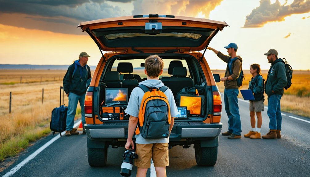
- Tours accommodate 6-7 participants in specialized vans equipped with mobile radar, GPS, and real-time weather tracking technology.
- Professional guides will explain visual storm features like wall clouds and shelf clouds while maintaining safe positioning strategies.
- You’ll experience dynamic repositioning throughout the day as meteorological conditions evolve and storm systems shift.
- Safety protocols include maintaining escape routes, avoiding hail cores, and monitoring multiple data sources for hazard awareness.
Getting Ready: Preparation and Planning Essentials
Before you commit to a storm chase tour, evaluate operators through quantifiable safety metrics: vehicle maintenance logs, emergency response protocols, and documented severe weather encounters. Examine their social media for real-time communication patterns and transparency regarding chase outcomes.
Prioritize operators with transparent safety records, documented protocols, and active social media communication before booking your chase experience.
Select tour styles aligned with your objectives—photography-focused, meteorology-focused, or adventure-focused configurations. Assess group size trade-offs: small groups maximize personal autonomy, while large groups provide diverse observational perspectives.
Pre trip training sessions familiarize you with meteorological terminology—supercells, mesocyclones, Enhanced Fujita Scale classifications. Review Storm Prediction Center’s convective outlook methodology and practice comparing personal forecasts against verification data. Study tour itineraries for daily structure and flexibility parameters.
Physical preparation demands stamina for extended van hours and rapid mobility during severe weather events. Confirm gear storage recommendations accommodate camera equipment, emergency supplies, and hydration systems for remote deployment scenarios.
What to Pack for Storm Chasing Success
Successful storm chasing requires 47 distinct equipment categories distributed across five operational systems: navigation/tracking, communication/connectivity, power management, documentation, and personal protection. Your gear selection determines operational capability during severe weather intercepts.
Critical equipment priorities include:
- Navigation redundancy: Real-time radar software like RadarScope Pro paired with offline GPS systems and paper atlases guarantees route flexibility when cellular networks fail
- Power independence: EcoFlow Delta Pro stations and 24,000+ mAh power banks maintain equipment functionality throughout multi-day deployments
- Communication resilience: Cellular boosters, weather band radios, and ham radio systems provide uninterrupted data access in remote territories
Regular gear maintenance protocols prevent equipment failure during critical storm intercepts. Weatherproof your DSLR cameras, verify drone battery cycles, and test all charging systems before departure. Pack polarized lenses for rain-wrapped tornado identification.
Understanding Safety Protocols and Best Practices
Storm chasing safety protocols function as threat mitigation systems protecting operators from five primary hazard categories: vehicular exposure during severe convection, lightning strike probability, tornado proximity events, compromised situational awareness, and equipment failure cascades.
You’ll maintain escape routes while approaching storm features cautiously, never core-punching through precipitation or positioning beneath rotating wall clouds. Adhering to advanced driver training means stopping immediately when hail strikes—continued momentum compromises windshield integrity.
Lightning warrants isolation from ground contact and vertical objects during cloud-to-ground activity. Your situational awareness demands radar app monitoring, real-time NOAA broadcasts, and recognition of RFD gust fronts indicating tornado-producing regions.
Position right of mean tornado motion for ideal safety margins. Deploy your preparedness kit containing communication devices, sustenance provisions, and thermal management equipment when conditions deteriorate unexpectedly.
How Professional Storm Tours Operate
Professional storm chase operations deploy specialized infrastructure comprising meteorological expertise, mobile technology platforms, and systematic forecasting protocols across 5-11 day expeditions concentrated in April-June throughout Tornado Alley’s primary convective corridors.
Multi-day storm chase expeditions utilize advanced meteorological systems and mobile technology to intercept severe weather across Tornado Alley’s peak convective season.
Your tour operates through data-driven methodologies:
- Evening Forecast Refinement: Teams analyze model runs arriving 7-8pm, establishing target corridors for next-day deployment
- Morning Briefings: Meteorological staff present chase planning strategy, convective outlooks, and positioning tactics
- Real-Time Adaptation: Mobile radar networks and satellite feeds enable dynamic repositioning toward supercell formations
Guide training encompasses 50+ combined years across meteorology, climatology, and National Weather Service protocols. Heavy-duty vans accommodate 6-7 participants, equipped with redundant GPS, weather trackers, and protective shielding. Teams shift from computer-based forecasting to visual storm assessment—analyzing cloud structure, rotation indicators, and atmospheric cues that determine tornadic potential.
The Active Chase: Tracking and Positioning Strategies
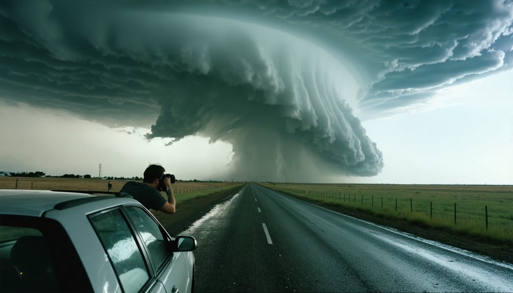
Once you’re actively tracking a storm system, you’ll need to synthesize visual meteorological signatures with real-time radar data while simultaneously maneuvering unfamiliar rural infrastructure. Your success depends on identifying mesocyclonic features—wall clouds, inflow bands, and precipitation cascades—through direct observation rather than model forecasts alone.
Equally critical is maintaining spatial awareness of road networks and pre-planned egress routes, as chaser convergence and rapidly evolving storm dynamics can compromise your positioning within minutes.
Reading Visual Storm Cues
While radar provides quantitative data on storm structure, visual observation remains critical for identifying immediate tornado threats and mesocyclone development. You’ll need to distinguish between features quickly as conditions evolve.
Essential visual indicators include:
- Wall cloud detection – Persistent, rotating lowerings beneath the rain-free base signal mesocyclone presence and potential tornado genesis, appearing lower than the ambient cloud base with visible rotation.
- Shelf cloud identification – Low-hanging bulges along the gust front indicate strong outflow rather than rotation, typically preceding severe winds instead of tornadoes.
- RFD clear slots – Dry air intrusions wrapping behind the updraft correlate with hook echoes, creating favorable tornado environments that warrant immediate reporting.
Monitor cloud motion vectors: low-level clouds racing northward while upper cirrus moves eastward confirms directional shear supporting supercell development.
Strategic positioning during active storm pursuits requires mastery of rural infrastructure limitations that aren’t apparent from mobile radar displays alone. Proactive road monitoring during chase operations identifies real-time obstacles—construction zones, livestock crossings, stopped vehicles—that compromise escape vectors when tornadoes shift trajectory.
Regional infrastructure mapping before deployment reveals critical bottlenecks: single-bridge river crossings, unpaved routes that become impassable under precipitation loading, and cellular coverage gaps that eliminate communication redundancy.
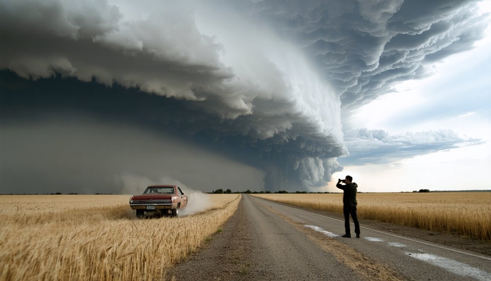
You’ll optimize approach angles by selecting southeastern positioning relative to tornado paths, avoiding northern routes that force hail core penetration with compromised visibility. Pre-storm reconnaissance of road networks provides tactical advantages during high-chaser-density scenarios, where simultaneous repositioning attempts saturate finite rural thoroughfares.
Early departure from observation positions—minutes before traffic convergence—maintains route flexibility and collision avoidance margins.
Maintaining Safe Escape Routes
- Minimum two perpendicular escape routes accounting for bridge washouts and flash flooding scenarios
- Southeast positioning for ideal storm visibility assessment through rain-shielded sectors
- Northern trajectory options that never intersect the tornado’s projected path
Avoid left-flank positioning—statistically the highest-risk quadrant. Never core-punch through precipitation cores or assume unlimited decision time. Radar fixation kills situational awareness; reevaluate constantly. Rain-wrapped tornadoes in inflow regions won’t announce themselves. Your escape geometry must account for deviant storm motions triggered by boundary interactions. Vehicle failure scenarios require pre-planned contingencies. Calculate, don’t panic.
Setting Realistic Expectations for Your Adventure
Before you commence your first storm chase, you’ll need to understand that meteorological forecasting remains an imperfect science with significant uncertainty margins. Setting realistic expectations means accepting high bust rates when forecasted storms fail to materialize.
You won’t receive guarantees of tornado intercepts—even ideal setups combining instability, moisture, lift, and wind shear can disappoint. Instead, anticipate diverse weather encounters ranging from general severe weather to towering supercells with hail and lightning.
Multiple forecast models require analysis, and you’ll likely overlook critical boundaries or atmospheric variables initially. Storm Prediction Center outlooks contain advanced meteorological terminology that’ll challenge your interpretation skills.
Your chase may involve hours of strategic positioning across Tornado Alley followed by minimal storm activity. Accept this variability as inherent to severe weather pursuit.
Learning Opportunities Beyond Tornado Sightings
Storm chasing delivers extensive meteorological learning beyond tornado documentation through systematic forecast analysis, atmospheric data interpretation, and real-time verification of predictions. You’ll develop critical forecast skills assessments by comparing your pre-chase predictions against observed conditions, identifying gaps in your understanding of convective parameters and mesoscale processes.
Your expedition includes:
- Atmospheric data collection through weather balloon launches, measuring temperature, humidity, and wind profiles that feed directly into soundings and hodograph analysis
- Model interpretation practice using aggregators like pivotalweather.com to recognize initialization errors and forecast biases
- Storm structure documentation observing supercell morphology, inflow characteristics, and boundary interactions that textbooks can’t adequately convey
Each chase builds your meteorological intuition through direct observation of atmospheric dynamics unfolding in real-time.
Frequently Asked Questions
How Much Does a Typical Storm Chasing Tour Cost?
You’ll find storm chasing company packages ranging from $1,999 for budget 4-day expeditions to $5,050 for premium 10-day pursuits. Storm chasing tour group rates offer $200-$300 discounts per participant when you’re sharing accommodations versus solo occupancy.
What Time of Year Is Best for Storm Chasing?
You’ll find ideal storm chasing during late May through early June, when storm season duration peaks with perfect weather conditions. This window maximizes severe convective parameters and tornado frequency, offering you the highest probability for witnessing significant supercell development.
Can Children Join Storm Chasing Tours?
Navigate the gray zone carefully—children *can* join tours, but child safety requirements vary by operator. You’ll find guided youth programs adjust pursuit protocols, maintaining greater buffer distances from mesocyclones while accommodating young storm enthusiasts appropriately.
Do I Need Photography Experience to Capture Good Storm Photos?
No, you don’t need prior experience. You’ll master essential storm photography techniques and camera equipment fundamentals quickly through field practice. Understanding basic exposure settings and composition principles enables you to capture compelling imagery independently.
What Happens if I Get Motion Sickness During Long Drives?
You’ll experience reduced chase effectiveness, so prepare motion sickness medication like antihistamines beforehand. Plan frequent rest stops every 30 minutes to mitigate vestibular-ocular conflict. Sit forward, maintain horizon fixation, guarantee ventilation, and avoid reading during pursuit maneuvers for ideal symptom management.