You’ll predict storm trajectories by integrating Doppler radar velocity scans from NEXRAD stations with numerical weather models that calculate CAPE, wind shear, and supercell motion vectors. Your toolkit includes GPS-enabled mobile mesonet systems collecting real-time atmospheric data, RadarScope for professional-grade radar analysis, and GRLevel3 Pro for fusing multiple data sources with your vehicle position. You’ll deploy portable weather stations measuring wind speed, pressure, and temperature while leveraging satellite-based nowcasting and ML-enhanced forecasting platforms. The following sections reveal how these technologies combine to optimize intercept positioning.
Key Takeaways
- Doppler radar stations perform volume scans every 4.5 minutes to track storm movement and identify rotation patterns.
- Numerical weather models generate diagrams showing atmospheric instability, wind shear, and predicted supercell motion vectors.
- GPS systems with dual-frequency receivers provide precise positioning data integrated with real-time radar for intercept calculations.
- GRLevel3 Pro software fuses multiple radar sources with vehicle location to calculate optimal storm intercept routes.
- Mobile mesonet stations collect atmospheric data at one-second intervals to monitor changing conditions along storm paths.
Radar Applications for Real-Time Storm Monitoring
When storm chasers track severe weather in the field, Doppler radar technology serves as their primary tool for detecting both precipitation location and atmospheric velocity. You’ll access NEXRAD’s 158 high-resolution stations operating advanced scanning modes—switching between slow surveillance scans and rapid precipitation modes during active weather.
NEXRAD’s 158 radar stations provide storm chasers with real-time precipitation and velocity data through dual-mode scanning technology during severe weather events.
The system completes 14-elevation volume scans in 4.5 minutes, providing cross-sectional atmospheric data you need for trajectory analysis.
Storm relative velocity products remove base storm motion from wind field measurements, revealing rotational signatures critical for tornado identification. Enhanced clutter rejection filters eliminate ground interference, ensuring you receive clean radial velocity data showing precipitation movement toward or away from radar stations.
This real-time information lets you independently assess developing mesocyclones and make autonomous positioning decisions without relying solely on official forecasts.
Weather Instruments for Environmental Data Collection
You’ll need specialized weather instruments to capture critical environmental data during storm intercepts. Wind speed measurement tools, atmospheric pressure monitoring devices, and real-time lightning detection systems form the core instrumentation suite for documenting storm characteristics.
These instruments provide quantifiable metrics that validate visual observations and support post-event analysis of severe weather phenomena.
Wind Speed Measurement Tools
Since storm-chasing demands real-time environmental data collection under extreme conditions, selecting appropriate wind speed measurement tools becomes critical to your safety and research objectives. Ultrasonic wind signatures captured by solid-state sensors like the FT752-D-PM deliver precision measurements up to 90 m/s without mechanical failure points, proven during 51.5 m/s tornado intercepts near Morton, Texas.
Cup anemometer durability makes Inspeed’s mag-mount models ideal for rapid vehicle deployment, withstanding debris and hail through purely mechanical rotation. Vane anemometers provide simultaneous directional tracking, while Kestrel 5500 handheld meters offer waterproof portability for documenting microclimate variations.
Integrated portable weather stations combine foldable anemometers with wireless data logging, recording 100 km/hr winds alongside precipitation intensity—essential for autonomous field operations.
Atmospheric Pressure Monitoring Devices
Your field setup integrates MeteoTemp in situ pressure sensors within MeteoShield protection, recording alongside temperature and humidity through wireless EasyLogGSM loggers.
For tornado intercepts, you’ll rapid-deploy gravity wave sensors using drones, detecting mesocyclone pressure fluctuations before funnel formation.
This systematic sensor array—combining portable barometers with fixed monitoring stations—delivers the atmospheric pressure gradients essential for autonomous trajectory prediction without centralized forecast dependency.
Real-Time Lightning Detection Systems
Real-time lightning detection systems form the electromagnetic sensing backbone of severe weather intercepts, operating through three deployment tiers: network-based regional arrays, portable field devices, and satellite-based continental monitoring. You’ll access the National Lightning Detection Network‘s grid of sensors delivering IC and CG flash coordinates within milliseconds, while iStrike’s 1,200-node international array provides cross-continental coverage.
Portable TALOS units extend your lightning strike detection capabilities to 25 miles radius, transmitting color-coded alerts at threshold distances of 25, 16, and 6 miles with corresponding audible signatures. Real time lightning alert systems like OmniWarn eliminate false positives through NLDN integration, while Geostationary Lightning Mapper satellites track thunderstorm development across entire weather systems.
Lightning Mapping Arrays employ VHF time-of-arrival calculations achieving 20-100 nanosecond resolution for three-dimensional stroke progression analysis.
Model Analysis Platforms for Atmospheric Profiling
When atmospheric conditions evolve rapidly during severe weather events, storm chasers rely on model analysis platforms to extract critical thermodynamic and kinematic data from numerical weather predictions. You’ll access Tropical Tidbits and HRRR systems to generate Skew-T-L Log-P diagrams showing CAPE, LCL, LFC, and equilibrium levels for targeted storm cells. Temporal sounding comparisons reveal instability trends, while model initialization assumptions determine forecast reliability.
Numerical weather models provide storm chasers with essential thermodynamic parameters and kinematic profiles needed for accurate severe weather forecasting and tactical positioning.
Your hodograph analysis evaluates wind shear profiles, SRH calculations, and supercell motion vectors. These platforms integrate:
- Parcel path diagnostics overlaying environmental temperature profiles
- Storm-relative wind parameters for right-mover trajectory estimation
- Forecast discussion sections providing mesoscale context
You’ll monitor hourly low-level flow changes and boundary interactions, empowering independent chase decisions without institutional constraints. Real-time radar overlays validate model outputs against observed convective development.
Communication Systems for Remote Operations
While atmospheric profiling tools determine *where* to position chase vehicles, communication infrastructure determines *whether* you’ll maintain operational capability once cellular networks fail. You’ll need two-way radio systems like the GXT1000VP4 for network-independent coordination when towers go down.
Redundancy planning becomes critical through Dejero Smart Blending Technology, which aggregates 3G, 4G, 5G, Wi-Fi, and satellite connections simultaneously—preventing single-point failures during atmospheric interference.
DataStorm satellite systems deliver high-speed internet for radar data transmission where terrestrial networks don’t reach. Bandwidth optimization occurs through EnGo 265 transmitters supporting multiple camera feeds via GateWay Mode.
Cloud-based command platforms provide centralized fleet control through web browsers, eliminating physical proximity requirements. Gyro-stabilized antennas maintain broadcast stability from moving intercept vehicles, ensuring data reaches weather services regardless of environmental conditions.
Establishing reliable communication links means nothing if you can’t navigate to the precise geographic coordinates where atmospheric conditions warrant observation. GPS positioning algorithms anchor your intercept strategy—dual-frequency receivers correct ionospheric delays during geomagnetic disturbances, while single-frequency units suffice in stable conditions. Spatial data visualization transforms raw coordinates into actionable intelligence through real-time plotting on dynamic maps.
Core Navigation Components:
- Mapping Software – Street Atlas and Tom Tom distinguish paved from unpaved roads, preventing entrapment on impassable routes during rapidly evolving scenarios.
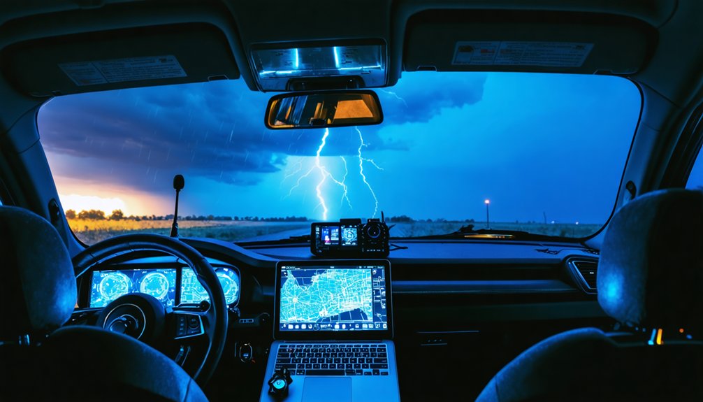
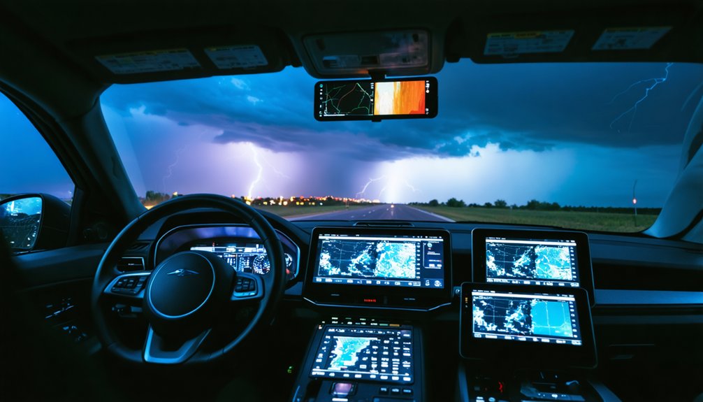
- Mobile Integration – RadarScope overlays live GPS with Doppler data, enabling turn-by-turn adjustments as mesocyclones shift.
- Trajectory Monitoring – GRLevel3 Pro fuses multiple radar sources with vehicle position, calculating optimal intercept vectors under heavy precipitation.
This configuration guarantees autonomous positioning despite infrastructure failures.
Mobile Research Equipment for Field Deployment
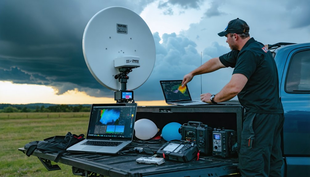
Vehicle-mounted mesonet systems transform your chase vehicle into a mobile weather station, collecting temperature, humidity, pressure, and wind data while you navigate storm environments.
You’ll deploy portable atmospheric sensing stations—ruggedized pods containing sensor arrays—directly in tornado paths to capture measurements where traditional infrastructure can’t reach.
Real-time data collection methods integrate GPS-synchronized instruments with onboard logging systems, transmitting observations at one-second intervals to build precise temporal and spatial records of storm-scale phenomena.
Vehicle-Mounted Mesonet Systems
- Solid-state sensors (ultrasonic design) provide high speed sensor durability without moving parts, surviving 90+ m/s winds and Category 5 conditions.
- Modular racks accommodate temperature, pressure, humidity, radiation, and PM2.5 sensors for extensive atmospheric profiling.
- Real-time transmission enables data collection in 70-85 mph wind fields with minimal latency.
This configuration delivers validated measurements where traditional stationary networks can’t reach.
Portable Atmospheric Sensing Stations
While vehicle-mounted systems excel at collecting data during active pursuit, storm chasers frequently need stationary measurement capabilities at strategic locations ahead of severe weather. You’ll deploy portable stations like AcuRite’s 5-in-1 sensors or allMeteo’s professional-grade equipment featuring foldable stainless steel construction and protective shielding against hail and debris.
These units measure wind speed, direction, temperature, pressure, humidity, and rainfall intensity with real-time precision. Environmental resilience proves critical—orange-painted steel frames withstand 100+ km/hr winds while signalization lights enable night identification.
Data aggregation occurs through wireless loggers with SD card backup, exporting measurements to laptops for NWS and SKYWARN reporting. Project WeatherEye enhances this approach by establishing instrumented “walls” across storm paths, combining fixed-point observations with mobile chase data for superior trajectory prediction and ground-truth validation.
Real-Time Data Collection Methods
As storm systems develop and move across the landscape, you’ll rely on mobile research equipment that transforms your chase vehicle into a moving atmospheric laboratory. Vehicle-mounted anemometers like the RM Young 5103 capture wind data at one-second intervals through roof-mounted data loggers, while handheld instruments such as the Kestrel 5500 provide immediate measurements of temperature, pressure, and wind speed at your exact position.
Wireless data transmission systems enable seamless integration with real time forecasting models:
- DROP D3 data loggers transmit atmospheric measurements directly to mobile devices for instant analysis
- GPS-synchronized recording timestamps environmental data with precise location coordinates
- Dual-unit configurations enable simultaneous multi-location sampling for enhanced spatial resolution
These integrated systems feed your field observations into prediction frameworks, allowing you to adjust intercept strategies based on actual atmospheric conditions rather than forecast estimations alone.
Digital Integration Tools for Multi-Source Forecasting
Storm chasers require unified platforms that consolidate atmospheric data from disparate sources into actionable forecasts. You’ll leverage satellite based nowcasting through EUMETSAT and NWCSAF software, which processes atmospheric changes in 15-minute intervals to track storm evolution.
Tropical Tidbits aggregates high resolution model ensembles like HRRR alongside forecast discussions and radar overlays, enabling rapid comparison across prediction systems. You can request model soundings per supercell for targeted trajectory analysis.
Flask-based web applications integrate these streams—combining dual-polarization radar feeds, hodograph data, and machine learning outputs like NTDA tornado probabilities. RadarScope delivers professional-grade radar beyond consumer apps. Google Weather Lab’s AI demonstrates emerging capabilities, outperforming ECMWF ENS by 1.5 days on track error.
This multi-source integration transforms fragmented datasets into coherent forecasting frameworks you control.
Frequently Asked Questions
How Do Storm Chasers Determine When It’s Too Dangerous to Continue Pursuit?
You’ll know it’s too dangerous by monitoring wind speed and direction changes through real-time data, evaluating cloud formations and their evolution via radar, and recognizing sudden structural shifts that signal imminent threats exceeding your safe escape threshold.
What Training or Certification Is Required to Become a Professional Storm Chaser?
You’ll need solid educational background in meteorology through bachelor’s or graduate degrees, plus technical expertise via SKYWARN certification. However, there’s no mandatory licensing—you’re free to chase storms after gaining essential forecasting and safety skills independently.
How Much Does a Complete Storm Chasing Equipment Setup Typically Cost?
You’ll face minimal entry barriers yet substantial storm chasing gear expenses: basic setups start at $2,000-$5,000, while professional configurations reach $15,000-$30,000. Storm chasing vehicle costs add another $5,000-$50,000, depending on your chosen modifications and capabilities.
Can Amateur Storm Chasers Contribute Valuable Data to Meteorological Research Institutions?
You’ll contribute valuable citizen science contributions through systematic observation protocols. Your instrumented vehicle data, hail reports, and ground-truth measurements enable crowdsourcing weather data that refines forecast models, validates radar signatures, and advances tornado warning systems for meteorological institutions.
What Are the Most Common Mistakes Beginners Make When Predicting Storm Trajectories?
You’ll chase ghosts if you’re relying on outdated forecasts without verifying real-time radar data. Beginners also err by underestimating storm intensity, misreading hodographs, ignoring boundary interactions, and failing to integrate multiple data sources for accurate trajectory predictions.


