You’ll position yourself safely and effectively during severe weather events by accurately interpreting atmospheric data in real time. Multi-layered radar systems like MRMS reveal complete vertical storm profiles, while dual-polarization technology distinguishes rain from hail with precision. Ground-based sensors detect pressure falls and measure wind speeds up to 90 m/s, and 0-2 km azimutical shear provides critical lead time for tornado warnings. By recognizing vertically aligned mesocyclones, hook echoes, and differential reflectivity dipoles, you’ll distinguish tornadic from non-tornadic supercells. The following sections explain how these technologies work together to enhance your forecasting capabilities.
Key Takeaways
- Atmospheric data enables storm chasers to distinguish tornadic from non-tornadic supercells, maximizing safety and scientific documentation opportunities.
- Real-time radar analysis provides critical lead time for tornado warnings through 0-2 km azimuthal shear detection and mesocyclone tracking.
- Multi-source data integration reveals vertical storm structure evolution, helping chasers anticipate dangerous developments before visible confirmation.
- Ground-based sensors detect pressure falls and environmental changes that remote sensing cannot observe, enhancing situational awareness.
- Proper data interpretation guides positioning decisions, keeping chasers in optimal observation zones while avoiding hook echoes and tornado paths.
Understanding Multi-Layered Radar Technology for Storm Analysis
When single Doppler radar scans a supercell thunderstorm, it captures only the component of wind moving toward or away from the antenna—a fundamental limitation that obscures the storm’s true three-dimensional structure. You’ll overcome this constraint through the Multi-Radar/Multi-Sensor (MRMS) system, which merges data from multiple radars across the contiguous United States every two minutes.
This integration eliminates beam tilting effects and cone-of-silence gaps that plague isolated installations. MRMS generates composite reflectivity and azimuthal shear products on a unified 3D grid, giving you complete vertical storm profiles. Dual-polarization enhances hydrometeor classification, distinguishing rain from hail with precision.
For tornado warnings, 0-2 km azimuthal shear provides critical lead time, while Phased Array Radar delivers sub-minute updates that track mesocyclone evolution in real time.
Ground-Based Instrumentation and Real-Time Weather Monitoring
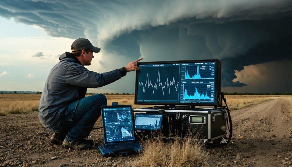
When you’re pursuing severe weather systems, vehicle-mounted sensor networks transform your chase vehicle into a mobile mesonet station capable of recording wind speeds exceeding 51.5 m/s and transmitting data in real-time to meteorological databases.
These systems typically feature FT752-PM sensors certified to 90 m/s, mounted on NSSL-standard aluminum racks that withstand debris impacts and extreme turbulence during close-range tornado intercepts.
Complementing your mobile platform, deployable probe array systems like the allMeteo station provide fixed-point measurements of temperature, pressure, humidity, and precipitation intensity up to 46 mm/hr, establishing ground-truth validation networks across the storm’s mesoscale environment.
Vehicle-Mounted Sensor Networks
Modern storm chase vehicles function as mobile meteorological laboratories, equipped with sensor arrays that capture atmospheric data at one-second intervals during severe weather events. You’ll need to weigh sensor placement criteria carefully—mounting pressure sensors to vehicle exteriors enables micro barometric measurements that reveal pressure falls driving damaging tornado winds.
GPS integration subtracts vehicle motion from wind readings, delivering true atmospheric measurements rather than apparent data. Power management considerations become vital when operating dual sensor systems that provide redundancy against hail and debris damage.
Your pressure sensors can record 5-millibar dips during tornado penetration, while simultaneously deployed ground-based probes capture surface data. These gravitron network sensors, flex-taped to vehicle sides, record pressure variations that remote sensing can’t detect, providing wind-driving mechanisms data essential for understanding storm intensification.
Deployable Probe Array Systems
Ground-based probe arrays represent the most direct method for capturing atmospheric conditions within tornadoes, combining hardened sensors with strategic deployment protocols that place instrumentation directly in predicted storm paths.
You’ll find systems like TWISTEX’s HITPR capturing 10 samples per second of pressure, temperature, and wind data, while CONVEX’s TOWER probes integrate ultrasonic weather stations with 360-degree cameras for thorough documentation.
Gravitron sensors excel at detecting tornado-generated gravity waves through high-resolution atmospheric measurements.
The OTUS Project’s drone arrays push boundaries further, employing FAA-approved waivers to maneuver custom sUAS through active vortices.
Probe resilience proves critical—these instruments must withstand direct tornado passage while maintaining data integrity.
Terrain adaptability determines deployment success, requiring rapid positioning across highways and open areas despite rain-wrapped visibility challenges that demand split-second decision-making.
Atmospheric Profiling Through Balloons and Drones
Although traditional radar systems map storms from a distance, atmospheric profiling tools like weather balloons and drones penetrate the storm environment itself to capture direct measurements. You’ll obtain temperature, humidity, pressure, and wind profiles from surface to upper atmosphere—quantifying the instability and moisture that fuel severe weather.
PASIV sensors reveal particle microphysics through high-definition imaging of water and ice particles, while drones capture surface-level tornado and flash flood details that aircraft can’t safely reach. Sequential launches during storm events document vertical storm structure evolution, showing why certain storms produce tornadoes while others dissipate.
Collaboration with NOAA’s LIFT project tracks low-level inflow dynamics, building timelines that reveal formation triggers. You’re not constrained by traditional observation limits—these tools deliver actionable data where conventional methods fail.
Combining Multiple Data Sources for Comprehensive Storm Models
Direct measurements from balloons and drones provide vertical snapshots of storm environments, but thorough storm prediction demands integration across multiple observation platforms and modeling frameworks. You’ll achieve superior forecasting accuracy through data fusion techniques that merge satellite imagery, radar reflectivity, surface observations, and numerical model outputs into unified analytical systems.
Modern multi-source precipitation modeling empowers your independent storm analysis through:
- Web-based platforms accessing THREDDS and NOAA NOMADS for real-time satellite, radar, and forecast model integration
- Machine learning algorithms like Random Forest combining wind speed, SST, precipitation, and pressure datasets
- Spatiotemporal models capturing spatial dependence across storm events for enhanced prediction
- Cloud infrastructure coordinating coupled simulations across hurricane, flood, and surge models
- Statistical validation against tide gauge records and observational datasets
You’ll break free from single-source limitations by deploying extensive data integration strategies.
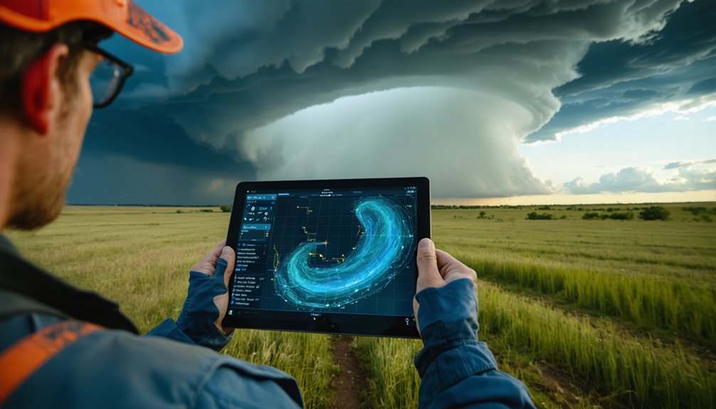
Distinguishing Tornadic From Non-Tornadic Supercells
When intercepting supercell thunderstorms, your ability to distinguish tornadic from non-tornadic systems depends on recognizing subtle but critical structural and environmental differences that emerge before, during, and after tornadogenesis. You’ll observe that tornadic supercells maintain vertically aligned mesocyclone orientation, while non-tornadic systems exhibit misalignment between altitude levels.
Environmental wind profiles reveal higher 0-1 km storm-relative helicity and lower lifted condensation levels in tornadic cases. Your radar analysis should identify low-level mesocyclone presence—the most critical predictor of tornado development. Additionally, you’ll notice hook echoes positioned approximately 10 km right of storm center in tornadic supercells versus 5-10 km down-motion displacement in non-tornadic variants. Differential reflectivity dipoles aligned parallel to storm motion further indicate tornado potential, giving you actionable intelligence for positioning decisions.
Using Data Interpretation to Minimize Chasing Hazards
Successful storm chasing requires you to transform raw atmospheric data into tactical hazard-avoidance decisions that protect your safety while maintaining observational objectives. You’ll minimize exposure by leveraging divergence convergence patterns—divergence signals weakening storms you can approach, while convergence demands immediate repositioning. Reducing core punching hazards depends on interpreting radar reflectivity to maintain safe distances from precipitation cores containing large hail and violent winds.
Critical data interpretation protocols include:
- Identifying bow echoes and squall lines indicating straight-line wind threats
- Analyzing storm relative motion to detect rotating supercell features
- Monitoring RFD gust fronts and inflow tails marking tornado-producing zones
- Planning escape routes using current maps integrated with Threats-in-Motion warnings
- Running pre-chase HRRR and NAM3K models to forecast hazardous environmental ingredients
Night operations compound interpretation challenges when visual confirmation becomes impossible.
Anticipating Storm Behavior and Path Changes
Real-time radar interpretation enables you to anticipate storm evolution by identifying structural changes that precede intensification or dissipation. Monitor storm morphology patterns through dual-pane reflectivity and velocity displays—transitioning hook echoes signal strengthening supercells, while weakening rotation indicates decay.
You’ll detect evolving environmental influences by tracking convergence zones that fuel intensification and divergence areas marking collapse. Observe moisture advection and warm air advection shifts that alter storm paths unexpectedly. Upper-level divergence from jet streaks enhances development, while low-level boundaries like dry lines trigger new cells. LI values dropping below -7 warn of extreme instability ahead.
High-resolution models refine your positioning hours before arrival, but radar confirms actual behavior. You’re free to adjust routes when environmental data contradicts model forecasts, maximizing safety and intercept success.
Contributing to Advanced Forecasting and Warning Systems
Your field observations directly enhance numerical weather prediction models through data assimilation techniques that integrate real-time atmospheric measurements with physics-based forecasts. When you contribute in-situ measurements from understudied regions, you’re supplying the critical observational data that improves initial conditions—studies demonstrate even small quantities of targeted data can boost conventional model accuracy by 10-18% for storm track predictions.
These improvements translate to more reliable emergency alerts, as ensemble forecasting systems convert your contributed data into probabilistic threat assessments that inform evacuation timing and severe weather warnings.
Enhancing Prediction Model Accuracy
While traditional Numerical Weather Prediction (NWP) models struggle with rapidly evolving small-scale storms due to computational constraints and limited resolution, AI-driven approaches now deliver measurable improvements in forecast accuracy across critical timescales.
Key Accuracy Enhancements:
- Deep Diffusion Models achieve 8.26% average accuracy gain in critical 2-4 hour lead time windows for severe convective storms
- AI models outperform physics-based systems on weekly timescales for mean sea level pressure predictions
- GraphCast and Pangu-Weather demonstrate comparable or superior skill in reproducing wind anomalies for extratropical cyclones
- Five-day forecasts reach 90% accuracy when proper data interpretation addresses observational data limitations
- Hybrid model integration enables better surface wind field predictions despite weaker error correlations between linked atmospheric variables
Your autonomy in forecast decision-making expands as these systems reduce computational expenses while delivering faster, more precise predictions.
Strengthening Emergency Alert Reliability
Between 2007 and 2014, National Weather Service offices achieved a 31% reduction in tornado warning false alarm rates—from 83.0% to 58.3%—while maintaining consistent 70.6% detection probability and 14-minute lead times. You’ll find these false alarm reduction strategies stem from rigorous scientific research rather than statistical manipulation alone.
Impact-based decision support services now provide you with context-driven warnings that enhance your operational autonomy. These systems integrate historical data and real-time analysis to assess threat severity before, during, and after severe weather events.
Early warnings issued within 24 hours demonstrate 30% damage reduction effectiveness.
However, you should recognize that 30% of the global population remains without early warning coverage, and only 39% of major cities have implemented extensive systems. Your independent decision-making depends on accessing reliable, scientifically validated atmospheric intelligence.
Protecting Communities Through Enhanced Severe Weather Knowledge

Enhanced severe weather knowledge transforms how communities prepare for and respond to atmospheric threats, directly reducing casualties and economic losses. You’ll find that building community trust requires addressing gaps where vulnerable populations show lower warning comprehension and reduced confidence in forecasting services.
The FACETs framework delivers actionable intelligence through:
- Threats-In-Motion technology providing equitable lead times with precise arrival and departure windows
- Impact-Based Decision Support Services offering insights before, during, and after extreme events
- 12-hour advance flood warnings reducing damages by 22%
- National Water Model extending river forecasts to 18 hours
- Incorporating user feedback to measure public preparedness and response effectiveness
With NWS forecasts generating $11.6 in benefits per dollar spent, you’re empowered to make informed decisions that protect lives and property while maintaining autonomy during severe weather events.
Frequently Asked Questions
What Training Do Storm Chasers Need to Interpret Atmospheric Data Effectively?
You’ll need SKYWMART training covering radar interpretation, sounding analysis, and hodograph reading to develop atmospheric analysis skills. These programs teach data interpretation techniques including CAPE values, lapse rates, wind shear assessment, and boundary recognition for independent storm forecasting.
How Much Does Professional Storm Chasing Equipment Typically Cost?
You’ll spend $10,000-$30,000 initially on professional storm equipment costs—cameras, weather meters, communication gear—while chasing equipment maintenance adds thousands annually. Freedom-seekers quickly discover atmospheric data interpretation requires wallets as deep as supercell updrafts demand respect.
Yes, you’ll find storm chasers actively engage in data sharing with agencies like the National Weather Service and National Hurricane Center, providing ground-truth observations that enable collaborative forecasting and fill critical gaps in satellite coverage during severe weather events.
What Are the Legal Requirements for Deploying Instruments in Storm Paths?
You’ll need local permits for instrument deployments in severe jurisdictions, maintain current liability insurance, and follow data transmission protocols. FCC licensing governs radar operations, while disaster-recovery deployments require business licenses depending on jurisdiction severity.
How Has Climate Change Affected Storm Chasing Data Collection Strategies?
You’ll need to adapt your collection strategies as shifting data patterns emerge from regional tornado frequency changes, requiring evolving forecasting methods that integrate AI modeling with traditional ground-truth observations to capture climate-driven atmospheric transformations effectively.

