Chasing severe thunderstorms on the Great Plains puts you at the epicenter of the world’s most volatile convective weather, where over 1,000 tornadoes touch down annually across a region engineered by geography to produce catastrophic storms. You’re working an environment where Gulf moisture collides with Canadian air masses, Rocky Mountain terrain amplifies wind shear, and CAPE values spike explosively. Understanding these converging atmospheric forces — and how climate change is intensifying them — is what separates a successful chase from a fatal miscalculation.
Key Takeaways
- The Great Plains is the world’s severe thunderstorm capital, where Rocky Mountain terrain, Gulf moisture, and Canadian air create extreme atmospheric instability.
- CAPE values measure atmospheric instability and directly determine whether ordinary storms or dangerous supercells develop during chase scenarios.
- Radar and satellite tools like NASA’s AIRS instrument provide real-time storm tracking through CAPE calculations, moisture profiles, and wind pattern analysis.
- Nighttime storm cycles driven by low-level jet streams produce mesoscale convective complexes, causing widespread rainfall and damaging winds across Nebraska, Iowa, and Kansas.
- Storm chasers must maintain southern escape routes, monitor dual-pol radar continuously, and establish pre-planned bail-out thresholds to ensure safety.
What Makes the Great Plains the World’s Severe Thunderstorm Capital
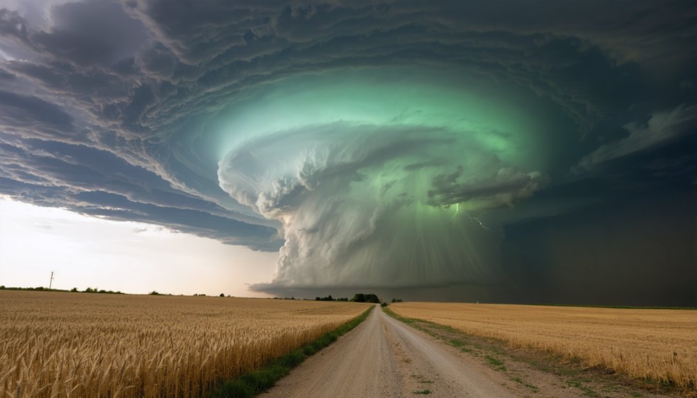
The Great Plains isn’t just a hotspot for severe thunderstorms—it’s the world’s most prolific breeding ground for them, producing storms that rank among the strongest on Earth.
You’re looking at a region where geography and atmospheric dynamics converge with unmatched precision. The Rocky Mountains drive high lapse rates eastward, fueling the atmospheric instability that powers explosive storm formation.
Where geography and atmosphere collide, the Rockies unleash instability that transforms ordinary air into explosive storm energy.
Warm, moisture-laden air surges northward from the Gulf of Mexico, colliding with cold, dry air descending from Canada. That collision creates the thermodynamic fuel severe storms demand.
These systems account for over 40% of annual rainfall in some areas, while also delivering catastrophic destruction.
No other region on Earth combines terrain, moisture flux, and wind shear so efficiently, making the Great Plains uniquely dangerous and scientifically irreplaceable.
How CAPE, Radar, and Satellite Data Predict Dangerous Plains Storms
When you’re tracking dangerous Plains storms, Convective Available Potential Energy (CAPE) serves as your primary instability metric, quantifying the energy available for explosive thunderstorm development.
You can merge satellite-derived temperature and moisture profiles—particularly from NASA’s AIRS instrument aboard the Aqua satellite—with radiosonde data to compute CAPE accurately across the Southern Great Plains.
Radar systems then let you monitor storm organization in real time, while polar-orbiting satellite measurements complement surface observations to push severe storm forecasting closer to operational nowcasting.
Understanding CAPE’s Storm Role
Predicting dangerous Plains storms requires understanding Convective Available Potential Energy (CAPE), a measure of atmospheric instability that quantifies how much energy a rising air parcel can access before losing buoyancy.
CAPE significance extends beyond simple instability measurement—it directly governs storm dynamics, determining whether atmospheric conditions will produce ordinary convection or violent supercells.
When you analyze CAPE values, you’re fundamentally reading the atmosphere’s potential to generate destructive vertical motion. Higher CAPE values accelerate updrafts, intensifying rotation and precipitation.
Research confirms that future increases in severe thunderstorm environments will be driven by rising CAPE, meaning tomorrow’s Plains storms could dwarf today’s most destructive events.
Understanding this metric gives you the analytical foundation necessary to interpret why certain atmospheric configurations consistently produce catastrophic severe weather across the Great Plains.
Radar Tracking Severe Storms
Radar systems transform raw atmospheric data into actionable storm intelligence, but their predictive power multiplies dramatically when integrated with CAPE calculations and satellite-derived moisture profiles.
You’re tracking storm dynamics across the Southern Great Plains using tools that synthesize multiple data streams simultaneously.
NASA’s AIRS instrument delivers precise temperature and moisture profiles, while polar-orbiting satellites merge with surface radiosonde measurements for near-real-time forecasting.
This radar technology integration gives you unmatched situational awareness.
Four Critical Radar-Based Prediction Layers:
- CAPE values identifying atmospheric instability thresholds
- AIRS moisture profiles pinpointing convective trigger zones
- Synoptic wind pattern analysis revealing storm organization
- Reanalysis datasets correlating environments with historically significant severe events
Together, these systems convert complex atmospheric variables into precise, actionable intelligence before dangerous conditions materialize across the Plains.
Satellites Enhancing Storm Prediction
Satellites transform storm prediction by delivering atmospheric data that ground-based radar simply can’t capture alone. NASA’s AIRS instrument aboard the Aqua satellite measures precise temperature and moisture profiles, enabling accurate CAPE computations that identify explosive storm environments before they develop.
You’re fundamentally gaining vertical atmospheric snapshots unavailable from surface stations alone.
These satellite advancements integrate with radiosonde measurements, sharpening forecast accuracy across the Southern Great Plains. Polar-orbiting platforms combine with surface data, pushing storm tracking capabilities toward near-real-time severe weather detection.
A decade of AIRS data validated over the Plains confirms reliable CAPE calculation methodologies.
You’re now armed with tools that merge reanalysis climatologies, synoptic wind patterns, and moisture diagnostics, giving forecasters sharper decision windows before dangerous thunderstorms threaten fields, infrastructure, and lives.
How Climate Change Is Making Great Plains Thunderstorms Worse
As global temperatures rise, the Great Plains face increasingly volatile thunderstorm conditions driven by a key atmospheric variable: Convective Available Potential Energy, or CAPE.
Higher CAPE intensifies atmospheric instability, amplifying climate feedback loops that fuel stronger, more destructive storms. The IPCC projects increased frequency and severity, though specific regional predictions carry low confidence.
Higher CAPE fuels stronger storms—but regional predictions remain uncertain, even as the IPCC warns of increasing severity.
Key climate-driven shifts you’re seeing:
- Rising CAPE values increase storm energy, producing more violent updrafts.
- Projected CAPE decreases in southern Great Plains during summer complicate regional forecasting.
- Glacial climate shifts spanning 120,000–11,500 years ago demonstrate how quickly storm organization can change.
- Texas stalactite isotope data confirms long-term precipitation pattern shifts tied to climate variability.
Understanding these dynamics isn’t optional—it’s essential for protecting your land, property, and community.
The Best Seasons to Chase Severe Thunderstorms on the Great Plains
If you’re planning to chase severe thunderstorms on the Great Plains, timing your pursuit around seasonal patterns dramatically increases your chances of encountering significant storm activity.
You’ll find the most productive opportunities in spring, when storm systems originate in the southeast and south-central U.S. before expanding westward and northward into early summer, evolving into repetitive nighttime convective events by mid-summer.
From August through October, you can also exploit the Southwest monsoon‘s influx of humidity, which amplifies thunderstorm activity and extends your operational window well into early fall.
Spring Storm Season Peaks
When you’re planning to chase severe thunderstorms on the Great Plains, timing is everything. Spring delivers peak storm formation as atmospheric instability surges across the region.
Originating in the southeast and south-central U.S., activity expands westward and northward through early summer.
Key spring storm season indicators to track:
- March–April: Initial severe storm development in southeast U.S., driven by early moisture surges.
- May: Peak atmospheric instability across central Plains; highest CAPE values recorded.
- Early June: Storm corridors shift northward into Kansas, Nebraska, and Iowa.
- Nighttime cycles: Repetitive nocturnal storms propagate east of the Rockies, maximizing early-morning rainfall.
Understanding these windows lets you position strategically, maximizing your intercept opportunities while minimizing unnecessary risk exposure.
Summer Nighttime Storm Patterns
Summer on the Great Plains introduces a distinct storm-chasing dynamic: repetitive nighttime thunderstorm cycles that differ fundamentally from daytime convective events.
You’ll encounter unique nighttime dynamics as storms propagate eastward from the Rockies, driven by low-level jet streams that intensify after sunset. Unlike spring’s afternoon supercells, these systems maximize rainfall during early morning hours across Nebraska, Iowa, and Kansas.
Understanding storm behavior during these nocturnal cycles requires you to track moisture convergence patterns that develop independently of solar heating.
Convective systems reorganize into mesoscale convective complexes, producing widespread rainfall and damaging winds.
You’re operating in an environment where instability mechanisms shift dramatically, demanding recalibrated forecasting strategies.
Recognizing these patterns gives you a tactical edge when positioning for documentation and scientific observation across open Plains terrain.
Monsoon Season Activity Increases
As nighttime storm cycles wind down across the northern Plains, your attention shifts southwest, where August through October marks a dramatic amplification in severe weather activity driven by monsoon humidity infiltrating the region.
Monsoon moisture surges northward, fueling elevated CAPE values and intensifying storm intensity across Arizona, New Mexico, and surrounding areas.
Track these four critical monsoon-driven factors:
- Moisture flux — Gulf of California surges inject deep humidity layers
- CAPE escalation — Instability spikes sharply as monsoon moisture establishes itself
- Storm intensity peaks — Supercell potential increases with enhanced wind shear interactions
- Temporal windows — Late afternoon convective triggers dominate your chase scheduling
You’ll find this southwestern amplification distinctly different from Plains spring dynamics, demanding recalibrated strategies and updated radiosonde-informed forecasting approaches.
How to Read Storm Environments Before You Chase
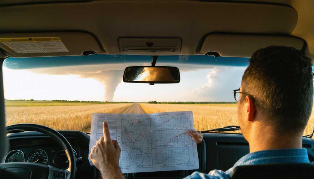
Before you ever get in the car, you need to assess the atmospheric environment that will either support or suppress storm development. Start by analyzing CAPE values — high CAPE signals explosive convective potential.
Check wind shear profiles, since directional and speed shear drive storm dynamics and determine whether discrete supercells or disorganized clusters form.
Pull radiosonde data and cross-reference it with satellite-derived moisture profiles. Environmental indicators like lapse rates, lifting condensation levels, and low-level jet positioning tell you where instability concentrates.
The Rockies enhance high lapse rates across the Plains, so terrain context matters.
Examine synoptic-scale wind and moisture patterns through reanalysis tools. You’re not guessing — you’re building a precise picture of what the atmosphere will do before you commit to a chase route.
How to Stay Safe Chasing Severe Thunderstorms on the Plains
Reading the atmosphere correctly gets you to the right storm — but staying alive requires a separate discipline once you’re in the field.
Storm safety isn’t instinct; it’s trained behavior. Apply these chasing tips every chase:
Storm safety isn’t inherited — it’s drilled, rehearsed, and applied deliberately every single time you chase.
- Maintain a southern escape route — tornadoes track northeast; your exit must run perpendicular to that motion.
- Monitor dual-pol radar continuously — debris signatures confirm tornado ground contact before visual confirmation arrives.
- Never park under an overpass — wind accelerates through gaps, turning debris lethal.
- Establish a bail-out threshold — define your abandonment condition before adrenaline clouds judgment.
You’re operating inside one of Earth’s most violent atmospheric environments.
Discipline, pre-planned routes, and real-time radar interpretation keep you mobile, informed, and in control of your own survival.
Frequently Asked Questions
What Historical Storms Caused the Most Destruction Across the Great Plains?
You’ll find tornado history’s most destructive storms include the 1925 Tri-State Tornado and 1974 Super Outbreak, both causing catastrophic storm damage across the Great Plains, obliterating fields, homes, and communities with unprecedented atmospheric fury.
Which Great Plains States Have the Highest Number of Storm Chaser Fatalities?
Ironically, you’d chase freedom but find fatality statistics highest in Oklahoma, Kansas, and Nebraska. Storm chaser safety’s most tested where you’d love it most—these states’ volatile severe thunderstorm environments claim the most lives annually.
What Equipment Do Professional Storm Chasers Typically Carry on Expeditions?
You’ll carry mobile radar systems, GPS, weather stations, and dashcams for storm tracking, while safety protocols demand you’re also equipped with helmets, communication radios, and emergency kits to guarantee operational independence and survivability.
How Do Rocky Mountain Terrain Features Directly Influence Great Plains Storm Paths?
The Rockies shape your storm paths by creating mountain shadows that enhance high lapse rates, driving instability across the Plains. You’ll notice these terrain-forced wind patterns actively funnel moisture, fueling severe thunderstorm development eastward.
What Insurance or Legal Considerations Exist for Storm Chasers on Private Land?
You’ll need storm permits and must respect trespass laws on private land. Secure landowner liability waivers before entering, as you’re legally responsible for damages. Always get written permission—it’s your best protection against costly lawsuits.
References
- https://stories.tamu.edu/news/2021/06/22/more-intense-and-frequent-thunderstorms-linked-to-global-climate-variability/
- https://gpm.nasa.gov/science/thunderstorms-rumble-over-great-plains
- https://www.ssec.wisc.edu/news/articles/10209
- https://pmc.ncbi.nlm.nih.gov/articles/PMC2148364/
- https://www.nssl.noaa.gov/users/brooks/public_html/papers/brisbane.pdf
- https://www.jstor.org/stable/26222416
- https://egusphere.copernicus.org/preprints/2024/egusphere-2024-2798/egusphere-2024-2798.pdf
- https://nebraskapublicmedia.org/news/news-articles/chasing-severe-weather-in-the-great-plains-with-drones/


