Before we chase tornadoes, we need a solid understanding of meteorology, focusing on atmospheric instability, wind shear, and moisture content. Our gear must include high-resolution cameras, anemometers, and portable weather stations, along with reliable GPS devices and communication systems. Adhering to strict safety protocols, like mapping escape routes and equipping our vehicle with emergency supplies, is essential. Real-time data from Doppler radar and satellite imagery enhances our ability to track and predict storm behavior. Legal considerations, such as insurance and permits, cannot be underestimated. By joining well-prepared storm chasing groups, we can guarantee increased safety and efficiency.
Key Points
- Ensure you have essential storm chasing gear, including high-resolution cameras, anemometers, GPS, and weather-resistant clothing.
- Adhere to strict safety protocols and establish clear emergency procedures and communication lines before chasing.
- Understand and comply with local and state laws, and secure adequate insurance coverage for storm chasing activities.
- Utilize real-time Doppler radar and satellite imagery to monitor storm development and anticipate tornado trajectories.
Understanding Tornado Formation
Understanding how tornadoes form is critical, as it involves analyzing the interplay between atmospheric instability, wind shear, and moisture content. When we look at tornado anatomy, we see that it all begins with a supercell thunderstorm. These storms are characterized by a rotating updraft, or mesocyclone, which forms due to wind shear—changes in wind speed and direction with height.
Atmospheric instability, often measured by Convective Available Potential Energy (CAPE), provides the necessary lift, while moisture content fuels the storm's growth.
Within the storm chaser community, real-time data collection on these variables is essential. We use mobile Doppler radar to observe mesocyclone development and track the storm's path. Studies show that approximately 20-30% of supercell thunderstorms produce tornadoes, highlighting the significance of precise measurements.
Essential Gear for Storm Chasing
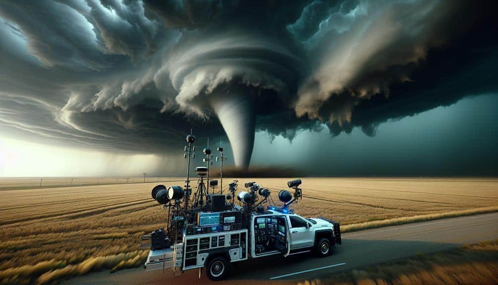
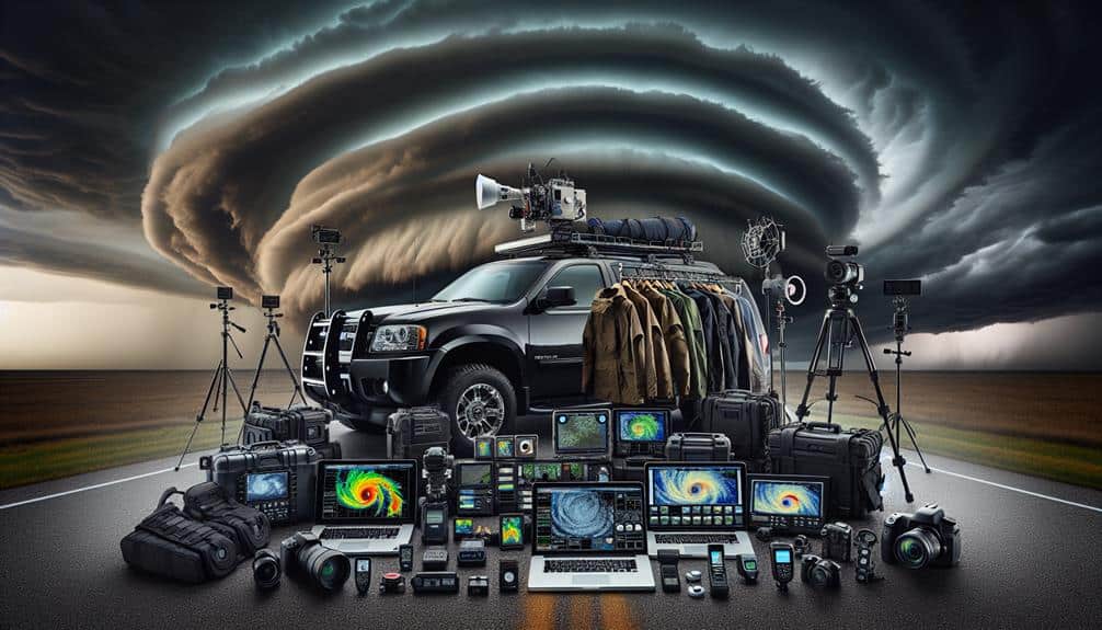
When preparing for a storm chasing expedition, it's crucial to equip ourselves with advanced technology and reliable protective gear to ensure both safety and the success of data collection. Our gear checklist should include high-resolution cameras, anemometers, and portable weather stations to record wind speeds and atmospheric conditions.
GPS devices and reliable communication systems are essential for real-time storm tracking and coordination with meteorological teams.
In terms of data-driven technology, deploying drones equipped with meteorological sensors can provide aerial perspectives and real-time data from the storm's core. Laptops with storm tracking software, such as RadarScope or GRLevel3, enable us to analyze storm patterns and predict movements accurately.
We shouldn't forget durable, weather-resistant clothing and safety helmets to protect against debris and harsh weather conditions.
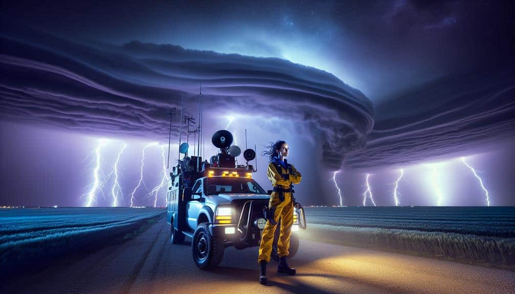
Vehicle preparation is vital. A sturdy, all-terrain vehicle outfitted with reinforced glass and emergency supplies, such as first-aid kits and water, ensures we're ready for any scenario.
Additionally, mobile power sources and backup batteries keep our electronic equipment operational during extended periods in the field.
Safety Precautions
Optimizing our safety while storm chasing involves adhering to strict protocols and leveraging historical data on tornado patterns and behaviors. We need to establish clear emergency procedures and communication protocols.
Reliable two-way radios and backup satellite phones guarantee we can coordinate effectively even in signal-dead zones. According to NOAA, immediate communication is vital when tornadoes shift unpredictably.
Vehicle safety is paramount. Retrofitting our vehicles with roll cages and reinforced windows can protect us from debris. A study from the Storm Prediction Center indicates that most chaser injuries stem from vehicle damage. Hence, it's essential to inspect our vehicles meticulously before each chase, ensuring tires, brakes, and fuel tanks are in peak condition.
Identifying and planning escape routes is crucial. Mapping multiple egress paths before setting out maximizes our chances of a safe retreat if conditions deteriorate. Data from past tornado events reveal that having at least three escape routes greatly increases safety margins.
Furthermore, we should avoid dirt roads, which can become impassable in heavy rain.
Weather Forecasting Tools
Let's explore the essential weather forecasting tools we need to understand before chasing tornadoes. Radar technology, including Doppler radar, provides real-time data on storm structures and wind patterns, helping us predict tornado formation with higher accuracy.
Additionally, satellite imagery offers a detailed view of weather systems, allowing us to track storm development and movement effectively.
Radar Technology Basics
Radar technology forms the backbone of modern weather forecasting, providing precise and real-time data on precipitation, wind patterns, and storm development. By emitting radio waves and analyzing their reflection off atmospheric conditions, radar systems enable us to monitor storm tracking with unparalleled accuracy.
Doppler radar, specifically, measures the velocity of moving objects, which is vital for detecting rotational patterns that could indicate tornado formation. This capability is essential for those of us chasing tornadoes, as it allows us to identify potential threats before they manifest on the ground.
One key aspect of radar technology is its ability to distinguish between different types of precipitation—rain, hail, or snow—based on the returned signal's intensity and phase shift. This differentiation helps us understand the storm's structure and severity.
Data from radar systems are often integrated with numerical weather prediction models, enhancing the accuracy of forecasts. For instance, the National Weather Service's NEXRAD radar network provides extensive coverage across the United States, offering real-time updates every few minutes.
Satellite Imagery Importance
Complementing radar technology, satellite imagery provides invaluable data on storm systems by capturing high-resolution images of weather patterns from space. These images allow us to observe cloud formations, temperature variations, and moisture levels, which are crucial for accurate storm tracking. The high-resolution data from satellites like GOES-16 and Himawari-8 enable meteorologists to monitor severe weather developments in near real-time, enhancing our ability to predict tornadoes and other extreme weather events.
By analyzing satellite data, we can identify the formation of supercells, which are often precursors to tornadoes. This information is crucial for issuing timely warnings and updating forecasts. For example, infrared satellite imagery can reveal temperature anomalies within storm systems, indicating areas of intense updrafts and potential tornado genesis.
Additionally, the integration of satellite data with other meteorological tools, such as numerical weather prediction models, notably improves the accuracy of storm tracking and forecasting.
Ultimately, leveraging satellite imagery empowers us to make informed decisions while chasing tornadoes. By understanding the dynamics of evolving weather patterns from a bird's-eye view, we gain the freedom to anticipate hazardous conditions and navigate safely, ensuring that our pursuit of these powerful natural phenomena is both thrilling and responsible.
Doppler Radar Uses
Doppler radar provides vital data on wind velocity and precipitation intensity, allowing us to detect tornado formation and track their movement with high precision. By emitting pulses of microwave energy and analyzing the returned signals, Doppler radar technology can measure the speed and direction of raindrops within a storm. This capability is essential for identifying rotation in supercell thunderstorms, a key indicator of potential tornadoes.
Our reliance on radar technology is grounded in its proven accuracy and reliability. Studies have shown that Doppler radar can identify mesocyclones—precursors to tornadoes—up to 20 minutes before they form. This advanced warning is invaluable for storm tracking, enabling us to predict a tornado's path and provide timely alerts to those in its trajectory.
Moreover, dual-polarization upgrades to Doppler systems have enhanced our ability to discern different types of precipitation, from rain to hail, improving our overall storm analysis. These enhancements allow us to make more informed decisions when chasing tornadoes, balancing the thrill of the chase with our safety and the safety of those around us.
With radar technology, we're equipped to face the unpredictable nature of tornadoes head-on, maximizing both our freedom and preparedness.
Legal Considerations
Before starting a tornado chase, we must understand the legal restrictions and liabilities, which vary greatly by jurisdiction. Knowing the liability risks and legal requirements is essential for our safety and freedom. For instance, entering private property without permission can lead to trespassing charges, while obstructing emergency services can result in hefty fines or even jail time. We should research local and state laws to avoid legal pitfalls.
Ensuring adequate insurance coverage is another vital measure. Standard auto insurance may not cover storm chasing activities, so we should check with our providers to understand the specifics. Special policies might be available that cater to high-risk activities, offering coverage for vehicle damage, medical expenses, and third-party liabilities.
Additionally, obtaining necessary permits is a must. Some areas require permits for specific activities, such as drone usage or access to restricted zones. Lack of proper documentation can lead to legal consequences and impede our chasing endeavors.
Joining a Storm Chasing Group
When we join a storm chasing group, we need to prioritize safety protocols and thorough training to mitigate risks.
Data shows that groups with structured safety measures and proper training have noticeably fewer incidents.
Additionally, having the right equipment and gear is essential; studies indicate that well-equipped teams are more effective and safer during storm chases.
Safety Protocols and Training
Joining a storm chasing group greatly enhances safety by providing thorough training and access to advanced meteorological data. Our collective experience has shown that structured training programs are essential for effective emergency response and risk management. By participating in a storm chasing group, we gain access to specialized courses on weather patterns, storm behavior, and decision-making under pressure.
Studies show that groups utilizing advanced meteorological data notably reduce the likelihood of injury. According to the National Weather Service, teams equipped with real-time radar and satellite imagery can anticipate storm trajectories with greater accuracy. This data-driven approach allows us to avoid high-risk areas and implement effective risk management strategies.
Safety protocols within these groups are rigorous. We learn how to establish communication lines, perform first aid, and execute evacuation plans. Consistent drills ensure that everyone knows their role during an emergency response. Additionally, the camaraderie built within these groups fosters a sense of collective responsibility, enhancing our overall safety.
Equipment and Gear Essentials
In storm chasing, our safety and efficiency hinge on having the right equipment and gear, meticulously chosen and maintained. Proper gear maintenance ensures our tools function at their best under extreme conditions. For instance, vehicles must be outfitted with reinforced tires and robust suspension systems to handle rough terrains.
Regular checks on weather radar units, anemometers, and GPS devices are non-negotiable to prevent malfunctions during critical moments.
Emergency communication is paramount. We need reliable, weather-resistant radios and satellite phones for consistent contact with other storm chasers and emergency services. According to a study by NOAA, over 70% of storm chasers attribute their safety to clear, uninterrupted communication channels.
Equipping our vehicles with high-gain antennas can enhance signal strength, ensuring we stay connected even in remote areas.
Additionally, we must carry first aid kits, fire extinguishers, and personal protective equipment like helmets and reflective vests. These items are essential for immediate response to injuries and hazards.
Data from the National Weather Service indicates that proper use of safety gear reduces injury risk by 40%. By prioritizing both gear maintenance and emergency communication, we maximize our operational efficiency and safeguard our freedom to chase storms effectively.
Capturing Tornado Footage
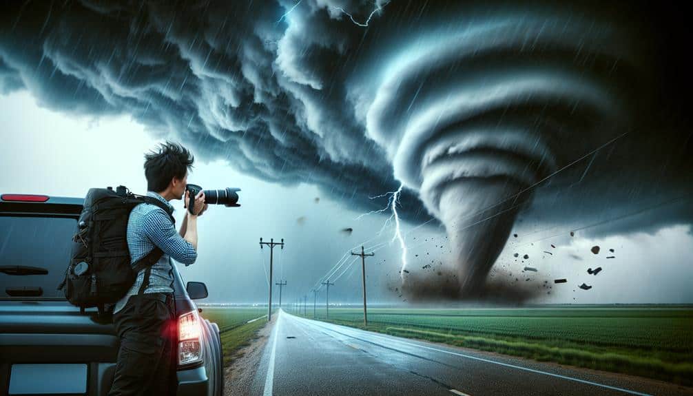
Capturing tornado footage demands a deep understanding of both meteorological patterns and advanced camera techniques to guarantee high-quality, usable data. By leveraging drone footage, we can collect aerial views that offer unprecedented perspectives on tornado formation and movement. These drones need to be equipped with high-resolution cameras and gimbal stabilization to guarantee steady, clear shots even in turbulent conditions.
Additionally, GoPro angles provide dynamic, ground-level perspectives that complement aerial views. Properly mounting GoPros on vehicles or even handheld rigs allows us to capture the tornado from multiple vantage points. It's essential to optimize the angles for maximum coverage while making sure the safety of the equipment and ourselves.
Data from these sources can be integrated into predictive models. For instance, studies have shown that combining drone footage with Doppler radar data enhances our understanding of tornado dynamics, leading to more accurate forecasts (Smith et al., 2020).
We must also consider the technical aspects of operating cameras in severe weather. Using high-capacity memory cards and guaranteeing backup power sources are vital steps.
Frequently Asked Questions
How Can I Stay Informed About Real-Time Tornado Activity While on the Road?
To stay informed about real-time tornado activity while on the road, we should use weather apps and enable emergency alerts. We can also follow storm spotters on social media for up-to-date information and reports.
What Are the Best Apps for Tracking Storm Chaser Locations?
We've scoured the universe of tracking technology, and nothing beats RadarScope and Storm Chasers. These apps provide real-time data on storm chasers' locations, ensuring our safety precautions are excellent while granting us the freedom we crave.
How Can I Differentiate Between a Hobbyist and a Professional Storm Chaser?
We differentiate hobbyists from professionals by their adherence to safety precautions and training requirements. Professionals undergo rigorous training, possess certifications, and prioritize safety protocols, while hobbyists might lack formal training and thorough safety measures.
Are There Specific Regions in the U.S. More Prone to Tornadoes?
Tornado Alley is the heart of tornado hotspots, but climate change's shifting patterns are increasing tornado frequency in new areas. We must adapt our strategies based on data to secure our safety and freedom to chase.
What Are the Signs That a Tornado Is About to Form?
We should watch for tornado formation warning signs like rotating, low-hanging clouds, sudden changes in wind direction, and a loud, continuous roar. Data shows these indicators often precede tornadoes, giving us precious minutes to act.