Climate change is rewriting tornado science, and you’re watching it happen in real time. Tornado Alley‘s shifting eastward, storm outbreaks are intensifying, and traditional seasonal patterns are breaking down. A warming Gulf of Mexico is injecting unprecedented moisture and heat into atmospheric systems, fueling stronger supercells. Meanwhile, storm chasers and machine learning are closing the forecasting gap. The full picture of what’s coming—and what it means for vulnerable regions—runs deeper than you’d expect.
Key Takeaways
- Climate change is shifting Tornado Alley eastward into the southeastern US, creating stronger tornadoes in historically underprepared communities.
- Warmer Gulf of Mexico waters inject greater moisture and heat energy into storm systems, intensifying tornado outbreaks.
- Future tornado patterns will feature fewer individual tornado days but more frequent, violent large-scale outbreaks.
- Storm chasers now use drones, radar, and machine learning to improve forecasting accuracy and early warning systems.
- Emergency management agencies must update building codes, warnings, and resource allocation to address evolving tornado risks.
How Climate Change Is Rewriting the Rules for Tornadoes
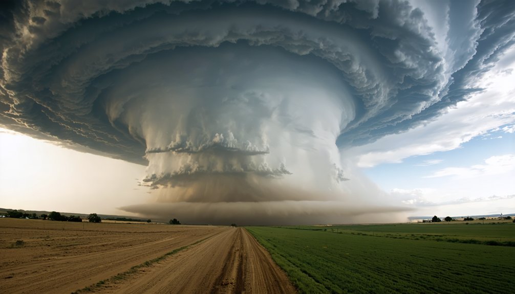
Climate change isn’t just intensifying tornadoes—it’s fundamentally altering where and when they strike. You’re now seeing Tornado Alley shift eastward into the southeastern US, while strong tornadoes increasingly appear outside their traditional season.
Climate change isn’t just intensifying tornadoes—it’s changing where and when they strike.
This geographic and temporal redistribution reflects direct climate feedback: a warming Gulf of Mexico injects greater heat energy into storm systems, amplifying their destructive potential.
Tornado variability has also grown more complex. Individual tornado days have decreased, yet large-scale outbreaks exceeding 30 tornadoes have increased.
Meanwhile, a rapidly warming Arctic weakens the jet stream, reducing wind shear critical for tornado formation. You’re watching two competing forces—greater atmospheric instability versus diminished wind shear—reshape tornado dynamics in ways that challenge long-standing assumptions about where and how these storms develop.
Why Is Tornado Alley Moving East?
As warming reshapes atmospheric dynamics, Tornado Alley‘s eastward migration reflects a convergence of thermal, moisture, and geographic factors.
You’re witnessing a fundamental shift in tornado geography, driven by a warming Gulf of Mexico that’s pumping unprecedented moisture into the southeastern United States.
Climate impact becomes clear when you examine the data: traditional Great Plains tornado corridors are yielding to new high-risk zones across Tennessee, Mississippi, and Alabama.
Warmer sea surface temperatures amplify atmospheric instability, creating prime conditions for severe thunderstorm development further east.
Meanwhile, weakening jet streams from Arctic warming are disrupting the wind shear patterns that historically defined Tornado Alley’s boundaries.
These communities weren’t built with tornado resilience in mind, making this geographic redistribution particularly dangerous for populations unaccustomed to such extreme weather threats.
The Climate Mechanisms Making Tornadoes Stronger
When you examine the mechanics behind stronger tornadoes, you’ll find that climate change injects additional heat energy into the atmosphere, giving storm systems more fuel to intensify.
Warmer Gulf of Mexico waters pull greater moisture volumes into traditional storm corridors, amplifying the atmospheric instability that drives severe thunderstorm development.
At the same time, rapid Arctic warming weakens the jet stream, altering the wind shear patterns that have historically both shaped and constrained tornado formation.
Heat Energy Fuels Tornadoes
Rising global temperatures are fundamentally altering the atmospheric conditions that drive tornado formation and intensity. As the climate warms, excess heat energy accumulates in the lower atmosphere, directly amplifying tornado dynamics.
You’re looking at a system where warmer Gulf of Mexico waters inject greater moisture and thermal energy into storm systems, creating more volatile instability profiles.
This additional heat energy doesn’t just strengthen individual tornadoes — it extends their potential outside traditional seasonal windows. Increased atmospheric instability generates stronger updrafts, the critical mechanism that sustains rotating supercell thunderstorms.
While wind shear, essential for tornado rotation, faces potential reduction from Arctic warming patterns, the net thermal energy input creates conditions where severe tornado outbreaks become statistically more probable, particularly across the expanded, eastward-shifted tornado corridor.
Warmer Oceans Intensify Storms
Warmer oceans function as the primary energy reservoir feeding intensified storm systems. When you examine ocean warming’s mechanics, the connection to storm intensity becomes undeniable. A warming Gulf of Mexico transfers substantial heat energy directly into atmospheric systems, pulling unprecedented moisture volumes into traditional tornado corridors.
You’re watching a feedback loop accelerate. Higher ocean surface temperatures increase evaporation rates, injecting additional instability into already volatile atmospheric conditions.
That moisture-laden air collides with cooler continental air masses, generating stronger convective forces that spawn more extreme severe thunderstorms.
The data confirms what storm chasers document firsthand: tornadoes outside traditional seasons are strengthening. Ocean warming isn’t a peripheral variable — it’s a fundamental driver reshaping storm intensity patterns across previously predictable geographic boundaries, demanding your serious attention.
Shifting Wind Shear Patterns
Wind shear — the change in wind speed and direction with altitude — is the critical ingredient tornado formation requires, and climate change is systematically disrupting it.
Rapid Arctic warming is weakening the jet stream, reducing the wind shear that traditionally organizes severe storm patterns into tornado-producing supercells.
Here’s what that means for you: the atmosphere is simultaneously losing one tornado-formation mechanism while gaining another. Increased instability from warmer, moisture-laden air compensates for reduced wind shear, producing fewer but potentially more explosive outbreaks.
You’re watching two competing forces reshape tornado climatology in real time.
Scientists can’t yet fully model these interactions at tornado-scale resolution, but the data confirm that shifting wind shear patterns are fundamentally restructuring when, where, and how violently tornadoes strike.
How Storm Chasers and New Technology Are Closing the Forecasting Gap
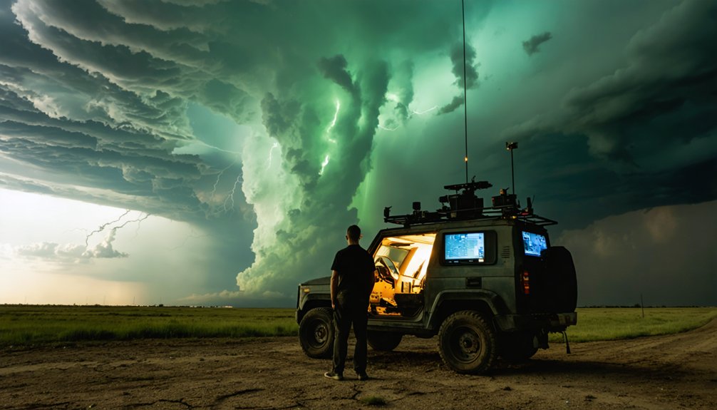
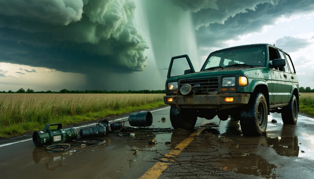
When you consider how rapidly forecasting technology has evolved, the contributions of storm chasers become impossible to ignore—their radar systems, instrumented vehicles, and drone deployments feed scientists real-time data that climate models alone can’t capture.
You’ll find that agencies like FEMA now consult chase-derived datasets to assess climate resilience and refine severe weather response strategies.
As video streaming and cellular internet expand the reach of field observation, you’re looking at a forecasting infrastructure that’s closing the gap between atmospheric uncertainty and actionable storm prediction.
Technology Closing Forecast Gaps
As storm chasers deploy radar arrays, drones, and instrumented vehicles directly into tornado paths, they’re collecting granular, real-time data that stationary weather stations simply can’t capture. This data collection feeds directly into forecasting models, sharpening lead times and accuracy.
Technology integration has accelerated this process considerably—cellular internet and video streaming now transmit field measurements instantaneously to meteorological agencies.
You’re seeing the results in measurable improvements: earlier warnings, more precise storm tracks, and better-informed evacuation decisions. Tools that once required laboratory settings now operate from mobile platforms in active storm environments.
Storm chasers also consult with agencies like FEMA, translating raw chase data into actionable resilience strategies. The gap between observation and prediction is narrowing, giving communities critical seconds that can mean survival.
Storm Chasers Gathering Data
Behind every sharpened forecast is a storm chaser threading instrumented vehicles through tornado-adjacent environments, pulling data that fixed infrastructure can’t reach.
You’re looking at mobile radar units, atmospheric sensors, and drone deployments working in coordinated sweeps to capture pressure gradients, wind shear signatures, and moisture profiles at near-ground level.
That data collection feeds directly into forecasting models that static weather stations simply can’t populate.
Storm documentation has accelerated further through cellular internet and live video streaming, compressing the gap between observation and analysis.
Scientists receive granular, real-time datasets that sharpen predictive accuracy for outbreak timing and intensity.
You’re not dealing with approximations anymore — you’re working with ground-truth measurements that redefine what operational forecasting can deliver before the next tornado touches down.
Future Forecasting Innovations
The forecasting gap that storm chasers have long worked to close is now shrinking faster through converging technologies that didn’t exist a decade ago.
You’re seeing advanced algorithms and machine learning process chase-collected data at speeds no human analyst can match. Real time analytics merge remote sensing inputs with ground-truth observations, sharpening predictive modeling accuracy across shifting tornado corridors.
Data integration across collaborative platforms lets independent chasers, university researchers, and federal agencies share innovative tools simultaneously.
Climate simulations now incorporate warming Gulf moisture patterns, refining outbreak probability windows. Automated forecasting systems flag tornado-favorable instability thresholds before conditions fully develop, giving communities in newly vulnerable southeastern regions critical lead time.
These converging capabilities aren’t just improving predictions—they’re directly expanding your margin for informed, independent decision-making before dangerous weather arrives.
Bigger Tornadoes, Underprepared Regions: The Climate Change Blind Spot
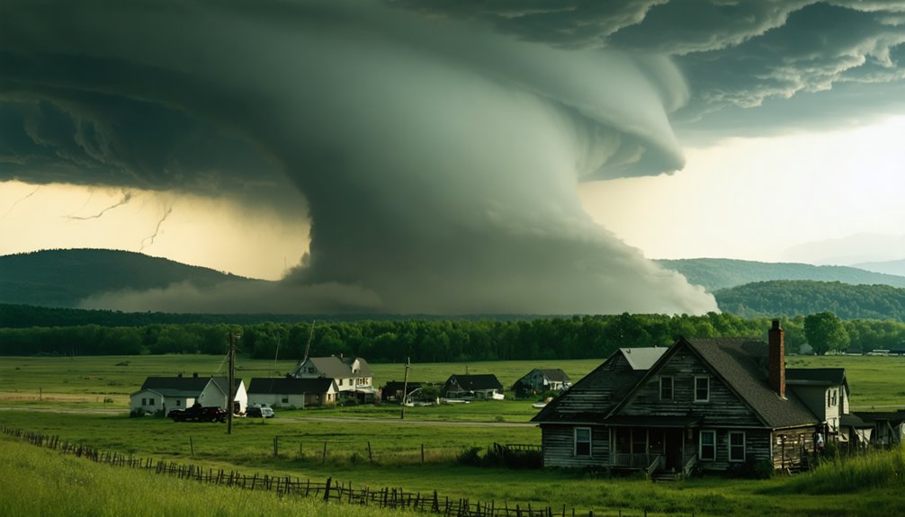
While Tornado Alley‘s geographic shift eastward into the southeastern United States signals a critical vulnerability, communities in these regions haven’t adapted infrastructure or emergency protocols to match the escalating risk.
You’re now seeing stronger tornadoes striking areas where tornado preparedness remains dangerously underdeveloped. Unlike the Great Plains, southeastern communities feature denser populations, mobile home concentrations, and heavily forested terrain that obscures approaching storms.
Stronger tornadoes are now hitting communities least equipped to survive them — and the terrain itself is working against them.
Regional vulnerability compounds further when warming Gulf waters inject additional heat energy, intensifying storm severity outside traditional seasons.
You can’t rely on outdated risk assumptions when climate dynamics are actively redrawing danger zones. Governments and emergency management agencies must recalibrate resource allocation, building codes, and public warning systems to reflect this new reality, or communities will remain dangerously exposed to escalating atmospheric threats they weren’t historically designed to withstand.
What Scientists Expect Tornadoes to Look Like in a Warmer World
As global temperatures climb, scientists project a paradoxical tornado future: fewer individual tornado days but more concentrated, violent outbreak events.
You’re looking at atmospheric changes that simultaneously reduce wind shear while intensifying thermodynamic instability — two competing forces reshaping tornado patterns fundamentally.
Warmer Arctic temperatures weaken the jet stream, cutting the wind shear critical for tornado formation.
Yet warming Gulf waters inject more moisture and heat energy into storm systems, amplifying severity when conditions align.
The result: fewer opportunities for tornadoes, but dramatically more destructive events when they strike.
You should understand that climate models can’t directly simulate individual tornadoes, but they effectively track the instability and shear conditions producing them — giving scientists reliable predictive frameworks for tomorrow’s increasingly unpredictable severe weather landscape.
Frequently Asked Questions
How Does Storm Chasing Data Directly Influence Fema’s Disaster Resilience Planning?
Daring data drives decisions: You’re directly shaping FEMA’s resilience metrics through storm chasing’s data accuracy, refining emergency preparedness strategies and enhancing storm prediction models, empowering communities with the freedom to better withstand nature’s intensifying fury.
What Safety Regulations Exist for Storm Chasers Near Emergency Response Zones?
No formal federal safety protocols exist specifically for storm chasers near emergency response zones. You’d need to follow local traffic laws, maintain emergency communications channels, and avoid interfering with first responders’ active operations.
How Is African SWIFT Nowcasting Technology Similar to Storm Chasing Methods?
Satellites cut storm deaths by 30%—you’ll find African SWIFT nowcasting mirrors storm chasing’s data integration approach, using remote sensing instead of physical pursuit to achieve nowcasting accuracy, delivering real-time severe weather intelligence to vulnerable, underserved communities.
Do Tornado Clusters Occurring Closer Together Increase Community Casualty Risks Significantly?
Yes, when tornado clusters occur closer together, you’re facing amplified community casualty risks. Increased tornado frequency compresses response windows, demanding stronger community preparedness—you can’t afford gaps in your emergency protocols when multiple tornadoes strike simultaneously.
How Has Video Streaming Technology Changed Real-Time Public Tornado Warning Systems?
You’d think streaming accuracy alone drives better warnings, but public engagement transforms real-time alerts too. Video streaming’s technology impact lets you witness tornadoes live, accelerating community responses and empowering independent verification beyond traditional warning systems.
References
- https://www.youtube.com/watch?v=uFGdZeKtYnI
- https://www.accuweather.com/en/severe-weather/how-climate-change-is-influencing-tornadoes/1768890
- https://environment.leeds.ac.uk/icas-research-impact/doc/storm-chasers-making-life-saving-forecasts
- https://www.c2es.org/content/tornadoes-and-climate-change/
- https://skepticalscience.com/why-chase-tornadoes.html
- https://www.omicsonline.org/open-access/tornados-and-their-impact-on-the-environment-unleashing-natures-fury-125697.html
- https://u.osu.edu/janahouser/tornadoes-and-climate-change/
- https://www.usgs.gov/faqs/how-can-climate-change-affect-natural-disasters