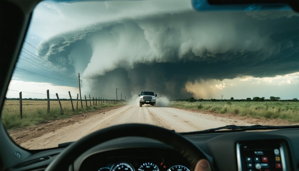
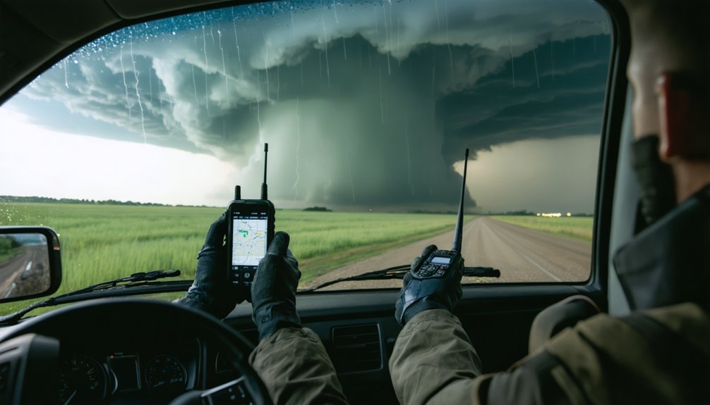
To guarantee reliable communication during storm chasing, you’ll need layered systems that don’t depend on a single network. Cell towers fail under load, high winds, and power loss, so carry two-way radios like the Yaesu FT-991A alongside satellite communicators like the Garmin inReach Mini 2. Real-time radar apps, portable weather instruments, and pre-downloaded offline maps eliminate dangerous blind spots. A clear reporting chain keeps your team synchronized when conditions deteriorate fast — and every tip here goes deeper than you’d expect.
Key Takeaways
- Severe storms damage cellular infrastructure, making alternative communication methods like two-way radios and satellite communicators essential for storm chasers.
- Devices like Garmin inReach Mini 2 and ZOLEO provide reliable satellite-based communication and SOS functionality when terrestrial networks fail.
- Real-time radar apps like RadarScope Pro enable continuous storm tracking, helping teams make precise navigation decisions during chase operations.
- Establishing a clear reporting hierarchy, including a designated NWS contact, ensures structured and effective communication during severe weather events.
- Layering navigation strategies using GPS devices, offline maps, and paper backups eliminates single points of failure during storm chasing.
Why Cell Networks Fail When You Need Them Most
When a severe storm moves through an area, the cellular infrastructure that you depend on for navigation, communication, and weather data collapses under simultaneous stress points.
Cell tower limitations become critical vulnerabilities when high winds damage antennas, power outages disable backup generators, and thousands of users flood networks simultaneously.
Communication failures cascade rapidly once tower capacity saturates, leaving you without data, voice calls, or location sharing precisely when operational decisions matter most.
Physical tower destruction from tornadoes or straight-line winds creates dead zones that persist for hours or days.
You can’t afford to rely on a system engineered for everyday traffic loads, not emergency surge conditions.
Understanding these failure points drives the case for dedicated radio and satellite communication systems.
Choose the Right Two-Way Radio for Storm Chaser Communication
Replacing your failed cell network with a dedicated two-way radio system starts with matching hardware to your operational demands.
Radio range considerations determine whether your team stays connected across sprawling storm corridors. Communication device compatibility guarantees your handheld and mobile units operate on shared frequencies without signal loss.
Evaluate these options against your chase setup:
- Midland MXT575 MicroMobile — vehicle-mounted unit delivering consistent range across open terrain
- Yaesu FT-991A — HF/VHF/UHF transceiver supporting multi-band coordination for extended operations
- Handheld units — carried by members operating outside vehicles for immediate field communication
- Frequency coordination — confirm all devices share programmable channels before deployment
Pairing mobile and handheld radios eliminates dead zones that cripple app-dependent teams, giving you operational independence regardless of infrastructure collapse.
Add a Satellite Communicator to Your Storm Chasing Kit
Even when two-way radios keep your team connected, cellular and radio infrastructure can still fail completely in remote or heavily impacted areas, making a satellite communicator your most critical backup layer.
Devices like the Garmin inReach Mini 2 and ZOLEO Satellite Communicator operate independently of terrestrial networks, transmitting GPS coordinates and messages via satellite regardless of local conditions.
Both units also carry dedicated SOS functionality, connecting you directly to emergency response services when a life-threatening situation leaves every other communication channel unavailable.
Why Satellite Communicators Matter
Cellular networks are the first infrastructure to fail during severe weather events, making satellite communicators a non-negotiable addition to your storm chasing kit.
Satellite reliability keeps you connected when ground-based infrastructure collapses entirely. Communicator advantages extend beyond basic messaging, giving you operational independence regardless of location.
Key capabilities you’ll gain:
- GPS coordinate sharing delivers precise position data to your team without cellular dependency
- SOS signaling activates emergency rescue notifications during life-threatening situations
- Extended coverage reaches remote areas where radio and cellular networks don’t penetrate
- Redundant communication layers combine with two-way radios to maximize your response options
Devices like the Garmin inReach Mini 2 and ZOLEO Satellite Communicator function independently, ensuring you’re never operationally blind when conditions deteriorate fastest.
Top Satellite Communicator Options
Two devices stand out when you’re building a satellite communication layer into your storm chasing kit: the Garmin inReach Mini 2 and the ZOLEO Satellite Communicator.
Both operate independently of cellular infrastructure, transmit GPS coordinates, and trigger SOS alerts to rescue services during life-threatening situations.
The inReach Mini 2 runs on the Iridium network, delivering pole-to-pole coverage options that eliminate dead zones across remote chase corridors.
ZOLEO combines Iridium satellite, Wi-Fi, and cellular into one unit, automatically switching between networks for continuous connectivity.
Satellite pricing varies by plan. Garmin offers tiered subscriptions starting around $14.95 monthly, while ZOLEO plans begin near $20 monthly.
Evaluate your chase frequency and terrain to select the plan that fits your operational budget without sacrificing communication redundancy.
SOS and Emergency Features
When cellular and radio networks collapse under extreme storm conditions, your satellite communicator’s SOS function becomes the only reliable emergency link between your team and rescue services.
Activating SOS Features triggers an immediate distress signal routed to GEOS International Emergency Response Coordination Center, operating 24/7 regardless of terrain or infrastructure damage.
Emergency Preparedness requires understanding exactly what happens after activation:
- Two-way messaging confirmation verifies rescue services received your distress signal
- GPS coordinates transmit automatically, eliminating manual position reporting during high-stress situations
- Dedicated rescue coordination connects responders directly to your exact location
- Non-cellular operation guarantees functionality when towers fail or lose power
Test your SOS Features during pre-chase equipment checks.
Knowing your device responds correctly before you’re in danger gives your team a decisive operational advantage.
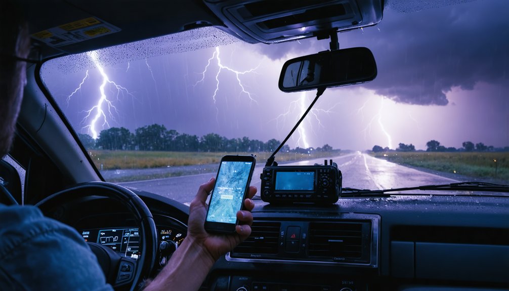
Use Real-Time Radar to Stay Ahead of the Storm
Real-time radar apps like Baron Mobile Threat Net and RadarScope Pro give you live storm data that drives precise navigation decisions when conditions shift rapidly.
You’ll want to track intensity changes and directional movement continuously so you can adjust your route before a storm’s behavior forces a reactive response.
Share radar data actively with your team members and coordinate updates with National Weather Service reporting points to maximize accuracy across all positions.
Mobile Radar Apps Matter
Staying ahead of a severe storm requires more than instinct—you need live, actionable data delivered directly to your device. Mobile radar apps like Baron Mobile Threat Net and RadarScope Pro give you independent situational awareness without relying on a team member’s updates.
Key app advantages that strengthen your mobile radar capability:
- Storm intensity tracking delivers objective measurements, replacing guesswork with quantifiable data.
- Real-time directional movement lets you anticipate route adjustments before conditions deteriorate.
- Remote multi-position monitoring keeps distributed team members equally informed simultaneously.
- NWS coordination support improves report accuracy when you’re sharing radar data with official channels.
These tools transform raw atmospheric data into actionable intelligence, keeping you mobile, informed, and operationally free from infrastructure dependency.
Track Storm Intensity Changes
Tracking storm intensity changes in real time gives you the operational edge needed to make split-second navigation decisions before conditions outpace your response.
Systems like Baron Mobile Threat Net and RadarScope Pro deliver continuous storm dynamics data, letting you monitor velocity, rotation, and reflectivity simultaneously.
Intensity measurement tools quantify wind shear, precipitation rates, and mesocyclone strength, replacing guesswork with objective metrics.
You’re not reacting blindly—you’re interpreting structured data and adjusting your position accordingly.
When radar shows intensification trends, you can execute route changes before the storm’s forward motion closes your exit options.
Distributing radar updates across your team guarantees every member operates from identical situational awareness, reducing coordination errors and keeping your entire operation responsive, informed, and positioned safely relative to the storm’s evolving threat envelope.
Coordinate Radar Data Sharing
Coordinating radar data sharing transforms isolated observations into a unified operational picture that keeps your entire team ahead of the storm’s movements.
Implement structured radar sharing strategies to maximize your team’s situational awareness and maintain operational independence from unreliable infrastructure.
- Use RadarScope Pro or Baron Mobile Threat Net for effective data transmission between distributed team members.
- Assign one member as radar coordinator who synthesizes incoming feeds and broadcasts critical updates.
- Establish timed reporting intervals to prevent communication overlap and data redundancy.
- Cross-reference multiple radar sources to verify storm intensity, direction, and projected path before rerouting.
When every member receives synchronized radar updates, you eliminate guesswork and react to objective measurements rather than assumptions.
Coordinated data sharing keeps your team mobile, informed, and genuinely free to operate on your terms.
Add Weather Instruments to Sharpen Your Field Reports
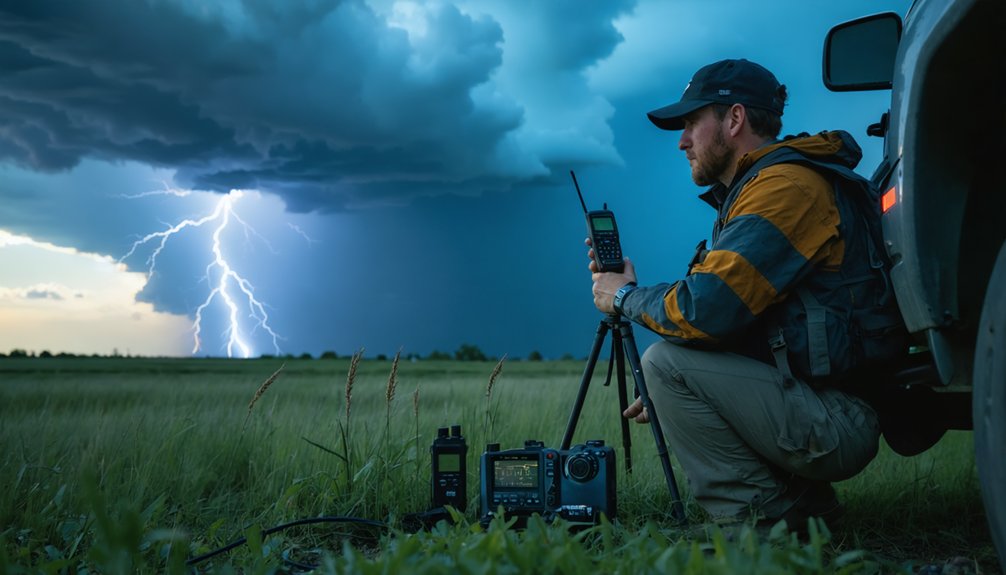
Portable weather instruments transform your field reports from subjective observations into quantifiable data that meteorologists can act on immediately. Anemometers, barometers, and lightning detectors like Thor Guard or StrikeAlert HD deliver precise local measurements that radar alone can’t capture.
Weather data integration across your team guarantees each member’s readings supplement collective radar analysis, producing more accurate NWS submissions.
Maintain instrument calibration before every deployment. Uncalibrated equipment introduces errors that undermine report credibility and compromise coordination among distributed team members.
Cross-reference your instrument readings against radar data to verify consistency before transmitting.
Distribute instruments across multiple team members to maintain data collection if individual equipment fails. Quantifiable wind speeds, pressure readings, and lightning proximity replace vague descriptions, giving meteorologists actionable intelligence and giving your team an independent operational edge.
Set Up Your Storm Chaser Reporting Chain Before You Leave
Sharp instrument data loses its value the moment it stalls inside your team and never reaches meteorological authorities.
Before deployment, you’ll need to establish a clear reporting hierarchy and define communication protocols every member follows without hesitation.
Structure your chain around these four elements:
- Designated NWS contact: Use the NWS Norman Public Service Line (405-325-3816) for imminent threats
- Central hub assignment: Assign one team member to consolidate reports before transmission
- Multi-platform redundancy: Confirm phone, social media, and online submission pathways are operational
- Chain-of-command documentation: Distribute written protocols so every member knows their reporting role
Pre-mission clarity eliminates errors that occur when uncoordinated data passes through multiple sources.
Your reporting hierarchy isn’t optional equipment — it’s the framework that transforms raw field observations into actionable meteorological intelligence.
When cellular networks collapse mid-chase, your navigation stack determines whether your team stays coordinated or fractures across unfamiliar road grids.
Deploy layered navigation strategies to eliminate single points of failure. Mount a dedicated Garmin Overlander 2025 Edition for real-time rerouting around road closures without relying on data connectivity.
Pre-download Google Maps Offline sectors covering your operational area before departure—cellular-dependent apps become useless mid-storm. Carry laminated paper maps of your target region as your final backup tool when electronics fail or batteries deplete.
Each team member should independently carry all three navigation layers, not depend on one vehicle’s equipment. Knowing regional road grids manually lets you navigate confidently when every electronic system fails simultaneously, keeping your team unified and operationally effective under maximum pressure.
Frequently Asked Questions
How Do Storm Chasers Legally Operate on Licensed Radio Frequencies?
You’ll need proper communication licensing to legally transmit on licensed bands. Obtain your FCC amateur radio license, follow radio frequency regulations, and you’re free to operate legally on authorized frequencies during storm chasing operations.
What Battery Backup Solutions Keep Communication Devices Powered During Extended Chases?
Power your pursuit persistently — you’ll want solar chargers and portable generators keeping devices charged during extended chases. They’ll sustain your radios, GPS units, and satellite communicators independently, ensuring you’re never powerless when severe weather communication’s most critical.
How Do Storm Chasing Teams Coordinate With Local Emergency Management Agencies?
You’ll coordinate with local emergency management agencies by following structured communication protocols—report storm tracking data through designated NWS contacts, use multi-platform submission options, and maintain chain-of-command clarity to guarantee accurate, timely information reaches meteorological authorities efficiently.
What Insurance Considerations Apply Specifically to Professional Storm Chasing Operations?
You’ll need liability coverage for third-party claims, equipment insurance protecting your radar and communication gear, vehicle protection covering storm damage, and data policies safeguarding collected meteorological records—each policy directly supporting your autonomous operational independence.
How Do Storm Chasers Protect Sensitive Electronic Equipment From Hail Damage?
Ever watched hail shred unprotected gear in seconds? You’ll shield your electronics using hail resistant gear like padded cases and vehicle-mounted enclosures, while equipment shielding covers cameras and radios from direct impact during active storm pursuit.
References
- https://store.sirui.com/blogs/guides/essential-equipment-for-storm-chasing-guide-for-2025
- https://midlandusa.com/blogs/blog/storm-chasers-rely-on-walkie-talkies-to-communicate
- https://svinews.com/2024/featured/97765/things-every-storm-chaser-needs-in-their-truck/
- https://www.weather.gov/oun/stormspotting
- http://forums.radioreference.com/threads/storm-chasers-question.316415/
- https://www.youtube.com/watch?v=w-5nJ61umeA