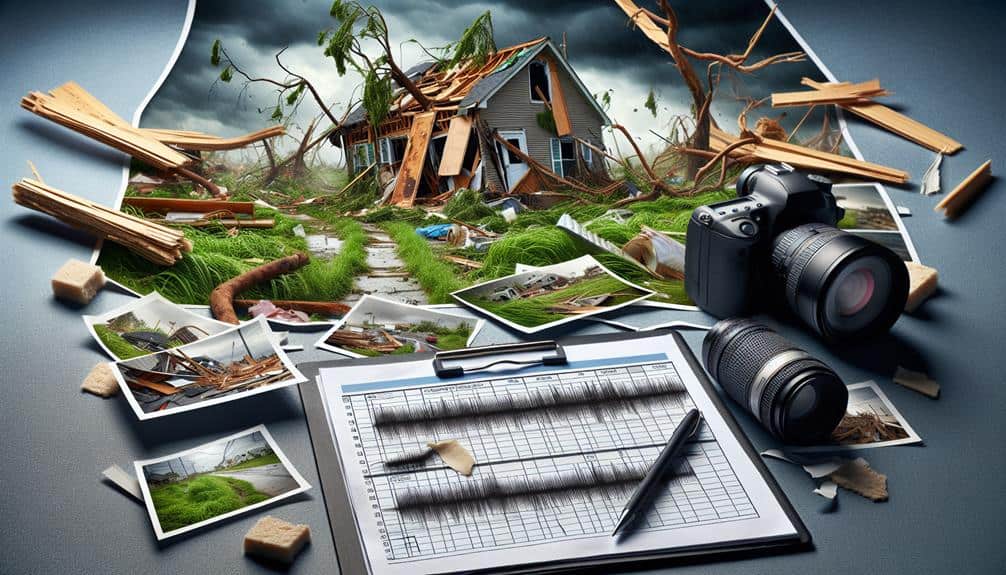
Proper documentation is essential for evaluating storm damage because it allows us to capture precise, thorough records necessary for efficient resource allocation and trustworthy claims processing. Using tools like digital cameras, GPS devices, and drones helps us obtain high-quality, time-stamped images and exact location data. Detailed written descriptions and structured data help pinpoint crucial damage areas and avoid post-storm disorder. Additionally, detailed records support insurance claims and legal processes, speeding up assessments and improving the likelihood of settlements. By consistently updating, we stay current and monitor damage progression accurately. Learn how to enhance your documentation strategy further here.
Key Points
- Accurate documentation aids reliable assessments and informed resource allocation.
- Comprehensive records identify critical damage areas for targeted repairs.
- High-quality evidence supports insurance claims and expedites settlements.
- Continuous updates ensure relevant and precise damage tracking.
Importance of Accurate Records
Accurate records are essential for effectively evaluating storm damage and ensuring thorough recovery efforts. We must prioritize data accuracy in our record keeping to achieve reliable assessments.
When we meticulously document the extent of the damage, we're better equipped to allocate resources and plan the recovery process methodically. Precision in our records allows us to identify patterns and areas that may require more immediate attention, ensuring no detail is overlooked.
To maintain high documentation efficiency, we should adopt structured methods and organized systems. This not only streamlines the record-keeping process but also enhances our ability to retrieve and analyze data swiftly.
Organization is key; it prevents the chaos that often follows a storm, allowing us to stay focused on the recovery rather than sifting through disorganized information.
Tools for Documenting Damage
Let's start by identifying the essential tools we need for documenting storm damage. These tools include cameras, measuring devices, and notepads.
We'll also explore how we can use technology effectively. This includes utilizing apps and software that streamline the process.
Essential Documentation Tools
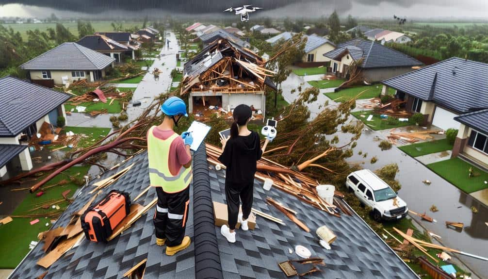
To effectively assess storm damage, we need a thorough toolkit that includes digital cameras, GPS devices, drones, and specialized software for accurate documentation and analysis. High-resolution digital cameras capture detailed images of damage, providing clear visual records. These photos serve as digital evidence, essential for insurance claims and repair planning.
GPS devices help us pinpoint exact locations, guaranteeing our documentation is precise and geographically accurate. Drones offer a bird's-eye view of affected areas, enabling us to survey large regions quickly and safely. This aerial perspective reveals damage that might be missed from the ground.
Specialized documentation software is essential for organizing and analyzing these data points. Such software allows us to annotate images, integrate GPS coordinates, and generate detailed reports. Using documentation software, we can efficiently compile digital evidence, streamlining the assessment process.
Each tool in our kit plays a pivotal role in creating a complete picture of the storm's impact. By employing these indispensable documentation tools, we guarantee our assessments are thorough, accurate, and actionable. This methodical approach empowers us to make informed decisions, ultimately supporting our goal of restoring affected areas swiftly and effectively.
Using Technology Effectively
Harnessing the full potential of modern technology, we can streamline the documentation process for storm damage, making sure every detail is meticulously recorded and easily accessible. By integrating technology into our documentation efforts, we enhance data accuracy and efficiency.
Mobile apps, for instance, allow us to take high-resolution photos and annotate them in real-time, capturing damage with precision. GPS-enabled devices help us track exact locations, which is vital for large-scale storm assessments.
Drones offer an aerial perspective that's invaluable for inspecting roofs and hard-to-reach areas without putting anyone at risk. Their high-definition cameras provide thorough overviews, allowing us to document extensive areas quickly.
Cloud-based storage solutions make sure that all collected data is securely stored and can be accessed from anywhere, facilitating collaboration among team members and stakeholders.
Additionally, digital templates and checklists can standardize our documentation procedures, reducing human error and making certain that no important information is overlooked. By leveraging these technological tools, we not only improve our data accuracy but also expedite the entire assessment process.
This approach empowers us to make informed decisions swiftly, ultimately aiding in quicker recovery and restoration efforts.
Photographic Evidence Guidelines
Let's start by ensuring our photographs are high-resolution to capture intricate details of the storm damage.
We should also cover the entire affected area thoroughly to provide a full scope of the situation.
Additionally, we'll make sure all photos are time-stamped to establish a clear timeline of the damage.
High-Resolution Image Quality
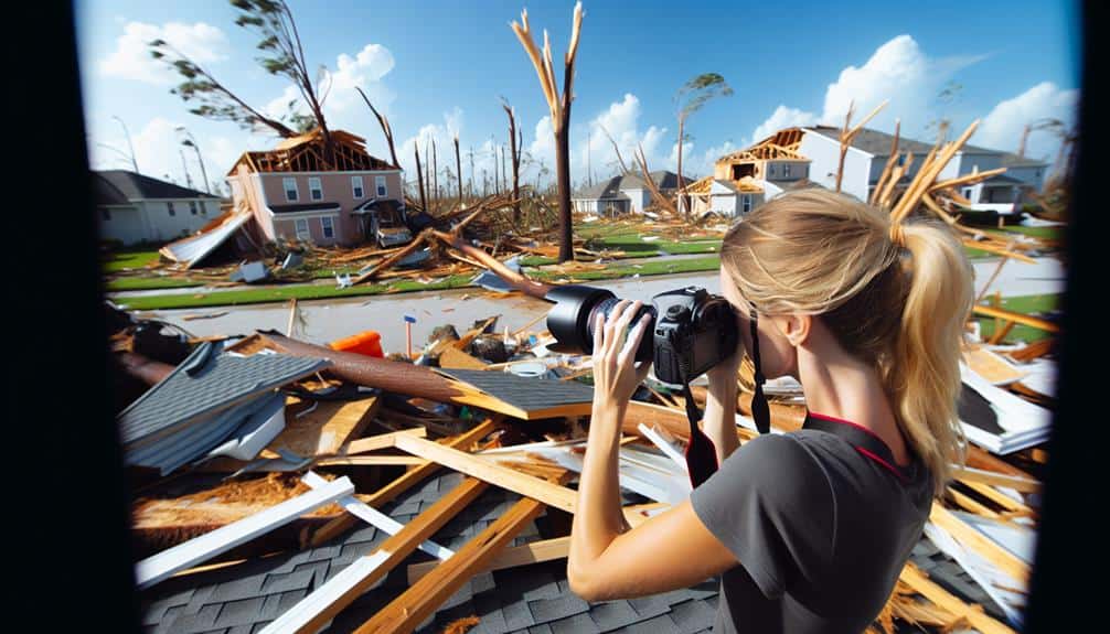
Capturing high-quality images is vital for accurately documenting storm damage and ensuring clear, detailed evidence. When we aim for high image resolution, we enhance our ability to provide clear documentation of the extent and specifics of the damage. This clarity is crucial for a detailed assessment, allowing us to see minute details that might be missed with lower-quality images. High-quality photos capture the full scope of the damage, from minor scratches to major structural issues, providing thorough visual evidence for evaluations and claims.
To achieve this, we should use cameras or smartphones capable of capturing high-quality images. We need to make sure our settings are optimized for maximum clarity. This includes adjusting the focus, exposure, and lighting conditions to avoid blurry or dark photos. By doing so, we create a reliable record that can be scrutinized without ambiguity.
Furthermore, it's important to take multiple photos from various angles and distances. This approach helps us cover all aspects of the damage and provides a more complete visual narrative.
To summarize, high-quality image quality isn't just a technical choice; it's a fundamental practice that supports accurate, clear, and detailed storm damage documentation.
Comprehensive Coverage Scope
To ensure a thorough and precise record of storm damage, we must systematically photograph all affected areas from multiple perspectives. This approach guarantees assessment accuracy and aids in identifying the full extent of the damage, which is essential for insurance claims. By covering every angle, we can avoid gaps in our documentation that might lead to coverage limits being applied unfairly.
We should start by photographing the exterior of the property, capturing wide shots to show the overall context and close-ups to highlight specific damages. Each damaged area must be documented from at least three different angles to provide a detailed view. This helps in overcoming documentation challenges and minimizes the risk of claim disputes.
Inside the property, we need to follow a similar methodical approach. Capture images of each room, focusing on damaged walls, floors, and ceilings. We must also document any personal property affected by the storm. Consistent and detailed photographic evidence is crucial in presenting a clear picture of the damage.
Time-Stamped Records
As we methodically document the storm damage with detailed photographs, it's essential to verify that each image is time-stamped to confirm the timeline of events accurately.
Time-stamped data plays a pivotal role in maintaining documentation accuracy and ensuring the integrity of our records. When every photograph includes a precise date and time, we can establish a clear sequence of events, which is crucial for insurance claims and legal purposes.
To achieve excellent record keeping, we should follow specific photographic evidence guidelines.
First, make sure that your camera or smartphone settings are configured to automatically time-stamp each image. If your device lacks this feature, consider using supplementary applications designed for this purpose.
Second, capture wide-angle shots for context and close-ups for detailed damage assessment. This dual approach enhances documentation accuracy by providing a thorough view of the affected areas.
Furthermore, regularly back up these time-stamped photos to secure storage locations, both online and offline.
Consistent, accurate record keeping is indispensable for preserving information integrity. By adhering to these guidelines, we not only protect our assets but also empower ourselves with the freedom to navigate post-storm recovery processes confidently and efficiently.
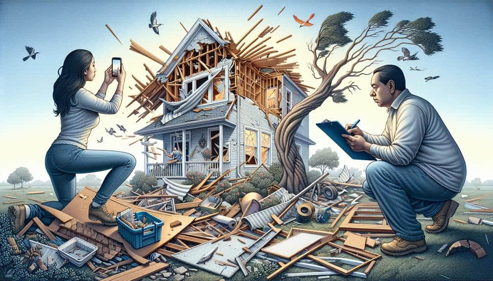
Detailed Written Descriptions
We should meticulously document each aspect of the storm damage with detailed written descriptions to guarantee accuracy and thoroughness. First, we need to create detailed sketches and visual aids to accompany our descriptions. These tools will provide a clear picture of the damage, ensuring we capture every nuance. Including accurate measurements of affected areas is essential. We should record dimensions such as the length and width of damaged sections, the depth of any indentations, and the height of any fallen structures.
Next, specifying the exact location of the damage using coordinates can help future assessments and repairs. By noting precise location coordinates, we allow for a systematic approach to evaluating and addressing the damage. This level of detail ensures that anyone reviewing the documentation can understand the extent and specific areas impacted by the storm.
Moreover, our descriptions should cover the nature of the damage, including the type and severity. Was the roof torn off, or were windows shattered? Is there water damage, or have trees fallen onto structures? Providing this information will help in determining the necessary steps for repairs and recovery. By being methodical and precise, we empower ourselves to respond effectively and efficiently.
Utilizing Drone Technology
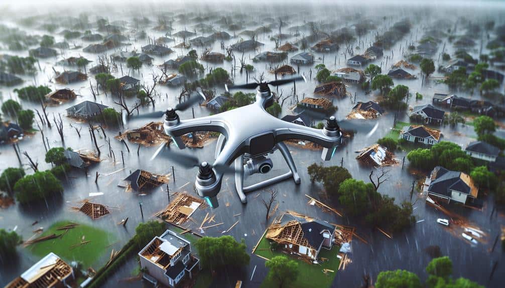
Utilizing drone technology enables us to efficiently capture high-quality images and videos of storm damage from various angles. This approach ensures that we gather detailed visual data, which is essential for thorough data analysis and accurate risk assessment. By using drones, we can quickly survey large areas, identifying damage that might be overlooked with ground-level inspections.
The high-quality imagery obtained from drones provides a detailed view of the affected structures and landscapes. This level of detail is vital for pinpointing specific areas of concern and understanding the full extent of the damage. Moreover, drones can access locations that are challenging or hazardous for humans to reach, enhancing our ability to document storm damage safely and thoroughly.
Integrating drone technology into our assessment process also allows us to create 3D models and maps of the damaged areas. These models facilitate a more detailed analysis, helping us to predict potential risks and prioritize repairs. The data collected by drones can be stored and referenced in future risk assessment efforts, providing a valuable record that supports informed decision-making.
Legal and Insurance Benefits
Incorporating proper documentation of storm damage offers significant legal and insurance benefits, ensuring that claims are substantiated with clear and thorough evidence. When we document damage meticulously, we streamline the claim process by providing insurance companies with the precise proof they need. This not only speeds up the evaluation but also increases the likelihood of a fair settlement.
By capturing high-quality photographs, videos, and written descriptions, we create a robust record that can be easily referenced throughout the claim process. This detailed evidence serves as irrefutable proof of the damage's extent, making it harder for insurers to dispute our claims. Additionally, having a well-documented account of the damage can be instrumental if legal action becomes necessary, providing a solid foundation for our case.
Accurate proof submission also safeguards us against potential accusations of fraud. By presenting clear and organized evidence, we demonstrate our integrity and adherence to policy guidelines. This transparency fosters trust and minimizes disputes, ensuring our claims are processed efficiently.
Thorough documentation isn't just a bureaucratic necessity; it's a strategic tool that empowers us to navigate the complexities of the insurance and legal systems effectively.
Maintaining Continuous Updates
To ensure the accuracy and relevance of our storm damage assessments, maintaining continuous updates throughout the recovery process is crucial. This practice guarantees that our evaluations reflect the most current state of the affected areas, allowing for precise data management and record accuracy.
First, we should regularly document any changes or new findings in the damaged areas. By doing so, we create a thorough timeline that tracks the progression of damage and repairs. This ongoing documentation helps us adjust our assessments in real time, ensuring they remain accurate and relevant.
Second, integrating technological tools, such as digital logs and cloud-based storage, can greatly enhance our ability to manage data efficiently. These tools allow us to update records instantaneously, reducing the risk of information loss or errors. Furthermore, they provide easy access for all stakeholders, fostering transparent and collaborative decision-making.
Frequently Asked Questions
How Can I Prepare for Storm Damage Documentation Before a Storm Occurs?
We can prepare for storm damage documentation by taking photos of our property, making an inventory of valuables, and ensuring document storage is secure and accessible. Pre-storm preparations help us stay organized and ready for any aftermath.
What Should I Do Immediately After a Storm to Begin Documentation?
In the aftermath, let's capture photo evidence and video footage of our property inventory. Documenting meticulously guarantees our insurance claims are solid. Our freedom to rebuild starts with thorough, immediate documentation of the storm's impact.
Can Social Media Posts Be Used in Storm Damage Documentation?
Yes, we can use social media posts in storm damage documentation. However, we must consider privacy concerns and make sure the verification process is thorough. Digital evidence can have significant legal implications, so accuracy and reliability are vital.
How Do I Organize My Documentation for Easy Reference?
We should organize our documentation by categorizing evidence in physical folders and creating digital backups. Label folders clearly, store them in a secure place, and guarantee digital copies are accessible from multiple devices for easy reference.
What Are Common Mistakes to Avoid When Documenting Storm Damage?
When documenting storm damage, let's confirm accuracy by avoiding exaggerations. We should photograph all damages, keep detailed notes, and cross-check information. This methodical approach ensures our documentation is reliable and helps us maintain our freedom in assessments.