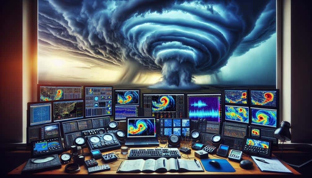
For storm chasers, we've identified five top tools with Doppler radar technology essential for tracking severe weather patterns. Mobile Doppler radar systems provide real-time data on wind velocity and storm structure, necessary for traversing diverse terrains. Handheld weather devices give accurate readings on temperature, humidity, and wind speed, aiding quick decisions. High-resolution radar apps visualize storm intensity and movements, enhancing predictive capabilities. Portable weather stations offer real-time data collection in remote areas, integrating seamlessly with smartphones. Advanced weather software combines real-time analysis with predictive modeling to identify areas at risk. Continue, and you'll uncover how these tools enhance storm chasing.
Key Points
- Mobile Doppler Radar Systems: Real-time storm tracking with vehicle-mount capabilities for diverse terrains.
- High-Resolution Radar Apps: Detailed visualization and real-time tracking of storm movements and intensity.
- Advanced Weather Software: Predictive modeling and real-time notifications for severe weather events.
- Portable Weather Stations: On-the-go data collection of wind speed, temperature, and humidity, with smartphone integration.
Mobile Doppler Radar Systems
Mobile Doppler radar systems, utilizing advanced technology, provide storm chasers with real-time data essential for tracking and analyzing severe weather patterns. By mounting these systems on our vehicles, we gain the capability for real-time tracking of storm movements, which is pivotal for making informed decisions during our chases. The integration of vehicle mounts allows us to navigate through diverse terrains while maintaining a constant stream of meteorological data.
These systems are designed with compactness in mind, ensuring they fit seamlessly into our mobile setups without compromising functionality. The compact design doesn't just save space but also enhances mobility, enabling us to reach remote locations where severe weather phenomena are most potent. Additionally, remote access features empower us to control and monitor the radar systems from a distance, providing flexibility and freedom to adjust our strategies on the fly.
Data collected from mobile Doppler radar systems include wind velocity, precipitation intensity, and storm structure, which are vital for understanding and predicting storm behavior. By leveraging this technology, we can document detailed storm profiles, enhancing both our safety and the accuracy of our weather forecasts.
Handheld Weather Devices
In addition to mobile radar systems, handheld weather devices provide us with necessary on-the-go meteorological data, enhancing our ability to monitor storm conditions in real-time. These compact instruments measure essential parameters such as temperature, humidity, barometric pressure, and wind speed. This real-time data is critical for both emergency response and field research, allowing us to make informed decisions quickly.
Devices like Kestrel Weather Meters and Skywatch Wind Meters offer accurate readings that can be instantly relayed to our team. When we're in the field, these handheld tools guarantee we're not solely reliant on larger, stationary systems. They offer the flexibility to move through varied terrains, capturing localized data that might otherwise be missed.
Moreover, handheld weather devices are indispensable during emergency response situations. They help us assess immediate environmental conditions, aiding in the deployment of resources and personnel. For instance, knowing the exact wind speed and direction can inform evacuation routes and safety measures. In field research, these devices allow us to log precise data points that contribute to broader meteorological studies.
In short, handheld weather devices are vital for storm chasers seeking accurate, real-time data in dynamic environments. Their portability and precision empower us to act swiftly and effectively, enhancing both our research and emergency response efforts.
High-Resolution Radar Apps
High-resolution radar apps transform our ability to monitor and analyze storm systems with unmatched detail and accuracy. Through advancements in Doppler radar technology, we can now engage in real-time tracking and storm detection that provides vital data when we need it most. These apps enable us to visualize storm movements, intensity, and potential threats, offering a thorough view of developing weather patterns.
The precision of high-resolution radar apps allows for timely identification of severe weather phenomena such as tornadoes, hailstorms, and flash floods. This detailed data is essential for making informed decisions and implementing safety precautions. With features like velocity scans and reflectivity analysis, we can distinguish wind speeds and precipitation intensity, enhancing our predictive capabilities.
Portable Weather Stations
While high-resolution radar apps provide critical storm data, portable weather stations empower us to gather on-the-ground measurements with precision and immediacy. These compact devices are essential for real-time weather monitoring, enabling us to make informed decisions during storm chases. By deploying portable weather stations, we enhance our emergency response capabilities, guaranteeing we're always prepared for sudden changes.
Portable weather stations offer several key benefits:
- Real-Time Data Collection: We can measure wind speed, temperature, barometric pressure, and humidity directly in the storm's path. This immediate data is invaluable for analyzing storm development and potential hazards.
- Versatility and Mobility: These devices are designed to be easily transported and quickly set up, allowing us to monitor weather conditions in remote and dynamic environments.
- Integration with Other Tools: Many portable weather stations can sync with our smartphones or laptops, providing seamless data transfer and enabling us to cross-reference with Doppler radar readings.
Our commitment to accurate weather monitoring ensures that we stay ahead of the storm, keeping our team safe and informed. Whether we're tracking tornadoes or monitoring severe thunderstorms, portable weather stations are indispensable tools that enhance our field data collection and support our mission for freedom and precision.
Advanced Weather Software
Advanced weather software equips us with powerful analytical tools that enhance our ability to predict, track, and respond to severe weather events with unparalleled accuracy. These sophisticated platforms integrate storm tracking capabilities with real-time data analysis, providing us with a detailed view of weather patterns.
By leveraging Doppler radar data, we can visualize storm trajectories and identify potential areas at risk.
One of the key features of advanced weather software is its predictive modeling. Using historical data and current atmospheric conditions, the software can generate forecasts that help us anticipate severe weather events before they occur. This predictive power is essential for making informed decisions on the ground, whether we're chasing storms or coordinating emergency responses.
Severe weather alerts are another vital component. By setting custom alert parameters, we receive real-time notifications when specific weather conditions develop. These alerts enable us to act swiftly, ensuring that we never miss a crucial update.
Furthermore, the software's ability to overlay multiple data sets—such as temperature, humidity, and wind speed—enhances our situational awareness, allowing us to operate with greater freedom and precision.
Frequently Asked Questions
What Safety Precautions Should Storm Chasers Take During Severe Weather Events?
We should secure safety by setting up emergency shelters and studying evacuation routes. Prioritize lightning safety and practice tornado drills. Data-driven decisions and technical terminology keep us prepared and protected during severe weather scenarios.
How Can Storm Chasers Communicate in Areas With Poor Cell Reception?
To communicate in areas with poor cell reception, we use satellite communication and emergency beacons. Satellite devices guarantee connectivity, while beacons provide location data, enhancing our ability to stay in touch and remain safe during severe weather.
What Are the Recommended Vehicles for Storm Chasing?
When considering vehicle selection, we prioritize durability and equipment storage. Reliable communication options and advanced navigation tools are essential. Our top choices include SUVs and modified trucks equipped with radar, satellite phones, and GPS systems for peak performance.
How Do Storm Chasers Fund Their Expeditions?
We fund our expeditions through diverse fundraising strategies and sponsorship opportunities. Effective financial planning and budget management are essential. We leverage data-driven approaches to secure resources, ensuring our freedom to chase storms safely and efficiently.
What Personal Protective Equipment Is Essential for Storm Chasers?
In storm chasing, we prioritize protective gear and essential items. Helmets, sturdy boots, and fire-resistant clothing are crucial. Safety measures and necessary precautions, like first-aid kits and emergency communication devices, guarantee our protection and readiness for unpredictable conditions.


