We must prioritize safety and accuracy when storm chasing near water bodies. Using current meteorological data from satellites, radar, and ground-based sensors allows us to monitor storm intensity and predict trajectories effectively. We should select safe locations with clear visibility and multiple escape routes, while using appropriate equipment like wind gauges, water-resistant GPS units, and high-definition cameras. Maintaining communication via VHF radios or satellite phones and having a strong emergency response plan, including mapped evacuation routes and stocked supplies, is essential. By integrating these practices, we guarantee safety and best data collection for more detailed insights.
Key Points
- Continuously monitor real-time meteorological data from satellites, radar, and ground-based sensors for accurate storm tracking.
- Choose vantage points with multiple escape routes and clear visibility near water bodies for quick and safe evacuation.
- Use waterproof GPS units and high-resolution cameras to navigate safely and capture detailed storm visuals.
- Establish and maintain reliable communication using VHF radios and satellite phones to ensure team coordination.
Assess Weather Conditions
To effectively assess weather conditions, we must analyze real-time meteorological data from satellites, radar systems, and ground-based sensors. By integrating these data sources, we can enhance our ability to monitor forecasts and make informed decisions.
Satellite imagery provides us with high-resolution views of cloud formations, storm systems, and atmospheric phenomena. This bird's-eye perspective is vital for identifying developing weather patterns over water bodies.
Simultaneously, radar systems allow us to check radar reflectivity to detect precipitation intensity, storm cell movement, and potential severe weather events.
Ground-based sensors complement this by providing localized data on temperature, humidity, and wind speed. These sensors are invaluable for interpreting how larger weather systems might interact with specific areas.
Choose Safe Locations
Selecting safe locations for storm chasing requires a thorough analysis of topographical maps, historical storm data, and real-time environmental conditions. First, we must prioritize safety first. This means identifying areas with minimal risk of flooding, landslides, or other hazardous conditions. Topographical maps provide vital insights into elevation changes and potential water flow paths, allowing us to avoid low-lying areas prone to flash floods.
Next, we use historical storm data to pinpoint regions that have previously experienced severe weather events. This data helps us predict storm trajectories and likely impact zones. By understanding past storm behavior, we can position ourselves strategically to observe storm development while maintaining a safe distance.
Real-time environmental conditions are equally important. We rely on advanced meteorological tools and live data feeds to monitor storm intensity and movement. This information enables us to make informed decisions about where to position ourselves, ensuring we're not caught off-guard by sudden changes in weather patterns.
Strategic positioning also involves selecting vantage points that offer clear visibility of the storm while providing multiple escape routes. Access to reliable transportation and communication tools is crucial for rapid evacuation if conditions deteriorate. By combining these strategies, we can safely and effectively chase storms near water bodies.
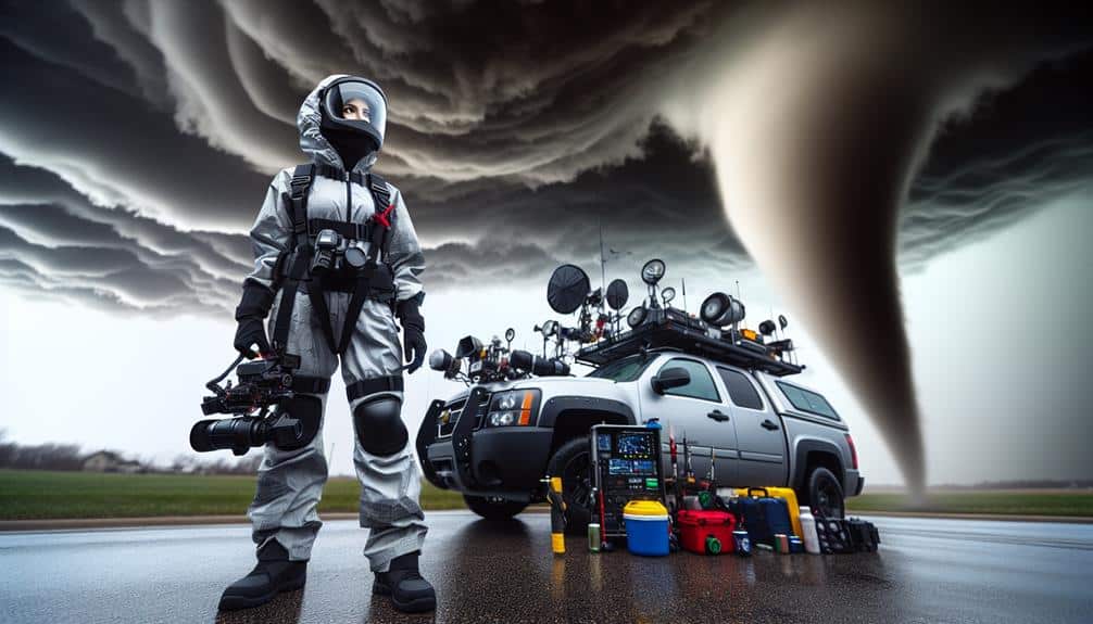
Use Proper Equipment
Proper equipment is essential for storm chasing, making sure we can capture accurate data and stay safe in unpredictable conditions. We need to prioritize proper gear and maintain a safety-first mindset to effectively tackle the challenges posed by storm chasing near water bodies. This isn't just about having the right tools; it's about maximizing our capabilities while minimizing risks.
The following items are vital for our storm chasing endeavors:
- Anemometers: These devices measure wind speed with high precision, providing us with essential data during storm events.
- Waterproof GPS units: Finding our way safely and efficiently is crucial, especially when weather conditions compromise visibility.
Advanced storm chasing requires an understanding of meteorological instruments and their proper use. Anemometers, for instance, give us real-time wind speed readings, which are crucial for evaluating storm intensity. Waterproof GPS units ensure we don't lose our way, even in heavy rain or flooding. High-resolution cameras allow us to document storm phenomena meticulously, aiding in post-event analysis.
Maintain Communication
Effective communication is crucial in storm chasing, ensuring that our team remains coordinated and informed amidst rapidly changing weather conditions. We've found that establishing protocols is necessary for maintaining this communication. By setting clear guidelines on how and when to share updates, we reduce confusion and enhance our operational efficiency.
First, we utilize a range of communication devices tailored to diverse scenarios. VHF radios are essential for short-range, real-time updates, especially in areas where cellular networks may fail. Satellite phones provide a reliable backup, ensuring we're never out of touch, even in the most remote locations. Additionally, we incorporate GPS tracking systems that allow us to monitor each team member's position relative to the storm and water bodies.
To streamline information flow, we employ a centralized command center. This hub receives data from all team members, processes it, and disseminates actionable intelligence. We also use data encryption to protect sensitive information and maintain operational security.
Emergency Response Plan
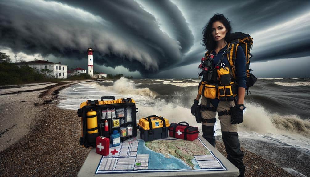
Developing a strong emergency response plan is crucial to safeguard our team's safety and operational success during severe weather events near water bodies. We must prioritize establishing detailed and data-driven protocols to guarantee our rapid response capabilities. Our plan should encompass multiple facets, from identifying reliable evacuation routes to stockpiling essential emergency supplies.
To enhance our preparedness, we should focus on:
- Mapping Evacuation Routes: Utilize GIS technology to map multiple, viable escape paths, considering factors like water levels, road conditions, and real-time weather data.
- Stocking Emergency Supplies: Ensure we've a complete kit, including first aid, water filtration devices, flotation devices, and non-perishable food items.
Frequently Asked Questions
What Are the Legal Restrictions for Storm Chasing Near Water Bodies?
We need to follow legal restrictions like obtaining permits and adhering to local ordinances for storm chasing. Safety precautions, including maintaining a safe distance and having emergency plans, are essential for our protection and compliance.
How Do You Identify Safe Parking Spots for Your Vehicle?
When we identify safe parking spots, we prioritize vehicle safety by seeking solid, sheltered sites. We constantly check weather conditions, confirming we're away from water surge zones and unstable grounds. Accurate positioning guarantees freedom and security.
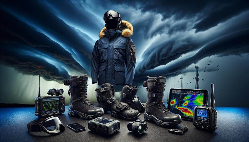
Are There Specific Clothing Recommendations for Storm Chasing?
For storm chasing, we prioritize wearing safety gear like waterproof boots and helmets. Rain protection is key, so we opt for high-quality rain jackets and pants. Our attire guarantees mobility and minimizes exposure to hazards.
What Is the Best Way to Document Storm Activity?
Who knew documenting storms isn't just about fancy cameras? We need reliable equipment like waterproof gear and drones. But let's not forget safety precautions: maintaining distance, monitoring forecasts, and having emergency kits. Freedom's great, but safety first!
How Can You Stay Updated With Real-Time Weather Alerts?
We should stay updated with real-time weather alerts by using weather apps and social media for quick information. Additionally, emergency alerts and weather radios provide reliable, data-driven updates essential for making informed decisions while maintaining our freedom to chase.