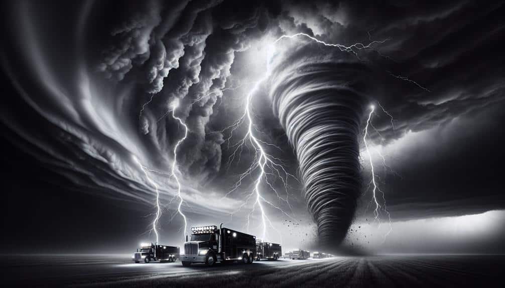
When tracking storms, we rely on three essential pieces of equipment: weather radar systems, high-definition cameras, and GPS navigation devices. Weather radar systems, especially Doppler radar, offer real-time data on precipitation intensity and movement, providing crucial storm structure and trajectory insights. High-definition cameras, particularly those on drones and satellites, deliver detailed visual data that enhance predictive accuracy. GPS navigation devices are important for tracking storm paths and coordinating emergency responses, thanks to real-time updates and seamless data sharing capabilities. With these tools working in tandem, we markedly improve storm prediction and response strategies, ensuring we're always one step ahead.
Key Points
- Weather radar systems provide real-time data on precipitation intensity, movement, and storm structure.
- High-resolution cameras offer detailed visual data, enhancing predictive accuracy when combined with radar information.
- Drones equipped with high-definition cameras gather real-time data from otherwise inaccessible locations.
- GPS navigation devices accurately track storm paths and predict impacts on specific areas, integrating satellite imagery for better predictions.
Weather Radar Systems
When tracking storms, we depend heavily on weather radar systems to provide real-time data on precipitation intensity and movement. Weather radar systems are essential tools for storm prediction, enabling us to analyze data swiftly and accurately. These systems operate by emitting radio waves that bounce off precipitation particles, returning signals that are then processed to generate detailed images of weather conditions.
Using Doppler radar, we can detect not only the presence of precipitation but also its velocity relative to the radar. This capability is vital for identifying storm rotation, which is often a precursor to tornado formation. By integrating multiple radar data points, we can create a complete view of a storm's structure and trajectory.
Data analysis becomes crucial as we interpret radar readings to predict a storm's path and intensity. Algorithms process vast amounts of data to identify patterns, helping us issue timely warnings and make well-informed decisions. The freedom to act on accurate information empowers communities to protect lives and property.
In an era where weather patterns are increasingly unpredictable, leveraging advanced radar technology for storm prediction isn't just a luxury but a necessity. Accurate, real-time data guarantees we're always a step ahead of the storm.
High-Resolution Cameras
To improve our storm-tracking capabilities, high-definition cameras offer detailed visual data that complements radar information. By integrating this advanced imaging technology, we can achieve precise and timely observations essential for accurate storm tracking. High-definition cameras enable us to capture fine details of storm structures, which are necessary for image analysis.
Utilizing drone technology, we can deploy high-definition cameras to gather real-time data from vantage points otherwise inaccessible. Drones equipped with these cameras offer unparalleled mobility and flexibility, allowing us to monitor rapidly changing storm conditions up close. This dynamic approach ensures that we don't overlook important moments during storm development.
Satellite imagery also plays a crucial role. High-definition satellite cameras provide extensive views of storm systems from space, offering a macro perspective that complements ground-based observations. These satellite images give us the ability to track storm movements across vast regions, enabling better prediction and preparedness.
Combining these high-definition visual inputs with existing radar data, we can refine our storm-tracking models and improve predictive accuracy. The enhanced detail from high-definition cameras aids in the precise identification of storm intensities and trajectories, ultimately contributing to more effective storm tracking and increased safety for all.
GPS navigation devices are necessary for accurately tracking storm paths and predicting their impact on specific locations. With precise geospatial data, we can pinpoint the exact trajectory of a storm, enhancing our ability to issue timely warnings. These devices utilize satellite imagery to provide real-time updates, guaranteeing our data is always current. By integrating this technology, we greatly improve our situational awareness.
When tracking storms, it's essential to have reliable emergency communication. GPS navigation devices often come equipped with features that allow us to send distress signals and coordinate rescue operations. This functionality is crucial, especially when ground-based communication networks are compromised. The accuracy of these devices ensures that help can be dispatched to precise locations, minimizing response times and potentially saving lives.
Moreover, GPS devices facilitate seamless data sharing among meteorologists, emergency responders, and local authorities. The integration of satellite imagery with GPS data allows us to create detailed maps of storm-affected areas, which are crucial for planning evacuations and resource allocation. This synthesis of technology not only enhances our predictive capabilities but also empowers us to act decisively and maintain our autonomy during emergency situations.
Frequently Asked Questions
How Do Storm Trackers Communicate With Emergency Services During Severe Weather Events?
We use emergency communication methods to relay real-time data to emergency services. Storm trackers employ advanced communication methods like satellite phones and encrypted radio channels during severe weather to guarantee accurate, timely information dissemination, ensuring public safety.
What Are the Best Practices for Safely Deploying Storm Tracking Equipment?
Just like Prometheus wielding fire, we must prioritize safety measures and equipment maintenance. Effective communication strategies and robust emergency response plans are crucial. Let's make sure our storm tracking endeavors are both safe and scientifically sound.
Can Storm Tracking Data Be Integrated With Mobile Apps for Real-Time Updates?
Yes, we can integrate storm tracking data with mobile apps for real-time updates. Utilizing APIs and IoT devices, we guarantee continuous data flow, empowering us to make informed decisions and maintain our freedom during severe weather events.
How Do Storm Trackers Maintain Their Equipment in Extreme Weather Conditions?
Isn't it ironic that storm trackers must brave the very storms they track? We guarantee equipment durability in extreme conditions using robust maintenance strategies. Regular inspections and weatherproofing techniques are crucial for reliable performance in severe weather.
What Training Is Required to Become a Certified Storm Tracker?
To become certified storm trackers, we need to meet certification requirements, which include completing meteorology coursework and hands-on field experience. This guarantees we're equipped with technical skills and practical knowledge to track storms accurately and safely.