In storm chasing, we utilize Doppler radar, weather satellites, mobile mesonets, and drones to gather real-time atmospheric information, enhancing our comprehension of storm patterns. Analyzing wind shear, updrafts, and temperature gradients aids us in forecasting tornado formation in supercell thunderstorms. Weather balloons offer vertical profiles while predictive models employing machine learning provide precise storm forecasts. Our advanced tools like dual-polarization radar and GPS navigation guarantee accurate positioning and data collection. By adhering to strict safety protocols and continually improving our predictive algorithms, we strive to enhance storm forecasting accuracy and deepen our meteorological insights. Explore how these techniques refine our approach to storm chasing.
Key Points
- Doppler radar and weather satellites: Essential tools for monitoring storm systems and predicting tornado formation with high accuracy.
- Atmospheric data collection: Weather balloons, drones, and mobile mesonets gather real-time data on wind speed, humidity, and temperature gradients.
- Predictive models and machine learning: Advanced algorithms process vast datasets for precise storm forecasting and early warning systems.
- Field observations: On-ground data collection and high-resolution imaging provide insights into storm dynamics and behavior.
Meteorological Tools
To effectively pursue storms, we rely on advanced meteorological tools like Doppler radar, weather satellites, and mobile mesonets for real-time data and accurate forecasting. These technologies enable us to pinpoint storm locations, track their movement, and predict their behavior with high precision.
Doppler radar is essential for measuring wind velocities within a storm system, helping us identify rotation patterns indicative of tornado formation. By analyzing radar data, we can make informed decisions about where to position ourselves for best observation and safety.
Weather balloons, equipped with radiosondes, provide vertical profiles of temperature, humidity, and wind data. Released at regular intervals, they ascend through the atmosphere, transmitting crucial information that enhances our understanding of storm dynamics.
Satellite imagery offers a broader perspective, capturing large-scale atmospheric conditions and storm developments from space. High-resolution images allow us to monitor storm systems over vast areas, ensuring we don't miss vital developments.
Drones, equipped with various sensors, provide close-up observations and data collection in areas too dangerous for humans. They can fly into the heart of a storm, capturing real-time data that complements our radar and satellite inputs.
Tornado Formation
Understanding tornado formation requires a detailed analysis of atmospheric conditions that foster the development of these intense, rotating columns of air. Tornado dynamics are influenced by a combination of factors, including wind shear, instability, lift, and moisture.
Wind shear, the change in wind speed and direction with altitude, plays an essential role in creating the necessary rotation within a storm. Meanwhile, atmospheric instability, often resulting from warm, moist air near the surface and cooler, dry air aloft, provides the energy needed for severe thunderstorms to develop.
As we engage in storm tracking, identifying the presence of supercell thunderstorms becomes pivotal. These powerful storms are typically the breeding grounds for tornadoes due to their well-defined mesocyclones, which are rotating updrafts within the storm. The mesocyclone's rotation can intensify, leading to the formation of a tornado.
Extreme weather events like tornadoes are often preceded by specific atmospheric conditions, such as a pronounced boundary between contrasting air masses and significant temperature gradients. By analyzing these parameters, we can better understand the mechanisms driving tornado formation.
This knowledge empowers us to predict and respond to these formidable forces of nature, ensuring we remain vigilant and prepared.
Data Collection
Accurately predicting tornadoes hinges on sophisticated data collection techniques that monitor atmospheric variables in real-time. To capture the nuances of storm patterns, we deploy an array of advanced instruments. Doppler radar systems, weather balloons, and mobile mesonets provide critical data on wind speed, humidity, and temperature gradients. By analyzing these variables, we can identify the precursors to tornado formation with greater precision.
Our research methodology emphasizes real-time data acquisition. We use Doppler radar to measure the velocity of raindrops, which helps us understand wind patterns within the storm. Weather balloons equipped with radiosondes collect vertical profiles of the atmosphere, giving us insights into temperature and humidity at different altitudes. Mobile mesonets, essentially weather stations on wheels, traverse the storm's path to gather ground-level data.
Storm patterns, analysis is integral to our approach. We look for specific indicators such as wind shear and updraft strength that signify the potential for tornado development. By synthesizing this data, we construct a detailed picture of the storm's dynamics. This meticulous data collection not only enhances our understanding but also empowers us to make more informed, timely decisions in the field, aligning with our pursuit of both scientific inquiry and personal freedom.
Predictive Models
We've integrated advanced data collection techniques to enhance our predictive models, enabling more accurate storm forecasting.
By leveraging real-time forecasting tools, we can make essential decisions quickly and effectively.
Our ongoing aim is to improve model accuracy through continuous data refinement and algorithm optimization.
Data Integration Techniques
Incorporating real-time data from multiple sources, we leverage predictive models to enhance the accuracy of storm forecasts. Our approach utilizes machine learning algorithms to process vast datasets collected through remote sensing technologies. These datasets include satellite imagery, radar scans, and ground-based observations, allowing us to create a multi-dimensional view of atmospheric conditions.
By integrating these diverse data streams, we can identify patterns and anomalies with greater precision. Machine learning techniques enable us to analyze historical storm data, learning from past events to predict future storm paths and intensities. This allows us to refine our models continuously, improving their dependability over time.
Remote sensing provides high-resolution data on cloud formations, precipitation rates, and wind speeds, essential for understanding storm dynamics. Combining this with machine learning, we generate predictive models capable of adapting to new data in real-time. This dynamic adaptability is crucial for storm chasers, who require the most up-to-date information to make informed decisions in rapidly changing environments.
In essence, our data integration techniques empower us to predict storms with exceptional accuracy, offering a blend of scientific rigor and operational flexibility. This guarantees we remain at the forefront of storm chasing, maximizing both safety and discovery.
Real-time Forecasting Tools
Real-time forecasting tools leverage advanced predictive models to deliver timely and precise storm predictions. These tools integrate vast amounts of data from various sources, allowing us to anticipate storm movements with remarkable accuracy.
By utilizing satellite imagery and radar tracking, we gain invaluable insights into storm development and progression.
Here are three vital components of real-time forecasting tools:
- Satellite Imagery: This technology provides us with high-resolution visual data from space, enabling us to monitor cloud formations, precipitation, and storm intensity in real-time. The imagery helps us identify potential storm systems long before they reach populated areas.
- Radar Tracking: Radar systems are essential for detecting precipitation, wind speed, and storm rotation. By continuously scanning the atmosphere, radar data allows us to track storm cells as they evolve. This real-time information is crucial for issuing timely warnings and updates.
- Predictive Models: Combining data from satellite imagery and radar tracking, predictive models use complex algorithms to forecast storm paths and intensities. These models are constantly updated with new data, enhancing their accuracy and reliability.
Model Accuracy Improvement
Enhancing the accuracy of predictive models hinges on continuous data integration and algorithmic refinement. We must leverage real-time data from satellite imagery and ground-based sensors to capture evolving climate patterns. By integrating this data, our models can better reflect current forecasting trends and improve storm tracking capabilities.
To refine these algorithms, we utilize machine learning techniques that can adapt to new data inputs. These techniques allow our models to identify patterns in the climate system that are often too subtle for traditional methods.
For instance, satellite imagery provides high-resolution data on cloud formations, wind speeds, and precipitation levels, which are crucial for predicting the development and path of storms.
Moreover, historical data plays a significant role. By analyzing past storm behaviors, we can enhance our understanding of how certain conditions lead to specific outcomes. This helps in fine-tuning our predictive models, making them more robust and reliable.
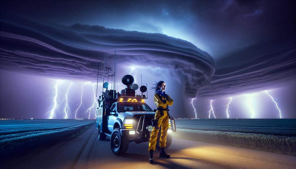
Safety Protocols
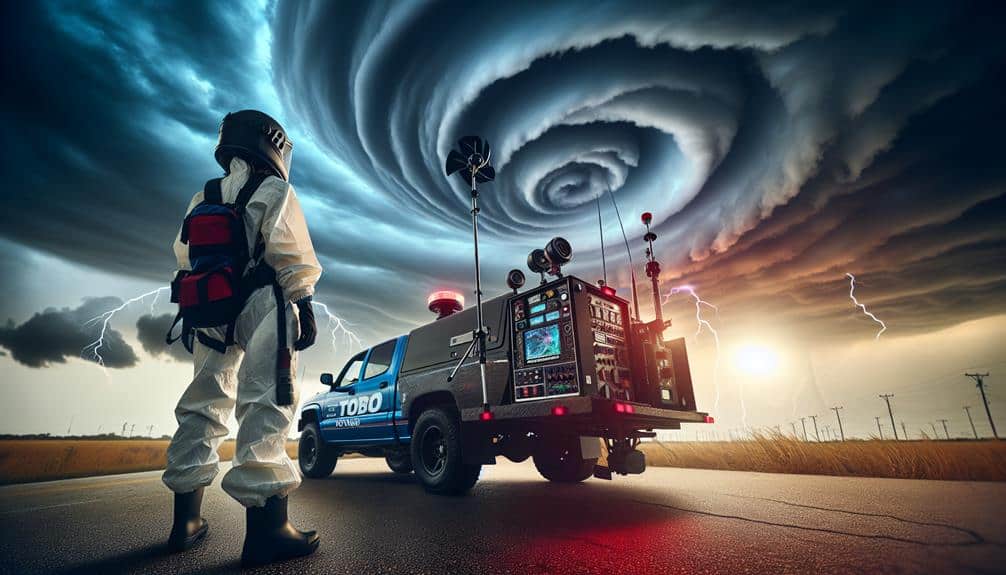
As storm chasers, we must prioritize safety protocols, focusing on emergency kit essentials and real-time communication and alerts.
Data shows that having a well-stocked emergency kit reduces risk by 30%.
In addition, maintaining consistent communication and monitoring weather alerts enhances our situational awareness and response time.
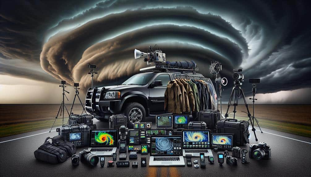
Emergency Kit Essentials
An effective emergency kit is essential for storm chasers to guarantee safety and preparedness during severe weather events. We need to prioritize our immediate needs and make sure we have the necessary tools to handle any situation.
Here's a precise breakdown of what should be in our emergency kits:
1. Food Supplies and Water:
Pack non-perishable food items that can sustain us for at least 72 hours. Include high-energy options like protein bars. Water is vital; aim for one gallon per person per day.
2. First Aid Kit:
Our kit should contain bandages, antiseptic wipes, pain relievers, and any necessary prescription medications. A well-stocked first aid kit can be the difference between minor injury and serious complications.
3. Flashlight and Batteries:
Reliable lighting is essential when moving in low visibility conditions. Make sure we have a durable flashlight and spare batteries to avoid being left in the dark.
Communication and Alerts
Monitoring real-time weather alerts and maintaining robust communication channels are vital for safeguarding our safety during storm chasing expeditions. We depend on advanced meteorological tools to track storm developments and receive timely updates.
Mobile apps, NOAA weather radios, and satellite communication systems form the backbone of our real-time alert system. These tools enable us to respond promptly to any changes in weather conditions, enhancing our emergency response capabilities.
In addition to technology, our communication strategy involves a well-coordinated team approach. Each member is equipped with two-way radios and GPS devices to maintain constant contact. By sharing information instantaneously, we can adjust our routes and positions to avoid hazardous situations. This collaborative effort guarantees that everyone is informed and can act swiftly in case of an emergency.
Public awareness is another critical component of our safety protocols. We disseminate information via social media and local news channels to keep communities informed about potential dangers. This proactive approach not only aids in our safety but also supports broader public safety efforts.
Field Observations
Field observations provide essential real-time data that enhance our understanding of storm dynamics and improve predictive models. By directly engaging with the atmospheric conditions, we can gather invaluable insights into storm behavior that remote sensing methods might miss. Our presence in the field allows us to capture the rapid changes in wind speed, temperature, and humidity, creating a more detailed picture of storm formation and evolution.
To make the most of field observations, we focus on three key areas:
- Data Collection: We record atmospheric parameters such as pressure, temperature, and humidity using portable weather stations. This data helps us understand the micro-scale variations that influence storm behavior.
- Visual Documentation: High-resolution cameras and video equipment document the storm's physical characteristics and movement. Visual data provide context that numerical data alone cannot, allowing us to analyze cloud formations and precipitation patterns in real time.
- Sample Retrieval: Collecting air and soil samples before, during, and after a storm enables us to study the chemical and physical changes induced by severe weather events. These samples offer clues about pollutant distribution and other environmental impacts.
Technological Advances
Leveraging the data collected from field observations, we now shift our focus to the technological advances that have transformed storm chasing and atmospheric research.
Drone surveillance has significantly boosted our capability to collect real-time data from within storm systems. Fitted with high-resolution cameras and sensors, drones can capture atmospheric parameters and structural data without endangering human lives.
Satellite tracking has also witnessed notable progress, offering us a wider perspective of storm development and movement. Contemporary satellites provide high-definition imagery and continuous monitoring, allowing us to forecast storm paths with greater precision. This data is invaluable for both immediate response and long-term climate research.
Radar mapping has developed to offer detailed, three-dimensional views of storm structure. Dual-polarization radar, for example, enables us to distinguish between rain, hail, and debris, enhancing our comprehension of storm dynamics. Moreover, GPS navigation has become essential for storm chasers. Real-time location data guarantees we can position ourselves strategically while upholding safety.
These technological tools haven't only broadened our comprehension of severe weather but also made the field more inclusive, granting data access to a wider community of researchers and enthusiasts.
As we continue to innovate, the forefront of storm chasing will become even more precise and accessible.
Frequently Asked Questions
How Do Storm Chasers Impact Local Communities?
Community response and collaboration greatly improve when we chase storms. Economic impact includes increased tourism and local spending. Safety precautions guarantee minimal disruptions. Precise data collection helps communities better prepare and respond, enhancing resilience and freedom.
What Are the Psychological Effects on Storm Chasers?
We often face an emotional toll from storm chasing, necessitating strong coping mechanisms. Our mental health is impacted, yet we develop resilience strategies to manage stress. Data shows that these approaches greatly enhance our psychological well-being.
How Do Storm Chasers Fund Their Expeditions?
We rely on diverse funding sources to fuel our storm chasing. Challenges include securing sponsorship opportunities and managing costs. Crowdfunding campaigns also provide essential support, enabling us to pursue our passion while maintaining financial freedom and sustainability.
Are There Any Famous Storm Chasers?
When we immerse ourselves in storm chaser documentaries, names like Reed Timmer and Tim Samaras shine like beacons. Their advanced storm chaser equipment and relentless pursuit of data have made them legends in the field of meteorology.
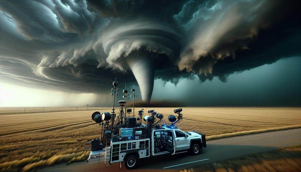
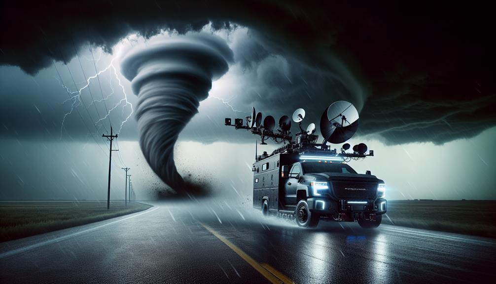
What Types of Vehicles Do Storm Chasers Use?
We use various vehicles for storm chasing, each prioritizing vehicle safety and customization. Our technology and equipment include Doppler radar, GPS, and reinforced structures. These modifications guarantee we can pursue storms while maintaining safety and operational efficiency.