We should watch for supercell thunderstorms and monitor mesocyclones via radar in Tornado Alley. Substantial drops in atmospheric pressure can signal an approaching tornado. Observing wall clouds and funnel clouds is pivotal, as wall clouds indicate mesocyclones, and funnel clouds mean a tornado is imminent. Sudden wind shifts, rapid pressure gradients, and unusual sky colors like green or yellow also point to severe weather. Audible signs include a continuous roar akin to a freight train and emergency sirens. By understanding these indicators, we'll enhance our situational awareness and readiness for potential tornadoes. There's a wealth of data that can further inform our preparedness.
Key Points
- Monitor supercell thunderstorms and mesocyclones using radar for early tornado detection.
- Observe wall clouds and funnel clouds as indicators of tornado development.
- Note sudden wind shifts and rapid air pressure changes signaling storm instability.
- Recognize unique sky colors like greenish hues, indicating moisture and hail in storm clouds.
Weather Patterns to Watch
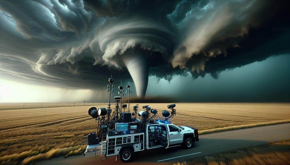
When monitoring weather patterns in Tornado Alley, we should prioritize tracking supercell thunderstorms due to their high potential for producing tornadoes. These storms are marked by a mesocyclone, a rotating updraft that's detectable via radar. Utilizing radar detection allows us to identify these mesocyclones early, giving us a pivotal advantage in predicting tornado formation.
Atmospheric pressure plays a significant role in the development of supercells. We often observe a substantial drop in atmospheric pressure within the storm's core. This pressure drop is a precursor to severe weather events, including tornadoes. By continuously monitoring pressure changes, we can better anticipate when and where these violent storms might occur.
To improve our radar detection capabilities, we leverage dual-polarization radar systems. These systems provide detailed data on precipitation type, intensity, and movement, offering a more thorough understanding of storm dynamics. This data, combined with atmospheric pressure readings, equips us to make more accurate predictions.
Understanding these key indicators—radar-detected mesocyclones and atmospheric pressure drops—empowers us to act swiftly and decisively. By focusing on these weather patterns, we not only enhance our preparedness but also protect our communities, ensuring that we maintain the freedom to live safely in Tornado Alley.
Cloud Formations and Structures
Cloud formations and structures, particularly wall clouds and funnel clouds, provide important visual cues for identifying potential tornado development. We should closely observe cloud shapes; a wall cloud often appears as a lowered, rotating section of a larger thunderstorm cloud. This rotation indicates a mesocyclone, a precursor to tornado formation.
Funnel clouds, which are conical and extend downward from the storm base, signify imminent tornadoes if they touch the ground.
Monitoring lightning frequency is also vital. An increase in lightning can indicate a strengthening storm, enhancing the risk of tornado development. Data shows that storms with high lightning frequency and rapidly changing cloud shapes often correlate with severe weather events.
Temperature drops and humidity levels are key metrics. A sudden temperature drop, combined with high humidity, can destabilize the atmosphere, fostering conditions conducive to tornadoes. We should note that wall clouds typically form in areas where warm, moist air meets cooler air, further lowering the temperature and increasing relative humidity.
Changes in Wind Direction
Observing shifts in wind direction, particularly sudden alterations at different altitudes, can provide critical data for predicting tornado formation. When we encounter abrupt wind shifts, it's a strong indicator of wind shear, a fundamental factor in tornado genesis. Wind shear occurs when wind speed and direction change with height in the atmosphere, creating rotational energy that can be harnessed by a developing storm.
To accurately monitor these changes, we need to pay attention to several key indicators:
- Surface Winds: Sudden changes in wind direction at ground level often precede severe weather.
- Low-Level Jet Streams: These fast-moving air currents at about 1,000-3,000 feet can greatly influence storm rotation.
- Vertical Wind Profiles: Using radar or weather balloons, we can measure how wind speed and direction change with altitude.
- Air Pressure Gradients: Rapid shifts in air pressure often accompany wind shifts, indicating potential instability.
Unusual Sky Colors
Distinctive hues in the sky, such as an eerie green or vivid yellow, often signal the presence of severe weather conditions conducive to tornado formation. These unusual sky colors result from the scattering of light by atmospheric particles and are frequently observed in Tornado Alley. The greenish tint is particularly telling; it indicates the presence of moisture and hail within storm clouds, which are critical factors for supercell development.
We should also monitor lightning strikes during these periods. Increased frequency and intensity of lightning can indicate an electrically charged atmosphere, which often precedes tornadic activity. The National Severe Storms Laboratory (NSSL) notes that nearly 80% of tornadoes are associated with severe thunderstorms featuring prolific lightning.
Additionally, examining animal behavior can provide supplementary data. Animals often exhibit heightened senses regarding atmospheric changes. For example, livestock might become agitated, or birds could seek shelter en masse. These behavioral anomalies can be early indicators of impending severe weather.
Audible Tornado Indicators

Recognizing audible tornado indicators involves distinguishing the unique acoustic signatures that tornadoes produce, such as a continuous roar resembling a freight train. This distinct sound can serve as a vital cue for us when visual confirmation isn't possible. Additionally, the auditory landscape often shifts drastically before a tornado strikes.
Let's examine some key audible indicators:
- Emergency sirens: These are activated by local authorities upon detecting tornadoes. Always take sirens seriously as they signify imminent danger.
- Roaring sounds: Unlike typical storm noises, tornadoes emit a deep, continuous roar that can be likened to a freight train or jet engine.
- Hail impact: The sound of large hailstones hitting surfaces often precedes tornado formation, indicating severe storm activity.
- Storm chasers' reports: Real-time observations from storm chasers often include detailed descriptions of sounds, providing valuable auditory information.
Frequently Asked Questions
How Should I Prepare an Emergency Kit for a Tornado?
We should organize our emergency supplies, including first aid, water, and non-perishable food. Evaluate shelter options like basements or storm shelters. Guarantee communication tools, like a battery-powered radio, are accessible and in working order.
What Should I Do if I'm Driving and a Tornado Hits?
When a tornado hits while we're driving, let's pretend we're in a disaster movie. First, identify safe shelters nearby. If none are available, stay in the car, buckle up, and avoid evacuation routes prone to congestion.
Are There Specific Safety Measures for Pets During a Tornado?
We must prioritize pet shelters and integrate them into our evacuation plans. Ensuring pets have identification and emergency supplies increases their safety. Data shows pets' survival rates improve greatly when included in structured evacuation protocols.
How Can I Secure My Home Against Tornado Damage?
We should prioritize roof reinforcement and window protection to secure our homes against tornado damage. Data shows that reinforced roofs and shatter-resistant windows reduce structural failures by up to 80%, providing both safety and peace of mind.
What Are the Best Apps for Real-Time Tornado Alerts?
For real-time tornado alerts, we recommend apps like RadarScope and Tornado by American Red Cross. They provide accurate tornado tracking, safety tips, and facilitate emergency response with effective communication strategies, ensuring we're always prepared and informed.