Today’s top hurricane tracking innovations include GOES-R satellites scanning every 30 seconds, the Advanced Baseline Imager‘s 16 spectral channels, and infrared sensing that estimates central pressure without aircraft data. You’ll also find Tail Doppler Radar mapping 3D wind fields, dropsondes capturing vertical atmospheric profiles, AI processing 1.5 billion data points daily, high-resolution models operating at 0.67 km resolution, smart buoys, drones, and IoT sensors. Each technology’s real-world impact on forecast accuracy is ranked further ahead.
Key Takeaways
- GOES-R satellites use the Advanced Baseline Imager to deliver 16-channel imagery every 30 seconds, revolutionizing real-time hurricane monitoring and intensity estimation.
- Tail Doppler Radar maps three-dimensional wind fields inside hurricane cores, revealing eyewall asymmetries and rapid intensification signals traditional measurements cannot detect.
- Dropsondes collect vertical atmospheric profiles of temperature, humidity, pressure, and wind, directly feeding numerical models to improve forecast accuracy.
- AI processes over 1.5 billion daily atmospheric data points, identifying rapid intensification signals earlier than conventional forecasting methods allow.
- Smart buoys, drones, and IoT ground sensors deliver continuous real-time wind, pressure, and flood data where satellites cannot provide sufficient coverage.
Next-Gen Geostationary Satellites Revolutionizing Hurricane Tracking
The GOES-R series satellites represent a fundamental leap in hurricane monitoring capability, anchored by the Advanced Baseline Imager (ABI).
These geostationary advancements deliver more spectral channels, sharper spatial resolution, and scan intervals as fast as every 30 seconds. You’re now working with satellite imaging that reveals smaller ocean eddies, detailed cloud structures, and subtle intensity shifts that older platforms simply couldn’t capture.
ABI’s enhanced resolution directly strengthens center fixes and wind-speed estimation while guiding hurricane hunter aircraft into ideal flight paths.
Its expanded channel set exposes eyewall evolution, rain-band intensity, and convective organization in near-real-time. For forecasters demanding precise, actionable data without bureaucratic delay, GOES-R delivers independent, high-frequency intelligence that meaningfully accelerates every critical decision before and during landfall.
How the Advanced Baseline Imager Changed Hurricane Forecasting
At the center of GOES-R’s capability upgrade sits the Advanced Baseline Imager, and it’s worth examining exactly how it reshaped hurricane forecasting workflows.
ABI advancements gave forecasters 16 spectral channels compared to the previous five, dramatically expanding storm analysis capabilities. You’re now looking at improved resolution that reveals small-scale ocean eddies and intricate cloud features previously invisible to operational satellites.
Real time imaging refreshes targeted sectors every 30 seconds, tightening hurricane surveillance timelines and sharpening center-fix accuracy. Those additional channels support sea-surface temperature derivation, eyewall evolution tracking, and rain-band intensity assessment simultaneously.
Forecasting accuracy improves further when you use ABI data for satellite validation against dropsonde and buoy observations.
Every upgrade compounds—faster scans, sharper imagery, and richer spectral data collectively deliver intelligence that older platforms simply couldn’t provide.
Infrared Sensing Tech That Sharpens Hurricane Intensity Tracking
When you examine GOES-16‘s expanded infrared channel set, you’ll find tools that directly sharpen hurricane intensity analysis. The “clean” longwave infrared window channel lets you monitor cloud structure and eye temperature with precision, while additional channels capture cloud-top cooling rates critical for rainfall and flash-flood forecasting.
You can use these infrared measurements to derive central pressure estimates and maximum sustained wind speeds, giving forecasters a data-driven foundation for intensity assessments without relying solely on aircraft reconnaissance.
Infrared Channel Capabilities
Infrared channel technology has become one of the most powerful tools meteorologists use to track hurricane intensity from space.
Infrared channel advancements on GOES-R’s Advanced Baseline Imager give you sharper, faster reads on storm behavior:
- Cloud top analysis measures cooling rates and temperatures, directly linking convective strength to rainfall and flood potential.
- The “clean” longwave infrared window channel isolates eye temperature, supporting central pressure and maximum wind-speed estimates.
- Expanded channel sets detect eyewall evolution, rain-band intensity shifts, and rapid structural changes during landfall.
These capabilities aren’t theoretical — they’re active, operational tools processing data in near-real time.
You’re no longer waiting hours for meaningful intensity updates. The expanded infrared suite delivers actionable intelligence faster, keeping forecasters ahead of a storm’s most dangerous developments.
Intensity Estimation Improvements
Sharp intensity estimates depend on more than just tracking a storm’s position — they require continuous, high-fidelity reads on internal structure, and that’s exactly where modern infrared sensing delivers.
You’re now working with sensor fusion that combines satellite-derived cloud-top temperatures, cooling rates, and eye-region thermal signatures into unified intensity metrics.
GOES-16’s clean longwave infrared window channel feeds real-time analytics directly into predictive models, sharpening forecast accuracy well beyond legacy capabilities.
Data integration across airborne dropsondes, buoy networks, and geostationary platforms captures rapidly shifting atmospheric conditions and storm dynamics simultaneously.
These modeling techniques let forecasters detect rapid intensification signals earlier, giving you actionable lead time.
Environmental monitoring at this resolution guarantees that no structural shift in the eyewall escapes detection before it drives forecast-critical intensity changes.
Why Tail Doppler Radar Transformed Inner-Core Analysis
Before Tail Doppler Radar (TDR), forecasters relied heavily on dropsonde point measurements and coarse satellite estimates to reconstruct a hurricane’s inner-core structure—a process that left critical gaps in wind-field mapping.
Tail radar advancements changed everything by delivering continuous, three-dimensional wind retrievals across the entire inner core dynamics zone.
TDR now gives NOAA aircraft the ability to map:
- Eyewall circulation — revealing asymmetric wind distributions that point measurements simply can’t capture
- Rainband structure — identifying convective bursts linked to rapid intensification signals
- Vortex tilt and shear interaction — exposing structural vulnerabilities invisible to satellite sensors
These precise measurements validate satellite-derived intensity estimates and directly sharpen numerical model initialization, giving you forecasts with tighter uncertainty bounds and stronger decision-support data when it matters most.
How Dropsondes Improve Hurricane Tracking From Inside the Storm

When a NOAA aircraft releases a dropsonde into a hurricane, you get direct measurements of temperature, humidity, pressure, and wind at multiple altitudes as the sensor falls through the storm.
These vertical atmospheric profiles reveal how the storm’s structure changes with height, giving forecasters precise data that no remote sensing platform can fully replicate.
You can then use that in-situ data to validate satellite-derived intensity estimates, correcting biases and sharpening confidence in central pressure and maximum sustained wind analyses.
Dropsonde Data Collection
While satellites capture the broader storm environment from above, dropsondes take measurements directly inside the hurricane’s core. Dropsonde deployment from NOAA reconnaissance aircraft gives you real-time vertical profiles that no remote sensor can replicate.
Each dropsonde captures:
- Temperature and humidity at multiple atmospheric levels, revealing moisture distribution driving storm intensity
- Pressure readings that help forecasters estimate central pressure and maximum sustained winds
- Wind speed and direction throughout the column, mapping the inner circulation with precision
This data accuracy directly improves intensity forecasts and validates satellite-derived estimates. Without these in-situ measurements, forecasters rely solely on indirect observations, increasing uncertainty.
Dropsonde data feeds directly into numerical models, tightening forecast guidance and giving emergency managers the reliable intelligence they need to make critical, timely decisions.
Vertical Atmospheric Profile Insights
Once a dropsonde deploys from a NOAA reconnaissance aircraft, it transmits continuous measurements as it descends through the storm’s full atmospheric column, giving forecasters a vertical profile no satellite can match.
That real-time atmospheric data collection captures temperature, humidity, pressure, and wind at every altitude, exposing layers of warm air, moisture gradients, and wind shear that ground sensors can’t reach.
You’re getting raw data that directly feeds numerical models, tightening intensity forecasts and rapid intensification alerts.
Vertical profile analysis reveals structural weaknesses or strengthening signatures inside the eyewall before they appear on radar. Each sounding sharpens the model’s initial conditions, reducing forecast error.
When you multiply that precision across dozens of dropsondes per mission, you’re compressing uncertainty and giving emergency managers actionable intelligence they can actually use.
Validating Satellite Intensity Estimates
Those vertical profiles don’t just sharpen model initialization—they give forecasters a direct ground truth against which satellite intensity estimates can be tested and corrected.
Satellite validation depends on comparing space-based readings against dropsonde-measured pressure, wind, and temperature data collected inside the storm’s core.
Aircraft observations close critical gaps where satellite algorithms struggle, directly boosting intensity accuracy across the board:
- Dropsonde pressure readings confirm or correct satellite-derived central pressure estimates
- Inner-core wind profiles validate maximum sustained wind retrievals from infrared and microwave sensors
- Temperature and humidity data refine cloud-top algorithms that estimate convective strength
You’re getting real, unfiltered measurements from inside the system itself.
That hard data keeps satellite products honest, reduces forecast uncertainty, and ultimately protects communities making life-or-death decisions before landfall.
How AI Is Making Hurricane Prediction Faster and More Accurate

As hurricane forecasting enters a new era, AI and machine learning are driving measurable gains in prediction speed and accuracy. These AI advancements process over 1.5 billion atmospheric data points daily, enabling tighter hurricane modeling and faster data assimilation cycles.
You’ll see predictive analytics cutting through noise in storm patterns, flagging rapid intensification signals hours earlier than traditional methods allowed. Machine learning algorithms sharpen hurricane forecasts by identifying subtle circulation changes that numerical models often miss.
Tracking innovations like Climavision’s Horizon AI Global operate on an 8.5 km global grid, delivering 15-day outlooks with improved resolution. These tools give forecasters a decisive edge, compressing decision timelines and strengthening confidence in both track and intensity guidance before storms threaten coastlines.
High-Resolution Models That Improve Hurricane Landfall Forecasts
Beyond AI-driven assimilation cycles, high-resolution numerical models are sharpening the most consequential phase of any hurricane forecast: landfall.
These systems directly address forecasting challenges by resolving storm dynamics at scales coarse models miss entirely.
Resolution benefits become critical when coastal impacts depend on kilometer-level terrain features, convergence zones, and surge corridors.
Coastal impact forecasting hinges on resolving terrain features, convergence zones, and surge corridors at the kilometer scale.
Horizon AI HIRES operates at 0.67 km resolution, delivering predictive capabilities that standard grids simply can’t match.
Key model accuracy advantages include:
- Data assimilation integrating real-time buoy, dropsonde, and satellite feeds into model initialization
- Computational efficiency enabling 15-day forecasts on an 8.5 km global grid without sacrificing speed
- Hyper-local outputs capturing rainfall gradients, coastal flooding thresholds, and tornado threat corridors before landfall
You get actionable precision exactly when it matters most.
The Role of Smart Buoys in Real-Time Hurricane Tracking

Upgraded coastal weather buoys serve as the ocean’s first line of real-time data collection when a hurricane approaches. These platforms use advanced buoy technology to measure wind speed, gusts, pressure, and wave height at short intervals.
You get real-time data fed directly into storm tracking systems, where predictive analytics models process each observation to refine intensity and track forecasts.
Environmental sensors within these sensor networks capture shifting ocean conditions that satellites can’t resolve at the surface. That data integration connects ocean monitoring inputs with numerical models, tightening coastal impact assessments before landfall.
As weather patterns evolve rapidly near a storm’s core, buoy readings fill critical observational gaps. You benefit from faster, more accurate warnings when these distributed networks operate at peak capacity.
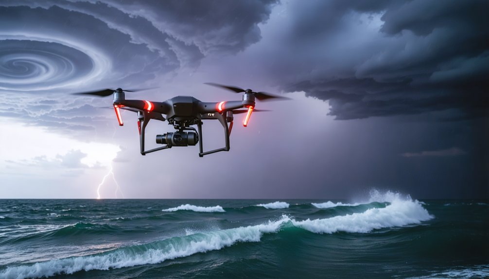
How Drones and IoT Sensors Track Hurricanes at Ground Level
While smart buoys anchor real-time ocean data collection, drones and IoT sensors extend that ground-level surveillance deeper into a storm’s most dangerous zones.
You’re now operating with tools that deliver unprecedented storm impact visibility where satellites can’t reach.
Drone capabilities and IoT integration give emergency response teams critical operational benefits:
- Ground sensors stream flood levels, wind gusts, and pressure data continuously, improving data accuracy during rapid intensification.
- Real-time monitoring from UAVs captures infrastructure stress and damage assessment without risking personnel.
- IoT-connected networks transmit localized atmospheric readings directly into forecast models, sharpening precision.
However, technology limitations remain real.
Environmental factors like extreme winds and saltwater exposure can disable equipment mid-storm.
You’re gaining powerful situational awareness, but redundancy planning stays essential for maintaining reliable coverage when conditions deteriorate fastest.
Hurricane Tracking Technologies Ranked by Real-World Impact
When you assess hurricane tracking technologies, you can’t rely on theoretical capabilities alone—you need to measure real-world operational impact against verifiable forecast improvements.
Each tool, from GOES-R’s 30-second ABI scans to AI-driven data assimilation processing over 1.5 billion daily observations, earns its rank based on demonstrated gains in track accuracy, intensity prediction, and lead time.
Ranking these systems by effectiveness helps you allocate resources, prioritize investments, and understand which technologies deliver the greatest protective value when storms threaten life and infrastructure.
Measuring Real-World Effectiveness
Ranking hurricane tracking technologies by real-world impact requires weighing operational data, forecast-skill improvements, and life-saving outcomes against each tool’s deployment cost and coverage.
You can’t separate effectiveness from context—each technology earns its rank through measurable performance under real conditions.
Key metrics driving these rankings include:
- Forecast error reduction: Track and intensity errors measured in nautical miles and knots across verified storm events.
- Real time analytics throughput: Volume and speed of data integration from satellites, dropsondes, and buoys into operational models.
- Lead time improvements: Hours gained for evacuation decisions and emergency resource deployment.
Technologies that consistently reduce forecast error while delivering actionable, high-confidence guidance rank highest.
Cost-effectiveness and scalability across multiple storm scenarios further separate proven tools from experimental ones.
Ranking By Operational Impact
Five technologies stand out when you stack hurricane tracking tools against verified forecast improvements, operational data throughput, and measurable lead-time gains.
GOES-R satellite advancements deliver 30-second scan intervals, transforming storm data acquisition and hurricane monitoring precision.
Tail Doppler Radar and dropsonde reconnaissance methods map inner-core wind fields with accuracy no remote sensor currently matches.
AI-driven predictive analytics, processing over 1.5 billion daily observations, sharpen forecasting accuracy and flag rapid intensification signals earlier than conventional systems.
High-resolution weather modeling at sub-kilometer scales captures coastal terrain effects and landfall timing that coarser grids miss entirely.
Finally, IoT-based technology integration connects buoy networks, mobile sensors, and command dashboards, reducing environmental impacts through faster, more coordinated emergency response.
These five tracking innovations collectively define modern operational hurricane forecasting capability.
Frequently Asked Questions
How Much Does Hurricane Tracking Technology Cost Taxpayers Annually?
The provided knowledge doesn’t include cost analysis or funding sources data. You’d need to consult NOAA’s annual budget reports for precise taxpayer expenditure figures on hurricane tracking technology investments.
Several nations actively engage in international partnerships and data sharing with you through WMO agreements. Canada, Mexico, Cuba, and European nations contribute satellite, buoy, and reconnaissance data, strengthening your collective hurricane tracking capabilities considerably.
Can Hurricane Tracking Technology Predict Tornadoes Spawned by Hurricanes?
“Knowledge is power” — you can use high-resolution predictive models and AI tools to anticipate tornado-spawning storm formation during hurricanes. They’ll analyze convective bands, wind shear, and rainfall patterns, giving you critical early warnings.
How Do Forecasters Communicate Hurricane Tracking Data to Emergency Managers?
Forecasters use data visualization tools and communication strategies to relay hurricane tracking data directly to you. You’ll access real-time dashboards, radar overlays, and model outputs, empowering emergency managers to make swift, informed decisions protecting communities from storm impacts.
What Career Paths Exist in Hurricane Tracking and Meteorological Technology?
You’ll find diverse career opportunities processing over 1.5 billion daily observations through data analysis, technology development, and research advancements. Educational programs in meteorology, combined with field experience, actively prepare you for impactful roles in hurricane tracking.
References
- https://www.goes-r.gov/featureStories/monitoringHurricanes.html
- https://climavision.com/blog/how-are-hurricanes-tracked-tools-and-tips-for-superior-coverage/
- https://publicsafety.ieee.org/topics/hurricane-tracking-technology-advancements-and-opportunities/
- https://www.aoml.noaa.gov/hurricane-airborne-observation-and-emerging-technologies/
- https://www.activu.com/top-10-trends-in-hurricane-disaster-preparedness-and-response/
- https://bryghtpath.com/hurricane-preparedness/
- https://teamrubiconusa.org/news-and-stories/best-hurricane-tracking-apps-and-tools/
- https://www.pbsnc.org/blogs/science/better-hurricane-forecasting-thanks-to-new-technologies/
- https://www.sciencedirect.com/science/article/pii/S2950630125000055
- https://www.youtube.com/watch?v=-ZYvoYRMCU8