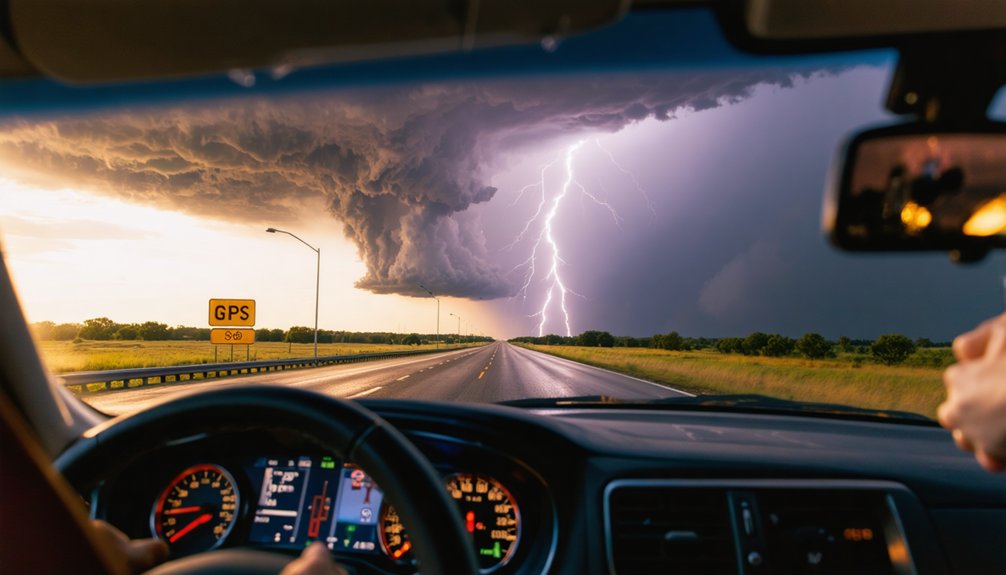
Your ideal storm chasing routes center on I-70 for east-west positioning and I-40 for southern flexibility, while 1-mile grid road networks across Kansas and Oklahoma provide systematic access to mesocyclones. You’ll start early season operations in northern Texas via I-40 and Route 35, then advance northward through I-70 and Route 83 as moisture patterns shift toward the Dakotas by late May. The eastern Great Plains offer superior sightlines with road densities exceeding 0.8 miles per square mile, enabling continuous visual contact during peak April-to-June interception windows. Mastering these corridors grants the strategic positioning techniques that maximize your tornadic supercell encounters.
Key Takeaways
- Interstate 70 serves as the primary east-west corridor for chasers intercepting supercells across Kansas and central Tornado Alley.
- Grid road systems with 1-mile spacing enable systematic positioning for mesocyclones moving at 45 mph across flat terrain.
- Early season chasing begins in Texas and Oklahoma, then shifts northward through Kansas to the Dakotas by June.
- Eastern Great Plains offer optimal conditions with road densities exceeding 0.8 miles per square mile and unobstructed visibility.
- Texas Panhandle’s irregular grid and terrain changes require calculated positioning along Highway 87/102 and Booker-Cameron Road corridors.
Core Interstate Highways for Prime Storm Interception
When atmospheric conditions align across the central Plains, Interstate 70 functions as the primary east-west positioning corridor for storm chasers targeting supercell development. You’ll utilize this route to intercept rotating thunderstorms near Scott City, Kansas, where atmospheric boundaries trigger severe weather events. Remote sensing data guides your westward repositioning to catch evening convection.
Interstate 40 provides southern flexibility when systems track toward Oklahoma’s terrain features. You’ll access multiple chase zones while maintaining fuel supply connections for extended operations.
These corridors enable rapid acceleration when fast-moving tornadic supercells develop. Your route selection depends on real-time atmospheric monitoring from gas station staging areas, where you’ll analyze mesoscale weather patterns throughout the day. Highway positioning determines your interception success across Tornado Alley‘s prime development zones.
Grid Road Systems That Enable Strategic Positioning
You’ll find Tornado Alley‘s 1-mile grid road networks provide systematic mile-by-mile access across 35 designated zones, enabling precise positioning ahead of supercells moving at 45 mph. These dirt-surfaced grids complement interstate highway intercept corridors by offering perpendicular routing options when storms deviate from primary chase axes.
The combination allows you to maintain contact with mesocyclones spanning 2-6 miles in diameter during extended 10-hour pursuit operations.
Mile-by-Mile Road Access
Across the agricultural flatlands of Tornado Alley, a vast network of 1-mile grid roads provides storm chasers with unparalleled tactical positioning capabilities during high-speed pursuits. You’ll find these well-maintained dirt roads enable storm tracking accuracy through precise mile-by-mile adjustments matching supercell motion patterns.
When mesocyclones measuring 2-6 miles in diameter approach at 45 mph, the grid spacing allows you to intercept right rear flanks without paved bottlenecks constraining your movement.
The terrain’s flatness eliminates elevation obstacles, supporting high speed pursuit viability across 35 designated zones. You’re free to position ahead of quasilinear systems using state highways like SH 4 as arterial access points. These connectors link north-south grid segments, letting you track lowerings and rotations from ideal vantage intersections while submitting real-time ground reports to NWS.
Interstate Highway Intercept Corridors
The interstate highway system intersecting Tornado Alley provides critical high-speed repositioning arteries that complement rural grid networks during severe weather operations. You’ll leverage these corridors to rapidly adjust positioning based on key meteorological data points streaming from mobile radar units and satellite feeds.
Primary Interstate Intercept Corridors:
- I-35 (North-South Axis) – Traverses Oklahoma and Kansas, enabling 200-mile repositioning windows during seasonal storm migration shifts
- I-40 (East-West Corridor) – Provides cross-state mobility through Oklahoma and Texas Panhandle supercell zones
- I-70 (Northern Plains Access) – Facilitates rapid deployment across Kansas and eastern Colorado during late-season outbreaks
These high-speed arteries grant you autonomous navigation between target cells without grid road limitations, maintaining 70+ mph transit speeds between storm intercept points while monitoring real-time atmospheric developments.
Seasonal Route Planning From Texas to the Dakotas
When planning seasonal chase routes through Tornado Alley‘s 500,000-square-mile expanse, you’ll need to align your positioning with the jet stream’s northward progression from mid-April through mid-June.
Start your early season operations in northern Texas and Oklahoma, utilizing Interstate 40 and Route 35 as primary corridors. As moisture tracking patterns shift northward, advance through Kansas and Nebraska via I-70 and Route 83. By late May, you’ll progress toward the Dakotas and eastern South Dakota where supercell probabilities peak in June.
Master remote road navigation across gridded county roads spaced one-mile apart, executing stairstep intercepts that mirror northeast storm trajectories. Road quality deteriorates from Texas’s highway-standard backroads to gravel surfaces northward, demanding pre-storm reconnaissance and alternate route identification for ideal interception flexibility.
Unlike the mile-spaced grids dominating Kansas and Nebraska, Texas Panhandle’s road network presents storm chasers with a less predictable grid-type layout that demands strategic route selection across 35 distinct chase zones delineated by state boundaries and river systems.
Texas Panhandle’s irregular grid system forces chasers into calculated positioning decisions across 35 zones defined by natural and political boundaries.
Critical navigation protocols for Panhandle operations:
- Highway 87/102 corridor from Dalhart enables 5-mile northwest positioning followed by eastward interception routes aligned with 20 mph northeast storm motion
- Booker-Cameron Road sequence facilitates storm surge interception through RFD clear slots on tornado-warned supercells
- Lake Meredith terrain alteration creates abrupt elevation changes where curvy roads contrast western High Plains’ flat straightaways
Amarillo’s 13.6 mph average winds (exceeding 50 mph annually) generate disorienting dust conditions on featureless terrain. You’ll need eastward-bending roads to position ahead of southeast-displaced inflow bases, maintaining visual contact through minimal landmark zones.
Eastern Great Plains: Where Visibility Meets Accessibility
Storm chasers operating across Kansas, Oklahoma, and western Missouri benefit from geography that combines unobstructed sightlines with road densities exceeding 0.8 miles of pavement per square mile—a configuration enabling continuous visual contact with supercell mesocyclones from distances of 15-20 miles. You’ll navigate gridded farm-to-market routes that function as tactical veins connecting Interstate-70, Route 83, and Highway 34 arterials.
Relative humidity impacts become visually apparent along dryline bulges where moisture convergence triggers convective initiation. The terrain’s openness allows real-time assessment of thunderstorm updraft dynamics without vegetation obstruction. Peak season—mid-April through mid-June—delivers maximum intercept probability.
You’ll execute stairstep maneuvers (east-north-east-north) across Oklahoma and Kansas, exploiting triple points and outflow boundaries where supercells reliably develop. This region’s infrastructure supports autonomous navigation without artificial barriers.
High-Probability Chase Corridors Along US-83 and US-35
US-83 functions as Tornado Alley‘s primary longitudinal artery, bisecting the region’s core from northern Texas through Nebraska with a geographic alignment that maximizes supercell intercept opportunities during May chase operations.
You’ll find US-35 provides complementary east-west positioning across Oklahoma and Kansas high-frequency zones.
Strategic corridor advantages for autonomous chase operations:
- Mobile radar operations: Both routes offer pull-off access for real-time data analysis without urban congestion constraints
- Multi-state flexibility: Rapid repositioning across Texas-Oklahoma-Kansas-Nebraska setup changes within single chase days
- Regional roadside infrastructure: Fuel stations and visual confirmation points spaced at ideal intervals for sustained pursuit
These highways deliver maximum intercept probability during mid-April through mid-June peak windows, positioning you where supercell development probabilities align with terrain accessibility. Eastern Colorado and western Kansas targets become readily achievable through strategic route selection.
Adapting Routes to Modern Eastward Storm Migration Patterns
Historical chase strategies centered on Great Plains corridors now require significant recalibration as tornado frequency data from 1996-2024 demonstrates measurable eastward migration into the Mississippi Valley and Southeast. You’ll maximize intercept probability by incorporating Dixie Alley states—Mississippi, Alabama, Tennessee, Arkansas—into your primary routing matrices.
Tornado activity has shifted eastward from the Great Plains into Dixie Alley, requiring storm chasers to recalibrate traditional pursuit strategies.
Regional forecast modeling reveals supercell development increasingly favors these eastern zones where Gulf moisture convergence creates ideal instability thresholds.
Your route planning must integrate satellite data analysis to identify mesoscale boundaries forming across Missouri, Arkansas, and Illinois corridors. Traditional Rocky Mountain-influenced setups now compete with moisture-rich southeastern environments that generate nocturnal tornado events.
You can’t rely exclusively on US-83 anymore—eastward repositioning toward I-55 and I-40 corridors positions you within modern high-probability zones where atmospheric dynamics currently concentrate tornadic supercells.
Terrain and Road Quality Considerations by Chase Zone
You’ll find ideal chase conditions across the Great Plains’ flat terrain, where 180-degree horizon-to-horizon visibility enables visual storm tracking up to 60,000-foot supercell heights without radar dependency. The region’s perpendicular grid road networks—particularly Kansas’s extensive gravel road system—allow precise positioning adjustments to maintain your strategic 15-mile storm intercept distance as systems move southeast.
However, you’ll encounter significant operational constraints in the Texas Panhandle’s northern and eastern sectors, where the Canadian River’s terrain cuts and increased topographic relief degrade both sightlines and navigation efficiency compared to core Tornado Alley zones.
Flat Plains Visibility Advantages
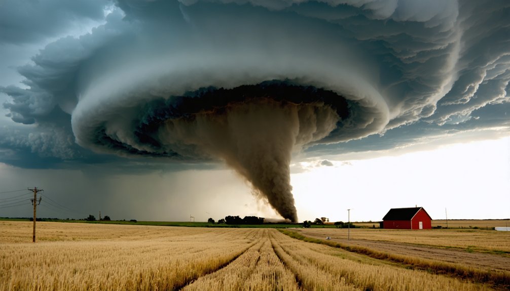
When storm chasers enter the Great Plains’ treeless expanse stretching from northern Texas to Missouri, they gain unobstructed sightlines that extend up to 15 miles for supercell observation. These vegetation free sightlines enable precise anticipation of storm movements across minimal elevation changes.
The flat terrain delivers three critical tactical advantages:
- Wall cloud and mammatus formations remain clearly visible against barren horizons, allowing 5-10 minute data collection intervals
- Rain-wrapped tornadoes become detectable in low-vegetation zones where forests would obscure vortices
- Golden evening light illuminates colliding air masses and funnel structures across open expanses
You’ll position strategically 1-5 miles from supercells on quality highways, executing chess-like intercept maneuvers. Even HP supercells reveal structural details that southeastern forests would completely mask, maximizing your operational freedom.
Grid Road Network Benefits
The Midwest’s systematically engineered grid road networks—spaced at uniform 1-2 mile intervals along cardinal directions—transform storm interception from reactive guesswork into calculated geometry. You’ll exploit perpendicular intersections to execute core punching maneuvers while historical storm patterns confirm supercells favor these predictable corridors.
Central Oklahoma’s section-line roads and I-35 corridor deliver ideal positioning, while Kansas’s western quadrants maintain rigid mile-grids despite Flint Hills topography. Nebraska’s Sandhills challenge gravel-dependent routes, yet rectangular surveys preserve east-west progression. Asphalt durability withstands chase traffic volumes, and wide shoulders accommodate rapid vehicle spotting without impeding traffic management strategies.
Contrast this with Dixie Alley’s irregular networks—hilly terrain and flood-prone surfaces restrict your autonomous pursuit capabilities where tornado frequency increasingly demands grid-quality infrastructure.
Texas Panhandle Route Challenges
Unlike central Oklahoma’s predictable section-line grids, Texas Panhandle’s curved, irregular road networks introduce geometric complications that degrade storm interception accuracy by forcing constant trajectory recalculations. You’ll face three critical operational constraints:
- Agricultural flatlands generate visibility-obscuring dust during high winds, reducing radar correlation and eliminating natural vantage points for storm structure assessment.
- County-maintained farm-to-market roads deteriorate rapidly under pursuit conditions, while flooding blocks remote road accessibility during spring chase seasons.
- Stairstepping maneuvers (eastward, then northward) become necessary to match supercell northeast trajectories, compounding navigation complexity near state boundaries.
These infrastructure deficiencies force tornado interception tactics emphasizing primary highway corridors like US-87 and FM-102, sacrificing ideal positioning flexibility. Baseball-sized hail cores further restrict escape routes, creating hazardous bottlenecks that contradict autonomous chase operations.
Frequently Asked Questions
What Permits or Licenses Do I Need to Chase Storms Legally?
You don’t need required legal permissions currently for storm chasing at federal level. However, proper storm tracking techniques require understanding meteorological data and safety protocols. Oklahoma’s proposed licensing remains tabled, preserving your freedom to chase storms independently.
How Do I Forecast Which Specific Roads Will Have Tornadoes?
You can’t forecast specific roads, but tornado forecast models and storm motion predictions help you position strategically. For example, May 2013 El Reno chasers used mesoscale analysis and velocity data to intercept along Highway 81’s north-south corridor.
What Vehicle Modifications Are Best for Storm Chasing Safety?
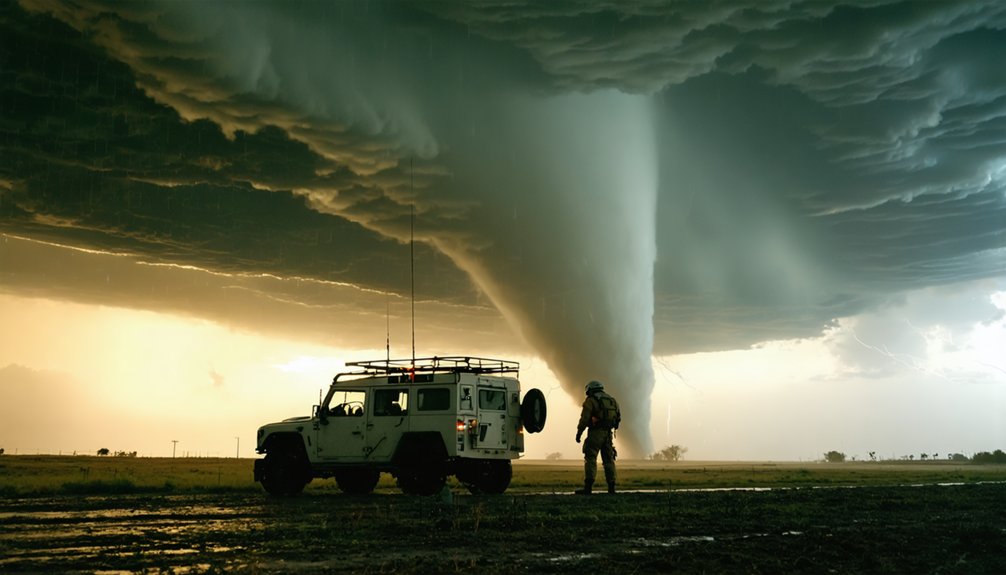
You’ll need reinforced chassis design with steel plating mounted on square tubing, hydraulic stabilization systems, and all-terrain tire upgrades on lifted suspensions. These modifications provide maximum wind resistance, debris protection, and mobility independence during severe weather pursuits.
Can I Chase Tornadoes Profitably as a Beginner Photographer?
You’ll likely chase financial storms before profit arrives. Beginners average $63,000 annually but face $13,700+ first-year costs. Master storm photography techniques and personal safety precautions first—your independence demands technical skill before sustainable revenue materializes.
What Communication Equipment Works When Cell Towers Fail During Storms?
You’ll need satellite phones for unlimited-range communication via orbiting satellites and emergency radios like NOAA weather receivers for independent tornado warnings. Ham radios with battery operation and CB radios using generator backup provide reliable network-independent connectivity.