Exploring Tornado Alley demands we utilize real-time data and analyze key meteorological patterns. When warm, moist Gulf air collides with cool, dry air from the Rockies, conditions ripen for tornado formation. Wind shear and high CAPE levels are our primary indicators. We depend on high-definition radar to track mesocyclones and monitor anvil-shaped cumulonimbus clouds with wall clouds. Using GPS guidance and maintaining communication, we stay updated with the latest storm movements. Prioritizing safety, we identify emergency shelters and equip ourselves with weather radios and first aid kits. With these practices, we enhance our storm chasing strategy and accuracy. Uncover more insights that will refine our approach further.
Key Points
- Monitor real-time radar data to track storm development and identify supercell structures.
- Understand wind shear and its role in storm rotation for predicting tornado formation.
- Use GPS navigation and real-time weather apps for safe and strategic chasing routes.
- Recognize key weather patterns like the dryline for pinpointing potential storm areas.
Understanding Tornado Alley
Tornado Alley, a region spanning parts of the central United States, is defined by its unique meteorological conditions that make it highly susceptible to tornado formation. To truly comprehend Tornado Alley, we must explore its intricate weather dynamics and climate patterns.
The interaction between warm, moist air from the Gulf of Mexico and cool, dry air from the Rockies creates a volatile atmosphere conducive to storm formation. This convergence is essential to the frequent development of severe thunderstorms and tornadoes.
As storm chasers, we understand that real-time data and analytical insights are vital. Meteorological instruments and radar technology help us monitor these weather dynamics closely. By studying past storm patterns, we can better predict future tornado outbreaks. For instance, the Enhanced Fujita (EF) scale categorizes tornadoes based on estimated wind speeds and damage.
Recognizing these patterns allows us to anticipate high-risk zones and time our interventions effectively.
We also consider large-scale climate patterns, such as La Niña and El Niño, which can influence tornado frequency. By understanding these variables, we enhance our ability to navigate Tornado Alley safely and efficiently.
Our pursuit of freedom and knowledge drives us to master the science behind storm chasing.
Key Weather Patterns
Understanding these climate influences sets the stage for analyzing the key weather patterns that play a pivotal role in tornado formation.
To begin, let's consider the convergence of warm, moist air from the Gulf of Mexico with cold, dry air from Canada. This atmospheric collision often results in the severe weather we chase. Specifically, the dryline, a boundary separating these air masses, often serves as a focal point for storm development.
Next, we need to examine wind shear, which is the change in wind speed and direction with altitude. Strong wind shear is essential for organizing thunderstorms and can be a precursor to tornado genesis. When we see a significant veering of winds from the surface to the upper levels, it signals the potential for rotation within the storm structure.
Additionally, atmospheric conditions such as instability are critical. High levels of Convective Available Potential Energy (CAPE) indicate that the atmosphere is primed for rapid upward motion, fueling severe thunderstorms.
Identifying Supercells
When identifying supercells, we should focus on specific cloud formation indicators like anvil-shaped tops and wall clouds. Additionally, monitoring rotational velocity through Doppler radar data can highlight mesocyclone presence.
Cloud Formation Indicators
Spotting supercells often starts with recognizing key cloud formation indicators that signal severe weather potential. Thunderstorm development hinges on specific atmospheric conditions such as instability, moisture, and lift. When we observe a cumulonimbus cloud with a distinct anvil shape, it's a significant clue. The anvil often spreads out at the tropopause, indicating robust convection.
We need to be on the lookout for a well-defined, rotating updraft known as a mesocyclone. This feature often manifests as a wall cloud, which hangs lower than the surrounding cloud base. A wall cloud can rapidly develop into a supercell if other atmospheric conditions are favorable.
Another pivotal indicator is the presence of mammatus clouds, which form under the anvil and suggest severe storm potential. These pouch-like structures indicate intense turbulence and instability within the storm.
Analyzing cloud formations like these enables us to make accurate storm predictions and increase our chances of successfully identifying supercells.
Rotational Velocity Signs
To identify supercells, we need to closely monitor Doppler radar data for signs of rotational velocity within the storm structure. This kind of detailed observation helps us understand the atmospheric dynamics at play and enhances our storm prediction capabilities.
Supercells, characterized by their rotating updrafts, pose a significant tornado risk due to their unique wind patterns.
When analyzing Doppler radar data, we should focus on:
- Velocity couplets: These appear as juxtaposed areas of inbound and outbound wind, indicating rotation.
- Mesocyclone signatures: Look for a persistent, well-defined rotation within the storm, usually spanning several kilometers.
- Hook echoes: These are classic radar signatures where precipitation wraps around the rotating updraft, signaling a potential tornado.
Tools for Storm Chasing
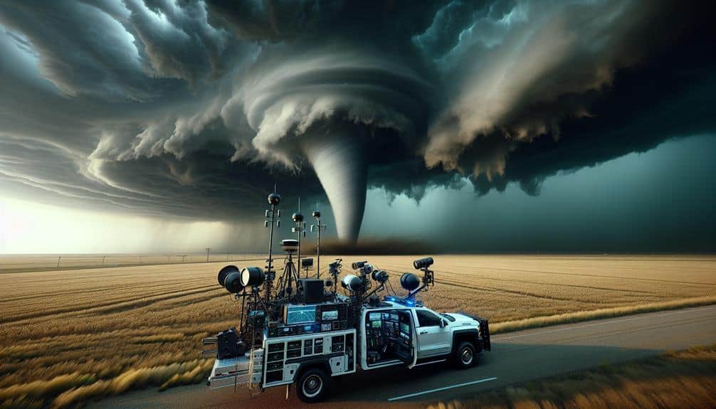
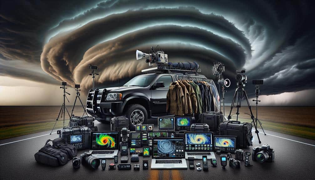
To maximize our effectiveness in the field, we need to equip ourselves with essential chasing gear and cutting-edge real-time weather apps. High-resolution radar systems, anemometers, and GPS units are critical for data accuracy and safety.
Essential Chasing Equipment
A well-equipped storm chaser's arsenal should include high-definition radar apps, GPS navigation systems, and durable communication devices to guarantee both safety and data accuracy. When we're out in the field, the right chaser gear can make all the difference between a successful chase and a risky ordeal. Let's break down the equipment essentials we need to carry:
- High-Definition Radar Apps: These apps provide real-time data on storm development, allowing us to anticipate changes in weather patterns and make informed decisions.
- GPS Navigation Systems: Reliable GPS systems help us navigate unfamiliar terrain, making sure we stay on course and avoid hazardous areas.
- Durable Communication Devices: Robust radios and satellite phones keep us connected with our team and emergency services, especially when cell service is unreliable.
Each piece of chaser gear is essential for our mission. High-definition radar apps help us track storm cells with pinpoint accuracy, while GPS navigation ensures we don't get lost in Tornado Alley's vast expanses. With the right equipment essentials, we can chase storms effectively and safely, capturing valuable data that contributes to meteorological science.
Real-time Weather Apps
Building on the significance of high-definition radar apps, real-time weather apps provide us with up-to-the-minute data essential for making quick decisions during unpredictable storm chases. These tools enhance our storm tracking capabilities with unparalleled accuracy, ensuring we stay ahead of rapidly evolving weather conditions.
One of the critical features of these apps is their ability to deliver real-time weather alerts. As we navigate Tornado Alley, receiving instantaneous notifications about severe weather developments can mean the difference between a successful chase and a dangerous encounter. The precision of these alerts allows us to adjust our routes and positioning to maximize safety and data collection.
Moreover, modern weather apps utilize advanced algorithms to offer predictive analytics, helping us anticipate storm movements and behaviors. This foresight is invaluable, enabling us to plan our chases more strategically.
The integration of GPS functionality further refines our storm tracking efforts, providing exact location data that syncs seamlessly with live weather updates.
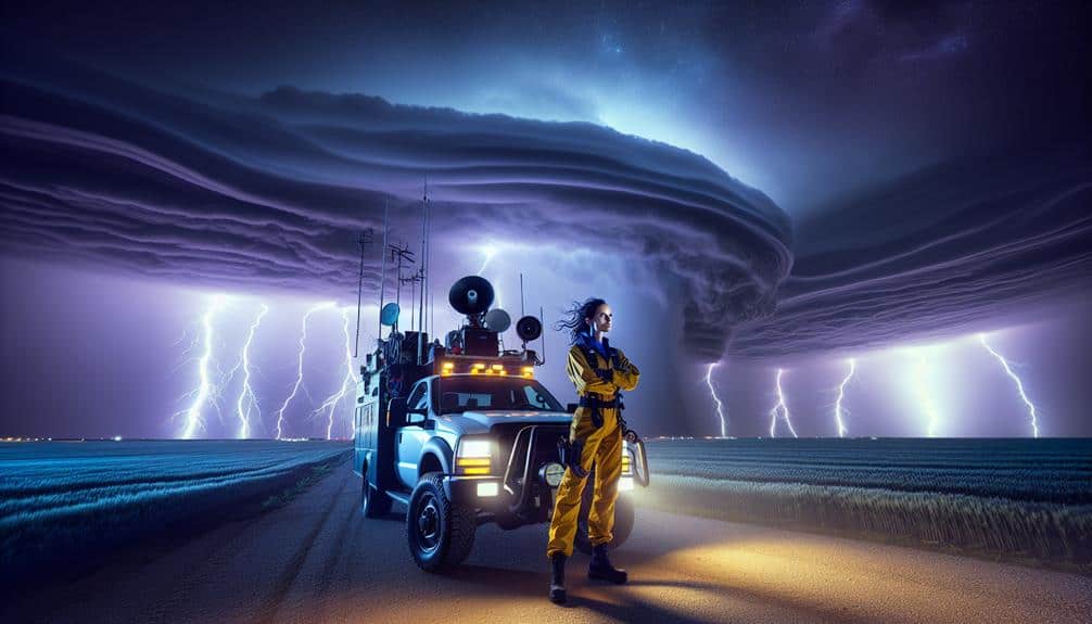
Safety Precautions
Equipping ourselves with the latest weather data and emergency supplies is crucial for maintaining safety while chasing storms in Tornado Alley. Accurate, real-time information allows us to make informed decisions and avoid dangerous situations.
Let's discuss the crucial safety precautions we need to implement. First, knowing emergency procedures is vital. Familiarize ourselves with the National Weather Service (NWS) alerts and understand the distinction between watches and warnings. This knowledge can be life-saving.
Second, identifying shelter locations in advance can make a significant difference. Scout out sturdy buildings or underground shelters along our planned route. Here are some key items to keep in mind:
- Weather radios: Make sure we've NOAA weather radios with backup batteries for continuous updates.
- First aid kits: Stock well-stocked first aid kits, including emergency blankets and flashlights.
- Vehicle maintenance: Regularly check tire pressure, oil levels, and fuel to avoid breakdowns during critical moments.
Best Chasing Practices
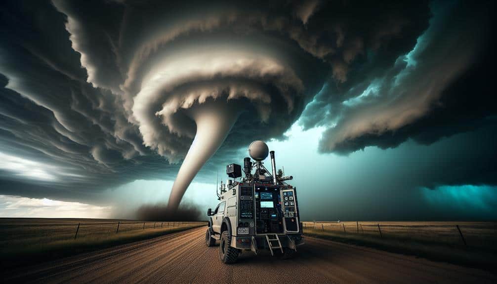
While safety measures keep us prepared, employing the best pursuing practices guarantees we gather valuable information without compromising our well-being. To start, our pursuing strategies should prioritize positioning. We need to stay within a safe distance yet close enough to capture essential data. Optimal placement ensures we're not in a tornado's direct route, reducing risks while maximizing observational opportunities.
Utilizing advanced observational methods enhances our data collection. We should equip our vehicles with high-definition cameras, wind speed measuring devices, and GPS trackers. Real-time data transmission to remote servers allows for immediate analysis and broader data sharing. By monitoring radar updates and atmospheric conditions, we can predict storm behavior and adjust our position accordingly.
Collaboration with fellow chasers improves data accuracy. By forming a network, we can cover more area and gather diverse data points. Sharing insights and observations in real-time enriches our collective understanding of storm dynamics.
Lastly, maintaining a flexible mindset is key. Tornadoes are unpredictable, and the ability to adapt our pursuing strategies based on evolving conditions is vital. By combining precise placement, advanced observational methods, and collaborative efforts, we can pursue effectively while ensuring our safety and freedom in the field.
Frequently Asked Questions
What Is the Best Time of Year to Chase Tornadoes in Tornado Alley?
The prime time to chase tornadoes in Tornado Alley is usually from April to June. During this period, storm patterns are most active. Utilize weather forecasting techniques and storm chasing strategies while prioritizing safety precautions for superior results.
How Do Tornado Sirens Work and When Are They Typically Activated?
Tornado sirens work through siren activation during a tornado warning to guarantee public safety. They're typically activated by local authorities, utilizing real-time communication systems to alert us when immediate shelter is needed due to severe weather conditions.
Can Tornadoes Form Outside Tornado Alley, and Where Are These Areas?
We should remember, tornadoes worldwide aren't limited to Tornado Alley. Other tornado-prone regions include the Southeastern U.S., parts of Europe, Australia, and Bangladesh. Tornado formation depends on atmospheric conditions, not just geography.
What Should You Include in an Emergency Kit for Storm Chasing?
In our emergency kit for storm chasing, we should include emergency supplies like first aid, water, and non-perishable food. Essential items include weather radios, flashlights, and extra batteries. Safety precautions and preparation tips guarantee we're ready for anything.
Are There Any Local Laws or Regulations Regarding Storm Chasing in Tornado Alley?
Just like a well-tuned engine, local regulations in Tornado Alley guarantee storm chaser safety. We must check storm chasing restrictions and storm chaser permits in each area to stay compliant and free to pursue our passion.