You’ll become a mission-critical observer who fills the dangerous gaps radar can’t cover—the 11.5-mile cone overhead, mountainous blind spots, and eight-minute data delays that leave communities vulnerable. Your ground-truth reports verify tornado touchdowns, confirm hail size, and validate the split-second warning decisions that have reduced tornado fatalities by over 800 lives compared to previous decades. Through accessible free training programs, you’ll transform your passion into life-saving expertise while discovering the extensive systems that make severe weather protection possible.
Key Takeaways
- Storm spotting teams provide free professional training in radar interpretation, storm mechanics, and severe weather identification through NWS SKYWARN and supplemental programs.
- Teams fill critical gaps where radar technology fails, including overhead blind spots, beam elevation at distance, and terrain-blocked coverage areas.
- Ground truth verification from spotters transforms radar data into confirmed warnings, directly enabling forecasters to issue timely tornado and severe weather alerts.
- Coordinated team networks ensure immediate communication of observations to emergency managers and meteorologists who make life-saving warning decisions.
- Storm spotters have saved over 800 lives compared to previous decades by serving as the first line of defense against deadly weather.
Serving as the First Line of Defense Against Deadly Storms
For over six decades, volunteer storm spotters have formed the nation’s first line of defense against deadly weather, operating at the critical intersection where meteorological science meets community safety. You’ll join a proven system that’s reduced tornado fatalities by more than 800 lives compared to previous decades.
Through direct ground-truth observations of hail size, wind speeds, and developing rotation, you’re enhancing public awareness of immediate threats that radar alone can’t detect. Your reports enable forecasters to issue timely warnings for tornadoes, severe thunderstorms, and flash floods—facilitating community preparedness by providing families those precious minutes needed to seek shelter.
Since the 1970s, the SKYWARN program has demonstrated that trained spotters serve as essential eyes in the field, transforming raw meteorological data into life-saving actionable intelligence for your neighbors.
Filling Critical Gaps in Radar Technology
While volunteer spotters provide irreplaceable human intelligence for warning operations, their necessity stems from fundamental physical limitations in radar technology itself. Earth’s curvature elevates radar beams with distance, sampling distant storms at higher altitudes while missing critical ground-level features. WSR-88D systems create an 11.5-mile cone of silence directly overhead, blocking mid-level circulation detection.
Beam broadening at range dilutes tornado signatures as large slow-wind returns dominate small fast-wind signals. Mountainous terrain blocks low-level coverage entirely, creating gaps below 10,000 feet. Update cycles taking several minutes leave broadcasters eight minutes behind rapidly evolving threats.
You’re bridging technology shortfalls by delivering enhanced observational data where radar coverage proves incomplete, outdated, or physically impossible—transforming theoretical storm analysis into verified ground truth that saves lives.
Protecting Your Community Through Ground Truth Verification
While Doppler radar excels at detecting atmospheric phenomena, it can’t confirm whether severe weather actually reaches the ground or causes damage in your community.
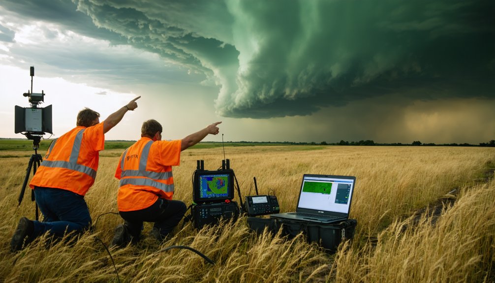
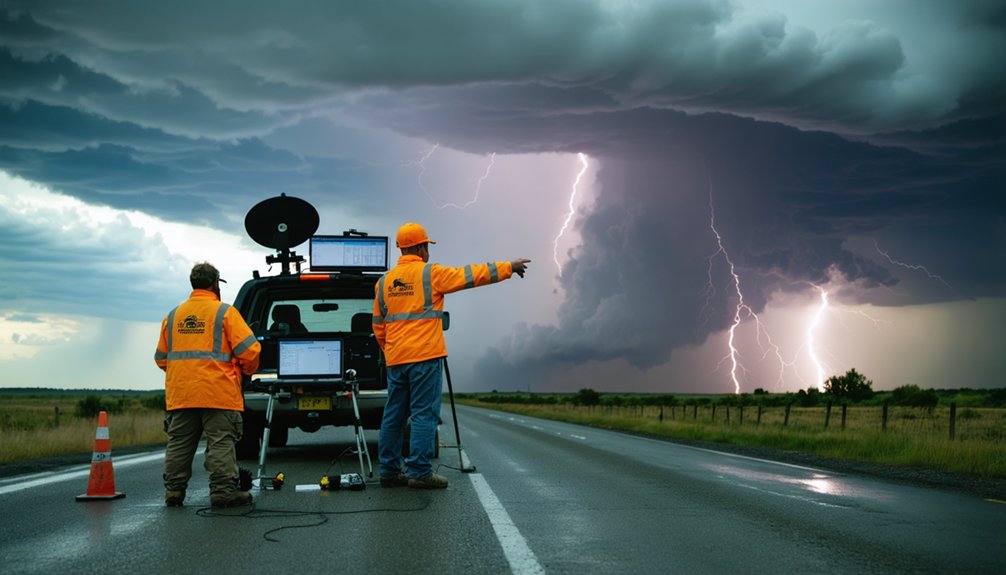
Your role as a trained spotter provides the essential ground truth verification that transforms radar signatures into actionable intelligence for the National Weather Service. By reporting real-time observations of hail size, wind damage, flooding depth, and tornado touchdowns, you fill critical data gaps that protect lives and property when technology alone falls short.
Filling Critical Radar Gaps
Though NEXRAD radar provides extensive weather surveillance across the contiguous United States, substantial coverage gaps persist—with mean area coverage reaching only 65% and a median of 69%. These limitations create velocity data blackouts in “RF rings” that can completely obscure small-scale features like rotation indicators.
You’ll find that storm spotting directly addresses these blind spots through supplementing automated detection with critical ground-truth observations. When you’re positioned where radar can’t see, your reports of hail, wind damage, and tornadoes become irreplaceable data points.
This enhanced understanding of hazard characteristics enables forecasters to overcome technological limitations and issue accurate warnings. Beyond 93.7 miles from radar installations, false alarm ratios increase drastically—making your on-site verification essential for protecting communities in these vulnerable zones.
Validating Technology With Observations
Ground truthing transforms your position in radar-blind zones from a coverage liability into a verification asset. Your field observations validate remote sensing data collection through real world physical verification that Doppler radar can’t provide.
When you document hail size, wind damage, or funnel clouds with GPS-tagged photographs and measurements, you’re confirming whether interpreted data correlates with actual conditions. This direct verification clears discrepancies in aerial imagery caused by environmental factors or technological limitations.
Your reports enable meteorologists to quantitatively compare hazard observations against warning polygons using geospatial grids, improving polygon orientation along storm paths. Since the 1970s, SKYWARN spotters combining ground truth with radar technology have saved countless lives.
You’re not just supplementing technology—you’re providing the essential physical measurements that guarantee reliable forecasting models and timely warnings.
Accessible Training Programs for Weather Enthusiasts
Because storm chasing demands specialized meteorological knowledge and real-time decision-making skills, aspiring weather enthusiasts now have access to structured training programs that remove traditional barriers to entry. NWS SKYWARN offers free two-hour sessions covering thunderstorm mechanics, severe features, and reporting protocols—available both virtually and in-person through local offices. These community outreach programs require no prerequisites, making hands on weather training accessible nationwide.
For specialized development, Girls Who Chase provides all-encompassing packages addressing radar interpretation, nowcasting strategies, and field positioning for $40 annually. COMET MetEd supplements these with interactive radar workshops focusing on hail detection and storm lifecycle analysis. You’ll find additional resources through Spotter Network‘s recalibrated courses, Skip Talbot’s positioning tutorials, and local Weather Watchers groups that combine observation training with real-world data submission.
Supporting Emergency Management and Warning Decisions
When you report storm conditions to the National Weather Service, your observations directly influence warning issuance and emergency siren activation decisions.
Emergency managers rely on spotter-confirmed ground truth to distinguish between radar artifacts and actual hazardous conditions, determining whether to sound civil defense sirens that alert thousands of residents.
Your coordinated reports through established communication channels provide the real-time verification officials need to make time-critical decisions that protect lives and property.
Coordinating Reports With Officials
Storm chasers and spotters coordinate their field observations with officials through several integrated systems that transform raw data into actionable intelligence for public safety.
You’ll access integrated communication networks including amateur radio repeaters spanning 30+ miles, where Net Control Stations dispatch operators and relay critical information to National Weather Service meteorologists.
The Spotter Network centralizes your GPS-verified reports, enabling emergency managers to access real-time weather monitoring through GIS-compatible platforms.
You’ll report directly to county 911, dispatch centers, or Emergency Management offices that deploy you strategically.
Your ground truth data—hail size, wind damage, tornado confirmations—validates Doppler radar signatures, enhancing warning accuracy.
This coordinated approach guarantees your observations reach decision-makers immediately, supporting timely warnings that protect communities from severe weather threats.
Enabling Siren Activation Decisions
Your field observations culminate in one of their most consequential applications: informing the split-second decisions emergency management officials make to activate outdoor warning sirens. When you confirm tornado touchdown or verify 80 mph winds causing extreme damage, you’re providing ground-truth verification that radar alone can’t deliver.
Your precise location reports—distance, direction, movement—enable officials to activate only sirens within the warning polygon, avoiding blanket alerts that diminish public trust. Real time threat assessments from trained spotters eliminate decision-making delays and reduce false alarms by confirming actual threats before sirens sound.
Through coordinated activation protocols, your consolidated reports streamline the activation chain, enabling faster deployment compared to radar-only methods. You’re directly protecting lives through actionable intelligence that transforms warnings into immediate protective action.
Detecting Nighttime and Hidden Weather Threats
Although visual confirmation remains the gold standard for tornado detection, darkness fundamentally compromises storm chasers’ and spotters’ ability to identify rotating columns until lightning briefly illuminates the structure. You’ll find dual-polarization radar becomes invaluable during these conditions, detecting debris signatures that confirm ground-level tornado presence with high confidence.
Mobile Doppler systems positioned near storms provide enhanced spatial resolution, capturing circulation development across multiple altitudes simultaneously. The Geostationary Lightning Mapper supplements detection by tracking 500 images per second, revealing storm intensity changes through lightning progression patterns.
Integrated data modeling combines radar, lightning, and spotter observations to overcome individual system limitations. Your ground-truth reports validate automated detection systems, enabling meteorologists to issue warnings when technological sensors alone can’t definitively confirm tornado occurrence in darkness or rain-wrapped conditions.
Building Severe Weather Expertise and Scientific Knowledge
Developing competence in severe weather operations requires systematic acquisition of atmospheric science fundamentals through formal meteorology education or National Weather Service SKYWARN spotter certification. You’ll gain critical understanding of atmospheric physics, storm dynamics, and forecasting methodologies that enable independent decision-making in the field.
Hands on learning experiences through university observation courses provide direct exposure to cumulonimbus development, tornado formation patterns, and real-time data collection protocols.
Field research support opportunities connect you with experienced meteorologists conducting operational studies, accelerating your skill development through mentorship and collaborative analysis. You’ll master weather tracking software, GPS navigation systems, and positioning techniques essential for safe intercepts.
This knowledge foundation transforms abstract atmospheric concepts into practical survival skills, enabling you to predict storm movement, assess risk factors, and execute strategic positioning decisions autonomously.
Providing Essential Communication When Technology Fails
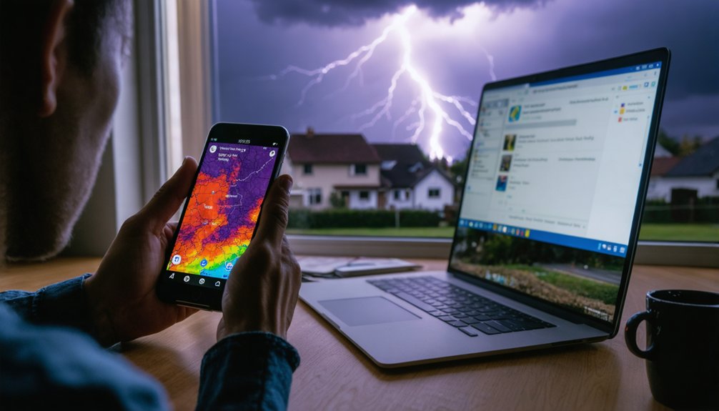
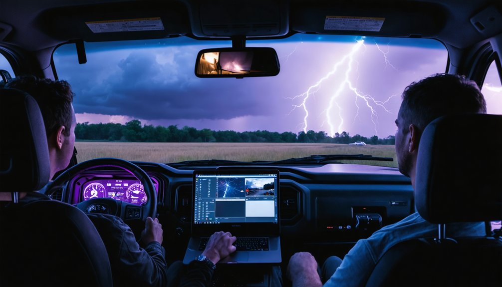
When cellular networks collapse under the strain of severe weather events, storm chasers become critical communication nodes between isolated communities and emergency management agencies. Your multi-modal communication integration—combining satellite uplinks, XM weather systems, and redundant cellular providers—ensures data transmission when single-source networks fail.
Though 4G LTE has largely replaced DataStorm technology, satellite systems remain essential backup infrastructure in areas without cellular coverage. Your Baron’s Mobile Threat Net delivers radar updates every five minutes, maintaining situational awareness during coverage gaps.
Modern adaptive protocol innovations enable seamless switching between communication methods: satellite internet uploads storm footage to news networks while Spotter Network applications transmit GPS-verified reports to the National Weather Service. This redundancy transforms you into a mobile relay station, bridging communication voids that endanger isolated populations.
Flexible Volunteer Opportunities With Meaningful Impact
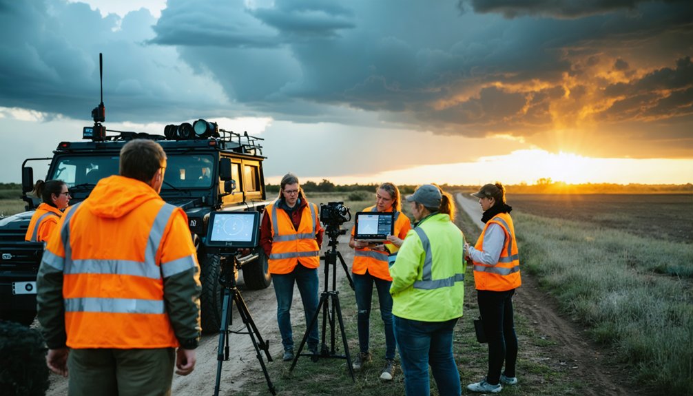
Storm spotting opens up volunteer pathways that don’t demand the resource commitment of full-scale chasing expeditions. You’ll access hands on storm experience through National Weather Service training courses that attract 1,500-2,300 participants annually, targeting radio amateurs, firefighters, and meteorology students. These cost effective community roles eliminate the hundreds of miles and hotel expenses typical of chasing, with training provided free at local NWS offices.
Your reports directly support civil authorities during severe weather while you maintain positioning near high-risk areas with established retreat options. This flexible scheduling integrates with your existing routine, requiring no seasonal full-time commitment.
You’ll contribute ground-truth observations that help scientists understand tornado formation patterns—critical when annual U.S. tornadoes cause 80 deaths, 1,500 injuries, and $229 million in damage.
Frequently Asked Questions
What Equipment Do I Need to Purchase to Become a Storm Spotter?
You’ll need basic camera equipment for documentation and portable weather devices like an anemometer and barometer. Add a NOAA weather radio, two-way communication system, and safety gear including reflective vests, first aid supplies, and backup navigation tools.
Can Storm Spotters Chase Storms Outside Their Assigned Local Area?
Storm spotters shouldn’t engage in local storm chasing or regional storm chasing outside their assigned area. You’re trained for fixed-position observation within your county’s network, where you’ll provide ground-truth verification using familiar terrain and established safety protocols.
How Do Storm Spotting Activities Affect Personal Liability and Insurance Coverage?
Like traversing uncharted waters, you’ll face increased personal risk and potential insurance complications during storm spotting. Standard auto policies won’t cover commercial chasing activities, exposing you to financial liability from accidents, negligence claims, and detailed coverage disputes.
Are Storm Spotters Compensated Financially for Their Time and Gas Expenses?
You won’t receive financial compensation for travel expenses as a storm spotter—it’s volunteer-based work. However, you’ll gain valuable team recognition and contribute critical real-time data that enhances public safety warnings while maintaining your independence.
What Physical Fitness Requirements Exist for Participating in Storm Spotting Teams?
No ideal body weight exists for storm spotters. You’ll need stamina requirements only for 2-hour training sessions and stationary observation periods. Networks prioritize safe positioning and reliable communication over physical fitness, with no mandatory fitness tests required.