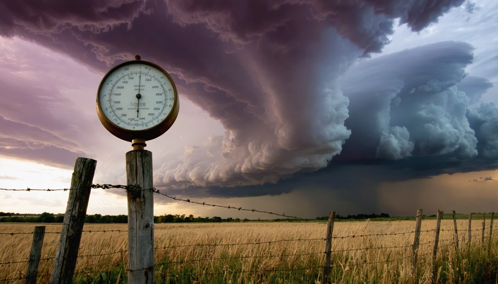
Tracking atmospheric pressure gives you a measurable edge in predicting hailstorms before radar even confirms development. A 4 mb drop within three hours signals accelerating convergence. Surface pressure at or below 1005 mb correlates with severe rotating storms. Cold fronts and pressure troughs trigger over half of recorded hail days. Sustained first-hour drops exceeding 1.5 mb separate supercell-capable storms from weaker convection. Each correlation below gives you actionable intelligence before conditions turn dangerous.
Key Takeaways
- A barometric pressure drop of at least 4 mb over three hours signals accelerating convergence and significantly raises hail likelihood.
- Surface pressure at or below 1005 mb correlates strongly with severe rotating storms capable of producing large hail.
- Low-pressure systems enhance updraft columns by pulling air inward, supplying the moisture and kinetic energy hailstorms require.
- Over half of all hail days align with cold frontal circulation types, linking surface pressure troughs directly to hail triggers.
- A sustained pressure fall exceeding 1.5 mb in the first hour distinguishes supercell-capable storms from weaker, non-severe convection.
Pre-Storm Pressure Drops That Signal Incoming Hail
Before a hailstorm strikes, the barometer often tells the story first. You’ll notice pressure fall impacts emerging well before hail arrives. A drop of at least 4 mb over three hours, pushing surface pressure below 1005 mb, signals serious hail formation triggers are already in motion.
Larger falls—8 mb or more within 8 to 12 hours—indicate even stronger convective development ahead. Pressure continues declining until it hits a sharp minimum, then rebounds as the storm matures. This falling trend reflects intensifying low-level convergence and accelerating updrafts.
Watch for a first-hour drop exceeding 1.5 mb, which often separates supercell-capable storms from weaker convection. Tracking these pressure trends gives you a measurable, data-backed advantage in anticipating dangerous hail before it reaches the ground.
How Low-Pressure Environments Fuel the Updrafts That Grow Hail
When a low-pressure system organizes at the surface, it pulls air inward and upward through convergence, directly feeding the updraft columns that sustain hail growth. Understanding low pressure dynamics clarifies why hail growth mechanisms depend so heavily on pressure structure:
- Stronger pressure gradients accelerate low-level inflow, supplying moisture and kinetic energy directly into the storm base.
- Convergent wind fields beneath the low concentrate instability, allowing updrafts to exceed 150 mph in extreme cases.
- Reduced surface pressure lowers the energy threshold for air parcels to rise freely through deep atmospheric layers.
- Cyclonic circulation organizes storm-relative winds, maximizing wind shear that tilts updrafts and prevents precipitation from choking them.
You’re fundamentally watching pressure differentials act as a natural pump, mechanically driving the vertical velocities hail requires to grow.
Why Cold Fronts and Pressure Troughs Set the Stage for Hail Days
Low-pressure systems don’t generate hail days in isolation—they’re almost always anchored to a larger synoptic forcing mechanism, and cold fronts with associated pressure troughs are the most consistent trigger.
Research from northern China confirms that over half of documented hail days align with cold frontal circulation types. At 500 hPa, the East Asia trough’s position and intensity directly influenced hail-favorable environments.
Surface pressure troughs amplify low-level convergence, forcing air upward while cold fronts sharpen wind shear and moisture boundaries. When upper-level and surface pressure troughs align, you get a stacked forcing environment that maximizes instability and vertical motion simultaneously.
That combination drives the sustained, powerful updrafts necessary for hail growth. Recognizing these pressure trough signatures gives you a reliable structural framework for anticipating severe hail potential before storm initiation.
The Pressure Clues That Warn of a Supercell Before It Forms
Supercells telegraph their development through barometric pressure well before radar confirms rotation. Tracking pressure thresholds gives you actionable lead time to respond independently.
Watch for these supercell dynamics signatures:
- Sustained pressure fall exceeding 1.5 mb in the first hour signals early convective organization and intensifying low-level inflow.
- Surface pressure dropping to or below 1005 mb crosses a documented hail-related threshold tied to severe rotating storms.
- A 4 mb drop within 3 hours indicates accelerating convergence, separating dangerous cells from ordinary convection.
- Pressure reaching its minimum then sharply rebounding marks storm maturation, often coinciding with peak hail production at the surface.
You don’t need institutional permission to read these numbers. A barometer, combined with hourly pressure logging, puts verified supercell warning intelligence directly in your hands.
What Pressure Tells You That Radar and CAPE Alone Cannot
Radar and CAPE each capture a snapshot—reflectivity shows precipitation structure, and CAPE quantifies thermodynamic fuel—but neither tracks the continuous pressure tendency that precedes storm organization.
Surface pressure indicators reveal what those tools miss: the sustained, directional fall that signals intensifying low-level convergence before convection erupts. A drop of 4 mb in three hours toward sub-1005 mb territory raises hail likelihood independently of radar returns, because the storm hasn’t fully organized yet.
CAPE tells you fuel exists; pressure tendency tells you the atmosphere is actively drawing air inward and building the updraft column. You can have high CAPE under stable pressure and see nothing severe.
But when pressure falls persistently alongside that instability, you’re watching the storm’s infrastructure assemble in real time—before the radar confirms it.
Frequently Asked Questions
Can Hail Occur When Atmospheric Pressure Is Rising Rather Than Falling?
Yes, you can see hail formation during rising pressure, though it’s less common. Pressure dynamics show hail occasionally occurs as storms mature and pressure rebounds, but falling pressure environments more reliably support severe, large-hail-producing updrafts.
Does Elevation Affect How Pressure Thresholds Relate to Hail Formation?
Yes, elevation impact greatly alters pressure variations, so you can’t apply sea-level thresholds directly. Higher elevations naturally have lower baseline pressures, requiring you to adjust hail-formation thresholds accordingly for accurate regional storm assessments.
How Quickly Does Pressure Recover After a Hailstorm Completely Passes Through?
Like a coiled spring releasing, pressure fluctuations reverse sharply once a hailstorm exits. You’ll typically see recovery within 1–3 hours, though storm duration directly influences how fast barometric readings rebound to pre-storm baseline levels.
Are Pressure-Based Hail Signals More Reliable in Certain Seasons Than Others?
Yes, you’ll find pressure-based hail signals more reliable in spring and early summer, when seasonal patterns amplify pressure anomalies, synoptic forcing strengthens, and organized frontal systems create clearer, more consistent barometric signatures tied to severe convection.
Can Pressure Trends Alone Trigger an Official Severe Weather Warning or Alert?
By Jove, pressure trends alone can’t trigger severe alerts. You need warning criteria combining pressure systems with CAPE, shear, and atmospheric dynamics before forecasters officially issue any actionable severe weather warning.
References
- https://adapt.psu.edu/ZHANG/papers/Lietal2016JC.pdf
- https://worldstormcentral.co/pdf/Predicting Hailstorms.pdf
- https://www.longdom.org/open-access-pdfs/understanding-patterns-and-trends-of-hailstorm-analysis.pdf
- https://openscied.org/wp-content/uploads/2023/12/Unit-6.3-Weather-Storyline.pdf
- https://www.youtube.com/watch?v=Vhlp9P5_3Ww
- https://www.nssl.noaa.gov/education/svrwx101/hail/
- https://agupubs.onlinelibrary.wiley.com/doi/full/10.1029/2019RG000665
- https://mrcc.purdue.edu/living_wx/hail
- https://www.sciencedirect.com/topics/earth-and-planetary-sciences/hailstorm
- https://www.earthnetworks.com/hail/


