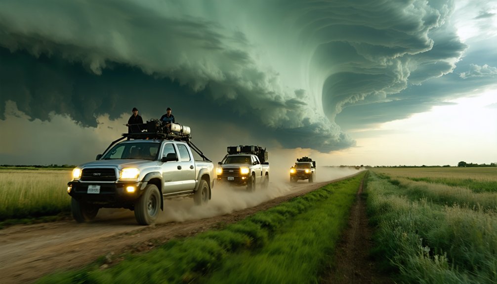
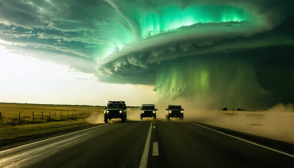
Effective storm chaser team tactics start with defined roles—navigator, spotter, and data analyst—so decisions happen fast and without overlap. You’ll need pre-planned escape routes perpendicular to storm motion, real-time radar cross-referenced against road networks, and redundant communication channels beyond cellular coverage. Position southeast of the hook echo, reassess exits every three minutes, and treat every intercept decision with analytical skepticism. The tactics covered ahead will sharpen your team’s execution markedly.
Key Takeaways
- Assign specific roles—spotter, navigator, and data analyst—to eliminate decision overlap and maintain efficient team communication during active chases.
- Pre-plan multiple escape routes perpendicular to storm motion, identifying at least two exits before intercepting any storm.
- Position southeast of the hook echo or tornado path, reassessing escape routes every three minutes using radar and visual cues.
- Synchronize data sharing through real-time radar apps while establishing redundant communication channels beyond standard cellular networks.
- Conduct thorough pre-chase preparation, analyzing forecast models, road networks, and gear readiness before storm initiation as non-negotiable protocols.
How Chase Teams Divide Roles for Maximum Efficiency
When a chase team operates without clearly defined roles, decision-making bottlenecks and communication breakdowns can cost critical seconds during a rapidly evolving storm intercept.
Strategic role allocation transforms your team into a high-efficiency unit. Assign one member as the dedicated spotter, maintaining continuous visual assessment of wall clouds, clear slots, and inflow tails.
Designate another as the navigator, managing road networks and escape routes perpendicular to storm motion. Your data analyst monitors GRLevel3 or GR2Analyst feeds, relaying real-time radar signatures to the team.
Effective task delegation eliminates redundancy and keeps each member focused on their domain. You’ll make faster, cleaner intercept decisions when nobody’s doubling up on responsibilities.
Establish your team structure, logo, and communication protocol before you’re ever in the field.
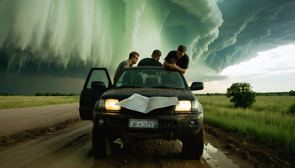
What Every Chase Team Should Do Before Leaving the House
Before you leave the house, you need to analyze forecast models, identify your primary target area, and map out multiple route alternatives that account for road network quality and storm motion vectors.
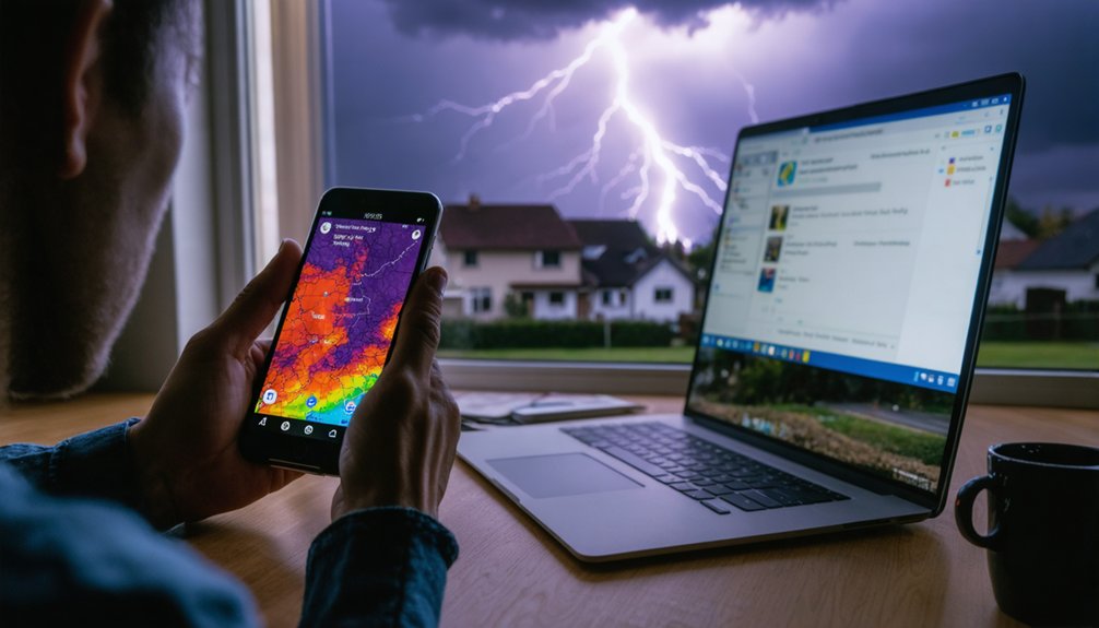
Your gear checklist must include a fully fueled vehicle, real-time radar apps like Radarscope, first aid supplies, food, water, and warning lights to signal other drivers.
Treat these pre-chase steps as non-negotiable protocols, since gaps in either route planning or equipment readiness compound risk exponentially once you’re in a dynamic storm environment.
Pre-Chase Route Planning
Planning your route before leaving the house isn’t optional—it’s the foundation of a successful chase. Route optimization separates disciplined teams from reactive ones. Study road networks, identify alternate pathways, and eliminate grids with poor escape geometry—hilly terrain or sparse roads trap you.
Here’s your pre-chase route checklist:
- Assess road density in your target zone—prioritize rectangular grids over irregular networks like Dixie Alley.
- Identify alternate pathways perpendicular to storm motion for rapid repositioning.
- Mark fuel stops along primary and secondary routes before departure.
- Cross-reference storm direction with escape corridors, ensuring southeast positioning remains viable throughout the chase.
Your freedom on the road depends on pre-built contingencies, not improvised decisions under pressure.
Essential Gear Checklist
Gear failure mid-chase doesn’t just compromise your intercept—it creates cascading risks that no radar app can fix.
Before leaving, execute a structured checklist covering vehicle modifications, safety equipment, and navigation tools. Run gear maintenance checks on warning lights, tires, and fuel systems.
Organize supply organization methodically—water, food, first aid, and emergency communication devices in accessible, designated positions. Load current technology updates onto Radarscope or GRLevel3 for accurate weather monitoring.
Verify GPS navigation tools against paper backup maps. Pack a complete first aid kit and confirm EMR or CPR training exercises are current among team members.
Treat this checklist as mission-critical data: one overlooked variable compounds downstream errors. Freedom in the field depends entirely on disciplined preparation before you ever leave the driveway.
How to Build a Chase Team Communication System
Building a reliable chase team communication system requires three foundational components: defined roles, shared data platforms, and redundant communication channels. Your team hierarchy determines who analyzes radar, who drives, and who monitors situational updates.
- Role Assignment – Designate a dedicated spotter, navigator, and data analyst to eliminate decision overlap.
- Data Synchronization – Share real-time radar via GRLevel3 or GR2Analyst across all devices for unified information sharing.
- Communication Tools – Use ham radios, mesh networks, or encrypted channels as backup beyond cellular.
- Emergency Protocols – Establish pre-agreed abort signals and feedback mechanisms so every team member triggers evacuation without debate.
These systems keep your operation agile, disciplined, and free from the chaos that kills unprepared teams.
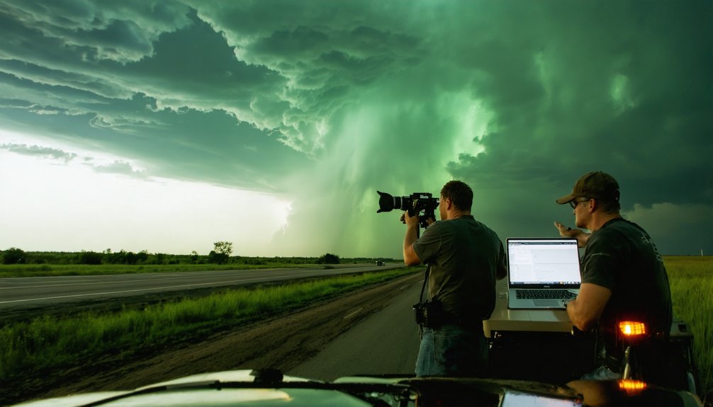
Storm Features to Read Before Radar Confirms the Threat
Before radar paints a complete picture, your eyes on the storm give you a critical time advantage. Reading storm behavior visually lets you act before confirmation arrives.
Watch cloud formations closely. Inflow tails signal strong moisture inflow, indicating an energized updraft base. A rotating wall cloud separates from the rain-free base, marking intensifying storm structure.
The rear flank downdraft clear slot wrapping around the updraft reveals evolving storm morphology before radar resolves it.
Monitor precipitation patterns for a “Bear’s Cage” configuration, where rain surrounds the updraft, suggesting a high-precipitation supercell. Early tornado signatures include a lowering, persistent rotation beneath the wall cloud.
Trust these visual indicators as your first data layer. They’re not supplemental—they’re primary intelligence that keeps you ahead of the threat and in control of your positioning.
Where to Position Your Team Relative to the Supercell
Once you’ve read the storm’s visual cues and established situational awareness, your next decision is where to physically place your team relative to the supercell. Mastering positioning strategies requires understanding supercell dynamics and committing to disciplined placement.
- Stay southeast of the hook echo or tornado path to minimize direct impact exposure.
- Avoid the inflow notch until your team has significant experience, as it risks occlusion into the tornado’s path.
- Use visual cues—clear slots and inflow tails—to refine your position before radar confirms movement.
- Plan perpendicular escape routes relative to storm motion, never positioning north of the storm’s track.
Your positioning determines survivability. Treat every placement decision as a calculated, data-driven commitment, not improvisation.
How Chase Teams Handle Chaser Convergence on High-Risk Days
When high-risk days draw dozens of chasers to the same target area, convergence transforms the roads into a hazard layer that rivals the storm itself.
Chaser etiquette breaks down fast when screens replace windshields. Your convergence strategies must account for this reality.
Assign a dedicated navigator so driving distractions don’t compromise your team dynamics or reaction time.
Communication protocols should keep your team coordinated without adding cognitive load to the driver.
Traffic awareness demands you slow down, refuse unsafe passes, and exit crowded positions early.
Situational challenges escalate when undisciplined chasers run 80 MPH while glued to radar apps.
Your safety measures must include positioning exits before congestion locks you in.
You’re not just managing a storm—you’re managing a mobile crowd operating at dangerous margins.
How to Plan Escape Routes Before the Storm Forces the Decision
Escape route planning starts the moment you assess the road network, not when the tornado is already rope-out and rain-wrapped behind you.
Pre-storm assessments reveal dead-end county roads, elevation traps, and bridge bottlenecks before they become fatal variables.
Build your escape route options around these four principles:
- Identify perpendicular roads east and south of the projected storm path before initiation.
- Flag road quality — unpaved sections become impassable mud during inflow precipitation.
- Mark bridge and overpass locations as hazard points, never refuge points.
- Establish multiple contingency routes in case primary roads face chaser convergence or debris blockage.
You control your mobility only when you’ve already mapped your exits.
Don’t negotiate escape under pressure — pre-plan it.
Before you ever hit the road, you should analyze regional road networks to identify grid limitations—areas like Dixie Alley or hilly terrain with sparse paved options will compress your intercept windows and constrain your escape geometry.
Once you’re in the field, you’ll need to adapt in real time, using storm motion vectors and visual cues to reposition southeast of the supercell while avoiding dead-end rural routes that cut off perpendicular exits.
Treating escape route planning as a dynamic, data-driven process—rather than a fixed pre-chase decision—keeps your options open as storm tracks shift and road conditions deteriorate.
Pre-Chase Road Assessment
Maneuvering difficult road grids before a chase begins can determine whether your team intercepts a storm or gets cut off entirely. Assess road conditions, traffic patterns, and weather updates before you leave your staging point.
- Map your primary and alternate routes using navigation apps like Google Maps or onX, identifying paved versus dirt road networks in advance.
- Flag poor grid areas — Dixie Alley’s hilly terrain and dead-end county roads demand extra route flexibility built into your plan.
- Integrate local resources like county road atlases and municipal DOT feeds to anticipate closures.
- Apply chaser etiquette and safety measures by pre-identifying pullout zones, avoiding narrow shoulders, and sharing your route with team members before storm initiation.
Once you’ve mapped your routes and flagged problem grids at the staging point, field conditions will still force real-time rerouting decisions that no pre-chase plan fully anticipates.
Poor weather conditions like mud-saturated county roads, flooded low-water crossings, and debris-covered pavement can shut down your primary escape vectors instantly. You’ll need to cross-reference live radar positioning with your road network assessment, prioritizing paved perpendicular escape routes over shorter dirt alternatives.
Core road safety tips apply here: never commit to a road you haven’t visually confirmed passable, and always maintain a secondary exit before advancing southeast of the mesocyclone.
In hilly terrain or fragmented grids like those common in Dixie Alley, your repositioning windows shrink fast, so anticipate cutoffs two to three minutes before they become critical.
Escape Route Planning
Escape route planning isn’t a one-time pre-chase task—it’s a continuous decision loop that you reassess every few minutes as storm motion, road conditions, and your position relative to the mesocyclone shift.
Effective storm navigation demands that your escape routes remain perpendicular to storm motion, never parallel.
Prioritize these four escape route principles:
- Pre-position southeast of the supercell, keeping paved perpendicular roads accessible.
- Avoid north positioning—storm motion traps you fastest from that angle.
- Identify two exits minimum before committing to any intercept position.
- Reassess every three minutes using real-time radar signatures and visual storm cues.
Freedom in the field means maintaining options.
The moment your escape routes narrow to one, you’ve already compromised your safety margin considerably.
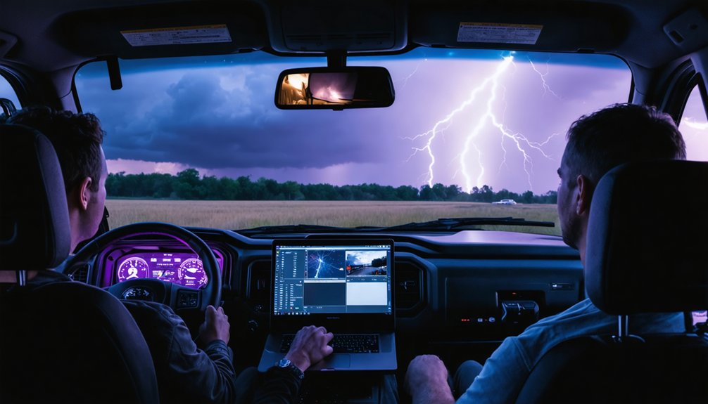
Night Chasing Tactics That Demand a Different Approach
Night chasing strips away your primary tool—visual confirmation—forcing you to rely almost entirely on radar interpretation, surface observations, and data-driven decision-making.
Nighttime visibility challenges eliminate your ability to read storm structure visually, making foundational radar signatures your lifeline. You can’t spot wall clouds, clear slots, or inflow tails in darkness, so your GRLevel3 or GR2Analyst data must compensate.
Communication adjustments become non-negotiable at night. Your team must increase check-in frequency, verbally confirm positioning, and maintain stricter situational awareness protocols.
Road hazards multiply when headlights replace daylight, demanding slower speeds and heightened vigilance.
Reposition conservatively—mistakes at night carry heavier consequences. You’re operating with fewer inputs, so your decision margins shrink.
Treat every intercept decision with disciplined skepticism, and never compromise your escape route integrity for a better viewing angle.
Frequently Asked Questions
What First Responder Certifications Should Storm Chasers Obtain Before Their First Chase?
You chase storms, yet you save lives — obtain EMR, first aid, and CPR certifications before your first chase. These credentials strengthen your storm preparedness and rescue techniques, ensuring you’re analytically equipped to respond effectively.
How Do Chase Teams Safely Handle Vehicle Damage From Unexpected Hail Encounters?
When you encounter unexpected hail damage, you’ll want to immediately document it, then retreat to a safe zone. Prioritize vehicle repairs promptly to maintain mobility, ensuring your team’s freedom to reposition and continue chasing effectively.
What Radar Applications Are Most Reliable for Real-Time Storm Data During Chases?
Stay ahead of the curve: you’ll rely on Radarscope and GRLevel3 for radar technology and data accuracy. These apps deliver real-time supercell signatures, helping your team make split-second, informed intercept decisions confidently.
How Can Beginners Practice Storm Chasing Skills Without Entering Dangerous Field Conditions?
You can sharpen your skills through virtual storm observation simulations using radar tools like Radarscope, running timed intercept safety drills, analyzing historical supercell data, and riding alongside experienced chasers to build situational awareness before independently entering the field.
What Supplies Should Every Chase Vehicle Carry for Multi-Day Storm Chasing Trips?
You’ll need emergency gear, safety kits, communication devices, and navigation tools stocked fully. Pack weather equipment, sufficient food supplies, water, first aid, and real-time radar apps to maintain operational independence across unpredictable multi-day chasing scenarios.
References
- https://www.wiu.edu/SevereWeather/images/presentations/How_to_Effectively_Storm_Chase.pdf
- https://www.youtube.com/watch?v=6otZLjSZvPU
- https://www.youtube.com/watch?v=nxPSFg2R8YY
- https://www.reddit.com/r/stormchasing/comments/1ooimws/does_anyone_have_tips_for_a_storm_chasing/
- https://www.foxweather.com/learn/storm-chasing-advice-from-the-pros
- https://www.wikihow.com/Storm-Chase
- https://www.livingskytours.com/storm-chasing-101/
- https://stormtrack.org/threads/night-storm-chasing-techniques.17618/
- https://www.youtube.com/playlist?list=PLVEuvNuSbsGgOY0ipyHTGM2FjG8Xd6KxV
- https://www.youtube.com/watch?v=Sr2lz72ZYwM