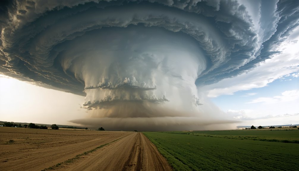
To enhance storm chasing strategies in a changing climate, you’ll need to abandon fixed assumptions tied to classic Tornado Alley. Tornado activity is shifting eastward into the Southeast, Mid-South, and Ohio Valley, while outbreak windows now extend into fall and winter. Prioritize mesoscale indicators like low-level shear, CAPE, and surface boundaries over climatological defaults. Integrate high-resolution models with real-time radar for faster targeting decisions. The full picture of how these shifts reshape every operational decision is ahead.
Key Takeaways
- Tornado activity has shifted eastward toward the Southeast and Ohio Valley, requiring chasers to update target regions beyond traditional Tornado Alley boundaries.
- Severe weather seasons now extend into fall and winter, demanding adjusted operational windows and continuous mesoscale analysis rather than climatological assumptions.
- Environment-based forecasting using surface boundaries, low-level shear, and CAPE provides more accurate targeting than relying on historical hotspot labels.
- Real-time integration of high-resolution radar, hodographs, and traffic-aware routing tools enables faster, safer decisions during rapidly evolving multi-tornado outbreaks.
- Nighttime chasing requires strict no-chase thresholds, pre-planned escape routes, and sole reliance on radar data when visual confirmation is impossible.
How Climate Change Is Creating New Storm Chasing Risks
Climate change is reshaping the severe weather landscape in ways that directly complicate storm chasing operations. You’re no longer working within predictable seasonal windows or reliable geographic corridors.
Human-caused warming is intensifying heavy rainfall rates in severe convective storms and extending favorable severe-weather environments into spring, fall, and winter months. That means your weather forecasting models must now account for a longer, less structured threat season.
Warming is lengthening the severe weather season—your forecasting models must adapt to a longer, less predictable threat window.
Cooler-season setups are already becoming more frequent, compressing your decision timelines and expanding your operational range. Flash-flood hazards are rising alongside storm intensity, adding layered risk to pursuit routes.
Building genuine climate resilience into your chase strategy requires abandoning fixed assumptions about when and where severe weather develops and replacing them with environment-based, real-time analysis frameworks.
How Eastward Tornado Shifts Change Where You Should Chase
Tornado activity has shifted measurably eastward, and if you’re still anchoring your chase targets around the traditional Oklahoma-Kansas corridor, you’re working from an outdated operational model.
Outbreak concentrations have increased across the Southeast, Mid-South, and Ohio Valley, regions where urban development has expanded road networks but simultaneously compressed safe intercept corridors. Higher population density and mobile-home concentrations elevate risk calculus considerably.
Ecosystem impact compounds this challenge, as dense tree cover and irregular terrain reduce sight lines critical for visual storm assessment.
You’ll need to restructure your regional targeting using mesoscale environment analysis rather than climatological habit. Prioritize high-resolution model output, outbreak-pattern archives, and terrain-aware routing.
The data demands it, and your operational freedom depends on adapting your strategy to where tornadoes are actually occurring.
Why “Tornado Alley” No Longer Tells the Whole Story
The geographic restructuring described above exposes a deeper problem: “Tornado Alley” was never a precise meteorological boundary—it was a statistical artifact built from decades of biased detection data concentrated where radar coverage and storm chasers were most active.
Historical climatology reinforced this illusion, embedding a Plains-centric worldview into chase culture that now demonstrably misrepresents tornado risk distribution.
Atmospheric oscillations, including ENSO-driven shifts in jet stream positioning, are amplifying activity across the Southeast and Ohio Valley in patterns historical climatology never adequately captured.
You can’t optimize your chase targeting by anchoring to an outdated geographic label. You need environment-based analysis, current outbreak climatology, and regional pattern recognition that reflects where favorable severe-weather conditions are actually developing—not where they statistically clustered before modern detection existed.
The New Tornado Hot Spots Chasers Are Targeting Now
As chase culture recalibrates away from Plains-centric assumptions, the Southeast, Mid-South, and Ohio Valley are emerging as the highest-priority targeting zones in modern outbreak climatology.
Outbreak clustering data confirms increased tornado frequency across Tennessee, Mississippi, Alabama, and Kentucky corridors. You’ll find that these regions combine favorable low-level shear environments with higher population density, mobile-home concentration, and limited urban resilience infrastructure—factors that amplify both risk and chase complexity.
Target selection now demands environment-based mesoscale analysis over historical climatology. Renewable energy installations across these corridors are also reshaping surface roughness and boundary interactions, potentially influencing localized convective dynamics.
Integrate high-resolution model output, real-time observations, and archived outbreak patterns into your pre-chase workflow. Expanding your operational geography beyond traditional Tornado Alley isn’t optional—it’s analytically necessary given observed regional pattern shifts.
Use Mesoscale Analysis to Find Storms Outside Traditional Hot Spots
When you’re chasing outside classic Tornado Alley, mesoscale analysis becomes your primary targeting tool rather than a supplement to regional climatology.
You’ll want to assess surface boundaries, low-level wind shear, convective available potential energy (CAPE), and capping strength across a tighter spatial scale than synoptic models typically resolve.
Shifting your workflow toward high-resolution mesoanalysis products lets you identify favorable tornado environments in the Southeast, Ohio Valley, and Mid-South before those setups mature into outbreak conditions.
Reading Mesoscale Environments Effectively
Relying solely on traditional Tornado Alley climatology leaves critical storm opportunities off your radar—literally. Mesoscale dynamics now drive significant tornado activity across the Southeast, Mid-South, and Ohio Valley—regions historically underweighted in chase planning.
You need to read environmental cues systematically: analyze CAPE gradients, shear profiles, and low-level jet positioning rather than defaulting to geographic assumptions.
Pull high-resolution model output early, then cross-reference against observed surface boundaries, moisture pooling, and mid-level lapse rates. These variables tell you where instability is building before storms initiate.
Seasonal shifts mean favorable environments increasingly appear in fall and winter setups outside classic spring windows. If you’re filtering targets by region instead of by atmospheric data, you’re already missing the setup.
Targeting Beyond Traditional Hot Spots
Tornado activity has shifted—outbreak concentrations in the Southeast, Mid-South, and Ohio Valley now demand that you build chase targets from mesoscale analysis rather than climatological habit. Classic “Tornado Alley” assumptions no longer hold, and relying on them costs you positioning and safety margins. Climate adaptation isn’t optional; it’s operational.
You’ll need to integrate real-time model guidance, surface boundary placement, and shear profiles to identify viable targets in non-traditional corridors. Risk mitigation depends on recognizing that these regions feature higher mobile-home density, complex terrain, and limited road networks—factors that compress your escape options.
Pull archived outbreak data from recent seasons, identify the shifting regional signatures, and build target checklists that reflect where severe environments are actually forming, not where they historically clustered.
Storm Chasing Strategies for Fall and Winter Outbreaks
As severe storm environments grow more favorable in fall and winter across the U.S., your chase strategy can’t rely on spring-centered Tornado Alley assumptions. Seasonal shifts are pushing outbreak activity into the Southeast, Mid-South, and Ohio Valley—regions where urban sprawl complicates escape routing and increases population exposure during low-visibility events.
Prioritize mesoscale analysis over climatological habit. Fall and winter setups often develop faster, with shorter decision windows and compressed storm modes. Monitor satellite imagery closely for early convective initiation signals, especially when surface boundaries interact with elevated instability in cooler-season environments.
Night chase risk rises sharply during these outbreaks. Build hard no-chase thresholds for darkness and terrain-limited corridors. Blending high-resolution model guidance with live radar keeps your targeting sharp when historical hot spots no longer tell the full story.
Technology Tools That Give Chasers a Real-Time Edge
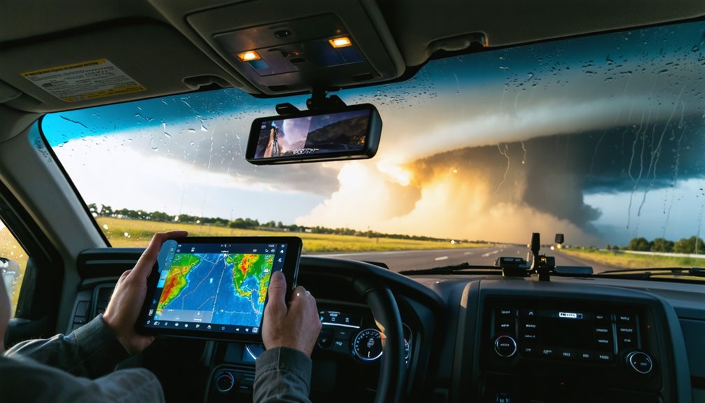
Faster decision cycles and tighter route planning in fall and winter setups demand tools that keep pace with rapidly evolving storm modes. You’re operating in environments where climatology alone fails you—blending climate models with live mesoscale analysis gives you a sharper operational edge.
- High-resolution radar and mobile data platforms let you track storm-mode transitions in real time, cutting reaction lag during fast-moving winter setups.
- Historical data overlays reveal shifting outbreak corridors across the Southeast and Ohio Valley, helping you pre-position without relying on outdated Tornado Alley assumptions.
- Traffic-aware digital routing tools integrate road conditions with storm movement, giving you actionable escape vectors before situations deteriorate.
You’re not just chasing storms—you’re processing a dynamic data stream. The chasers who stay free and safe are the ones who’ve built adaptive, tech-driven decision frameworks.
Faster Decisions in Multi-Tornado Outbreak Conditions
Multi-tornado outbreak conditions compress your decision window to minutes, not hours—mesoscale analysis and rapid target updates aren’t optional, they’re your operational baseline.
Historical climate data confirms outbreak days are growing more frequent and concentrated in shifting corridors, so yesterday’s static playbook won’t protect you today.
Weather variability across seasons now demands you monitor evolving hodographs, shear profiles, and storm-relative motion continuously, not just at chase launch.
When multiple supercells are cycling simultaneously, you’re triaging targets in real time. Prioritize discrete, isolated storms over embedded clusters.
Pre-plot escape vectors before you commit to a position.
Route decisions must integrate live radar, traffic-aware mapping, and mesoscale discussion updates simultaneously.
Outbreak environments punish hesitation and reward disciplined, data-driven repositioning over impulsive target switches.
Nighttime Storm Chasing Requires Stricter Safety Rules
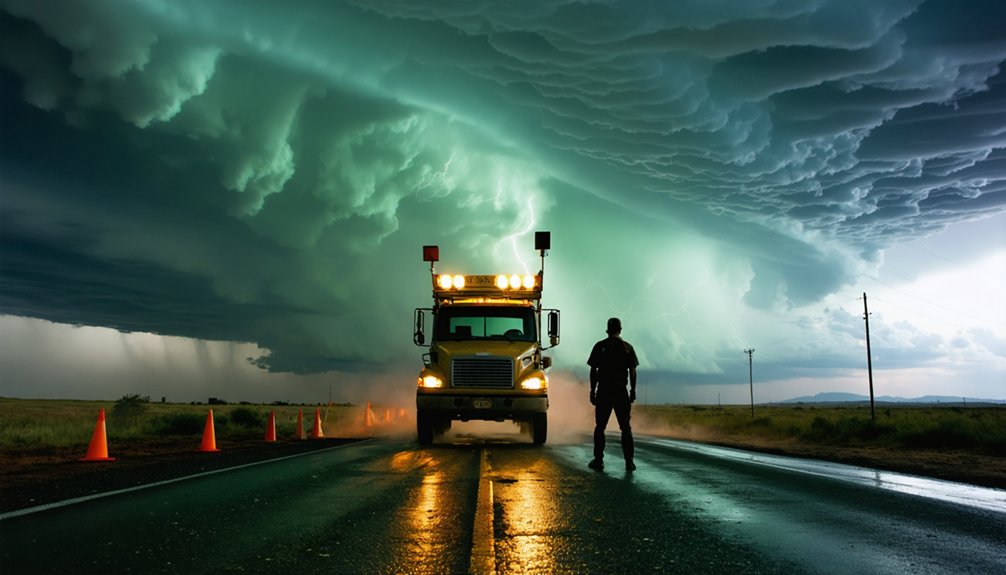
Nighttime tornado chasing carries a measurably higher fatality burden—darkness eliminates visual storm structure cues you’d rely on to judge wall cloud rotation, debris signatures, and storm motion in real time. Visibility challenges compound every decision, forcing complete reliance on radar interpretation without ground-truth confirmation.
Darkness strips away your greatest asset—visual confirmation—leaving radar data alone to stand between you and catastrophe.
Night safety isn’t optional—it’s operationally mandatory.
- Establish hard no-chase thresholds: If visual confirmation of storm structure is impossible, abort the intercept regardless of radar signatures.
- Pre-plan escape routes before dark: Identify road networks, dead ends, and shelter locations during daylight using high-resolution mapping tools.
- Monitor flash-flood risk continuously: Warming-driven precipitation increases make nocturnal flooding a compounding hazard alongside tornado exposure.
Tighten your protocols when the sun sets—the data clearly shows darkness kills.
Chase-Season Risk Planning When Tornado Patterns Keep Shifting
Tornado seasonality is no longer confined to the classic spring window—you’re now tracking credible outbreak potential across fall, winter, and shoulder months, with Southeast and Ohio Valley targets demanding equal weight alongside traditional Tornado Alley corridors.
You should build your seasonal risk calendar around environment-based forecasting models rather than historical hot-spot assumptions, since observed shifts in outbreak concentration and regional frequency are already outpacing older climatological baselines.
Adaptive route planning means you continuously update target regions and escape corridors as mesoscale data evolves, keeping your risk thresholds calibrated to the faster, less predictable outbreak cycles that current research confirms are becoming more common.
Shifting Tornado Season Risks
How you structure your chase season needs to reflect what the data’s actually showing: tornado patterns in the U.S. are shifting in ways that challenge traditional planning assumptions.
Historical patterns once anchored chasers to spring setups across the Southern Plains, but that framework’s increasingly unreliable. Risk perception has to evolve with the observed trends, not lag behind them.
Key shifts demanding updated strategy:
- Southeast and Ohio Valley concentration: Outbreak frequency is rising in these corridors, where terrain and housing density amplify exposure risk.
- Fall and winter activity increasing: Cooler-season severe environments are becoming more favorable, extending your operational window beyond conventional timelines.
- Summer activity declining in some analyses: Redirecting resources toward non-peak months requires flexible scheduling and continuous mesoscale monitoring.
Adapt your planning framework or accept preventable blind spots.
Adaptive Route Planning Strategies
Shifting patterns don’t just change where you target—they force a rebuild of how you construct routes in real time. Climate adaptation isn’t optional anymore; it’s operational. You’re no longer routing primarily through classic Tornado Alley corridors.
Southeast population density, mobile-home concentrations, and flash-flood exposure demand tighter escape-route margins and pre-identified shelter anchors.
Build weather resilience into every leg of your chase plan. Use high-resolution mesoscale analysis to identify environment-favorable zones rather than defaulting to historical hot spots.
Layer traffic-aware routing with live radar to stay ahead of rapid storm motions during multi-tornado outbreaks. Flag low-visibility thresholds before departure, not mid-chase.
Archived regional outbreak data reveals where seasonal shifts are concentrating activity. Let that data restructure your routing logic each season.
Frequently Asked Questions
How Does Climate Change Affect Tornado Intensity Compared to Tornado Frequency?
You’ll find that climate change shows stronger links to tornado energy and intensity than frequency variability. Total counts haven’t clearly risen, but larger outbreaks and stronger events appear increasingly common across available datasets.
What Insurance Considerations Should Storm Chasers Account for in Shifting Regions?
You’ll need to reassess your insurance coverage as tornado activity shifts eastward. Update policies for new regional risks, and review liability considerations when chasing in densely populated Southeast corridors where exposure and legal risk increase markedly.
How Are Storm Chasing Permits or Regulations Changing in Newly Active Tornado Zones?
With Southeast tornado outbreaks up 40%, you’ll encounter evolving local legal compliance requirements in newly active zones. Stay ahead by researching county-specific access rules and integrating updated safety protocols into your chase plan before entering unfamiliar jurisdictions.
Can Amateur Chasers Safely Operate During Cooler-Season Outbreaks Without Professional Training?
You can operate during cooler-season outbreaks, but you’ll need strict safety protocols and full equipment preparedness. These events move faster and strike at night, demanding real-time mesoscale analysis skills that typically require professional-level training to execute safely.
How Do Researchers Collect Tornado Data in Areas Without Traditional Reporting Infrastructure?
Sweeping skies reveal gaps where ground reports fail—you’d use satellite imaging to map damage corridors and deploy drone surveillance to capture structural evidence, letting researchers reconstruct tornado tracks analytically across infrastructure-sparse regions with precision and independence.
References
- https://www.c2es.org/content/tornadoes-and-climate-change/
- https://education.nationalgeographic.org/resource/tornadoes-and-climate-change/
- https://repository.library.noaa.gov/view/noaa/69985/noaa_69985_DS1.pdf
- https://climateinstitute.ca/news/fact-sheet-climate-change-and-storms/
- https://sites.psu.edu/pmarkowski/tornadoes-and-climate-change/
- https://www.congress.gov/119/meeting/house/118088/documents/HHRG-119-II15-20250402-SD001.pdf
- https://www.nationalgeographic.com/environment/article/tornado-extreme-weather-climate-change
- https://oxfordre.com/climatescience/display/10.1093/acrefore/9780190228620.001.0001/acrefore-9780190228620-e-62
- https://www.climatesignals.org/climate-signals/tornado-risk-increase
- https://www.climatecentral.org/climate-matters/severe-storm-supercell-and-tornado-trends-2023