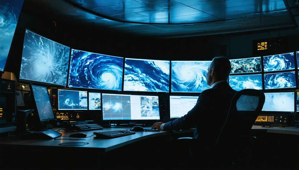
Harnessing satellites to predict storms means combining geostationary and polar-orbiting systems to monitor atmospheric conditions continuously. You can track hurricane intensification using GOES-16’s 30-second imagery across 16 spectral bands, while polar satellites capture high-resolution temperature and moisture profiles at 700–800 kilometers altitude. AI tools like ProbSevere then convert that raw data into actionable tornado and severe weather confidence scores, adding roughly two hours of warning lead time. There’s far more to unpack about how these systems work together.
Key Takeaways
- Geostationary satellites provide continuous regional storm coverage with rapid 30-60 second image updates, ideal for tracking rapid intensification and convective development.
- Polar-orbiting satellites deliver high-resolution atmospheric soundings, capturing critical temperature and moisture profiles from remote regions through approximately 14 daily orbits.
- Satellites detect pre-storm signals like unstable air masses and wind shear patterns through water vapor imagery, often before radar identifies threats.
- AI tools like ProbSevere integrate satellite feeds with weather modeling, providing roughly two additional hours of tornado warning lead time.
- Effective storm forecasting requires combining satellite data with radar, radiosondes, and surface observations to compensate for satellite resolution and coverage limitations.
How Satellites Became the Backbone of Storm Forecasting
Before satellites, meteorologists relied on ground-based radars, radiosondes, and surface observing networks—tools that left vast oceanic and remote regions nearly invisible to forecasters. Satellite evolution changed that permanently.
Geostationary platforms now hold fixed positions over specific regions, delivering continuous cloud and storm imagery every 5 to 15 minutes—sometimes faster.
Polar-orbiting satellites sweep the entire Earth, capturing high-resolution temperature and moisture profiles unreachable by surface systems.
These forecasting milestones gave you access to global atmospheric data that ground instruments simply can’t provide. You can now track storm organization, moisture transport, and rapid convective development across oceans, deserts, and polar zones simultaneously.
Today, satellites don’t just supplement traditional observing systems—they anchor them, forming the backbone of modern storm prediction worldwide.
Geostationary vs. Polar-Orbiting Satellites: Which Does What?
When you examine the two primary satellite types used in storm prediction, you’ll find that geostationary satellites orbit approximately 35,786 kilometers above a fixed equatorial point, delivering continuous regional coverage with image refresh rates as fast as 30 to 60 seconds during severe-weather events.
Polar-orbiting satellites, by contrast, circle Earth at altitudes between 700 and 800 kilometers, completing full global passes that yield higher-resolution atmospheric soundings, including detailed temperature and moisture profiles unavailable from geostationary platforms.
Understanding how each system’s orbital mechanics shape its data output helps you grasp why operational forecasters rely on both types simultaneously rather than treating them as interchangeable tools.
Geostationary Satellites Defined
Two fundamentally different orbital designs serve modern storm prediction: geostationary satellites and polar-orbiting satellites, each occupying a distinct role in the observing system.
A geostationary orbit positions a satellite approximately 35,786 kilometers above the equator, matching Earth’s rotational speed precisely. This synchronization locks the satellite over a fixed geographic region indefinitely, enabling uninterrupted real time monitoring of developing weather systems.
You get continuous imagery of the same domain without waiting for orbital return passes. GOES-16, for example, delivers enhanced severe-weather scans as frequently as every 30 to 60 seconds over targeted areas.
This persistent coverage makes geostationary satellites irreplaceable for tracking rapid storm intensification, convective development, and cloud-top changes across hours-long event cycles, providing the temporal resolution forecasters need to issue timely, accurate warnings.
Polar-Orbiting Satellites Explained
While geostationary satellites hold a fixed watch over one region, polar-orbiting satellites take a fundamentally different approach: they circle Earth from pole to pole at altitudes between roughly 700 and 800 kilometers, completing approximately 14 orbits per day.
This lower altitude delivers superior satellite resolution, capturing finer atmospheric detail than geostationary systems can achieve.
Among polar orbiting advantages, you get precise temperature and moisture profiles across every latitude, including remote oceanic and polar regions where ground-based instruments simply don’t exist.
Each pass covers a fresh swath of Earth, building a complete global picture within roughly 12 hours.
That extensive coverage feeds numerical weather models with high-quality sounding data, directly sharpening storm initiation analysis and extending forecast accuracy well beyond what regional satellite systems alone can provide.
Comparing Their Weather Roles
Both satellite types serve distinct but complementary roles, and understanding those differences sharpens how you interpret forecast data.
Geostationary satellites lock onto one region, delivering continuous storm prediction coverage every 5–60 seconds during severe-weather modes. That consistency lets you track rapid convective development without data gaps.
Polar-orbiting satellites sacrifice continuous coverage for higher-resolution atmospheric soundings, capturing precise temperature and humidity profiles across the entire globe on each pass. You gain deeper vertical detail that geostationary instruments can’t match.
Satellite evolution has pushed both systems toward faster updates, sharper resolution, and expanded spectral channels.
Neither type alone gives you the complete picture—geostationary monitors what’s happening now, while polar-orbiting reveals why atmospheric conditions support storm development in the first place.
What Weather Satellites See That Ground Radar Misses
Ground radar excels at detecting precipitation intensity and wind shear within roughly 200–300 kilometers of its antenna, but it can’t reach beyond that range or see what’s happening over open oceans, remote terrain, or other radar-sparse regions.
Satellites fill those critical gaps, giving you storm visibility across entire ocean basins, polar zones, and developing-world regions where ground infrastructure doesn’t exist. They detect water vapor transport, sea-surface temperature anomalies, volcanic ash, dust plumes, and large-scale convective organization—elements ground radar simply can’t capture.
Through data integration, satellite observations merge with radiosondes, surface stations, and radar networks to build a complete atmospheric picture. That combined dataset drives more accurate short-term forecasts and earlier warnings, especially for storms forming far outside any radar’s effective range.
How Satellites Detect Storm Formation Before It Happens
Before a storm ever shows up on radar, satellites are already reading the atmospheric signals that precede it. Satellite sensors track water vapor channels to identify moisture analysis opportunities—pinpointing unstable air masses hours before convective growth begins.
You’re seeing atmospheric data that ground systems simply can’t capture at scale. Visible and infrared imagery exposes cloud patterns and weather anomalies indicating rapid storm structure development.
Satellite imagery reveals what ground systems miss—cloud patterns and storm structures forming before conventional detection even begins.
Storm tracking becomes sharper when you combine cloud-motion vectors with lightning detection data, revealing rotation signatures before tornadoes form. Satellite-based soundings estimate temperature and humidity profiles that identify exactly where instability is building.
This isn’t passive observation—it’s active atmospheric intelligence. You gain warning lead time that radar alone can’t deliver, especially across oceanic and radar-gap regions where early detection matters most.
Can Satellites Predict Tornadoes?
You might expect satellites to spot tornadoes directly, but they can’t — instead, you rely on indirect indicators like rapid cloud-top rotation, lightning burst frequency, and storm-structure signatures to flag tornado-producing environments.
These methods carry real limitations: geostationary soundings lack the vertical resolution needed to pinpoint the precise atmospheric profiles that trigger tornadogenesis, and visible imagery degrades under low-light or thick cloud conditions.
AI tools like ProbSevere now process these indirect satellite signals faster and with greater precision, giving you roughly two hours of additional warning lead time in documented severe-weather events.
Indirect Tornado Detection Methods
While satellites can’t directly image a tornado’s narrow, low-level vortex, they detect several indirect signatures that strongly indicate tornado-producing environments.
You can leverage tornado detection techniques by analyzing cloud-motion vectors, which reveal mesocyclone rotation and wind shear patterns characteristic of supercell thunderstorms.
Water vapor imagery exposes dry-air intrusions that destabilize atmospheric layers, amplifying tornado risk.
Rapid-scan modes—refreshing every 30 to 60 seconds—capture sudden overshooting tops and explosive convective growth, both precursors to violent surface weather.
Lightning jump algorithms identify abrupt increases in flash rates, signaling intensification.
These storm monitoring advancements, combined with AI-driven pattern recognition tools like ProbSevere, give you approximately two hours of warning lead time.
Understanding these indirect methods empowers you to act decisively before conditions become life-threatening.
Satellite Tornado Prediction Limitations
These indirect detection methods reveal what satellites do well—but they also expose a fundamental boundary you can’t engineer around: satellites can’t directly observe a tornado.
Tornado detection challenges persist because the vortex itself is too small and too low for current geostationary resolution to resolve. You’re working with proxy signals—rotation inference, lightning surges, cloud-top cooling rates—not direct confirmation.
Satellite data limitations also include atmospheric-profile resolution gaps. Geostationary soundings deliver coarser vertical detail than radiosondes, reducing your ability to pinpoint instability thresholds precisely.
Visible channels lose effectiveness at night or under heavy overcast. Even high-frequency 30-second GOES imagery captures environmental context, not the surface-level vortex.
Understanding these constraints lets you deploy satellite intelligence where it’s strongest while avoiding overconfidence in what it fundamentally can’t show.
AI Enhancing Tornado Forecasting
Tools like ProbSevere leverage weather modeling outputs alongside satellite feeds, delivering automated insights that quantify tornado, hail, and wind threats with measurable confidence scores.
Storm tracking becomes faster and more precise when AI processes high-frequency geostationary updates every 30–60 seconds.
You gain roughly two hours of additional warning lead time through this decision support framework, enabling stronger risk assessment and better-informed protective action before dangerous conditions arrive.
Why Faster Satellite Updates Mean Earlier Storm Warnings
When a storm intensifies over minutes, every second of detection lag translates directly into reduced warning lead time. Faster satellite update cycles sharpen prediction accuracy by compressing the gap between storm development and forecaster response.
Modern storm monitoring relies on geostationary satellite technology that refreshes severe-weather zones every 30–60 seconds, enabling data integration across multiple atmospheric layers simultaneously.
These accelerated cycles deliver measurable forecasting innovation:
- Earlier intensification signals — rapid scan modes detect convective growth before radar confirms rotation
- Improved weather analysis — high-frequency imagery captures cloud-top cooling rates, hail signatures, and moisture flux in near real time
- Actionable lead time — AI-assisted satellite tools have demonstrated approximately two-hour warning advantages during documented severe-weather outbreaks
You gain freedom through information. Faster updates mean you decide sooner.
GOES-16 and the New Standard for Storm Monitoring
Faster update cycles only deliver value when the satellite generating them carries the instrumentation to match.
GOES-16 advancements redefined storm monitoring by delivering 16 spectral bands compared to the previous five, tripling spatial resolution, and cutting image delivery time markedly.
Sixteen spectral bands. Triple the resolution. GOES-16 didn’t upgrade storm monitoring — it replaced the standard entirely.
You’re now working with a system that scans the full Western Hemisphere every 15 minutes, targeted storm regions every five minutes, and mesoscale sectors every 30 to 60 seconds.
That data density lets you distinguish ice clouds from water clouds, track convective updraft pulses, and detect rapid intensification signals before ground-based systems confirm them.
GOES-16 also introduced onboard lightning mapping, giving you a continuous electrical activity record that correlates directly with tornado and severe hail potential.
It didn’t improve one capability — it restructured the entire operational baseline.
How AI Makes Satellite Storm Data Actionable in Real Time
When you consider the sheer volume of imagery, spectral channels, and atmospheric profiles that modern satellites generate every minute, you quickly realize that human analysts alone can’t process it fast enough to drive timely warnings.
AI algorithms close that gap by scanning satellite feeds in real time, flagging intensification signals, rotation signatures, and moisture anomalies that demand immediate forecaster attention.
Tools like ProbSevere integrate AI-processed satellite data with radar and lightning observations to sharpen threat probabilities for tornadoes, hail, and flash flooding, compressing the detection-to-warning timeline to roughly two hours or less.
AI Accelerates Data Interpretation
Because modern weather satellites generate enormous volumes of multispectral imagery every few minutes, human analysts alone can’t process that data fast enough to issue timely warnings.
AI advancements now drive faster, more accurate data interpretation by automating pattern recognition across massive satellite datasets.
AI tools deliver actionable severe-weather intelligence by:
- Identifying intensification signals — algorithms detect rapid convective growth, dry-air intrusion, and moisture transport before storms escalate
- Sharpening threat probabilities — ProbSevere integrates satellite data with AI to quantify lightning, hail, wind, and tornado risks simultaneously
- Extending warning lead time — documented cases show AI-assisted analysis providing approximately two hours of advance warning during high-impact events
You gain a critical advantage when AI handles the computational load, freeing meteorologists to act on precise, real-time intelligence rather than chase raw data.
Real-Time Warning Enhancements
AI’s ability to interpret satellite data quickly only delivers value when that output feeds directly into operational warning workflows.
Tools like ProbSevere combine AI-processed satellite observations with radar and surface data to generate real-time alerts covering tornado, hail, wind, and heavy-rain threats. You’re getting probabilistic outputs that sharpen decision windows rather than broad, vague watches.
In documented events, this integration has pushed warning lead time to approximately two hours ahead of impact. Storm detection no longer depends solely on radar coverage; satellite-fed AI fills critical gaps over remote and oceanic regions.
Meteorologists receive automated, continuously updated threat assessments, letting them act faster during high-impact outbreaks. That speed translates directly into more time for evacuation decisions, emergency deployment, and public notification before conditions deteriorate.
What Satellites Still Cannot Do in Storm Prediction
Key constraints you’ll encounter:
- No direct tornado visibility: Satellites infer rotation from cloud-motion vectors, not vortex confirmation.
- Reduced atmospheric profile resolution: Geostationary soundings deliver lower vertical detail than radiosondes or polar-orbiting systems.
- Channel interference: Cloud cover blocks infrared accuracy, while visible imagery degrades without solar illumination.
You can’t treat satellite data as a standalone solution.
Operational forecasting demands integrating radar, surface observations, and radiosondes alongside satellite feeds to compensate for these measurable deficiencies and maintain precise, reliable severe-weather decision-making.
How Next-Generation Satellites and AI Will Change Storm Warnings
While current geostationary systems like GOES-16 already refresh severe-weather sectors every 30–60 seconds, next-generation platforms will push that ceiling further with near-real-time high-definition imagery, denser lightning observations, and substantially higher data volumes.
Europe’s Meteosat Third Generation targets 10-minute full-disk updates with expanded spectral channels, representing one of several next gen advancements redefining operational meteorology.
AI integration accelerates what those improvements deliver. Tools like ProbSevere already fuse satellite data with AI models to sharpen tornado, hail, and flash-flood probability estimates, cutting warning lead times by up to two hours.
Future systems will extend that capability through multispectral pattern recognition and automated storm-volume analysis. You’ll benefit from forecasts that are faster, sharper, and built on richer data than any previous generation of storm prediction technology has ever provided.
Frequently Asked Questions
How Much Does It Cost to Launch a Weather Satellite?
Like reaching for the stars, satellite technology launch funding isn’t covered here. You’ll need to explore external sources for precise cost data, as this guide focuses solely on storm prediction applications.
Who Owns and Operates the World’s Major Weather Satellites?
National agencies own and operate the world’s major weather satellites. You’ll find the U.S. (NOAA), Europe (EUMETSAT), and others driving satellite technology through global collaboration, ensuring you’re never locked out of critical atmospheric data.
How Long Do Weather Satellites Typically Remain Operational in Orbit?
While lifespans vary, you’ll find most weather satellites remain operational for 7–15 years. Despite orbital degradation and operational challenges, geostationary systems like GOES often exceed their designed satellite lifespan, continuously delivering critical storm-prediction data you can rely on.
Can the Public Access Live Satellite Weather Imagery for Free?
Yes, you can freely access live public satellite access through satellite imagery sources like NOAA’s GOES Viewer and NASA Worldview, where you’ll find real-time multispectral data, water vapor imagery, and storm tracking without paywalls or restrictions.
How Many Weather Satellites Are Currently Orbiting Earth Right Now?
The exact count shifts constantly, but you’re looking at over 1,000 active weather-related satellites currently orbiting Earth, collectively advancing satellite technology and storm prediction through continuous, unrestricted global atmospheric monitoring that no single government can fully control.
References
- https://www.rmets.org/metmatters/role-satellites-weather-forecasting
- https://www.weather.gov/about/satellites
- https://news.wisc.edu/beyond-the-weather-forecast-5-ways-uw-satellite-technology-helps-save-lives/
- https://www.polytechnique-insights.com/en/braincamps/science/how-revolutionary-ai-and-satellites-are-changing-weather-predictions/
- https://en.wikipedia.org/wiki/Weather_satellite
- https://www.youtube.com/watch?v=qfJfbK1h2dA
- https://www.l3harris.com/all-capabilities/weather-satellite-technology
- https://www.sciencedirect.com/science/article/pii/S2950616625000300
- https://www.scribd.com/document/948010315/Advancements-in-Weather-Forecasting-Through-Satellite-Technology
- https://www.noaa.gov/stories/6-tools-our-meteorologists-use-to-forecast-weather


