You can trace America’s tornado research back to a 1643 Massachusetts report, but it took centuries of innovation to build a real science around it. The telegraph enabled synchronized storm warnings, John P. Finley introduced systematic forecasting rules in the 1880s, and U.S. Air Force officers cracked measurable prediction in 1948. Scientific storm chasing and VORTEX field campaigns then pushed warning lead times to roughly 15 minutes. There’s far more to this story than you’d expect.
Key Takeaways
- The earliest U.S. tornado report dates to 1643 in Massachusetts, with colonial records laying the groundwork for future scientific research.
- John P. Finley pioneered tornado forecasting in 1878, developing 15 forecasting rules and establishing the first tornado-spotter networks.
- The telegraph’s introduction enabled real-time storm warnings, shifting tornado response from reactive to proactive after 1845.
- Neil Ward executed the first scientific tornado chase on May 4, 1961, during the National Severe Storms Project.
- VORTEX2 deployed over 100 scientists, generating datasets that improved tornado warning lead times to approximately 15 minutes.
America’s First Tornado Reports and Early Observations
Although tornado science has advanced dramatically, America’s earliest recorded encounters with these storms stretch back to the colonial period. You’ll find that before formal research existed, tornado legends and ancient myths shaped how communities interpreted violent windstorms.
The first possible U.S. tornado report dates to July 1643, affecting Lynn, Newbury, and Hampton, Massachusetts. The first confirmed strike hit Rehoboth, Massachusetts, in August 1671. Then, on July 8, 1680, Cambridge, Massachusetts recorded the first confirmed tornadic fatality in American history.
Colonial-era documentation remained sparse because tornado occurrences appeared infrequent within early records. These initial observations lacked systematic methodology, yet they established a baseline from which researchers could later build structured scientific inquiry into tornado behavior, frequency, and geographic distribution across the continent.
How the Telegraph Made Tornado Warnings Possible
When the first commercial telegraph line opened on April 1, 1845, you gained a practical infrastructure for transmitting severe storm warnings across distances that previously made real-time alerts impossible.
That technological foundation directly influenced Congress, which on February 9, 1870, authorized systematic meteorological observations and warning signals, effectively launching a national weather service.
From that legislative mandate, organized forecasting took shape, and continuous tornado data collection by the Weather Bureau followed, running uninterrupted from 1916 onward.
Telegraph’s Early Warning Role
Before the telegraph, storm warnings couldn’t travel faster than the storm itself. You were fundamentally defenseless—your only alert was the darkening sky overhead.
The first commercial telegraph line opened April 1, 1845, essentially restructuring how communities processed incoming weather threats. That urban infrastructure shift meant critical data could now outpace severe weather across hundreds of miles.
When Congress authorized meteorological observations on February 9, 1870, it formalized what the telegraph had made operationally possible: coordinated, real-time warning distribution. You could now receive storm alerts before impact rather than during it.
Researchers also recognized that tracking atmospheric patterns—precursors to what we’d now contextualize within broader climate change discussions—required synchronized, multi-station data networks. The telegraph delivered exactly that capability, transforming tornado awareness from reactive survival into proactive, data-driven response.
Congress Authorizes Weather Observations
The telegraph didn’t just accelerate communication—it made coordinated atmospheric monitoring structurally viable for the first time. On February 9, 1870, Congress authorized meteorological observations and warning signals, establishing the institutional backbone of what would become a national weather service.
This legislative act directly dismantled tornado myths rooted in fatalism—the belief that violent storms were unpredictable acts beyond human understanding.
You can trace modern storm resilience to this precise moment. Centralized data collection replaced fragmented local observations, giving meteorologists synchronized atmospheric readings across multiple stations simultaneously.
The government’s authorization transformed tornado study from anecdotal recordkeeping into systematic science. Communities gained actionable intelligence rather than folklore.
This structural shift—government-mandated, telegraph-enabled, data-driven—created the operational framework that all subsequent tornado forecasting would build upon.
Organized Forecasting Takes Shape
Opening the first commercial telegraph line on April 1, 1845, fundamentally restructured how weather intelligence moved across the country. You can trace modern tornado warning infrastructure directly to this single technological shift. Real-time meteorological patterns could now travel faster than the storms themselves, giving communities actionable lead time they’d never possessed before.
Congress reinforced this capability on February 9, 1870, authorizing formal meteorological observations and warning signals. That legislation transformed historical documentation of isolated tornado events into a coordinated, government-backed recordkeeping system.
Systematic tornado data collection ran continuously from 1916 onward, though report volumes dipped during a roughly 20-year lull between 1896 and 1916.
These combined forces—telegraph infrastructure and legislative mandate—converted tornado research from reactive observation into an organized, analytically driven forecasting framework you could actually rely on.
John P. Finley and the Birth of Tornado Forecasting
If you trace America’s first systematic tornado forecasting, you’ll find John P. Finley at its center, beginning his studies in 1878 as part of the U.S. Army Signal Corps.
He took charge of tornado investigation by 1882. By 1884, he’d developed 15 forecasting rules drawn from the February 19 outbreak and was issuing routine forecasts across 18 regions of the country.
You can also credit Finley with establishing the first tornado-spotter networks, producing the first book dedicated to tornadoes, and creating an early framework for forecast verification.
Finley’s Early Tornado Studies
Among the earliest systematic investigators of tornado science, John P. Finley launched his tornado climatology research in 1878 under the U.S. Army Signal Corps. By 1882, authorities placed him in direct charge of tornado investigation and forecasting method development—a significant institutional commitment to structured analysis.
His historical documentation efforts established baseline datasets you can still trace in modern records. By 1884, he’d built routine forecasts covering 18 distinct regional zones and developed 15 rule-based warning criteria following the February 19, 1884 outbreak.
Finley also constructed the first tornado-spotter networks and authored the first dedicated book on tornadoes. His early forecast verification system introduced analytical accountability into meteorology, giving researchers a replicable framework for measuring predictive accuracy against observed outcomes.
Developing Forecasting Rules
Finley’s organizational work gave tornado science its institutional footing, but his more lasting contribution was methodological: the development of explicit, rule-based forecasting criteria.
After the February 19, 1884 outbreak, Finley codified 15 forecasting rules derived from observable storm formation precursors—atmospheric pressure gradients, wind shifts, temperature contrasts, and cloud behavior. These rules drew directly from tornado climatology, systematically linking environmental conditions to outbreak probability across his 18 designated forecast regions.
You can think of this as the first structured decision framework in operational meteorology. Each rule functioned as a testable hypothesis, making forecasts verifiable rather than speculative.
Finley even built an early verification system to measure forecast accuracy. His approach transformed tornado prediction from intuitive judgment into a disciplined, evidence-based methodology—a foundational shift that still underpins modern warning protocols.
First Tornado Spotter Networks
Beyond rule-based forecasting, Finley recognized that accurate tornado prediction required distributed observational infrastructure—not just centralized analysis. He built the first tornado spotter networks, training volunteers across multiple regions to systematically document storm activity. These observers submitted standardized reports, feeding raw data directly into Finley’s tornado climatology database and strengthening his statistical foundation.
You’d find this approach revolutionary for its time—storm spotter training transformed passive witnesses into active data collectors, extending observational coverage far beyond what centralized stations could achieve.
Finley coordinated these networks through the Army Signal Corps, creating feedback loops between field observers and forecasters. This decentralized model produced measurable improvements in report accuracy and geographic coverage, establishing the structural precedent that modern National Weather Service spotter programs still replicate today.
The Air Force Discoveries That Cracked Tornado Prediction
The late 1940s cracked open a new era in tornado prediction, driven not by civilian meteorologists but by U.S. Air Force officers Ernest J. Fawbush and Robert C. Miller. Their work dismantled long-standing tornado myths by grounding forecasting in measurable atmospheric parameters rather than intuition.
Analyzing historical tornado data alongside real-time surface and upper-air observations, they identified specific instability thresholds, wind shear profiles, and moisture configurations that preceded tornado development.
Their breakthrough came after accurately forecasting a tornado striking Tinker Air Force Base in 1948. That single verified prediction proved operational tornado forecasting wasn’t just possible—it was scalable.
How Tornado Storm Chasing Became a Scientific Discipline
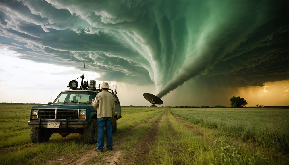
While institutional forecasting advanced inside government offices, storm chasing emerged in the field as a parallel and increasingly rigorous scientific discipline. Neil Ward executed the first scientific tornado chase on May 4, 1961, during the National Severe Storms Project, establishing direct intercept as a legitimate methodology.
Organized field programs launched in the early 1970s across the U.S. Plains, targeting storm behavior through systematic documentation and radar ground-truthing. You can trace tornado climatology’s quantitative advancement directly to these intercept campaigns.
Early chasers prioritized filming and in-situ measurement, then scaled operations using mobile Doppler radar and portable sounders. VORTEX in 1994–1995 and VORTEX2 in 2009–2010 formalized this approach into coordinated, multi-platform field campaigns, producing critical data on tornado genesis that no fixed observing network could replicate.
VORTEX and the Field Campaigns That Changed Tornado Science
Coordinated field campaigns took what individual chasers proved possible and scaled it into organized, instrumented science. VORTEX (1994–1995) deployed mobile Doppler radar, sounders, and instrumented vehicles to capture tornado genesis data that dismantled persistent tornado myths—particularly assumptions about storm symbolism suggesting tornadoes behaved predictably within supercell structures.
VORTEX didn’t just chase tornadoes—it dismantled the myths that made them seem predictable.
VORTEX2 (2009–2010) expanded that framework, coordinating over 100 scientists across multiple mobile platforms simultaneously.
These campaigns generated high-resolution datasets revealing why some mesocyclones produce tornadoes while others don’t—a question no single chaser could answer alone. The National Weather Service credits advances from these programs with pushing average tornado warning lead time to approximately 15 minutes.
You can trace nearly every modern forecasting improvement directly back to the disciplined, data-driven methodology these field campaigns established.
Doppler Radar and the Technology Behind Tornado Research
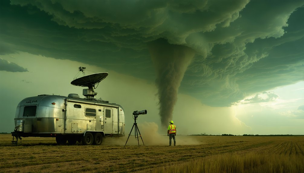
Doppler radar’s role in tornado research predates VORTEX by decades—significant tornadic storm observations were first captured in 1953 by research radars in Illinois and Massachusetts. That foundational work established Doppler imaging as a critical tool for detecting storm rotation within supercell structures before visual confirmation becomes possible.
You can trace modern warning capability directly to these technological advances. Doppler radar measures radial velocity, letting researchers identify rotating mesocyclones embedded in thunderstorms. That detection capacity drives the National Weather Service’s current average tornado warning lead time of approximately 15 minutes—a figure that represents measurable progress over pre-radar baselines.
Mobile Doppler units deployed during VORTEX2 extended this capability into the field, placing high-resolution velocity data directly inside tornadic environments and producing datasets that fixed installations simply couldn’t capture.
How the National Weather Service Delivers Tornado Warnings Today
The radar infrastructure that captures storm rotation feeds directly into the National Weather Service’s warning pipeline, where speed and precision determine outcomes. When forecasters detect a tornadic signature, they issue watches and warnings through an integrated system reaching millions simultaneously. You receive alerts via NOAA Weather Radio, wireless emergency alerts on your phone, and local broadcast interruptions.
Tornado safety depends on acting the moment that warning reaches you—you’ve got roughly 15 minutes of average lead time, which the NWS has worked decades to achieve. Storm preparedness means knowing your shelter location before rotation forms, not after.
The NWS disseminates polygon-based warnings targeting specific geographic corridors, giving you precise threat boundaries rather than broad county-wide alerts. That specificity protects your autonomy by delivering actionable intelligence exactly when you need it.
Frequently Asked Questions
What Is the Deadliest Tornado Ever Recorded in United States History?
The Tri-State Tornado of 1925 holds that grim record—you’re looking at 695 deaths across Missouri, Illinois, and Indiana. Its historical impacts drove meteorological advances, reshaping how researchers analyze, track, and ultimately forecast deadly tornadic events.
How Are Tornadoes Officially Rated for Intensity After They Occur?
You’ll find that tornado damage assessment uses the Enhanced Fujita scale, where investigators analyze structural destruction patterns post-event. This Fujita scale development gives you intensity ratings from EF0 to EF5 based on observed damage indicators.
Which U.S. States Experience the Highest Number of Tornadoes Annually?
You’ll find Texas, Kansas, and Oklahoma dominate tornado formation statistics annually. Storm chasing techniques confirm these states sit within “Tornado Alley,” where atmospheric instability consistently triggers the highest documented twister frequencies you’ll encounter anywhere nationwide.
How Long Does the Average Tornado Typically Last on the Ground?
You’ll find most tornadoes last under 10 minutes on the ground. Understanding tornado formation and applying storm chasing techniques, you can analyze lifespan data analytically, though violent tornadoes occasionally persist over an hour, defying average metrics.
What Safety Steps Should Families Take During a Tornado Warning?
Your shelter’s your fortress—activate your emergency preparedness plan immediately. Move to your lowest interior room, away from windows. Execute your family communication protocol, account for everyone, and monitor official alerts until authorities confirm the tornado warning’s lifted.
References
- https://en.wikipedia.org/wiki/History_of_tornado_research
- https://journals.ametsoc.org/view/journals/wefo/14/4/1520-0434_1999_014_0484_hromtf_2_0_co_2.xml
- https://celebrating200years.noaa.gov/magazine/tornado_forecasting/
- https://vlab.noaa.gov/web/nws-heritage/-/the-start-of-tornado-forecasts
- https://ams.confex.com/ams/pdfpapers/176816.pdf
- https://library.oarcloud.noaa.gov/noaa_documents.lib/NOAA_historic_documents/WB/Key_Meteorological_Records_Doc/KMRD_3.131.pdf
- https://www.nature.com/articles/494312a
- https://journals.ametsoc.org/view/journals/wefo/14/4/1520-0434_1999_014_0558_ahossi_2_0_co_2.xml
- https://academic.oup.com/edited-volume/61804/chapter/546635692?searchresult=1
- https://www.aos.wisc.edu/~hopkins/climate/usa/wahistor.html