You can track Josh Morgerman’s hurricane-chasing method back to three non-negotiable variables: storm intensity, geographic accessibility, and scientific value. He checks Global Forecast System (GFS) model outputs every six hours, identifying intercept windows weeks before landfall using ensemble tracking and pattern recognition. He prioritizes Category 4 and 5 cyclones, where ground-truth data carries the most scientific weight. His full methodology—including how he positions inside an eyewall—goes considerably deeper than that.
Key Takeaways
- Morgerman selects targets based on storm intensity, geographic accessibility, and scientific value, prioritizing Category 4 and 5 cyclones globally.
- He assesses computer models every six hours, using the Global Forecast System to identify intercept windows weeks before landfall.
- Ensemble tracking and pattern recognition guide his risk management and strategic positioning decisions during storm approaches.
- Morgerman deploys research-grade instruments inside fortified shelters, navigating rotating convective bands to collect eyewall data.
- His ground-level measurements fill critical gaps that satellites and aircraft miss, contributing to National Hurricane Center postseason analysis.
Who Is Josh Morgerman and Why Does He Chase Hurricanes?
Josh Morgerman is a stormchaser who’s spent decades doing what most people flee from — running toward hurricanes. He began storm chasing at age 21, targeting violent cyclones across the globe rather than staying within safe, predictable boundaries. His work isn’t reckless thrill-seeking — it’s disciplined cyclone research that produces measurable scientific value.
You can trace his expansion across four hemispheres: the U.S., Mexico, East Asia, and Australia. Each region demanded different strategies, different terrain, and different risk calculations.
He’s penetrated the eyewalls of Category 4 and 5 storms over 50 times, collecting wind speed and pressure data that national agencies actually use.
His motivation combines personal drive with scientific purpose — freedom to chase extreme weather while generating data that matters.
How Josh Morgerman Selects His Hurricane Targets Worldwide
Three core variables shape Morgerman’s target selection: storm intensity, geographic accessibility, and scientific value. His storm selection process filters out weak systems immediately.
You’re looking at a methodology that prioritizes Category 4 and 5 cyclones capable of generating research-grade data unavailable through conventional instrumentation.
His target criteria extend across four hemispheres — Gulf Coast systems, East Asian typhoons, Australian cyclones, and Mexican Pacific storms all qualify.
Geographic difficulty doesn’t deter him; it often attracts him. Storms others ignore in remote locations become prime targets precisely because untouched data carries greater scientific weight.
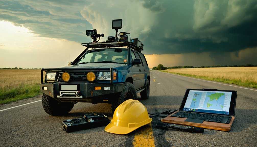
Every six hours, he’s reassessing computer models like the Global Forecast System, recalibrating storm track projections and intensity forecasts.
That disciplined monitoring cycle lets him identify intercept windows weeks before landfall, maximizing positioning precision.
What Forecasting Tools Does Josh Morgerman Use to Track Storms?
To track storms effectively, you’ll find that Morgerman relies heavily on the Global Forecast System (GFS), a computer model that generates weather predictions weeks in advance.
You check GFS outputs every six hours, allowing you to monitor rapid shifts in storm track and intensity with precision.
This disciplined, data-driven approach to model analysis gives you the long-range forecasting window necessary to position yourself ahead of a storm’s landfall.
Global Forecast System Monitoring
When tracking hurricanes weeks before landfall, Morgerman relies on the Global Forecast System (GFS), a computer model he checks every six hours to monitor projected storm paths and intensities.
This disciplined approach to hurricane prediction models lets him identify threatening systems far in advance, giving him time to position himself strategically.
Six-Hour Model Updates
Every six hours, Morgerman pulls fresh GFS model runs to reassess storm track and intensity projections. That update cycle isn’t arbitrary—it aligns with when new atmospheric data gets assimilated into the model, making each run meaningfully different from the last.
You’re fundamentally watching storm tracking evolve in near real-time, with each cycle revealing shifts in projected landfall timing, pressure drops, or intensification windows. Morgerman treats these updates as decision checkpoints, not background noise.
His data analysis approach compares successive runs, flagging where models agree or diverge. Consistency across runs signals confidence; divergence signals caution.
That discipline lets him commit to high-risk positioning days in advance—or pull back when the data tells him to. The six-hour rhythm becomes his operational heartbeat.
Long-Range Storm Predictions
Weeks before a storm makes landfall, Morgerman’s already running projections through the Global Forecast System, treating long-range model output as a probabilistic map rather than a definitive forecast.
His long range forecasting approach lets him position himself strategically while others react last-minute. Storm prediction at this lead time isn’t about certainty — it’s about calculated risk management.
His multi-week outlook relies on three core principles:
- Pattern recognition: Identifying atmospheric setups that historically favor rapid intensification
- Model ensemble tracking: Comparing divergent solutions to gauge forecast confidence intervals
- Logistical pre-positioning: Booking flights and securing fortified locations before evacuation crowds make access impossible
You’re watching someone treat uncertainty as an operational asset — extracting actionable intelligence from noisy data that most people dismiss as too speculative to trust.
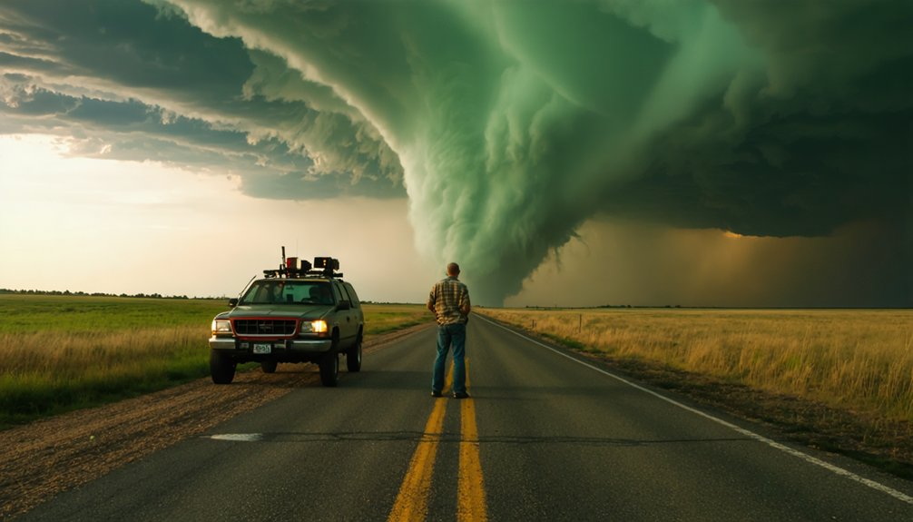
How Does He Actually Get Inside a Hurricane’s Eyewall?
Getting inside a hurricane’s eyewall isn’t a matter of simply driving toward a storm—it requires precise positioning, fortified shelter, and meticulous timing.
Josh’s eyewall penetration techniques depend on identifying structurally reinforced locations—typically hardened hotel rooms—where he can withstand roaring winds and violently trembling structures while collecting pressure and wind data.
Storm core navigation demands that he position himself directly beneath rotating convective bands, targeting eyes sometimes as narrow as five miles wide.
Navigating a storm’s core means threading through rotating convective bands to reach eyes barely five miles across.
He monitors computer models every six hours, refining his approach as landfall nears.
Once inside, he deploys research-grade instruments that capture readings the National Hurricane Center later uses in postanalysis.
Every decision is calculated—wrong positioning means missed data, compromised safety, or both.
Precision isn’t optional; it’s the entire methodology.
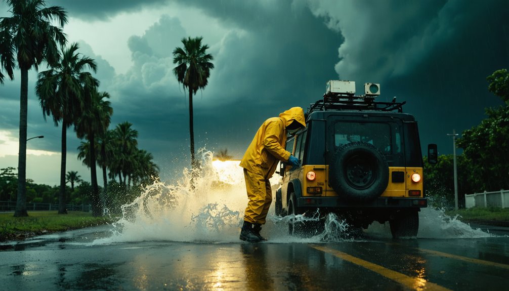
The Hurricane House and Field Equipment That Power His Research
Behind every eyewall penetration is a support infrastructure that makes the data collection possible in the first place. Morgerman’s Hurricane House in Bay Saint Louis, Mississippi, anchors his research data collection with professional-grade instrumentation that captures what satellites and aircraft often miss.
His Hurricane House equipment delivers ground-truth readings that independently verify or challenge official intensity estimates — data that carries real consequences:
- His Hurricane Odile pressure reading of 943.1 millibars directly invalidated Mexico’s insurance-bond payout.
- National Hurricane Center incorporates his seasonal postanalysis readings into official storm records.
- Co-authored peer-reviewed papers cite his field measurements as primary source data.
You’re looking at an independent operation producing institutionally significant results. No government funding. No bureaucratic gatekeeping. Just precise instrumentation, disciplined monitoring, and the freedom to chase storms others won’t touch.
Josh Morgerman’s Most Dangerous Storms: And What He Survived

When you examine Morgerman’s most dangerous intercepts, three storms define the outer limits of survivable field conditions: Super Typhoon Haiyan, Hurricane Dorian, and Hurricane Odile.
Haiyan, which struck the Philippines in 2013, carried the worst death toll of any storm he’s observed and stands as his most significant chase on record.
Dorian delivered one of his most extreme eyewall penetrations, while Odile produced a measured center pressure of 943.1 millibars—a reading decisive enough to disqualify Mexico from an insurance-bond payout by nine millibars.
Surviving Super Typhoon Haiyan
Super Typhoon Haiyan stands as Morgerman’s most consequential intercept—a Category 5 storm that struck the Philippines in 2013 with sustained winds exceeding 190 mph and a death toll surpassing 6,000.
You’d understand the Haiyan impact better knowing he survived the eyewall using deliberate survival techniques: fortified shelter selection, disciplined positioning, and continuous model monitoring beforehand.
His data from inside that storm became irreplaceable scientific documentation of history’s most powerful landfalling cyclone.
- Morgerman positioned inside a reinforced structure as winds obliterated surrounding infrastructure
- He recorded pressure and wind readings unavailable from any other ground-level source
- The storm’s catastrophic death toll reinforced why accurate intensity data matters for public warning systems
That combination of courage and methodology transformed a survival story into measurable scientific contribution.
Hurricane Dorian’s Extreme Eyewall
Haiyan set the benchmark for what Morgerman could endure—but Hurricane Dorian in the Bahamas pushed that benchmark further.
Dorian’s destruction wasn’t just catastrophic on the ground—it was scientifically extreme at the eyewall level. Eyewall dynamics inside a Category 5 storm produce the most violent wind shear and pressure gradients measurable, and Morgerman positioned himself directly within that chaos.
You’re not talking about observing from a safe distance. He penetrated Dorian’s inner core, capturing pressure and wind data during one of the Atlantic’s most intense landfalling hurricanes ever recorded.
That data didn’t just document destruction—it quantified it. For researchers and forecasters, those measurements translate into better models, sharper intensity predictions, and ultimately, stronger warnings that protect the freedom of coastal communities to make informed evacuation decisions.
Odile’s Record-Breaking Pressure
Hurricane Odile delivered one of Morgerman’s most consequential data captures: a center pressure reading of 943.1 millibars measured directly inside the storm’s core as it struck Mexico.
Odile’s intensity, confirmed through precise eyewall measurements, carried real financial weight—his readings disqualified Mexico from an insurance-bond payout by nine millibars.
That’s not atmospheric data sitting in a spreadsheet. That’s pressure readings reshaping economic outcomes:
- A nine-millibar difference determined whether a sovereign insurance bond triggered a payout
- Morgerman’s ground-truth readings contradicted or confirmed what satellites couldn’t definitively establish
- Independent field data gave institutions verifiable numbers free from bureaucratic estimation
You’re watching one person’s instruments influence policy-level decisions. That’s the power of independent, uncompromised data collected where few choose to stand.
How His Data Helps the National Hurricane Center
When Morgerman positions himself inside a hurricane’s eyewall, he’s collecting pressure and wind readings that the National Hurricane Center directly incorporates into its postseason analysis. His ground-level measurements fill critical gaps that satellites and aircraft reconnaissance sometimes miss, strengthening data accuracy across the historical record.
His readings have served as decisive factors in determining a storm’s actual landfall intensity — classifications that carry real consequences for insurance payouts, infrastructure policy, and future storm predictions. The Odile pressure measurement alone redefined how that storm’s impact got categorized.
You can think of his work as independent verification — a ground truth layer that government agencies can’t easily replicate without someone willing to stand inside the most dangerous storms on Earth and take precise measurements when it matters most.
Why the Gulf Coast Remains His Toughest Hunting Ground
Despite the global reach of Morgerman’s data contributions, his most operationally difficult intercepts happen closest to home. The Gulf Coast’s terrain challenges create unique tactical problems that exotic locations don’t replicate.
- Marshy landscapes and road limitations cut off viable positioning routes, forcing compromised chase strategy decisions under time pressure.
- Storm surge along the U.S. Gulf Coast reaches intensities uncommon elsewhere, threatening equipment and escape corridors simultaneously.
- Repeated high-stakes intercepts in familiar territory accelerate burnout risks, draining focus that precision data collection demands.
You’d assume home-field advantage simplifies execution, but the Gulf Coast inverts that logic entirely. When roads disappear into wetlands and surge cuts your exit, you’re not chasing the storm — you’re negotiating survival while still collecting actionable meteorological data.
The Physical and Emotional Toll of Chasing Hurricanes Worldwide
Surviving eyewall penetrations across four hemispheres extracts compounding physical and psychological costs that no single-season data summary captures.
You’re enduring roaring winds, trembling structures, and storm surges while simultaneously collecting precision measurements under extreme duress. That operational demand requires both physical endurance and emotional resilience working in parallel, not alternately.
Post-season fatigue mirrors what professional athletes experience after sustained high-intensity competition. Bad seasons compound the psychological weight, layering grief over logistical exhaustion.
You don’t simply recover between chases; you recalibrate your entire threat-assessment framework.
Yet autonomy drives continuation. You’re not institutionally obligated to intercept Category 5 storms globally — you choose it. That freedom sustains motivation when burnout threatens productivity.
Without it, the data stops, the peer-reviewed contributions stall, and decades of accumulated atmospheric intelligence go uncollected.
Frequently Asked Questions
How Does Josh Morgerman Fund His Global Hurricane Chasing Operations?
The provided knowledge doesn’t specify Josh’s exact funding sources, but you’d likely explore sponsorship deals with weather tech firms and crowdfunding campaigns, leveraging your peer-reviewed data contributions and global storm-chasing credibility to secure independent financial backing.
Has Josh Morgerman Ever Had to Abandon a Chase Mid-Storm?
The provided knowledge doesn’t confirm he’s abandoned a chase mid-storm. His chase strategies prioritize storm safety through fortified positions, letting you see how his near-100% success rate reflects calculated, data-driven decisions rather than reactive withdrawals.
Does Josh Morgerman Work Alone or With a Team?
Ironically, you’d think team dynamics and collaboration strategies define his pursuits, but Josh largely operates solo. He’s independently intercepting eyewalls, collecting decisive pressure data, and co-authoring peer-reviewed research — proving individual freedom drives groundbreaking scientific contributions.
How Long Does Josh Morgerman Typically Prepare Before Intercepting a Storm?
You’d start storm preparation weeks ahead, checking models like the GFS every six hours. Your chase logistics sharpen as data refines the path, letting you position precisely before intercepting the most powerful, dangerous storms worldwide.
Has Josh Morgerman Ever Sustained Injuries During a Hurricane Intercept?
The knowledge base doesn’t confirm he’s sustained injuries. You’ll notice his injury prevention strategy relies on storm safety protocols—fortified locations, precise positioning, and data-driven decisions—that’ve kept him operational across 50+ successful, high-intensity hurricane intercepts worldwide.
References
- https://www.youtube.com/watch?v=V5-CLt2PpQc
- https://www.icyclone.com/josh
- https://www.katc.com/lafayette-parish/hurricane-season-is-over-but-for-josh-morgerman-the-chase-never-stops
- https://www.outsideonline.com/outdoor-adventure/environment/josh-morgerman-hurricane-chaser/
- https://92report.com/podcast/episode-159-josh-morgerman-worlds-top-hurricane-chaser/