Storm chasers reshaped tornado research by positioning instrumented sensors directly inside storm environments that radar couldn’t penetrate. You can trace modern tornadogenesis models back to real-time pressure, wind, and debris data collected in Tornado Alley’s most active corridors. Coordinated field campaigns replaced guesswork with empirical measurements, compressing decades of theoretical uncertainty into verifiable datasets. Amateur and professional chasers together expanded spatial coverage and public engagement in ways no centralized program could match alone—and there’s considerably more ground to cover.
Key Takeaways
- Storm chasers provided real-time ground observations that captured critical pressure gradients, debris behavior, and mesocyclone structure during active tornado events.
- The 1972 Tornado Intercept Project replaced informal pursuits with coordinated data-collection protocols, establishing a structured framework for scientific storm observation.
- Close-range sensors and instrumented probes deployed by chasers mapped tornado wind fields with unprecedented precision, advancing tornadogenesis understanding.
- Amateur chasers filled geographic gaps in data collection, providing wider spatial coverage and multi-angle documentation during simultaneous storm events.
- Storm chasing’s cultural impact, amplified by films like *Twister*, drove atmospheric science enrollment and expanded community engagement with severe-weather research.
Why Ground-Level Tornado Observations Changed Everything
Before storm chasers took to the field, researchers relied almost entirely on radar returns and post-storm damage surveys to piece together what tornadoes actually did at ground level. Those methods left critical gaps in understanding tornado dynamics, particularly in the low-level inflow regions where rotation intensifies.
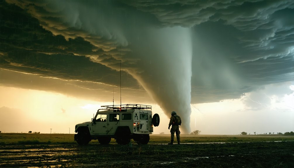
Ground observations changed that equation directly. When you position trained observers within kilometers of a tornado, you capture real-time data on pressure gradients, debris behavior, and mesocyclone structure that no satellite can resolve.
Chasers documented storm evolution continuously, from initial wall cloud formation through tornado dissipation, creating sequential records that radar snapshots couldn’t provide. That direct access compressed decades of theoretical uncertainty into verifiable field measurements, giving atmospheric scientists the empirical foundation they needed to build accurate tornadogenesis models.
How University Programs Gave Storm Chasing a Scientific Backbone
When you look back at how storm chasing gained scientific legitimacy, you find the University of Oklahoma and the National Severe Storms Laboratory at the center of it.
Their 1972 Tornado Intercept Project established the first structured, institution-backed framework for systematic storm observation, replacing informal pursuits with coordinated data-collection protocols.
From that foundation, you can trace a direct line to instrumented probe deployments, mobile weather balloon launches, and in-situ sensor networks that transformed chase vehicles into rolling field laboratories.
Early Institutional Chasing Efforts
Though early storm chasers operated largely on instinct and curiosity, the 1970s marked a turning point when universities and federal research institutions formalized tornado intercept as a scientific discipline.
Institutional collaborations between the University of Oklahoma and the National Severe Storms Laboratory transformed field chasing into structured, data-driven research. These historical milestones reshaped how scientists approached tornado study:
- 1972 – The Tornado Intercept Project launched the first major coordinated chase program.
- 1973 – The Union City, Oklahoma tornado became a foundational supercell research case.
- Instrument deployment – Probes, weather balloons, and sensors collected in-storm pressure and wind data.
- Multi-agency coordination – Federal and university teams standardized chase protocols and data collection.
You can trace modern tornado science directly to these structured early efforts.
University-Led Instrumentation Advances
As institutional storm chasing matured through the 1970s, university programs began engineering the instrumentation frameworks that would turn field observations into quantifiable data.
Teams from the University of Oklahoma and the National Severe Storms Laboratory pioneered sensor deployment strategies that captured pressure gradients, wind velocity, humidity, and temperature directly within storm environments.
These weren’t passive observations — they were structured, repeatable measurements built for data integration across multiple collection points.
Instrument innovation accelerated as researchers developed hardened probes, deployable weather balloons, and vehicle-mounted sensor arrays capable of surviving near-tornado conditions.
Research collaboration between universities and federal agencies expanded field campaign capacity, letting scientists test hypotheses against real storm data rather than theoretical models.
That freedom to measure, analyze, and refine drove atmospheric science forward faster than remote sensing alone ever could.
What Storm Chasers Discovered About How Tornadoes Form
When you examine the findings that emerged from decades of field campaigns, you’ll find that storm chasers generated critical data on tornadogenesis triggers, including the role of rear-flank downdrafts, low-level wind shear, and thermodynamic boundaries in initiating rotation.
By positioning sensors, probes, and radar platforms at close range, chasers mapped tornado wind fields with a precision that remote sensing alone couldn’t achieve, revealing the three-dimensional structure of rotating columns and their interaction with the surrounding storm environment.
That ground-level documentation also captured how supercell storms evolve structurally from initial mesocyclone development through tornado maturity and dissipation, giving researchers a sequential, observational record to test and refine tornadogenesis theory.
Identifying Tornadogenesis Key Triggers
Before storm chasers began collecting close-range field data, researchers had limited tools to test competing hypotheses about how tornadoes actually form. Chase-based observational techniques revealed specific trigger conditions tied to measurable atmospheric instability, wind shear, and storm dynamics.
Field teams identified four core tornadogenesis drivers:
- Wind shear gradients controlling rotational patterns across the storm’s lower boundary
- Environmental factors including moisture flux and boundary-layer thermodynamics
- Data integration from multi-sensor platforms confirming pressure drops near the mesocyclone
- Atmospheric instability thresholds that distinguished tornado-producing supercells from non-tornadic storms
You can trace modern warning improvements directly to these discoveries. Chasers didn’t just document tornadoes—they helped isolate which variables actually mattered, giving forecasters cleaner, more defensible models for predicting tornadic development before it happens.
Mapping Tornado Wind Fields
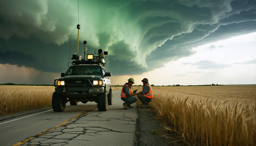
Mapping tornado wind fields required deploying instrumented probes, Doppler-on-Wheels radar units, and vehicle-mounted anemometers close enough to the circulation to capture sub-kilometer velocity structures that standard WSR-88D radar couldn’t resolve.
You’re dealing with observational challenges at every intercept — positioning equipment within lethal range while maintaining data accuracy demands precise timing and coordinated team movement.
Measurement techniques improved substantially once researchers combined mobile Doppler scans with surface probe networks, revealing wind patterns that exposed asymmetric velocity gradients and corner-flow acceleration zones critical to understanding tornado intensity.
These analysis methods confirmed theoretical predictions about storm dynamics while generating datasets that refined vortex-scale models.
Research implications extended beyond Tornado Alley — tighter wind-field maps directly informed structural engineering standards, warning thresholds, and probabilistic damage assessments tied to real-world tornado behavior.
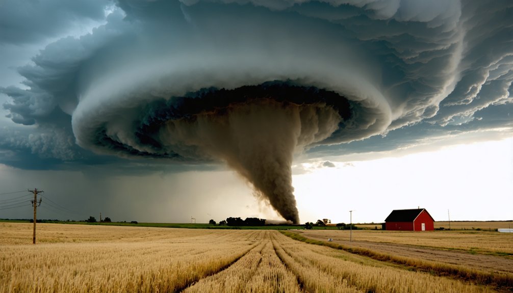
Documenting Storm Structure Evolution
Tighter wind-field maps answered questions about tornado intensity, but they couldn’t fully explain how a storm gets there in the first place. Chasers documented storm dynamics across the full lifecycle, tracking structural changes that radar alone couldn’t resolve. The 1973 Union City tornado became a landmark dataset for tornado morphology research, revealing stage-by-stage development from mesocyclone to mature vortex.
Chasers captured four critical structural phases:
- Inflow organization and boundary-layer convergence
- Mesocyclone intensification and wall cloud descent
- Tornado touchdown and vortex consolidation
- Rope-out stage and dissipation patterns
These sequential observations let researchers test tornadogenesis hypotheses against real storm behavior, building conceptual models grounded in direct field evidence rather than theory alone.
How Storm Chasing Put Tornado Research in the Public Eye
Storm chasing’s growing visibility in popular culture directly accelerated public and scientific interest in tornado research.
Films like *Twister* reshaped public perception, dismantling storm myths while amplifying media influence around severe-weather science. You can trace measurable educational impact through surging atmospheric science enrollment following peak cultural fascination with tornado events.
Scientific outreach expanded as celebrity chasers translated complex tornadogenesis data into accessible formats, strengthening community engagement across Tornado Alley. Risk awareness increased as broader audiences connected storm behavior to real disaster preparedness.
Public attention also attracted institutional funding, enabling larger coordinated field campaigns. That feedback loop—between cultural fascination, media influence, and scientific investment—proved self-reinforcing.
When you understand how visibility drives resources, you recognize why storm chasing‘s public profile directly shaped the trajectory of tornado research.
Why Amateur Chasers Mattered to Tornado Research
While public attention elevated tornado research’s profile and funding, the actual data collection in the field depended heavily on a network that extended far beyond university research teams.
Amateur collaboration filled critical geographic and logistical gaps that institutional teams couldn’t cover alone. Your independent data contribution mattered because distributed observers captured what centralized teams missed.
Amateur chasers delivered four measurable advantages:
- Wider spatial coverage across Tornado Alley during simultaneous storm events
- Multi-angle documentation confirming tornado location, timing, and structural characteristics
- Supplemental sensor data from vehicle-mounted instruments operating outside official program budgets
- Real-time reporting that helped verify radar signatures against ground-truth observations
This decentralized model strengthened severe-weather science by expanding observational density without requiring proportional institutional funding, making amateur participation structurally essential rather than merely supplemental.
How Drones and Field Instruments Pushed Tornado Science Forward
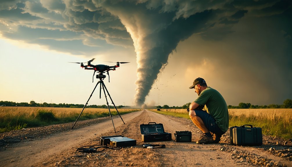
The shift from manual probe deployments to drone-based platforms transformed what researchers could safely measure inside a tornado’s core. Drone technology eliminated much of the physical risk tied to earlier measurement techniques, letting you position sensors directly within high-wind environments without endangering personnel.
Field instrumentation advanced alongside airframe durability, enabling sensor integration across pressure, humidity, temperature, and wind-velocity arrays simultaneously. Data collection became denser and more spatially precise, filling critical gaps in storm analysis that ground-based probes couldn’t reliably cover.
Denser sensor arrays and hardened airframes unlocked storm data that ground-based probes could never reliably capture.
Research collaboration between NOAA, university teams, and independent engineers accelerated development cycles for hardened UAS platforms. Safety measures improved as remote deployment replaced manual intercept strategies.
Together, these advances gave you a sharper, data-rich picture of tornado dynamics that earlier field campaigns simply couldn’t produce.
Frequently Asked Questions
What Legal Regulations Govern Storm Chasers Operating in Tornado Alley Today?
Darkness churns ahead — no federal chaser liability laws bind you. You’ll navigate state traffic codes and trespass statutes independently. Safety regulations remain minimal, leaving your risk assessment, route decisions, and ethical conduct entirely within your own hands.
How Do Storm Chasers Financially Support Their Research and Field Operations?
You’ll fund field operations through sponsorship opportunities from equipment manufacturers and media outlets, while crowdfunding campaigns let you source community backing, covering vehicle costs, instrumentation, fuel, and data-collection tools essential for sustained, analytically rigorous tornado research.
What Psychological Effects Does Repeated Tornado Exposure Have on Storm Chasers?
Repeated tornado exposure tests your psychological resilience, often triggering stress responses that demand active trauma coping strategies. You’ll likely develop analytical detachment, yet data shows prolonged field exposure correlates with measurable anxiety, requiring deliberate mental health management.
How Do Storm Chasers Coordinate With Emergency Responders During Active Tornado Events?
Like a well-oiled machine, you’ll sync tornado tracking data and communication strategies with emergency responders via radio frequencies, real-time GPS position sharing, and standardized reporting protocols, ensuring your field observations directly enhance situational awareness during active tornado events.
What Training or Certifications Are Recommended Before Someone Begins Storm Chasing?
Before chasing, you’ll want meteorology coursework, Skywarn certification, and hands-on storm monitoring experience. Master safety protocols, radar interpretation, and vehicle positioning strategies. These skills let you chase freely while minimizing risk and maximizing data collection efficiency.
References
- https://hull-repository.worktribe.com/preview/4415817/Hunter_ Nicolle – Storm Chasing in Contemporary American Society and Culture.pdf
- https://www.nationalgeographic.com/science/article/130520-tornado-chaser-samaras-thunderstorm-science
- https://research.unl.edu/blog/twisters-draws-from-storm-chasing-science-led-by-nebraska-expert/
- https://www.nationalgeographic.com/environment/article/chasing-tornadoes
- https://www.preventionweb.net/news/what-do-storm-chasers-really-do-two-tornado-scientists-take-us-inside-chase-and-tools-studying
- https://en.wikipedia.org/wiki/Storm_chasing
- https://nhmu.utah.edu/sites/default/files/attachments/When I think of Tornadoes.pdf
- https://www.facebook.com/oklahomamag/posts/in-tornado-alley-researchers-pursue-severe-weather-to-improve-forecasting-while-/1745717606404957/
- https://archive.nytimes.com/dotearth.blogs.nytimes.com/2013/06/04/how-storm-chasers-have-made-tornado-alley-safer/
- https://www.reddit.com/r/IAmA/comments/1eiewgz/were_three_meteorology_researchers_with/