Before radar, you relied on telegraph reports and manual observations to track storms. That changed when WWII operators accidentally discovered radar could detect precipitation. Engineers repurposed military equipment, and by the 1990s, WSR-88D pulse-Doppler systems gave you real-time velocity data before tornadoes even touched down. Mobile units like Doppler on Wheels brought measurements within striking distance of active storms. Every technological leap reshaped how you intercept, analyze, and survive severe weather — and the full story goes much deeper.
Key Takeaways
- WWII radar operators accidentally discovered radar’s ability to detect precipitation, leading to repurposed military technology for civilian weather observation.
- Doppler radar, acquired by NSSL between 1969 and 1973, enabled scientists to document tornado life cycles with unprecedented accuracy.
- WSR-88D pulse-Doppler systems in the 1990s enhanced storm forecasting, becoming the backbone of the National Weather Service’s detection network.
- Mobile radar units like Doppler on Wheels allowed close-range tornado interception, replacing stationary networks with real-time, accurate data collection.
- VORTEX projects revealed tornadogenesis has no single pathway, reshaping prediction science while the 2013 El Reno tornado exposed technology’s safety limits.
How Storm Observers Tracked Weather Before Radar Existed
Before radar existed, storm observers relied on manual documentation and primitive communication networks to track severe weather. You’d find farmers, sailors, and amateur meteorologists recording weather phenomena in meteorological notebooks and publishing early observations in newspapers throughout the 1800s and early 1900s. Their storm documentation formed critical observer networks that established historical context for understanding severe weather patterns.
Data collection remained constrained by significant reporting challenges. When the U.S. Weather Bureau formed in 1870, it leveraged telegraph-based communication methods to distribute storm prediction warnings, yet mobility stayed severely limited.
Early photographers attempted capturing storms, but bulky equipment restricted meaningful visual documentation. You can appreciate how these decentralized observer networks, despite their limitations, created foundational meteorological records that later generations would use to develop far more precise forecasting systems.
The WWII Radar Discovery That Accidentally Transformed Storm Tracking
During World War II, you’d find radar operators noticing unexpected interference cluttering their screens—precipitation and storms were reflecting radio waves back to their equipment, an accidental discovery that revealed radar’s potential beyond aircraft detection.
After the war, military engineers repurposed this technology, redirecting pulse-based radar systems toward systematic weather observation and early storm detection.
Radar’s Accidental Weather Discovery
When World War II radar operators pointed their antennas skyward to track enemy aircraft, they didn’t expect precipitation and storm systems to clutter their screens—but that’s exactly what happened.
This accidental innovation fundamentally redirected radar evolution toward meteorological application. What operators initially dismissed as interference became invaluable atmospheric data.
Post-war engineers recognized the potential, repurposing military-grade radar systems specifically for weather observation. You can trace today’s sophisticated storm-tracking infrastructure directly to those unintended wartime discoveries.
The technology that once frustrated aircraft detection specialists gave meteorologists their first systematic tool for identifying storm structures remotely. Rather than eliminating the “noise,” scientists built entire disciplines around interpreting it—transforming an operational liability into the foundational breakthrough that would eventually enable precise, real-time tornado tracking across the Great Plains.
Repurposing Military Technology Postwar
The radar sets that cluttered Allied instrument panels with precipitation returns during WWII didn’t stay in storage for long after V-J Day. Military repurposing happened fast — engineers redirected surplus hardware toward civilian meteorological applications, launching radar evolution beyond battlefield utility.
You’re looking at a pivotal shift: government scientists systematically converted wartime equipment into tools that could track storm systems with measurable precision. The U.S. Weather Bureau, formed decades earlier in 1870, finally gained detection capability that telegraphs never delivered.
Between 1956 and 1960, Weather Bureau engineers tested 3-cm continuous-wave Doppler radar at Wichita Falls and Wichita, recording winds reaching 205 mph. That quantifiable breakthrough wasn’t luck — it was deliberate, structured application of military technology to atmospheric science, fundamentally expanding your freedom to understand dangerous weather before it reaches you.
Early Storm Detection Breakthroughs
Repurposing military hardware gave meteorologists their instruments, but the discovery that radar could track storms at all arrived earlier — and accidentally.
Sir Robert Watson-Watt’s 1935 thunderstorm detection work laid the groundwork for the first operational radar system. That foundation enabled critical milestones you should understand for historical accuracy:
- 1935 — Watson-Watt develops thunderstorm detection methodology
- 1954 — Hurricane season triggers East Coast radar installations
- 1955 — Three additional stations added, establishing network infrastructure
- 1956–1960 — Weather Bureau tests 3-cm Doppler radar, detecting 205-mph winds
These sequential breakthroughs built the storm classification framework that forecasters still reference today.
Each development expanded detection range, increased data precision, and gave independent researchers verifiable benchmarks — freeing storm science from pure observation into measurable, reproducible analysis.
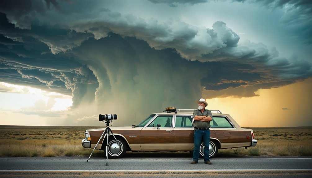
The Pioneers Who Risked Everything to Chase Storms
Before storm chasing became a structured scientific discipline, a handful of determined individuals ventured into violent weather with little more than notebooks, basic instruments, and sheer audacity.
You can trace modern storm chasing back to 1956, when David Hoadley pioneered field observation techniques that prioritized systematic data collection over reckless pursuit.
Neil B. Ward advanced risk management practices in 1961, coordinating with Oklahoma Highway Patrol near Geary to safely document a supercell’s structure on May 4th. Ward’s observations directly identified critical tornado formation characteristics.
The 1965 Palm Sunday Outbreak, which killed 271 people despite existing satellite and radar capabilities, exposed critical forecasting gaps.
These pioneers demonstrated that calculated, disciplined field exposure—not blind courage—produced the actionable meteorological intelligence that ultimately transformed storm prediction accuracy.
How Doppler Radar Gave Storm Chasers Their First Real Edge
When NSSL obtained Doppler radar between 1969 and 1973, you gained the first documented record of a tornado’s complete life cycle, a breakthrough that redefined how researchers approached storm analysis.
By 1981, NSSL engineers made that Doppler data actionable for NWS forecasters, giving you pulse-Doppler technology capable of extracting radial velocity and spectrum width with measurable precision.
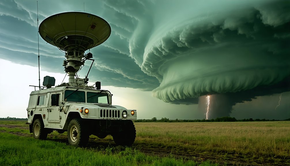
The shift from fixed installations to mobile Doppler units between 1987 and 1993 then placed that data-collection power directly in the field, letting you intercept tornadoes at close range and capture readings no stationary system could reach.
Doppler Radar’s Early Breakthroughs
Three decades after World War II, radar technology was repurposed for weather observation. NOAA’s National Severe Storms Laboratory made a critical breakthrough: between 1969 and 1973, it acquired and operated Doppler radar, documenting a tornado’s full life cycle for the first time.
These Doppler innovations transformed data accuracy and redefined equipment evolution for storm preparedness. Key historical techniques and milestones include:
- 1956–1960: Weather Bureau tested 3-cm continuous-wave Doppler radar, detecting 205-mph winds.
- 1969–1973: NSSL documented complete tornado life cycles, exposing prior radar limitations.
- 1981: NSSL made Doppler data operationally viable for NWS forecasters.
- 1987–1993: Mobile Doppler units advanced observer safety and chasing ethics by enabling closer, controlled data collection.
You now had independent, precise tools — freedom from guesswork.
Tracking Tornadoes With Precision
Once Doppler radar moved from laboratory research into operational forecasting in 1981, storm chasers gained something they’d never had before: real-time radial velocity data that could distinguish a storm’s rotational signature from background noise.
You could now identify mesocyclone development before a tornado touched down, giving you a measurable edge in positioning.
NSSL’s documentation of the full tornado life cycle between 1969 and 1973 transformed how researchers understood tornado dynamics, replacing guesswork with quantifiable wind field data.
By the 1990s, WSR-88D pulse-Doppler systems made this precision publicly accessible, fundamentally reshaping storm forecasting accuracy.
You weren’t maneuvering blind anymore.
Radial velocity scans let you intercept rotation signatures miles ahead, turning reactive positioning into calculated, data-driven interception strategies with actual lead time.
Mobile Radar Changes Everything
Fixed radar networks gave you velocity data, but they couldn’t get close enough to resolve the fine-scale structure of a tornado’s wind field.
Mobile advancements between 1987–1993 broke that barrier, fundamentally reshaping storm data collection and chaser safety protocols.
Here’s what mobile radar evolution delivered:
- Doppler on Wheels collected unprecedented close-range wind measurements during VORTEX2 (2009–2010), improving storm prediction models.
- Technology integration enabled real-time data accuracy, replacing historical methods dependent on stationary networks.
- Communication breakthroughs via XM Weather’s Mobile Threat Net provided 5-minute radar updates directly to chasers.
- Research impact expanded dramatically—tornado life cycles were documented with measurable precision for the first time.
You now had portable instruments delivering actionable intelligence, giving independent chasers genuine scientific capability previously reserved for institutional operations.
How the WSR-88D Became the Most Powerful Storm Radar Ever Built
By 1988, engineers had built and tested the WSR-88D Weather Surveillance Doppler Radar, establishing it as the most powerful storm-detection radar of its time. This WSR-88D advancement represented a critical leap in radar technology evolution, giving you access to data that earlier systems simply couldn’t deliver.
The WSR-88D used pulse-Doppler technology to extract radial velocity and spectrum width simultaneously, pushing detection ranges far beyond previous capabilities. You’re now looking at a system that doesn’t just locate storms — it measures internal wind structure with precision that transforms your decision-making in the field.
This radar became the backbone of the National Weather Service‘s detection network, processing atmospheric data at speeds that finally matched the rapid, unpredictable nature of severe weather systems you’re tracking.
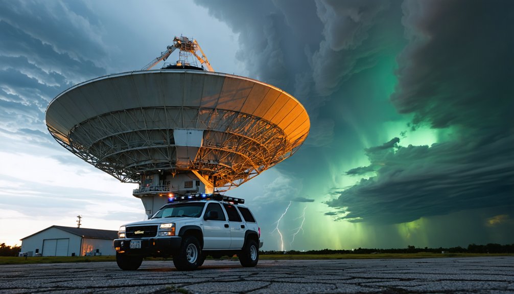
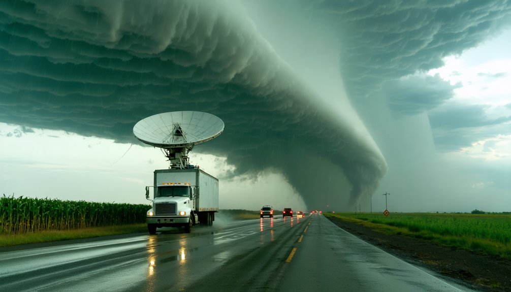
Mobile Radar Trucks and the Data They Captured Up Close
While the WSR-88D gave forecasters fixed-site power, it couldn’t close the distance between the radar beam and the tornado itself. Mobile radar trucks solved that gap directly.
By deploying mobile radar into the field, researchers captured storm-scale data that fixed installations simply couldn’t reach. Here’s what that meant in practice:
- 1987–1993: First portable mobile radar units deployed, collecting close-range tornado measurements.
- 1994–1995: VORTEX projects used mobile radar to study tornado formation with unprecedented data accuracy.
- 2009–2010: VORTEX2 deployed Doppler on Wheels trucks, recording detailed tornado structure data.
- 2013: El Reno data revealed extreme tornado width variations, reshaping safety protocols.
You’re looking at technology that put researchers inside the storm’s envelope, transforming raw danger into actionable, precise meteorological intelligence.
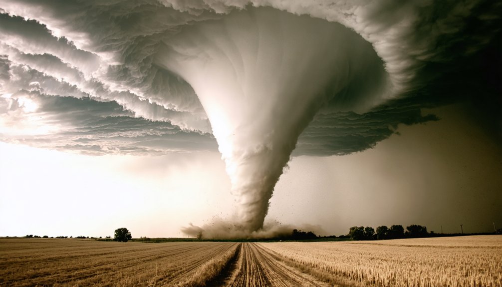
What the VORTEX Storm Chasing Projects Revealed About Tornadoes
The VORTEX projects—1994–1995 and again in 2009–2010—didn’t just chase tornadoes; they systematically dismantled assumptions about how tornadoes form, evolve, and dissipate.
VORTEX findings revealed that tornado behavior is far more irregular than models predicted. You’d expect clean, predictable rotation—instead, researchers documented asymmetrical wind fields, erratic pressure gradients, and rapid intensity shifts that defied earlier theories.
Tornado behavior defied every clean model—asymmetrical, erratic, and shifting in ways researchers never anticipated.
VORTEX2 deployed an unprecedented fleet of mobile technology, including Doppler on Wheels trucks, coordinating simultaneous data collection across multiple storm layers.
This exposed critical storm dynamics: tornadogenesis doesn’t follow a single pathway. Some supercells produced tornadoes; structurally identical ones didn’t. That distinction shattered oversimplified forecasting assumptions.
These projects handed you—and every researcher after—concrete data replacing guesswork, fundamentally reshaping tornado prediction science.
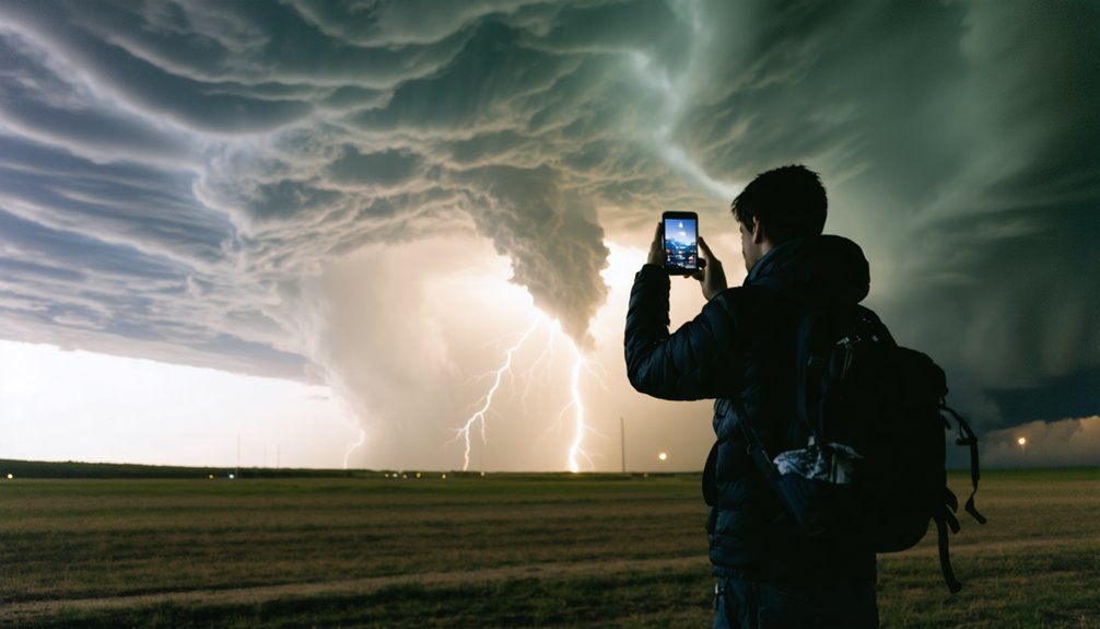
The Tech That Put Live Storm Data in Every Chase Vehicle
Transforming a chase vehicle into a mobile data terminal required solving a deceptively simple problem: getting radar updates fast enough to matter.
Baron’s Mobile Threat Net with XM Weather cracked it in 2004, delivering real-time updates every five minutes through a compact antenna. You’re no longer guessing storm positions—you’re tracking them live.
Four breakthroughs that redefined chase vehicles:
- XM Weather antenna — enabled live tracking under 60,000 feet of cumulus
- 5-minute radar cycles — sharpened real time updates for precise storm forecasting
- NOAA Weather Radio integration — embedded safety measures directly into communication advancements
- Public Doppler access (1990s) — democratized data accessibility, putting professional-grade storm technology into independent chasers’ hands
These tools didn’t just improve chasing—they fundamentally restructured how you intercept dangerous storms.
The 2013 El Reno Tornado and What It Exposed About Storm Chasing’s Limits
Even with every technological advantage at your disposal—mobile Doppler radar, live XM Weather feeds, five-minute update cycles—the 2013 El Reno tornado demonstrated that data alone can’t neutralize the variables a storm introduces at close range.
The tornado expanded to 2.6 miles wide in minutes, killing experienced researchers Tim Samaras, Paul Samaras, and Carl Young. Their deaths forced a hard recalibration of storm chasing ethics across the entire community.
You can’t outrun a storm that redefines its own boundaries faster than your instruments update. That reality exposed critical gaps in tornado safety measures, particularly regarding escape routes and minimum intercept distances.
Technology gives you better information—it doesn’t give you immunity. Knowing when to abandon a chase position remains the skill no radar system can provide.
Frequently Asked Questions
How Do Storm Chasers Stay Financially Supported During Long Chasing Seasons?
You’ll fund long chasing seasons through sponsorship opportunities with weather tech firms and crowdfunding strategies via platforms like Patreon. You can also monetize media footage, secure research grants, and sell real-time storm data to broadcast networks.
What Psychological Effects Does Repeated Storm Chasing Have on Researchers?
You chase, you document, you return—yet storm fatigue quietly reshapes your risk assessment. Repeated exposure desensitizes your threat perception, skews your decision-making thresholds, and compresses your psychological resilience, ultimately compromising your field safety protocols.
Are Storm Chasers Legally Required to Report Tornado Sightings to Authorities?
You don’t face legal obligations for tornado reporting as a storm chaser. No federal mandates require it, but you’re encouraged to voluntarily relay sightings to local NWS offices, enhancing public safety data precision.
How Does Storm Chasing Differ Across Various Countries Outside the United States?
Scattered, sparse storm chasing cultures exist globally, shaped by international weather patterns. You’ll find Europe tracks tempests differently, Australia pursues powerful cyclones, and Bangladesh battles brutal floods — each nation’s approach driven by distinct meteorological data and regional resources.
What Insurance Coverage Options Exist Specifically for Professional Storm Chasers?
You won’t find specific storm chaser insurance policies in the provided knowledge base. However, you’d typically explore specialized high-risk coverage limits through commercial liability and equipment protection plans tailored to your unique field operations.
References
- https://www.stormtours.com/information/storm-chasing-technology/
- https://en.wikipedia.org/wiki/Storm_chasing
- https://journals.ametsoc.org/view/journals/wefo/14/4/1520-0434_1999_014_0558_ahossi_2_0_co_2.xml
- https://www.stmweather.com/blog/a-history-of-tornado-chasing-and-upcoming-girls-who-chase-training
- https://theweathercatfacts.blogspot.com/2025/08/the-history-of-storm-chasing.html
- https://journals.ametsoc.org/view/journals/wefo/13/2/1520-0434_1998_013_0244_hoouow_2_0_co_2.xml
- https://www.proquest.com/docview/196331601
- https://www.dtn.com/a-brief-history-of-weather-radar/
- https://web.archive.org/web/20130215212436/http:/www.magazine.noaa.gov/stories/mag151.htm
- https://www.slideserve.com/ostinmannual/the-history-and-future-of