Effective storm chasing risk assessment requires you to evaluate five interdependent components: atmospheric analysis, real-time radar interpretation, route optimization, team communication protocols, and vehicle readiness verification. You’ll need to continuously monitor moisture, instability, lift, and wind shear while adapting to live radar data. Don’t overlook hazards beyond tornadoes—traffic incidents and flash flooding injure more chasers than storms do. Each component builds on the others, and understanding how they interact gives you a significant operational advantage in the field.
Key Takeaways
- Evaluating moisture, instability, lift, and wind shear forms the foundation of any effective storm chasing risk assessment.
- Real-time radar monitoring of velocity data, hook echoes, and mesocyclone signatures enables timely threat recognition and repositioning.
- Route optimization prioritizing paved roads with multiple exit vectors minimizes exposure to traffic and weather-related hazards.
- Recognizing abort signals, including compromised escape routes and erratic storm motion, prevents dangerous entrapment situations.
- Post-storm reviews of positioning errors, timing miscalculations, and route inefficiencies improve future decision-making and overall chase safety.
Why Storm Chasers Who Skip Risk Assessment Get Caught Off Guard
When storm chasers skip structured risk assessment, they lose the decision-making framework that separates controlled intercepts from dangerous scrambles. Without it, chase psychology shifts from calculated positioning to reactive improvisation.
You start trusting weather intuition over verified data, letting storm expectations override what environmental cues are actually signaling. That gap between assumption and reality is where mistakes happen.
Decision fatigue compounds the problem. As conditions evolve rapidly, unstructured chasers burn mental energy faster, degrading risk tolerance calibration precisely when precision matters most.
Your chase motivation can override judgment, pushing you deeper into hazardous positions without a defined exit threshold.
Emotional resilience also suffers without pre-established benchmarks. You need clear abort criteria before deployment, not mid-intercept.
Skipping assessment doesn’t give you freedom—it removes it.
Reading the Atmosphere Before Your First Decision
Before you make a single positioning decision, you need to evaluate the four core severe weather ingredients: moisture, instability, lift, and wind shear.
You’ll pull this data from SPC outlooks, model soundings, and local radiosonde profiles to quantify CAPE values, shear vectors, and convective inhibition.
Simultaneously, you’re identifying critical atmospheric boundaries—drylines, warm fronts, and outflow boundaries—because storm initiation and intensification are most likely where these boundaries intersect favorable thermodynamic parameters.
Analyzing Severe Weather Ingredients
Every storm chase begins long before you reach the target area—it starts with a disciplined read of the atmosphere using four core severe weather ingredients: moisture, instability, lift, and wind shear.
Your moisture analysis should confirm sufficient dewpoints and boundary layer depth. Instability assessment requires reviewing CAPE values, lapse rates, and capping strength. Lift mechanisms—drylines, frontal boundaries, or upper-level divergence—determine where convection initiates. Wind shear drives storm organization and supercell potential.
Layer in model evaluation using NAM, GFS, and HRRR output to identify timing and placement. Satellite tracking reveals boundary identification through cumulus field development and arc cloud signatures.
Monitor storm evolution continuously as initiation shifts. Each ingredient compounds the others—weakness in one layer can collapse the entire severe weather setup before you ever leave your driveway.
Identifying Atmospheric Boundaries
Atmospheric boundaries define where the storm chase actually begins—drylines, warm fronts, cold fronts, and outflow boundaries mark the convergence zones where lift, moisture contrast, and wind shear align to trigger convection.
Your boundary recognition skills directly determine intercept positioning. Study mesoscale analysis charts to map temperature gradients, moisture transport corridors, and atmospheric layering across your target region.
Frontal dynamics reveal where instability zones sharpen and where storm initiation becomes probable. You’re tracking moisture convergence by monitoring surface dewpoints, wind shifts, and pressure tendencies along boundary edges.
Overlapping convergence zones amplify risk and opportunity simultaneously. Cross-reference radiosonde data with model soundings to confirm wind shear profiles at each atmospheric layer.
Boundaries move—recheck positions frequently, or your positioning becomes obsolete before convection even develops.
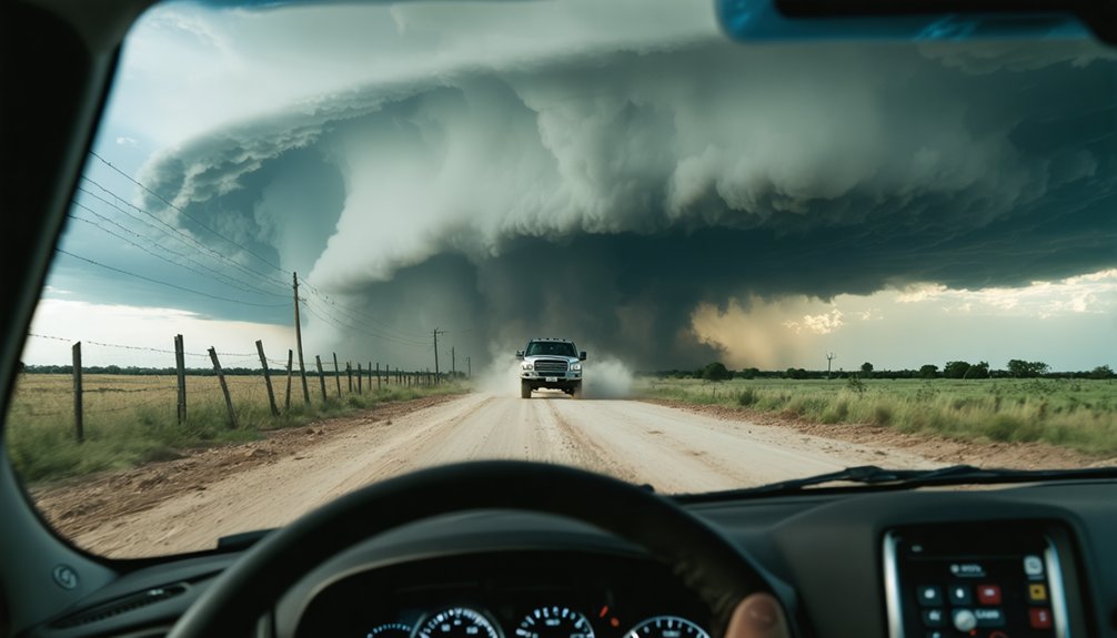
How Real-Time Radar Changes Your Risk Picture
As radar refreshes every few minutes, you must reassess your position relative to the storm’s forward motion, hook echo development, and any emerging mesocyclone signatures.
When velocity data shows increasing rotational shear or a tightening couplet, you identify a credible tornado threat and immediately calculate whether your current road network supports a safe lateral retreat.
You then cross-reference that rotation data against your mapped escape routes, adjusting your intercept angle or abandoning the position entirely if the risk geometry shifts against you.
Radar Updates Alter Positioning
Storm positioning isn’t static—it shifts with every radar update you receive. Each scan cycle reveals new velocity data, reflectivity gradients, and rotation signatures that directly override your previous positioning strategies.
When a hook echo tightens or a mesocyclone strengthens, you need to move—immediately and decisively.
Radar accuracy determines whether you’re in an ideal observation zone or in a rapidly closing threat corridor. A two-minute-old scan can misrepresent storm motion by several miles, so you’re always working against data latency.
Use dual-polarimetric radar when available to distinguish debris signatures from precipitation cores.
Reposition laterally rather than retreating straight back when a storm accelerates toward you. Staying perpendicular to storm motion preserves visibility while maximizing your exit options and overall field safety.
Identifying Rotation In Real-Time
Rotation signatures on Doppler radar transform your risk picture faster than any other single data input. When velocity scans reveal tight couplets of inbound and outbound winds, you’re seeing mesocyclone detection in action. Those storm signatures demand immediate positional reassessment.
Monitor radar reflectivity alongside rotational data—a hook echo paired with strengthening atmospheric shear confirms accelerating storm evolution. Don’t rely on a single scan. Consecutive Doppler analysis frames show whether rotation indicators are tightening or relaxing, giving you directional confidence before committing to a route.
Cross-reference velocity data with visible cloud formations, particularly lowering wall clouds and rapid inflow banding. Wind patterns shift quickly during supercell maturation, so you’ll need sub-five-minute radar refresh cycles to maintain accurate situational awareness and preserve your escape margin.
Adjusting Routes With Data
Adaptive planning means treating every new data layer as a potential route modifier, keeping you mobile, informed, and never boxed in.
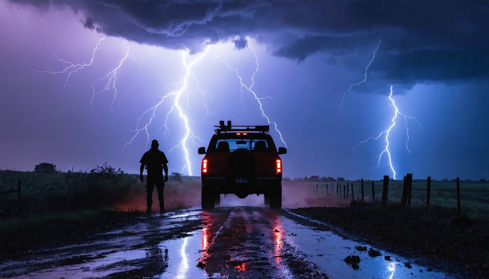
The Hazards That Injure More Chasers Than Tornadoes

While tornadoes dominate public perception of storm chasing danger, traffic accidents and secondary weather hazards injure far more chasers each season.
You’re statistically more vulnerable to high-speed collisions, blown-out tires on wet roads, and hail impacts than to any tornado encounter. Lightning strikes, flash flooding, and side-wind instability compound those risks considerably.
Storm psychology plays a direct role here. Adrenaline distorts your threat perception, pushing you toward reckless positioning and delayed retreat decisions.
Chase ethics demand you recognize that bias and override it with data. Treat hail cores, flooded intersections, and congested chase corridors as primary hazards, not inconveniences.
Real injury patterns in field documentation consistently show road-related incidents outpacing tornado contact. Discipline your decision-making before conditions demand it, not during them.
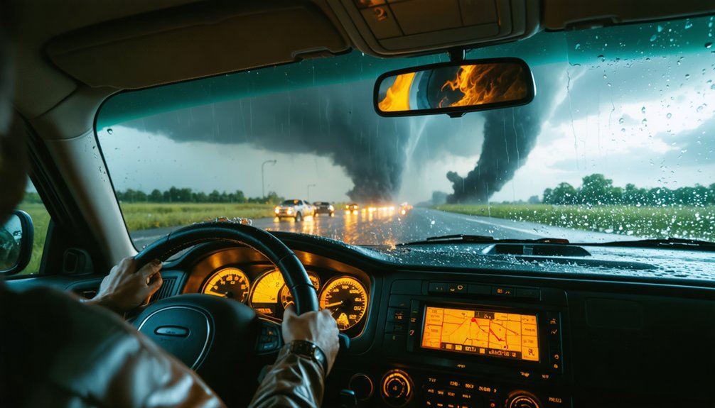
How to Plan Your Route and Build a Workable Escape Strategy
Route planning starts before you leave your staging area, not when a storm is already on top of you. Load your mapping tools, cross-reference road networks against projected storm motion, and complete your terrain assessment early.
Identify primary escape routes and establish backup plans for every viable intercept position.
Route optimization means favoring paved roads with multiple exit vectors, avoiding low-water crossings, and accounting for traffic management challenges near populated areas.
Situational awareness keeps your escape strategy functional as conditions shift. If your primary route floods or gets blocked, you execute emergency protocols immediately without hesitation.
You’re not locked into one path. Build flexibility into every decision, verify road safety continuously using live data, and never let a target position eliminate your ability to retreat cleanly.
How Team Communication Reduces Field Risk
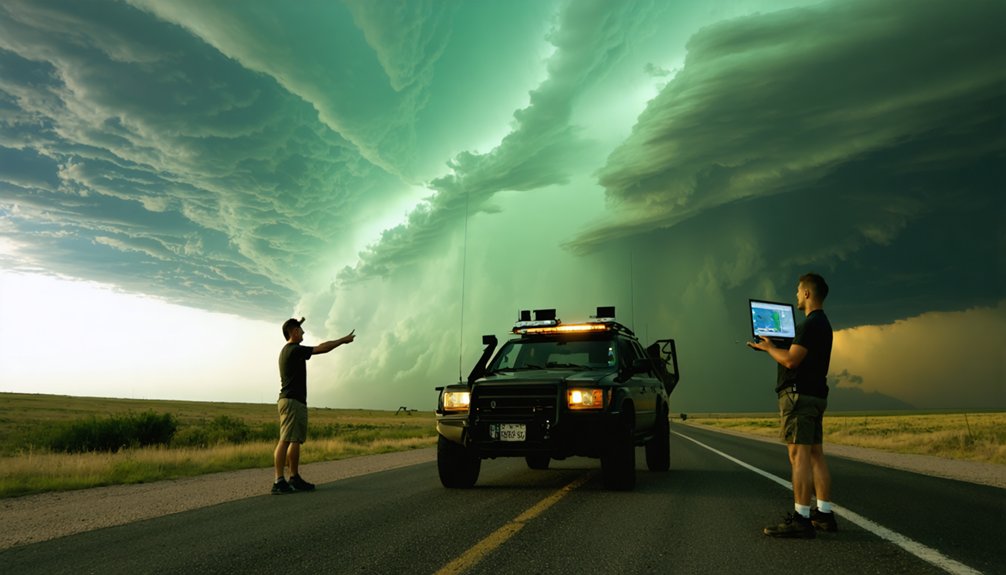
Clear team communication isn’t a soft skill in storm chasing—it’s an operational safeguard that directly reduces decision latency and exposure time in high-risk environments.
Your communication tools must support real-time situational updates, hazard alerts, and rapid decision making without bottlenecks. Standardized protocol standardization eliminates ambiguity when conditions shift fast.
You’ll want redundancy planning built into your communication architecture—satellite phones, mesh radio networks, and encrypted channels operating simultaneously.
Effective team dynamics depend on clearly assigned roles: one navigator, one radar operator, one driver.
Information sharing across multiple chase units strengthens collective awareness and sharpens your coordination strategies.
When each team member transmits clean, structured data instead of fragmented observations, your entire operation gains faster threat recognition and tighter exit timing before dangerous positioning becomes unavoidable.
Vehicle and Gear Readiness That Reduces Chase-Day Risk
Equip your vehicle before chase day, not during it—mechanical failure and supply gaps in the field convert manageable situations into critical ones. Vehicle maintenance, gear selection, and fuel management aren’t optional checkboxes; they’re operational necessities.
Carry emergency supplies, functional communication devices, and reliable navigation tools calibrated to your target region.
- Confirm fluid levels, tire pressure, and brake condition; a compromised vehicle eliminates your escape margin entirely.
- Pack safety equipment and weather protection gear rated for hail exposure, flash flooding, and rapid temperature shifts.
- Maintain fuel above half-tank continuously—remote intercepts can eliminate resupply access for hours.
Your gear loadout directly shapes your decision-making freedom. Underprepared chasers make reactive choices; prepared ones stay proactive, preserving both safety and data collection integrity.
Recognizing the Risk Signals That Mean You Should Abort the Chase
Gear readiness keeps you operational, but no amount of preparation justifies holding a position when field conditions turn against you.
Recognizing abort signals requires continuous chase reevaluation against live data, not gut instinct alone.
Trigger an immediate abort when escape routes become compromised by flooding, gridlock, or terrain. If storm motion accelerates toward your position faster than your exit speed allows, you’ve lost your margin.
Radar-confirmed multiple vortices, erratic storm motion, or rapid cyclic mesocyclone activity signal unpredictable tornado placement.
Low-visibility core punching situations, saturated road networks, and communication failures compound risk exponentially.
When two or more hazard categories converge simultaneously, no observational objective warrants staying.
Disciplined abort decisions aren’t retreats — they’re calculated responses that preserve your ability to chase again tomorrow.
What Post-Storm Reviews Reveal That In-Field Decisions Miss
Reviewing recorded data consistently reveals gaps you won’t catch while chasing:
- Positioning errors: Your logged coordinates often show you were closer to the mesocyclone than radar appeared during intercept.
- Timing miscalculations: Storm motion data frequently reveals you underestimated forward speed, compressing your escape margin.
- Route inefficiencies: GPS tracks exposed unnecessary core proximity caused by road network assumptions made without confirmed data.
You own these insights. Apply them to your next pre-chase forecast briefing to tighten your risk model before you deploy again.
Frequently Asked Questions
How Does Terrain Elevation Affect Tornado Risk During a Storm Chase?
Tornadoes occur 30% less frequently above 6,000 feet. Elevation factors greatly influence terrain impact on tornado formation. You’ll find higher ground disrupts low-level wind shear, reducing rotation potential, so always adjust your chase routes accordingly.
What Insurance Coverage Do Professional Storm Chasers Typically Carry for Chases?
You’ll typically carry equipment insurance to protect your gear and liability coverage to cover third-party damages. Policies often include vehicle collision riders, medical coverage, and specialized riders addressing storm-related operational hazards during active chases.
How Do Seasonal Weather Pattern Shifts Change Annual Storm Chasing Risk Levels?
Like shifting tides, seasonal variability reshapes your annual storm chasing risk levels considerably. You’ll adjust risk mitigation strategies as jet streams migrate, moisture surges, and instability patterns evolve, demanding updated forecasts, revised routes, and recalibrated threat assessments each season.
Are There Legal Permits Required Before Chasing Storms in Certain Jurisdictions?
You don’t universally need permits, but jurisdictional differences mean some states or localities enforce legal requirements for road closures or research access. Always verify regional regulations before deploying to avoid operational delays or fines during active chase scenarios.
How Does Fatigue From Multi-Day Chasing Sequences Affect Field Decision-Making Quality?
When cognitive weariness accumulates across multi-day sequences, your fatigue management falters, degrading mental clarity and distorting risk perception. You’ll experience decision fatigue, causing you to misread storm structure, underestimate hazards, and execute compromised intercept choices independently.
References
- https://crazystormchasers.com/role-of-emergency-preparedness-in-risk-assessment/
- http://www.stormeyes.org/tornado/chasing/FAQ/
- https://www.atms.unca.edu/cgodfrey/courses/swfex/pdf/ChasingSafety.pdf
- https://www.livingskytours.com/storm-chasing-101/
- https://www.youtube.com/watch?v=AKN78EFp3xE
- https://www.stormchasingusa.com/storm-chasing-and-safety/
- https://www.wiu.edu/SevereWeather/images/presentations/How_to_Effectively_Storm_Chase.pdf
- https://www.rims.org/resources/hurricane-storm-risk-management-resources
- https://www.weather.gov/rlx/HazardRiskAssessment
- https://www.scemd.org/media/1453/annex-1-hazard-identification-and-consequence-analysis-chart.pdf