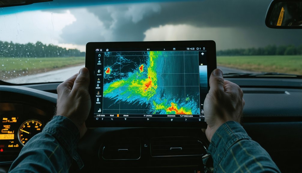
To chase storms safely, you need to track five critical atmospheric trends. Watch dewpoints above 65°F for moisture-rich air and CAPE exceeding 2,000 J/kg for explosive instability. Monitor bulk shear of 40+ knots and helicity above 300 m²/s² to identify rotation potential. Target boundaries like dry lines and cold fronts where storms initiate. Confirm threats using radar signatures like hook echoes and 55+ dBZ reflectivity. Each trend reveals far more than these thresholds suggest.
Key Takeaways
- Dewpoints above 65°F indicate strong storm-supportive moisture; sharp dewpoint gradients over short distances signal prime storm initiation zones.
- CAPE exceeding 2,000 J/kg provides explosive energy for storm development, especially when combined with forcing mechanisms like boundaries.
- Bulk wind shear above 40 knots and helicity exceeding 300 m²/s² strongly favor organized, rotating supercells with tornado potential.
- Cold fronts, dry lines, and boundary intersections concentrate lift and instability, making them the highest-priority storm chasing targets.
- Radar signatures like hook echoes, 55+ dBZ reflectivity, and tight velocity couplets confirm dangerous storms with rotation and large hail.
Dewpoint and Moisture Trends That Signal a Dangerous Warm Sector
When you’re scanning surface observations ahead of a potential chase day, dewpoint readings give you one of the fastest reads on warm-sector quality. Target areas where dewpoints climb above 65°F — that threshold separates marginal moisture from genuinely storm-supportive boundary-layer air. Higher dewpoints fuel stronger updrafts by loading the atmosphere with latent energy that releases once convection fires.
Pay close attention to moisture boundaries, where dewpoint contrasts shift sharply across short distances. Those gradients often mark frontal or mesoscale boundaries where initiation becomes focused. A 10°F dewpoint contrast over 50 miles signals a meaningful boundary worth tracking.
Moist sectors sustain organized convection longer, while dry-air intrusions undercut storm structure quickly. Reading these dewpoint contrasts accurately lets you position yourself in the richest, most dangerous part of the warm sector.
How CAPE and Instability Predict Explosive Storm Development
Once you’ve confirmed solid moisture, instability becomes your next critical filter — and CAPE is the number you’ll lean on most. Values exceeding 2,000 J/kg signal that atmospheric gravity won’t suppress rising parcels easily, giving updrafts the energy to accelerate violently. That’s where convective initiation shifts from a slow build to an explosive breakout.
Watch your Skew-T carefully. Steep lapse rates and strong temperature contrasts aloft amplify vertical acceleration, while a capping inversion can compress that energy until the cap breaks — then you get rapid, intense development.
Don’t chase CAPE alone, though. Without adequate forcing, high instability sits dormant. Pair it with shear, boundary position, and upper-level support to determine whether that available energy actually unleashes into organized, dangerous convection.
Wind Shear and Helicity Thresholds Every Storm Chaser Watches
CAPE gives you the fuel, but wind shear determines whether that fuel burns clean or chaotic. When you’re tracking a potential supercell, you’ll want bulk shear through the lowest 6 km hitting around 40 knots or more. That threshold separates organized, rotating storms from short-lived convective clutter.
Helicity above 300 m²/s² sharpens your tornado risk assessment considerably. Watch your hodograph shape—curved, sickle-like profiles signal rotation-favorable environments before storms even initiate.
Rising lightning frequency and rapidly dropping cloud top temperatures confirm an intensifying updraft, but shear dictates whether that intensity becomes structured rotation or collapses entirely.
You’re reading the atmosphere’s blueprint when you analyze these parameters together. Shear and helicity don’t just support storms—they govern how dangerous your target environment truly becomes.
Boundaries and Fronts That Define Where Storm Chasers Target
Cold fronts, warm fronts, dry lines, and outflow boundaries aren’t just meteorological features—they’re your chase targets. Frontal dynamics concentrate lift, moisture, and instability into tight corridors where storms fire. Boundary shifts can redefine your target within minutes, so real-time updates aren’t optional.
Watch these four boundary signals:
- Tight isobar spacing — stronger pressure gradients signal more dynamic wind fields near the boundary.
- Sharp dewpoint gradients — a 15°F+ drop across short distances marks a potent moisture boundary.
- Temperature contrasts — warm-sector air colliding with cooler air focuses lifting precisely.
- Outflow boundary intersections — where two boundaries cross, rotation potential spikes considerably.
Track boundaries aggressively. Missing a shift means missing the storm.
Radar Signatures That Confirm a Storm Is Turning Dangerous
Radar doesn’t just confirm a storm exists—it tells you whether that storm is organizing into something life-threatening. Watch radar reflectivity closely; values climbing above 55 dBZ signal large hail potential and a strengthening updraft core.
A hook echo emerging on the southwestern flank indicates rotation and possible tornado development—don’t dismiss it. Velocity couplets are equally critical: tight inbound and outbound winds in close proximity confirm a rotating mesocyclone. The stronger and more compact that couplet, the higher your threat level.
Rain wrapping around the mesocyclone visually confirms what radar shows digitally. Cross-reference these signatures with surface observations and soundings rather than treating radar as a standalone tool. Radar gives you confirmation—your job is acting on it decisively.
Frequently Asked Questions
How Does Upper-Level Jet Stream Positioning Affect Severe Storm Development?
When you’re chasing, jet stream dynamics directly enhance severe storm development by boosting upper atmosphere shear and divergence aloft. You’ll find storms intensify fastest where the jet’s entrance and exit regions drive strongest vertical wind structure.
What Role Does the 850 Mb Low-Level Jet Play in Storm Chasing?
Sure, ignore the 850 mb jet—it’s not like it’s hauling moisture, sharpening humidity gradients, lowering your cloud base, or cranking low-level shear to fuel the rotation you’re chasing. It’s doing all of that.
Can a Capping Inversion Actually Improve Storm-Chasing Outcomes Later in the Day?
Yes, a capping inversion can dramatically improve your chase. It preserves surface moisture and builds instability until the cap breaks, then you’ll see explosive updrafts with colder cloud top temperatures signaling violent, well-organized convection.
How Quickly Can Surface Boundaries Shift and Alter a Chase Target?
Surface boundary dynamics can shift your chase target within minutes—not hours. You’ll need real-time updates constantly. Outflow boundaries, dry lines, and fronts alter chase target stability rapidly, demanding you adapt decisions as conditions evolve unpredictably.
Does Dry-Air Intrusion Aloft Always Weaken an Ongoing Thunderstorm?
No, it doesn’t always. Strong wind shear dynamics can offset moisture entrainment losses, maintaining updraft integrity. You’ll find that a robust storm structure sometimes survives dry-air intrusions when shear and instability remain sufficiently favorable.
References
- https://www.instagram.com/reel/DR94nnTjj_r/
- https://www.pbs.org/newshour/science/inside-the-dangerous-and-unpredictable-science-of-storm-chasing
- https://www.reddit.com/r/stormchasing/comments/358qne/im_wanting_to_get_into_storm_chasing_what_should/
- https://science.howstuffworks.com/nature/climate-weather/storms/storm-chaser2.htm
- https://www.youtube.com/watch?v=sG4G23jXiug
- https://crazystormchasers.com/how-to-identify-dangerous-storms-as-a-new-storm-chaser/
- https://crazystormchasers.com/beginner-guide-reading-weather-maps-storm-chasing/
- https://www.youtube.com/watch?v=P3VAiA-VPmU
- https://www.youtube.com/watch?v=G2upCSLvmks