When storms strike, your smartphone becomes your most critical lifeline. Use IPAWS-integrated apps like Beacon or Clime for real-time alerts, and keep your device charged above 80% with a backup power bank. Share your GPS coordinates with responders immediately to accelerate rescue. Follow only verified accounts on social media, and cross-reference all updates before acting. The right technology protocols can mean the difference between danger and survival—and there’s much more you’ll want to know.
Key Takeaways
- IPAWS-integrated apps broadcast real-time official emergency alerts directly to smartphones, enabling faster decision-making during active storm events.
- GPS-enabled tools share precise location coordinates with responders, significantly reducing rescue response times during storm emergencies.
- Keeping device batteries above 80% and storing 10,000mAh backup power banks ensures communication access throughout storm events.
- Drones transmit live aerial footage into isolated areas, extending rescuers’ reach and improving situational awareness rapidly.
- Following only verified accounts like FEMA and NOAA prevents misinformation, ensuring reliable updates during critical storm situations.
How Emergency Communication Technology Keeps You Safer During Storms
When a storm strikes, emergency communication technology becomes your direct link to life-saving information. You’re no longer dependent solely on traditional broadcasts — today’s tools put critical alerts directly in your hands.
Systems like IPAWS push real-time warnings to your smartphone, while cloud-native PSAPs maintain infrastructure resilience even when physical facilities sustain damage.
When infrastructure fails, cloud-native PSAPs keep critical systems online — ensuring alerts reach you without interruption.
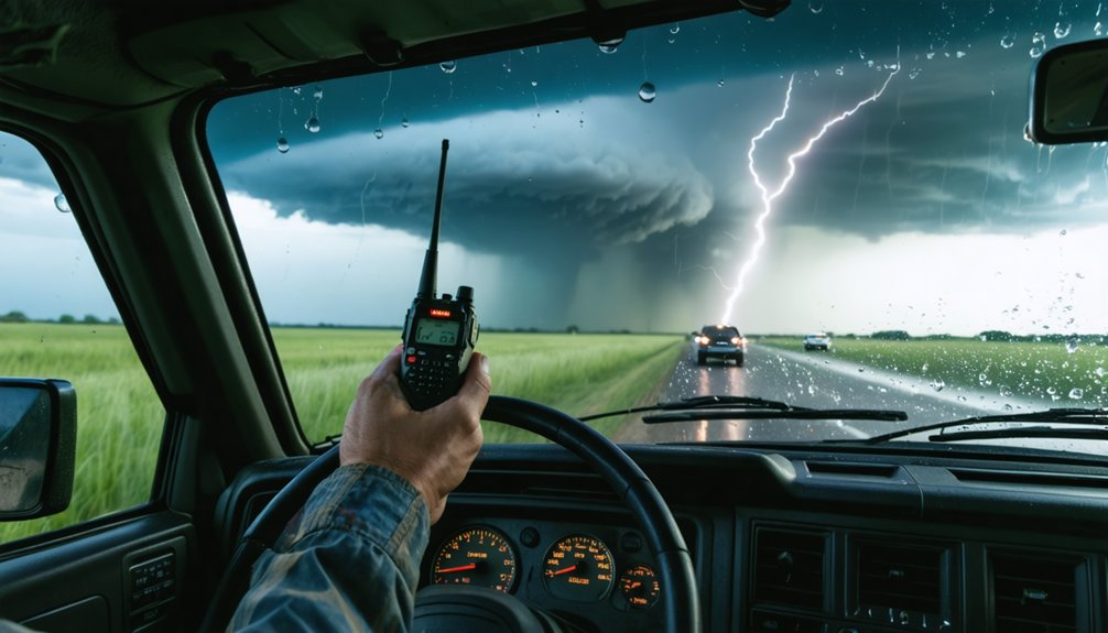
You can track storm movement using live radar apps, coordinate with neighbors through social media platforms, and relay precise location data to responders via voice or text.
Community engagement strengthens these systems further. When you participate in local emergency networks and stay connected with municipal agencies, you amplify collective response capacity.
Technology doesn’t replace preparedness — it accelerates it. Your active use of these tools directly influences how quickly and safely your community recovers.
Best Emergency Apps for Real-Time Storm Alerts and Service Connections
When a storm threatens, the right app puts critical, real-time alerts directly in your hands before conditions deteriorate. Apps like Beacon deliver instant NOAA-based weather alerts, lightning overlays, and direct communication tools that connect you with local emergency services fast.
Knowing which top storm alert apps to install—and how to use them to reach responders—can make the difference between a timely evacuation and a dangerous delay.
Top Storm Alert Apps
How you receive storm alerts can mean the difference between life and death. Choosing the right app puts critical information directly in your hands, keeping you ahead of rapidly developing threats.
For storm forecasting, Clime delivers NOAA-based radar overlays with lightning and hurricane tracking, giving you real-time situational awareness.
The Beacon app strengthens your disaster preparedness by pushing instant weather alerts, recovery resources, and direct communication tools during active emergencies.
IPAWS-integrated apps broadcast official alerts simultaneously to your smartphone and vehicle systems, ensuring you never miss a life-safety warning.
Don’t rely on a single source. Cross-reference multiple platforms, verify alerts through official channels, and act immediately when thresholds are crossed.
Your preparation window closes fast — the right app keeps it open longer.
Connecting With Emergency Services
Reaching emergency services in real time demands more than a functioning phone — it requires the right tools integrated before a crisis begins. Apps like Beacon deliver instant alerts and direct communication channels, connecting you to local agencies without delay.
You’ll want GPS-enabled tools active so responders can pinpoint your location accurately. Voice, text, and live video features let you transmit critical details — license plates, medical conditions, coordinates — fast.
Community resilience depends on individuals who’ve established these connections before storms strike. Emergency preparedness means downloading verified apps, storing emergency contacts offline, and understanding your local IPAWS alert system.
Don’t wait for infrastructure to fail. Configure your tools now, test them, and ensure your household operates from a clear, practiced communication protocol when conditions deteriorate.
How to Use Social Media for Reliable Updates When Disaster Strikes
When disaster strikes, you must follow only verified accounts—local emergency management agencies, official government pages, and trusted news outlets—to avoid acting on false information that can cost lives.
Platforms like Facebook, Twitter, and WhatsApp deliver real-time alerts, but you should cross-reference every update against official sources before sharing or acting on it.
Apply validated source protocols consistently, because unverified posts spread rapidly during crises and can compromise both personal safety and coordinated emergency response efforts.
Verified Sources During Disasters
Sorting reliable updates from misinformation during a disaster can determine whether you make a safe decision or a dangerous one. Follow only verified accounts from FEMA, NOAA, local emergency management agencies, and official law enforcement channels. These sources apply validated source protocols that filter unconfirmed reports before publishing.
Cross-reference information across multiple official platforms before acting. Infrastructure resilience depends on accurate, timely communication reaching citizens without distortion. When community engagement strengthens between residents and local agencies, false rumors spread less effectively.
Flag and avoid sharing unverified posts, even when details seem credible. During active disasters, misinformation travels faster than corrections. Prioritize government emergency portals and IPAWS alerts delivered directly to your smartphone.
Protect your decision-making by treating every unverified source as a potential threat to your safety.
Real-Time Social Media Alerts
Verified sources form the foundation of safe decision-making, and social media extends that foundation when you use it with the same discipline.
Platforms like Facebook, Twitter, and WhatsApp deliver real-time updates directly from local agencies, keeping community engagement active and informed during crises.
Follow these protocols when using social media during disasters:
- Follow only official accounts — government agencies, verified emergency services, and IPAWS-connected channels.
- Guard your data privacy — avoid sharing personal location details publicly; use direct messaging to contact responders instead.
- Cross-reference before acting — confirm alerts across multiple verified platforms before making evacuation or shelter decisions.
Social media moves fast, but your discipline must move faster.
Treat every unverified post as a potential liability and act only on confirmed, official information.
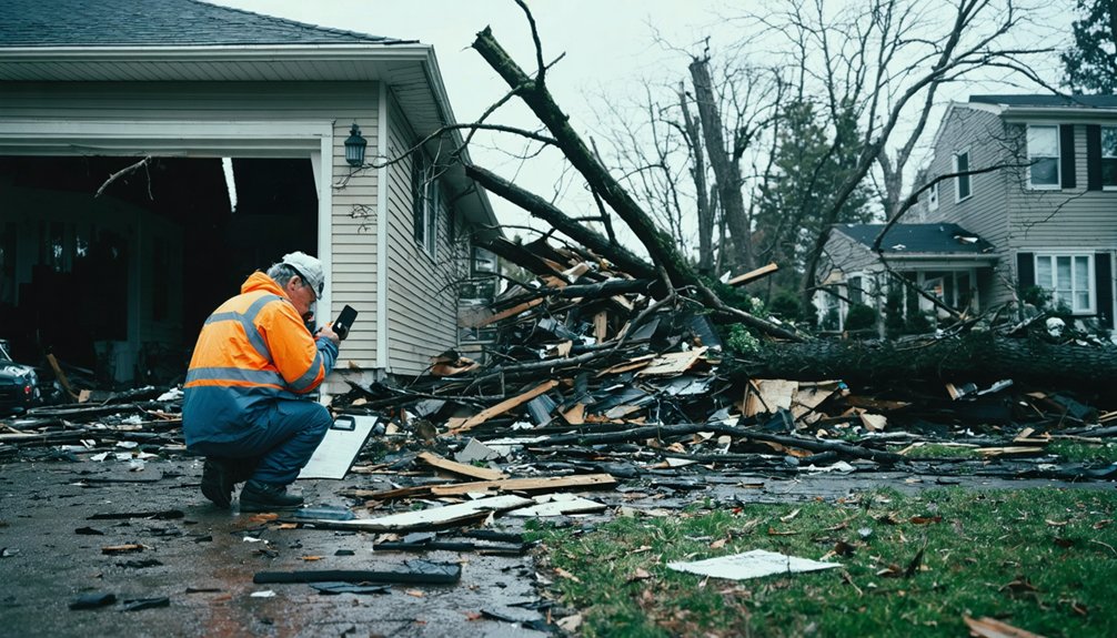
How GPS and GIS Technology Help Rescuers Reach You Faster
During a large-scale disaster, every second rescuers spend maneuvering blindly is a second they’re not reaching you. GPS tracking equips emergency fleets with your real-time position, cutting response times and eliminating guesswork.
Every second rescuers spend maneuvering blindly is a second they’re not reaching you.
GIS layers flood zones, infrastructure damage, and access routes onto a single operational map, letting commanders deploy resources with surgical precision.
When structural collapse blocks traditional entry, indoor navigation technology guides responders through compromised buildings without losing positional accuracy.
When ground access fails entirely, drone deployment extends rescuers’ reach into isolated areas, transmitting live aerial footage directly into GIS platforms for immediate assessment.
Your location data isn’t passive — it actively drives decisions. Sharing precise coordinates with emergency services the moment crisis strikes puts these systems to work for you, accelerating your rescue.
How AI Gives Emergency Teams a Critical Head Start on Storms

GPS and GIS put responders on the ground faster — but AI determines what they face before they arrive. Predictive analytics processes radar feeds, river gauges, and burn scar data simultaneously, converting raw inputs into actionable threat assessments before conditions deteriorate. Data interoperability connects these systems, ensuring no critical signal gets siloed.
AI gives emergency teams a decisive advantage by:
- Flagging flash-flood risk automatically when rainfall exceeds 3+ inches per hour over vulnerable basins
- Firing response playbooks triggered by combined radar data, local thresholds, and infrastructure vulnerabilities
- Identifying evolving storm rotation patterns faster than manual monitoring allows
You benefit directly — faster warnings reach your smartphone, evacuation routes activate earlier, and responders arrive informed. AI doesn’t replace human judgment; it sharpens it before the first unit rolls.
How to Keep Your Devices Storm-Ready Before an Emergency Hits
When AI sends that flash-flood warning to your phone, your device needs to be ready to receive it. Storm preparedness starts with device maintenance long before clouds gather. Keep your battery above 80% during active weather watches, and store a backup power bank with at least 10,000mAh capacity.
Enable IPAWS alerts in your notification settings so warnings reach you automatically. Save emergency contact numbers offline — don’t rely on internet access to retrieve them. Update your emergency apps, including weather radar tools, before storm season peaks.
Protect devices in waterproof cases and keep a secondary communication method available. Your freedom to act quickly during a crisis depends entirely on equipment that works when it matters. Preparation isn’t optional — it’s your first line of defense.
5G Sensors and Digital Twins Reshaping Future Storm Response

As storm systems grow more complex and faster-moving, 5G sensors and Digital Twin platforms are redefining how emergency managers visualize and respond to threats in real time. Through sensor integration, responders now pull live rainfall, river level, and infrastructure data into unified spatial models that mirror actual conditions on the ground.
Real-time data. Unified spatial models. Emergency managers finally see what’s happening on the ground as it unfolds.
Here’s what this technology delivers for you:
- Digital twin environments merge radar, IoT sensors, and satellite feeds into a single operational picture
- 5G sensor integration enables continuous, low-latency monitoring across flood-prone zones and critical infrastructure
- Automated spatial visualizations help councils and emergency teams act on verified data before conditions deteriorate
You’re no longer reacting blindly. These systems give emergency managers the situational clarity needed to protect communities faster and more precisely.
Frequently Asked Questions
What Should I Do if Emergency Communication Technology Completely Fails?
When technology fails like a broken compass, don’t panic—rely on alternative communication methods. Your emergency preparedness plan should include whistles, signal mirrors, and pre-arranged meeting points to keep you connected and free.
How Do I Verify if an Emergency Alert I Received Is Legitimate?
Cross-check alerts via IPAWS-authorized sources like official government websites and local agency social media. Don’t trust unverified messages—use validated source protocols to confirm legitimacy and protect yourself from false alerts through reliable verification methods.
Can People With Disabilities Access Emergency Communication Technologies Effectively?
You can access emergency communications through accessible features like IPAWS alerts, captioning, and visual notifications. Don’t let technology barriers stop you—advocate for inclusive tools that guarantee your right to life-saving information during crises.
How Do Rural Communities Access Storm Communication Technology Without Strong Connectivity?
Like frontier settlers forging paths through wilderness, you can leverage satellite communication and community networks to bypass weak connectivity. These tools guarantee you’re accessing real-time storm alerts, maintaining emergency coordination, and preserving your independence when traditional infrastructure fails.
You’re protected by data privacy laws limiting how agencies use your shared emergency information. Know your legal rights—authorities can’t misuse your personal data beyond crisis response without your explicit consent.
References
- https://www.dhs.gov/sites/default/files/2024-04/23_0426_st_emergency_mgmt_support_report_v2.pdf
- https://videos.trimble.com/library/watch/DdTqBF47gST1McWytzGQgA
- https://www.tylertech.com/resources/blog-articles/navigating-100-increase-in-call-volume-during-freak-storm
- https://www.afac.com.au/docs/default-source/2024-conference-proceedings/259-embracing-new-systems-and-technologies-an-agile-approach-to-flood-and-storm-intelligence_stephen-mcrobert_david-monk_1.pdf?sfvrsn=0&download=true
- http://www.thepattersonfoundation.org/blog/community-preparedness-recovery-and-resiliency/tech-and-preparedness-how-technology-can-help-you-in-a-disaster.html
- https://www.automotive-fleet.com/articles/from-storm-prep-to-emergency-response-the-growing-role-of-telematics-in-disaster-management
- https://www.dhs.gov/archive/science-and-technology/news/2018/10/18/snapshot-st-provides-real-time-tech-solutions-hurricanes
- https://www.npr.org/2018/09/18/649060315/technology-helps-motorists-maneuver-in-a-natural-disaster
- https://www.octave.com/learn/resources/blogs/how-technology-is-reshaping-severe-storm-preparedness-and-response
- https://climeradar.com/blog/radar-storm-tracking-emergency-management