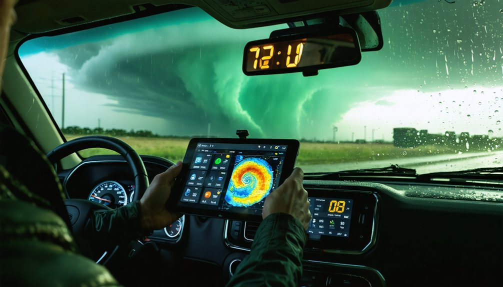
If you’re serious about storm chasing, you need apps pulling directly from NOAA’s NEXRAD radar network, not interpolated guesses. RadarScope delivers dual-polarization data with 99.9% uptime and 15-minute refresh cycles. Clime offers 35 weather layer visualizations and 16-day projections. MyRadar updates satellite imagery every 20 minutes for free. Storm Radar and WeatherWise round out your toolkit with cyclone tracking and point forecasts. Keep going to find out which app matches your exact chasing style.
Key Takeaways
- RadarScope provides NEXRAD dual-polarization radar with 99.9% uptime and 15-minute updates, making it ideal for precision storm analysis.
- Clime offers 35 weather layer visualizations and 16-day NOAA NWS forecasts, supporting long-range storm chasing planning.
- MyRadar delivers free, ad-free severe weather alerts with global satellite imagery updated every 20 minutes.
- Storm Radar supplies 12-hour current conditions and 7-day point forecasts, suiting mobile chasers needing reliable global coverage.
- WeatherWise combines tropical cyclone tracking, storm cell monitoring, and detailed lightning strike metrics for comprehensive severe weather analysis.
Why NOAA Data Separates Serious Storm Chasing Apps From the Rest
When it comes to storm chasing, not all weather data is created equal—NOAA’s NEXRAD radar network delivers 15-minute update intervals that give you actionable, real-time storm cell positioning no commercial alternative can match.
As a storm chaser, you need app effectiveness built on verified sources, not interpolated guesses.
NOAA data integration directly determines weather accuracy and alert reliability. Apps pulling from NOAA NWS feeds give you radar technology that tracks rotation, precipitation intensity, and storm cell movement with precision.
You’re not getting smoothed-over estimates—you’re getting raw, validated atmospheric data.
Real time insights from NOAA’s SRS and NEXRAD layers let you make split-second decisions with confidence.
When alerts fire, they’re grounded in federal-grade observation networks, not third-party algorithms cutting corners on data fidelity.
The Reliability Factors That Matter Most in the Field
Out in the field, data uptime and update frequency aren’t preferences—they’re operational requirements. When you’re tracking a rotating supercell, a 99.9% uptime guarantee—like RadarScope delivers—means your NEXRAD feed won’t drop during critical decision windows.
You need 15-minute radar refresh cycles minimum, and you need them consistently.
Data visualization quality determines how fast you interpret incoming storm data. Apps offering 35 distinct weather layers give you the flexibility to cross-reference satellite imagery, precipitation intensity, and lightning strike activity simultaneously.
The layers you visualize determine the decisions you make—and how fast you make them.
That’s operational leverage.
Update intervals matter equally. MyRadar refreshes satellite imagery every 20 minutes globally, while Storm Radar maintains 12-hour current condition accuracy.
For serious storm tracking, you’re not choosing convenience—you’re choosing the tools that keep your decisions grounded in verified, real-time data.
iOS vs. Android: Which Platforms Support the Best NOAA Apps
Whether you’re running iOS or Android, you’ll find that top NOAA apps like RadarScope, Clime, and MyRadar deliver identical core data sets, including 15-minute NEXRAD updates and 16-day projections, across both platforms.
iOS versions maintain tight integration with native alert systems, while Android builds offer greater customization for overlaying the 35 distinct weather layers that precision storm tracking demands.
Cross-platform data accuracy remains consistent since both pull directly from NOAA NWS feeds, meaning your platform choice ultimately comes down to interface preference rather than data reliability.
iOS App Performance Comparison
Both iOS and Android platforms support the top NOAA apps for storm chasing, but performance differences can affect your real-time data reliability in critical moments.
On iOS, RadarScope’s iOS App Features deliver NEXRAD and SRS radar with 15-minute Update Frequency, maintaining 99.9% uptime. The User Interface Design prioritizes fast Data Integration Methods, pulling directly from NOAA NWS feeds.
Clime’s Performance Metrics include 35 distinct weather layer visualizations with 16-day projections. MyRadar’s App Customization Options let you configure Notification Settings for severe alerts without ads disrupting your workflow.
Storm Radar and WeatherWise round out iOS offerings with 12-hour condition tracking and tropical cyclone monitoring.
User Experience Feedback consistently confirms iOS versions execute background refreshes more reliably, giving you uninterrupted access when storm conditions escalate rapidly.
Android Storm Chasing Features
Android delivers equally capable storm chasing tools, with RadarScope’s 15-minute NEXRAD and SRS radar intervals matching its iOS counterpart’s performance.
You’ll find the Android features across all five apps remain functionally identical to their iOS versions, giving you complete platform flexibility without sacrificing data precision.
Clime’s Android version delivers 7-day hyperlocal forecasts alongside 16-day projections, while MyRadar maintains its free, ad-free satellite imagery with 20-minute global update cycles.
Storm Radar provides 12-hour current conditions and 7-day point forecasts, and WeatherWise tracks tropical cyclones with lightning strike metrics.
The user experience across Android platforms prioritizes direct data access—35 distinct weather layers, real-time NEXRAD feeds, and tropical cyclone monitoring—letting you chase storms without hardware constraints dictating your toolkit.
Cross-Platform Data Accuracy
When comparing iOS and Android for NOAA storm chasing apps, the data accuracy remains consistent across both platforms. RadarScope maintains 99.9% uptime for NEXRAD and SRS feeds. MyRadar updates satellite imagery every 20 minutes globally, and Clime delivers identical 7-day hyperlocal forecasts and 16-day projections regardless of operating system.
Cross-platform compatibility guarantees you’re never disadvantaged by your device choice. Storm Radar provides the same 12-hour current conditions and 7-day point forecasts on both systems, while WeatherWise synchronizes tropical cyclone tracking and lightning strike metrics identically across platforms.
Data visualization techniques, including Clime’s 35 distinct weather layer visualizations, render uniformly whether you’re running iOS or Android. Your platform doesn’t limit your situational awareness—your app selection does.
RadarScope: Professional-Grade NEXRAD Radar for Storm Chasers
When you need professional-grade storm tracking, RadarScope delivers NEXRAD and SRS radar layers with 15-minute update intervals sourced directly from NOAA NWS feeds.
You’ll benefit from 99.9% data uptime, ensuring continuous access to real-time storm cell data without interruption.
This reliability makes RadarScope a dependable tool when accurate, up-to-the-minute radar data determines your safety in the field.
NEXRAD Radar Capabilities
RadarScope stands out as the go-to app for storm chasers who need professional-grade NEXRAD radar data. You’ll get direct access to NEXRAD technology that pulls real-time radar feeds straight from NOAA’s network, updating every 15 minutes for pinpoint storm cell accuracy.
The app also integrates SRS radar layers, giving you an all-encompassing radar visualization that most free apps simply can’t match.
You’re not locked into basic storm overviews here. RadarScope delivers precise dual-polarization data, letting you distinguish rain, hail, and debris signatures with confidence.
Whether you’re tracking a developing supercell or monitoring a fast-moving squall line, the 99.9% data uptime guarantees you’re never left without critical information. This level of reliability gives you the freedom to chase smarter and safer.
Real-Time Data Uptime
Dual-polarization data and SRS radar layers mean nothing if the feed goes down mid-chase. That’s where RadarScope’s data reliability separates it from competitors. The app maintains 99.9% uptime on NEXRAD and SRS feed delivery, giving you radar accuracy you can actually depend on when conditions escalate fast.
That level of forecast consistency directly impacts your user experience in the field. You’re not rejuvenating a dead screen — you’re tracking live storm precision with alert notifications firing on schedule.
The app’s data integration pulls directly from NOAA NWS feeds, updating every 15 minutes without interruption.
For storm chasers who can’t afford gaps in coverage, these app features aren’t optional extras — they’re operational requirements. Reliable uptime keeps you informed, mobile, and ahead of the storm.
Clime and Storm Radar for Long-Range NOAA Forecast Planning
For long-range NOAA forecast planning, Clime and Storm Radar stand out as two of the most data-rich tools available to storm chasers.
Clime features 7-day hyperlocal forecasts paired with 16-day weather projections sourced directly from NOAA NWS, giving you extended planning windows that most apps simply can’t match. You’ll also access 35 distinct weather layer visualizations, sharpening your situational awareness before you hit the road.
Clime’s 16-day NOAA NWS forecasts and 35 weather layers give storm chasers an unmatched planning edge.
Storm Radar advantages center on its 12-hour current conditions combined with 7-day point forecasts covering locations worldwide.
Whether you’re tracking a developing supercell or planning a multi-day chase route, Storm Radar delivers precise, location-specific data without geographic limitations.
Together, these two apps give you the forecasting depth and flexibility to make confident, informed decisions well ahead of severe weather events.
MyRadar and WeatherWise for Satellite and Cyclone Monitoring
When satellite imagery and cyclone tracking are your priorities, MyRadar and WeatherWise deliver two of the most specialized toolsets in the NOAA app lineup. Both apps give you precise, real-time data without ads or unnecessary clutter.
Here’s what you’re getting across both platforms:
- MyRadar updates satellite imagery every 20 minutes globally
- MyRadar provides free, no-ads access to severe weather alerts
- WeatherWise integrates tropical cyclone tracking with storm cell monitoring
- WeatherWise delivers detailed lightning strike metrics alongside cyclone data
- Both apps operate on iOS and Android without feature compromise
You’re not sacrificing accuracy for convenience here. MyRadar’s 35 distinct weather layer visualizations pair cleanly with WeatherWise’s cyclone-specific monitoring suite, giving you independent, redundant coverage when conditions deteriorate fastest.
Where These NOAA Apps Actually Get Their Data
Every app covered so far pulls its core data from NOAA NWS feeds, which deliver 15-minute NEXRAD radar updates as the primary source for storm cell precision.
These data sources feed directly into each app’s integration pipeline, giving you accurate, real-time situational awareness without relying on third-party intermediaries.
Direct data integration means real-time accuracy you can trust when dangerous weather demands split-second decisions.
Global satellite imagery sources supply 35 distinct weather layer visualizations, updating every 20 minutes for worldwide storm monitoring.
Long-term projection data powers 16-day severe alert planning, while hyperlocal forecast engines cover 12-hour current conditions for any location on earth.
Tropical cyclone tracking pulls detailed lightning strike metrics and storm cell data through dedicated integration channels.
Understanding where your app’s data originates lets you evaluate its reliability independently, so you’re never blindly trusting a forecast when conditions turn dangerous.
How Update Intervals and Uptime Affect Real-Time Accuracy
Update intervals and uptime percentages directly determine how much you can trust what’s on your screen during a fast-moving storm.
Poor update frequency or degraded data reliability can cost you critical decision-making time when conditions shift fast.
Here’s what the numbers actually mean for your situational awareness:
- RadarScope maintains 99.9% uptime for NEXRAD and SRS feeds, refreshing every 15 minutes.
- MyRadar updates satellite imagery every 20 minutes globally, giving you consistent storm layer coverage.
- Clime’s 35 distinct weather layer visualizations update independently, maximizing data reliability across sources.
- Storm Radar delivers 12-hour current conditions with consistent point forecast accuracy worldwide.
- NOAA NWS feeds drive 15-minute update frequency, making them the backbone of real-time precision.
You’re only as free as your data is accurate.
Which NOAA Storm Chasing App Fits Your Chasing Style?
Choosing the right app depends on how you chase and what data you prioritize in the field. Your chasing strategies should drive your app selection tips.
If you’re targeting precision radar analysis, RadarScope’s 99.9% NEXRAD uptime and 15-minute update intervals give you the edge. For long-range planning, Clime’s 16-day projections let you position yourself days ahead.
MyRadar suits budget-conscious chasers who need free, ad-free satellite imagery across 35 weather layers. Storm Radar fits mobile chasers needing 12-hour current conditions with global 7-day forecasts.
If you’re tracking tropical systems, WeatherWise delivers detailed cyclone and lightning strike metrics.
Match each app’s core strengths to your specific field demands, and you’ll operate with maximum situational awareness when it matters most.
Frequently Asked Questions
Do Any NOAA Storm Chasing Apps Offer Offline Functionality in Remote Areas?
The knowledge base doesn’t confirm offline maps or data caching features for these apps. You’ll want to verify each app’s offline functionality directly, as remote area coverage depends on your device’s pre-cached data capabilities.
Can Multiple NOAA Apps Run Simultaneously Without Draining Device Battery Excessively?
You can run multiple NOAA apps simultaneously, but you’ll need active battery management to prevent excessive drain. Optimize app performance by limiting background refresh rates, reducing radar update intervals, and disabling non-essential weather layers during extended field sessions.
Are There Subscription Costs Associated With Accessing Premium NOAA Radar Features?
Yes, you’ll encounter subscription costs for premium features in apps like RadarScope and Clime. These subscription benefits release advanced NEXRAD layers, 16-day projections, and 35 weather visualizations, giving you unrestricted, data-precise storm-chasing freedom beyond basic free tiers.
Do NOAA Storm Chasing Apps Support External Weather Station Device Integration?
The reviewed apps don’t explicitly support external weather station device compatibility. You’ll rely on NOAA NWS feeds for data accuracy. For personal station integration, you’d need specialized platforms beyond these five storm-chasing solutions.
Which NOAA Apps Provide Community-Based Storm Spotter Reporting and Crowdsourced Alerts?
The available knowledge doesn’t confirm which apps support community-based storm reporting or crowdsourced community alerts. You’ll want to verify WeatherWise.app or MyRadar directly, as their documented features focus on NEXRAD radar and satellite imagery integration.
References
- https://www.weather.gov/enterprise/fi-app-2d
- https://play.google.com/store/apps/details?id=weatherradar.livemaps.free&hl=en_US
- https://play.google.com/store/apps/details?id=com.ml.TXSC&hl=en_GB
- https://weatherwiki.mikewills.me/doku.php/tools/apps
- https://climeradar.com/blog/best-noaa-weather-apps-for-phone
- https://www.stormtours.com/radarscope-weather-radar-app/
- https://apps.apple.com/be/app/storm-radar-with-noaa-weather/id1216396545
- https://apps.apple.com/us/app/weather-radar-noaa-channel/id649264704
- https://www.reddit.com/r/stormchasing/comments/1qa9hh6/what_radar_app_do_storm_chasers_usually_use/
- https://play.google.com/store/apps/details?id=com.interactiveweather.weatherwise&hl=en_US


