When maneuvering real-time hailstorm analysis, you’re contending with radar’s five-minute scanning gaps, resonance scattering distortions, and unreliable ground-truth reports skewed by population density and subjectivity. No single metric—not MESH, VIL density, or HDR BML—reliably discriminates hail size across all scenarios. Machine learning helps, but biased, sparse training data limits its accuracy at extreme sizes. Understanding each layer of these compounding constraints is your first step toward building a more reliable detection framework.
Key Takeaways
- Radar scans refresh every five minutes, creating blind windows where entire hail-producing storm lifecycles can develop undetected.
- No single radar metric reliably discriminates hail size, particularly at larger, more dangerous scales.
- Resonance scattering and irregular hailstone shapes distort backscatter signals, making accurate real-time size estimation unreliable.
- Ground-truth hail reports are biased by population density, subjectivity, and timing errors, undermining verification accuracy.
- Machine learning models struggle with generalization due to biased training data and underrepresentation of extreme hail events.
Why Hailstorms Are Still Winning Against Modern Meteorology
Despite decades of radar upgrades and modeling advances, hailstorms continue to outpace meteorology’s ability to capture, characterize, and predict them in real time. You’re dealing with storm forecasting systems that refresh every five minutes while entire hailstorms form and collapse within that same window.
Hailstorms form and collapse faster than forecasting systems can refresh—meteorology is perpetually one step behind.
Hail-forming processes operate at sub-grid scales that operational models can’t resolve, leaving critical gaps in your situational awareness. Ground-truth reports arrive late, cluster around familiar reference sizes, and skew toward populated areas—corrupting the very datasets you’d use for verification.
Radar-based hail mitigation efforts face additional constraints: resonance scattering, water-coated irregular hailstones, and inconsistent network calibration all degrade size estimation. No single method closes these gaps.
The physics, instrumentation limits, and data-quality problems compound each other, keeping hailstorms stubbornly ahead of your best tools.
How Radar Detects Hail and Where It Falls Short
When you scan a hailstorm with NEXRAD, you’re pulling metrics like MESH, VIL density, and HDR BML to discriminate hail occurrence and estimate size in near-real time.
Dual-polarization upgrades have sharpened hydrometeor classification, and a multiparameter approach consistently outperforms any single-parameter method.
But you hit hard limits fast: hailstones approaching radar wavelengths trigger resonance scattering, water-coated or irregular stones distort returns, and five-minute scan cycles leave blind windows during rapid storm evolution.
Radar Hail Detection Basics
Radar serves as the fastest operational tool for hail detection, yet significant gaps remain in what it can reliably tell you. Recent NEXRAD upgrades introduced dual radar polarization and higher resolution, improving real-time hydrometeor discrimination and your ability to distinguish hail from rain. These advances let you identify hail occurrence with reasonable confidence and skillfully separate severe from nonsevere storms.
However, reliable size discrimination remains elusive. Hailstones approaching radar wavelengths trigger resonance scattering, distorting your size estimates. Complex shapes, water coatings, and storm electrification further complicate signal interpretation. Calibration differences across radar networks add another layer of uncertainty.
You can detect hail’s presence effectively, but quantifying exact size in real time stays a persistent, unresolved challenge that limits operational decision-making and extreme-event risk assessment.
Key Radar Limitations
Even with dual-polarization upgrades and higher resolution scanning, radar leaves critical gaps in real-time hail analysis. Scans refresh roughly every five minutes, meaning an entire storm can form and drop hail before you capture a single return.
Hailstone sizes approaching radar wavelengths trigger resonance scattering, distorting your size estimates regardless of hail forecasting model sophistication. Water coatings and irregular shapes compound that uncertainty further.
Radar calibration inconsistencies across networks add another layer of error, since differing bands, polarization configurations, and calibration standards make cross-network comparisons unreliable.
Metrics like MESH and HDR BML identify hail occurrence skillfully, but operational size discrimination remains unsolved. No single parameter closes the gap.
You’re left managing irreducible uncertainty, particularly at the extreme tail of the hail size distribution where risk is highest.
The Five-Minute Blind Spot in Radar Scanning
Because NEXRAD and similar operational systems complete a full volume scan roughly every five minutes, a critical blind spot opens during which fast-evolving convective cells can initiate, intensify, and begin producing hail entirely undetected. Within that window, storm microphysics can shift dramatically — ice nucleation accelerates, updraft velocities spike, and hailstone embryos form before your next data refresh arrives.
Radar calibration inconsistencies compound the problem; if calibration drifts between scans, you’re comparing measurements against an unstable baseline, further degrading detection confidence. A complete hailstorm lifecycle can unfold between two scan cycles, leaving you with no continuous trajectory of storm evolution.
Closing this gap demands rapid-scan capabilities, phased-array radar deployment, or supplementary remote sensing assets that reduce update intervals well below five minutes.
The Dirty Truth About Ground-Truth Hail Reports
Ground-truth hail reports sound authoritative, but they’re riddled with systematic biases that quietly corrupt any verification effort you build on top of them. Population density, road networks, and storm chasers dictate where reports cluster—not where hail actually falls.
Observers estimate size against coins or golf balls, artificially compressing the true distribution into discrete jumps. Timing errors shift occurrence records, misaligning surface reports with radar calibration windows and undermining any honest skill assessment.
Hailstone morphology—irregular shapes, water coatings, partial melting—makes physical size harder to infer from both observer estimates and radar returns simultaneously.
Europe lacks a standardized surface observing network entirely. You’re fundamentally verifying sophisticated detection algorithms against anecdotal, delayed, spatially uneven data.
Acknowledge that constraint explicitly, or your verification statistics will project false confidence.
Which Radar Metrics Actually Work for Hail Detection?
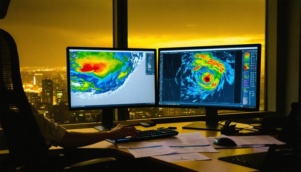
Sifting through the radar metric zoo, you’ll find that MESH, VIL density, and HDR BML consistently rise to the top for hail occurrence discrimination. Polarimetric improvements have pushed multi-parameter approaches ahead of any single-metric method.
Here’s what the data actually shows:
- HDR BML leads single-parameter detection for severe hailstorms.
- MESH outperforms competitors for significant severe hailstorm discrimination.
- VIL density shows limited operational value for size discrimination despite historical use.
- Multi-parameter fusion combining single- and dual-polarization metrics delivers the strongest overall detection performance.
Impact modeling benefits directly from these rankings, but uncertainty stays high at the extremes. You can’t rely on one metric alone—stack them strategically, understand each metric’s failure modes, and you’ll make sharper real-time decisions.
The Hail Size Problem No Single Method Can Solve
When you push radar-based hail size estimation to its operational limits, you find that no single method delivers consistent accuracy—MESH performs well for significant severe hailstorms, HDR BML leads for general severe detection, and VIL density has largely failed as a size discriminator.
You’re also fighting physics: hailstones large enough to cause serious damage can match or exceed radar wavelengths, triggering resonance scattering that corrupts backscatter-based size retrievals, while irregular shapes and melt-water coatings further degrade signal interpretation.
Multiparameter approaches combining single- and dual-polarization metrics improve discrimination, but the combined uncertainty from instrument calibration differences, sparse ground-truth data, and extreme-tail events keeps reliable real-time size estimation out of reach.
Radar Estimation Accuracy Limits
Although radar remains the fastest operational tool for hail detection, estimating actual hailstone size in real time exposes hard physical and methodological limits that no single technique has yet overcome.
Aerosol interactions alter hailstone coatings mid-storm, skewing reflectivity readings. Satellite integration adds spatial context but can’t resolve sub-kilometer hail swaths.
You’re working against four compounding constraints:
- Resonance scattering distorts returns when hailstones approach radar wavelength
- Water coatings and irregular shapes make direct size retrieval unreliable
- Cross-network comparability breaks down across differing bands, polarizations, and calibrations
- Machine-learning models stay limited by sparse, spatially uneven high-quality hail observations
No single parameter solves this. Combining dual-polarization metrics improves detection, but tail-risk quantification for extreme hail remains statistically unresolved.
Competing Methods, Mixed Results
Every method you deploy against the hail size problem delivers partial results, and the performance gaps between them are operationally significant.
HDR BML leads single-parameter detection for severe hailstorm dynamics, while MESH outperforms it when you’re targeting significant severe events.
Neither dominates across all scenarios.
VIL density, once considered useful, doesn’t hold up for operational size discrimination.
Multiparameter approaches combining single- and dual-polarization metrics improve detection, but they demand consistent radar calibration across networks that rarely share identical band configurations or calibration standards.
Machine learning offers promise, yet it’s constrained by sparse, spatially uneven training data.
NWP and nowcasting models frequently fail even at lead times of minutes.
You’re left managing a toolkit where every method contributes something—but none solves the problem independently.
Physics Complicates Size Detection
Even before method selection becomes relevant, the physics of large hailstones actively undermines your ability to extract reliable size information from radar returns.
When hailstones approach radar wavelengths, hailstone resonance distorts backscatter unpredictably. Add irregular radar shape and water coatings, and size retrieval becomes fundamentally ambiguous.
Four physical constraints you can’t engineer around:
- Resonance scattering makes large hailstones appear smaller or larger depending on wavelength
- Irregular radar shape produces inconsistent cross-sections across identical stone sizes
- Water coatings mimic rain signatures, masking hail returns
- Band differences across radar networks prevent direct size-estimate comparisons
These aren’t calibration failures—they’re physical realities. No single algorithm overcomes all four simultaneously, which is why tail-risk quantification for extreme hail remains statistically unreliable in real-time operations.
Why Hailstones Themselves Make Radar Readings Unreliable
When hailstones grow large enough to approach or exceed the wavelength of operational radar systems, they trigger resonance scattering effects that break the assumptions underlying standard reflectivity-to-size conversions. Hailstone resonance causes radar returns to fluctuate non-monotonically with size, meaning larger stones don’t consistently produce stronger signals. You can’t simply invert reflectivity to recover diameter.
Compounding this, water coatings on partially melted hailstones dramatically alter dielectric properties, inflating apparent reflectivity beyond what dry ice would produce. Irregular shapes introduce additional polarimetric ambiguity, scattering energy unpredictably across observation angles.
These combined factors mean your radar retrievals carry irreducible physical uncertainty at the detection stage itself, before any reporting bias or model error enters. No post-processing correction fully resolves what resonance scattering and surface melt introduce into the raw signal.
Sparse, Biased, Incomplete: The State of Hail Climatology Data

When you examine hail climatology databases, you’ll find that reporting biases systematically distort what the record actually captures—population density, road networks, storm chaser activity, and time of day all skew which events get logged and where.
You’re also working against a near-total absence of high-resolution, long-term, homogeneous hail observations across most regions outside the US and parts of Europe. These gaps don’t just frustrate local frequency analysis; they directly undermine your ability to detect meaningful trends or quantify how hail climatology may be shifting under changing climate conditions.
Reporting Biases Distort Records
Although hail databases represent one of the primary resources for climatological analysis, reporting biases severely distort what those records actually capture. Population density, road networks, and storm chasers skew where reports originate. Satellite imagery can supplement gaps, but urban heat signatures further complicate surface-level verification. You’re working with incomplete data by default.
Four critical distortions you need to recognize:
- Timing bias — hail is frequently logged well after it falls, corrupting occurrence records
- Size clustering — observers estimate diameter using reference objects, producing artificial size distributions
- Geographic gaps — rural and remote areas generate far fewer reports than populated zones
- Nocturnal underreporting — nighttime storms produce markedly fewer filed reports than daytime events
These biases compound, making objective verification of hail-detection algorithms fundamentally harder.
Long-Term Data Gaps Persist
Those reporting distortions don’t just affect short-term event records—they accumulate across decades, hollowing out the long-term observational record that climatologists depend on.
Historical data gaps are pervasive: hail covers small areas, reporting infrastructure remains absent across much of the world, and homogeneous long-term datasets are scarce even in well-monitored regions. Outside the US and parts of Europe, radar networks and surface observing systems simply don’t exist.
That absence makes climate impact assessments unreliable—you can’t distinguish a genuine trend from a data artifact when your observational baseline is fragmented. Insurance models and local-frequency studies suffer directly from this deficit.
Until standardized, continuous hail observation networks expand globally, trend estimates tied to climate change will carry uncertainty that no statistical correction can fully resolve.
Can Machine Learning Improve Real-Time Hail Detection?
Machine learning offers a compelling pathway to close the gap between radar observations and reliable hail size estimation, but its effectiveness hinges on data quality and spatial coverage. Artificial Intelligence models trained on multi-source Data Integration pipelines can extract patterns no single radar metric captures alone.
Consider these four critical constraints:
- Sparse, biased ground-truth reports limit training dataset quality and geographic representativeness.
- Radar network inconsistencies across bands, calibration standards, and polarization configurations reduce model transferability.
- Extreme hail events remain underrepresented, weakening tail-risk prediction accuracy.
- Real-time inference demands low-latency pipelines that operational infrastructure doesn’t always support.
You’re working within a system where data scarcity directly caps model ceiling. Until high-quality, spatially distributed hail observations scale up, machine learning improves detection incrementally rather than transformatively.
Why Real-Time Hail Analysis Is Still an Unsolved Problem

Real-time hail analysis remains unsolved because physics, instrumentation, and data quality failures compound each other at every stage of the detection chain.
Hailstone formation occurs at sub-grid scales that operational models can’t resolve, and radar calibration inconsistencies across networks prevent reliable cross-system comparisons.
When hailstones approach radar wavelengths, resonance scattering distorts size estimates before you’ve even accounted for water coatings or irregular shapes.
Radar refreshes every five minutes, meaning entire hail-producing cells can develop between scans.
Ground reports cluster around familiar reference sizes, skewing verification datasets.
Machine learning can’t compensate when the training data itself carries these biases.
No single metric—MESH, VIL density, or dual-polarization composites—solves discrimination alone.
Until observation gaps close simultaneously, you’re working with compounding uncertainties at every analytical layer.
Frequently Asked Questions
How Does Hail Damage Compare Between Urban and Rural Areas?
You’ll find urban areas amplify hail pattern impacts due to dense infrastructure, while rural zones show lower damage assessment totals. Population bias skews reports, so you can’t rely solely on incident counts to compare losses accurately.
What Insurance Products Currently Rely on Real-Time Hail Detection Data?
You’d think hailstone formation data drives sophisticated insurance products, but hailstone classification uncertainty limits them. Parametric catastrophe bonds, crop indemnity policies, and property CAT covers actively rely on real-time hail detection, though tail-risk quantification remains imprecise.
How Do Emergency Managers Use Hail Forecasts During Active Severe Weather?
You’ll use hail prediction outputs to trigger storm preparedness protocols—activating emergency alerts, pre-positioning resources, and coordinating evacuations. You’re working with radar-derived metrics, though you must account for detection uncertainty and short observational windows during fast-evolving severe weather events.
What Is the Average Lifespan of a Hailstone Before It Reaches the Ground?
You’ll find hailstone formation typically takes 5–25 minutes, depending on updraft strength and storm depth. Weather pattern analysis shows you can’t pin down an exact average, as atmospheric variability makes each hailstone’s descent uniquely unpredictable.
How Do Storm Chasers Coordinate With Meteorologists During Active Hailstorms?
Like a relay race, you’re passing storm tracking data directly to meteorologists in real-time. You’ll share field observations through data collaboration networks, ground-truthing radar returns and closing gaps that instruments can’t capture alone.
References
- https://pubmed.ncbi.nlm.nih.gov/33867891/
- https://journals.ametsoc.org/view/journals/apme/58/5/jamc-d-18-0247.1.pdf
- https://www.xweather.com/blog/worlds-most-reliable-hail-forecast
- https://ntrs.nasa.gov/citations/20205005399
- https://pmc.ncbi.nlm.nih.gov/articles/PMC8050948/
- https://www.frontiersin.org/articles/10.3389/fenvs.2025.1699216
- https://nhess.copernicus.org/articles/24/2331/2024/nhess-24-2331-2024.pdf
- https://journals.ametsoc.org/downloadpdf/view/journals/bams/99/3/bams-d-17-0207.1.pdf
- https://nhess.copernicus.org/articles/24/847/2024/nhess-24-847-2024.pdf



