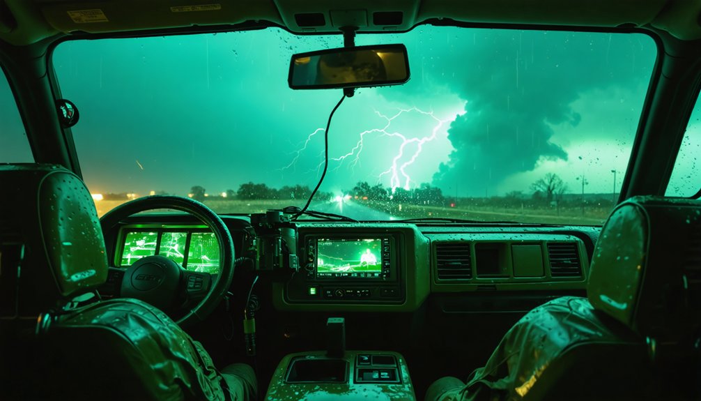
Tornado researchers are using innovative instruments because current warning systems carry a 70% false alarm rate and offer only 13 minutes of average lead time. You can’t improve those numbers without better data. Tools like StickNets, mobile mesonets, and dual-polarization radars capture precise pressure, wind, and debris measurements directly inside storm cores. These hard measurements replace unreliable radar estimates. Keep exploring to discover exactly how these instruments are transforming tornado forecasting.
Key Takeaways
- Tornado warnings have a 70% false alarm rate, causing public distrust and complacency that innovative instruments aim to address.
- Innovative tools like StickNets and PODs collect precise atmospheric data directly inside tornado cores, improving intensity measurements.
- Ground-level wind measurements replace unreliable radar estimates, helping researchers better understand violent tornado formation mechanisms.
- Advanced instruments extend warning lead times beyond 13 minutes, giving communities more time to seek shelter safely.
- Better data collection reduces forecasting uncertainty, directly correlating with decreased casualties during severe weather events.
The Real Problem With Tornado Warnings Today
Tornado warnings today carry a critical flaw: a false alarm rate hovering around 70%, meaning roughly seven out of every ten warnings never produce a tornado.
These warning system limitations erode public trust, causing people to ignore alerts when it matters most. When you hear a siren repeatedly without consequence, complacency becomes dangerous.
Tornado prediction challenges stem from incomplete data within storm cores—regions traditional radar can’t fully penetrate.
Current systems detect rotation suggesting tornado potential, but can’t confirm ground contact or intensity with precision. Warning lead times average just 13 minutes, barely enough time for you to reach shelter safely.
The result: communities face a binary choice between over-warning and under-warning, both carrying life-threatening consequences.
Communities don’t get a perfect warning system—they get a dangerous gamble between crying wolf and deadly silence.
Researchers recognize this gap demands better instruments and sharper data.
What Innovative Instruments Measure Inside a Storm
When you consider what these instruments actually capture, the data goes far beyond simple wind speed readings.
StickNets and Tornado PODs measure barometric pressure, temperature, humidity, G-forces, and wind velocity simultaneously, giving researchers a precise multi-variable snapshot of storm dynamics.
Critically, ground-level wind measurements taken where damage actually occurs let you quantify tornado intensity with far greater accuracy than radar-based estimates alone.
Key Atmospheric Variables Tracked
What exactly do innovative instruments measure inside a tornado’s core? You’ll find that researchers track several critical atmospheric variables simultaneously.
StickNets capture atmospheric pressure, temperature, humidity levels, and G-forces directly within storm cores. Tornado PODs measure wind velocity and direction at ground level, precisely where structural damage occurs.
These variables aren’t collected arbitrarily. Atmospheric pressure drops signal tornado intensification, while humidity levels reveal moisture dynamics fueling rotation. Wind measurements at ground level help researchers calculate actual intensity rather than relying solely on radar estimates.
Mobile mesonets mounted on trucks gather fine-scale data distinguishing tornado-producing supercells from non-threatening storms.
UAS platforms extend this capability into hazardous low-altitude zones, capturing temperature, pressure, and wind speed where traditional aircraft can’t safely operate. Each variable tracked brings researchers closer to cracking the tornado puzzle.
Ground-Level Wind Measurements
Ground-level winds present one of the most technically challenging measurements in tornado research, yet they’re arguably the most vital.
When you’re evaluating tornado intensity, you need accurate wind measurement precisely where destruction occurs—at ground level, not hundreds of meters above it.
Instruments like Tornado PODs and StickNets capture these critical near-surface data points, measuring velocity, direction, and pressure as winds spiral into the tornado core.
This ground level analysis reveals mechanisms that traditional radar simply can’t detect from elevated angles.
You’re fundamentally filling a critical observational gap.
By understanding how low-level inflow winds behave, researchers can identify which storm configurations produce the most violent tornadoes.
That data directly translates into more reliable intensity ratings, sharper warning criteria, and ultimately, faster alerts reaching your community.
Why Ground-Level Wind Data Changes Everything
When you examine ground-level wind data, you gain the precise measurements needed to accurately rate tornado intensity beyond what radar alone can provide.
Sensors like Tornado PODs capture wind velocity and direction at the surface, where actual structural damage occurs, giving researchers quantifiable metrics to refine intensity classifications.
This data also lets you map damage patterns with greater accuracy, directly linking specific wind speeds to the destruction signatures tornadoes leave behind.
Measuring Tornado Intensity Accurately
Accurately measuring tornado intensity hinges on capturing wind data at ground level—where destruction actually occurs.
Traditional radar misses critical near-surface winds, leaving intensity measurement incomplete. Innovative instruments like PODs and StickNets directly address this gap, giving you reliable tornado dynamics data that radar alone can’t provide.
These ground-level tools deliver:
- Precise wind velocity readings at the surface where structural damage originates
- Real-time pressure and humidity data that refines intensity measurement models
- Accurate tornado dynamics profiles distinguishing violent tornadoes from weaker rotations
With this data, researchers identify which mechanisms drive the most destructive storms.
You’re no longer relying on estimates—you’re working with hard measurements. That precision directly improves intensity ratings, strengthens forecast models, and ultimately gives communities the accurate warnings they need to act fast.
Mapping Damage Patterns Below
Damage patterns etched into the landscape tell a story that radar alone can’t fully decode. When you map ground-level winds against structural failures, you reveal data that transforms damage assessment from guesswork into precision science.
Innovative sensors capture the low-level inflow feeding tornado cores, revealing exactly which wind mechanisms produce the most violent destruction. You’re not just documenting aftermath—you’re building the foundation for more accurate tornado modeling.
That ground-truth data lets researchers correlate wind velocity measurements with specific damage signatures, identifying patterns that refine intensity ratings and expose structural vulnerabilities.
Every data point collected below 10 meters fills a critical gap that airborne radar simply can’t reach. The result? Forecasters gain sharper, more reliable models that you and your community can actually trust when severe weather threatens.
How Researchers Get Data From Inside Tornado Cores
Gathering data from inside a tornado core is one of the most technically demanding challenges in atmospheric research. You’re dealing with violent storm structure, extreme pressure gradients, and lethal debris fields.
Researchers deploy specialized instruments directly into these zones to capture critical tornado dynamics data that radar alone can’t provide.
Here’s how they do it:
- StickNets and PODs measure barometric pressure, temperature, humidity, and ground-level wind velocity inside active tornado cores.
- Uncrewed Aerial Systems (UAS) penetrate hazardous low-altitude zones, carrying sensors that record pressure, wind speed, and temperature in real time.
- Mobile mesonets collect fine-scale atmospheric data while tracking storms, helping distinguish tornado-producing supercells from non-producing ones.
Each instrument adds precision, giving you cleaner data, sharper models, and ultimately faster, more reliable tornado warnings.
How Mobile Radars and Drones Work Together
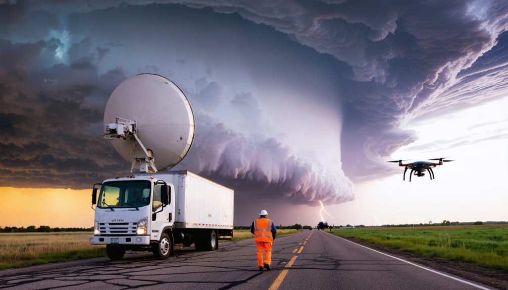
Ground-level sensors and UAS platforms give you high-resolution data from inside the storm, but they’re limited in spatial coverage.
That’s where mobile radars and drone integration close the gap in data collection.
Mobile radars and drone integration work together to eliminate critical gaps in storm data collection.
Projects like VORTEX2 deployed 10 mobile radars simultaneously, mapping winds and precipitation across entire storm systems.
When you combine that broad radar coverage with UAS-mounted atmospheric sensors probing the tornado’s inner core, you get a layered dataset that neither technology produces alone.
Dual-polarization radars detect airborne debris, pinpointing tornado locations during nighttime or heavy rain events.
Research collaboration across 100+ scientists coordinates these instrument flotillas in real time, feeding storm analysis models with unprecedented resolution.
This multi-platform approach directly advances tornado forecasting accuracy and drives measurable safety enhancement for communities in high-risk zones.
Why Better Instruments Are Finally Saving More Lives
Every second gained in tornado warning time translates directly into lives saved, and better instruments are finally delivering those seconds.
You’re now seeing tornado forecasting powered by life saving technology that captures data radar alone can’t provide.
Here’s what that means practically:
- StickNets and PODs measure ground-level pressure and wind velocity, giving forecasters precise intensity data within minutes.
- UAS platforms penetrate storm cores, identifying tornado signatures earlier and slashing false alarm rates.
- Mobile mesonets distinguish tornado-producing supercells from non-producing ones before rotation fully develops.
These advances aren’t incremental—they’re fundamental.
When forecasters accurately identify which storms produce tornadoes, communities receive warnings with enough lead time to act.
You gain freedom from uncertainty, and that freedom directly reduces casualties when violent weather strikes.
Frequently Asked Questions
What Training Do Tornado Researchers Need Before Deploying Innovative Instruments?
You’d think instinct alone guides researchers, but you actually need rigorous field training and instrument calibration before deploying tools. You’ll master data collection protocols, sensor operation, and storm positioning to guarantee precise, reliable measurements in dangerous tornado environments.
How Much Do Innovative Tornado Research Instruments Typically Cost to Develop?
The knowledge doesn’t specify exact development expenses, but you’d typically rely on funding sources like federal grants and university partnerships to finance innovative instruments, ranging from affordable StickNets to costly mobile radar systems like those in VORTEX2.
Which Universities or Institutions Fund the Largest Tornado Research Projects?
You’ll find that NOAA, NSF, and universities like OU and NSSL drive tornado funding through research collaboration, pooling resources across 100+ scientists in projects like VORTEX2, deploying mobile radars and cutting-edge instruments independently.
How Long Does It Take to Deploy Instruments Before a Tornado Strikes?
You’ve got minutes—sometimes seconds—for tornado preparation. Researchers achieve rapid deployment by pre-positioning instruments like StickNets and PODs along storm paths, using mobile mesonets to track supercells and place sensors before tornado touchdown occurs.
Are Tornado Researchers Required to Follow Specific Safety Protocols During Deployments?
Like a soldier’s rulebook, yes, you’d follow strict safety measures during deployments. You’re managing deployment challenges by maintaining safe distances, coordinating with mobile radars, and using UAS to minimize direct exposure to violent tornado cores.
References
- https://www.nssl.noaa.gov/news/factsheets/twisterscience.pdf
- https://inside.nssl.noaa.gov/nsslnews/2025/11/nssl-advances-tornado-research-with-uncrewed-aircraft-systems/
- https://www.nssl.noaa.gov/research/tornadoes
- https://inside.nssl.noaa.gov/nsslnews/2024/01/far-afield-researchers-seek-out-and-study-tornadoes-and-severe-weather/
- https://news.ucar.edu/2069/scientists-track-twisters-worlds-largest-tornado-study
- https://www.youtube.com/watch?v=uF4jzkOLemE
- https://www.depts.ttu.edu/nwi/news/posts/2024/Weiss.php?v=preview
- https://www.nssl.noaa.gov/tools/observation/
- https://airs.jpl.nasa.gov/news/174/reconstructing-a-tornado/
- https://en.wikipedia.org/wiki/VORTEX_projects