Understanding supercells starts with recognizing what sets them apart: organized rotation driven by a persistent mesocyclone. Unlike ordinary thunderstorms, supercells separate their updraft and downdraft regions, allowing them to sustain themselves for hours. You’ll need to monitor three critical ingredients — wind shear exceeding 40 knots, CAPE values between 2,000–4,000 J/kg, and surface dewpoints above 55°F. Master these fundamentals, and everything from radar interpretation to safe positioning around a storm’s structure starts clicking into place.
Key Takeaways
- Supercells develop organized rotation called a mesocyclone, enabling them to last several hours and produce violent tornadoes, large hail, and strong winds.
- Three key ingredients fuel supercell formation: wind shear exceeding 40 knots, CAPE values of 2,000–4,000 J/kg, and sufficient low-level moisture.
- The rear-flank downdraft tightens surface rotation, while the structural separation of updraft and downdraft prevents the storm from destroying itself.
- Safe positioning means staying southeast of the mesocyclone in the inflow region, avoiding the rear-flank downdraft and forward-flank precipitation core.
- Essential beginner tools include live radar apps, GPS, weather radio, Skew-T diagrams, and pre-established escape routes for rapid condition changes.
What Makes a Supercell Different From Other Thunderstorms?
When most thunderstorms form, they develop without any organized rotation—cells fire, mature, and dissipate within 30 to 60 minutes, cycling through their lifecycle with little structural coherence.
A supercell breaks that pattern entirely. Its defining supercell characteristic isn’t size or height—it’s rotation. A persistent, organized mesocyclone develops within the updraft, allowing the storm lifecycle to extend across several hours rather than minutes.
That rotation continuously feeds warm, moist inflow while structurally separating the updraft from the downdraft, preventing self-destruction. The result is a storm capable of producing violent tornadoes, hail exceeding baseball size, and outflow winds exceeding 100 mph.
You’re dealing with a fundamentally different atmospheric engine—one that’s self-sustaining, structurally complex, and demands serious respect before you position anywhere near it.
Why Supercells Produce More Tornadoes Than Any Other Storm Type
When you study supercell dynamics, you’ll find that the mesocyclone—a column of rotating air embedded within the storm—creates the organized vertical vorticity that most other storm types simply can’t sustain.
That persistent rotation stretches and intensifies low-level wind shear, greatly increasing the probability of tornado development compared to non-rotating convection.
Your understanding of supercell tornado production improves considerably once you recognize that the same sustained updraft feeding the mesocyclone also maintains the storm’s longevity, giving vorticity more time to concentrate near the surface.
Rotation Drives Tornado Formation
Supercells produce more tornadoes than any other storm type because rotation is already built into their structure. The mesocyclone provides a pre-existing rotating column of air, which notably lowers the energy threshold required for tornado genesis.
You’re fundamentally watching rotation dynamics already in motion before any tornado touches down.
When the rear-flank downdraft wraps around the mesocyclone, it tightens and concentrates that rotation near the surface. Wind shear continues feeding angular momentum into the system, accelerating the vortex. This mechanical process is systematic, not random.
Other storm types lack this organized rotational framework, making tornado production far less likely.
With supercells, the structural conditions that favor tornadoes are baked in from the start, giving you a measurably higher probability of witnessing notable tornado events.
Sustained Updrafts Support Development
Rotation alone doesn’t sustain a tornado-producing supercell — the updraft does. Strong updraft dynamics keep the mesocyclone organized and prevent precipitation from choking off the storm’s energy source. When warm, moist inflow continuously feeds the updraft, you get sustained growth that separates supercells from ordinary convective cells that collapse within minutes.
Wind shear tilts the updraft away from the downdraft, preventing rain-cooled air from undercutting the storm’s base. That separation is critical. Without it, the downdraft smothers the updraft, and the storm dies.
Supercells can persist for hours because this balance holds. You’re fundamentally watching a self-organizing system maintain structural integrity under extreme atmospheric stress — and that longevity is precisely what gives supercells repeated opportunities to produce tornadoes.
Wind Shear, Instability, and Moisture: The 3 Ingredients Supercells Need
Three ingredients—wind shear, atmospheric instability, and low-level moisture—drive supercell development, and understanding each one sharpens both your forecasting accuracy and your positioning decisions in the field.
Wind shear dynamics dictate rotation potential. Speed shear tilts the updraft, while directional shear generates horizontal vorticity that convective updrafts convert into vertical spin.
You’re looking for 0–6 km bulk shear values exceeding 40 knots as a baseline threshold.
Instability, measured through CAPE values, determines updraft intensity. Strong supercells typically develop in environments with 2,000–4,000 J/kg of CAPE.
Moisture sources, primarily Gulf of Mexico advection across the Plains, establish the necessary low-level theta-e ridge. Surface dewpoints above 55°F meaningfully increase tornado potential.
When all three ingredients overlap spatially and temporally, supercell development becomes likely.
Updrafts, Downdrafts, and the Mesocyclone Explained
Once you understand the ingredients driving supercell development, the internal mechanics of the storm itself become the next critical layer of knowledge.
Updraft dynamics define how powerfully rising air sustains the storm’s engine, feeding moisture upward and driving hail formation through repeated ice crystal cycling.
The updraft is the storm’s heartbeat — raw vertical force that builds hail and keeps supercells alive.
Downdraft characteristics split into two distinct regions: the forward-flank downdraft and the rear-flank downdraft, each shaping precipitation types, storm visibility, and your positioning options.
Mesocyclone behavior ties these regions together, creating organized rotation that extends the storm lifecycle well beyond ordinary convection.
Thermal dynamics between warm inflow and cold outflow boundaries fuel this persistent rotation.
Understanding how these components interact gives you genuine analytical control over how you read, approach, and safely navigate any supercell you encounter.
How to Identify Supercell Structure on Radar
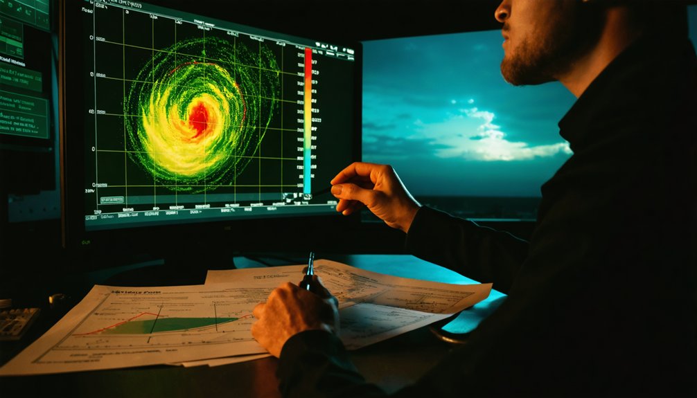
Radar interpretation transforms abstract storm data into actionable positional intelligence, and learning to decode supercell signatures starts with recognizing a handful of key structural patterns.
On base reflectivity, you’re looking for the classic hook echo, where precipitation wraps around the mesocyclone’s southern flank. That curvature marks the RFD region and frequently indicates tornado potential.
Velocity products reveal rotation directly — tight, adjacent red and green couplets signal intense wind shear within the mesocyclone.
Storm features like the bounded weak echo region appear on cross-sectional views, confirming a powerful, tilted updraft.
Dual-pol radar adds correlation coefficient data, helping you distinguish hail cores from rain.
Combining reflectivity, velocity, and dual-pol radar signatures gives you a layered, precise picture of storm structure before you ever position your vehicle.
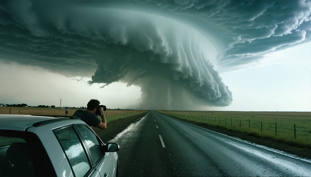
How to Position Yourself Safely Around a Supercell
Once you’ve identified a supercell on radar, you need to track its motion vector to determine where it’s heading and how fast, since most supercells move right of the mean tropospheric wind at speeds that can exceed 40 mph.
You’ll want to position yourself southeast of the mesocyclone, within the inflow region, where you can observe the wall cloud and any developing rotation while staying clear of the RFD and its associated damaging winds.
Avoid the forward-flank core and never let the storm’s forward motion cut off your escape route to the south or east.
Reading Storm Motion
Positioning yourself safely around a supercell starts with understanding how the storm moves. Supercells typically travel right of the mean tropospheric wind, so don’t assume storm direction mirrors surface winds. Track radar consistently, noting storm motion vectors and updating your positioning every few minutes.
Visual cues matter too. Watch the storm’s forward edge, inflow bands, and precipitation core to gauge movement relative to your location. If the wall cloud is drifting toward you, you’re losing your safety margin fast.
Calculate storm speed and heading, then identify escape routes perpendicular to storm motion, ideally south or southeast. Avoid positioning directly east or northeast, where the heaviest precipitation and most dangerous outflow typically occur.
Freedom of movement depends entirely on staying ahead of the data.
Safe Viewing Zones
Understanding storm structure directly shapes where you can safely stand—and where you can’t. Position yourself southeast of the mesocyclone, where you’re outside the RFD and maintain clear viewing angles toward the wall cloud and inflow base.
The RFD wraps around the rear and southern flanks, carrying damaging winds and large hail—avoid it entirely.
Maintain a safe distance of at least one to two miles from the circulation, adjusting continuously as the storm evolves. Supercells move right of the mean wind, so your escape route must stay ahead of that motion.
Keep a paved road behind you that runs perpendicular to storm movement. LP supercells offer better visibility but don’t eliminate hazards.
Monitor radar actively—structure changes fast, and your positioning window can close without warning.
The Tools Every Beginner Needs Before Chasing Supercells
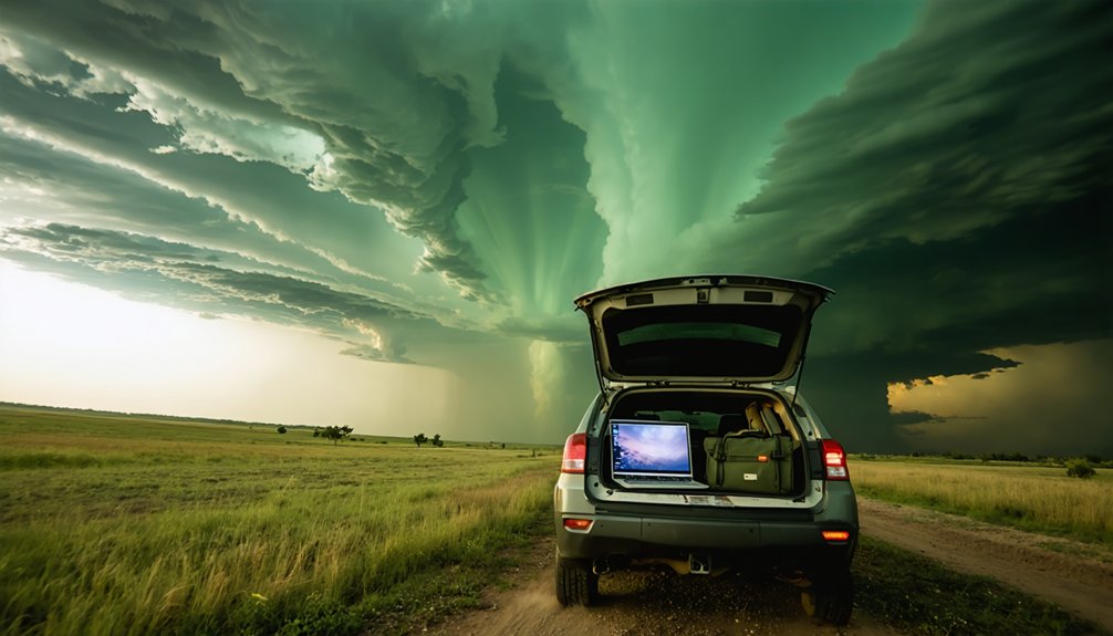
Before you chase your first supercell, you’ll need a core set of tools that support both forecasting and real-time decision-making.
Your forecasting tools should include surface observation charts, upper-air data, and weather charts like Skew-T log-P diagrams, which reveal instability, moisture, and wind shear profiles.
Storm apps with live radar interpretation capabilities let you track mesocyclone development and monitor storm motion in real time.
Safety essentials include a reliable GPS device, a weather radio, and a clearly defined escape route.
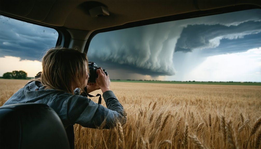
For documentation, photography gear like wide-angle lenses and sturdy tripods helps you capture storm structure from a safe distance.
Mastering these tools before your first chase reduces reactive decision-making and strengthens your situational awareness when conditions evolve rapidly around an active supercell.
Frequently Asked Questions
Can Supercells Occur Outside of Tornado Alley or Traditional Storm Chasing Regions?
Yes, you’ll find supercell formation across diverse regions worldwide. Geographic distribution spans Europe, Australia, South America, and beyond. Anywhere wind shear, instability, and moisture converge, you’re potentially witnessing conditions that’ll support dangerous supercell development outside traditional chasing corridors.
How Long Does a Typical Supercell Last Before It Weakens or Dissipates?
A supercell’s lifespan typically runs two to six hours. Unlike ordinary storms lasting minutes, rotation actively sustains the updraft, delaying storm weakening. You’re witnessing a self-perpetuating system until shear weakens or cold outflow cuts off the inflow.
What Time of Year Are Supercells Most Likely to Develop and Occur?
You’ll find supercells most frequently during spring months, particularly April through June, when atmospheric instability, moisture, and wind shear converge ideally. These peak conditions drive intense storm formation across the central United States, commonly known as Tornado Alley.
Can a Single Supercell Split Into Two Separate Rotating Storms Simultaneously?
Splitting storms showcase stunning storm dynamics — yes, a supercell can split into two separate rotating updrafts. You’ll witness supercell interaction where atmospheric conditions force division, creating both left-moving and right-moving storms simultaneously, each sustaining independent rotation.
Do Supercells Always Look Visually Dramatic and Identifiable From the Ground?
No, supercells don’t always display dramatic visual indicators. Storm structure varies greatly; you’ll sometimes encounter low-precipitation supercells with subtle features, while heavily wrapped storms can obscure rotation entirely, demanding radar interpretation over visual reliance.
References
- https://www.gabegarfield.com/blog/zerotohero
- https://www.weather.gov/spotterguide/supercell1
- https://www.reddit.com/r/stormchasing/comments/bszk2t/lets_talk_about_positioning_supercell_edition/
- https://www.youtube.com/watch?v=FJWWHDFBRLI
- https://www.livingskytours.com/storm-chasing-guide/
- https://www.youtube.com/playlist?list=PLg23mPRzqQAo68M87-pgdgOpA7rlHq0om
- https://www.naturettl.com/how-to-photograph-storms-supercells-lightning-tornadoes/
- https://www.facebook.com/groups/severeweatherphoto/posts/3268012710031863/
- https://www.stormchasingusa.com/blog/learning-the-basics-about-storm-chasing/
- https://www.tiktok.com/@stormchasercoaching/video/7535904103268896030