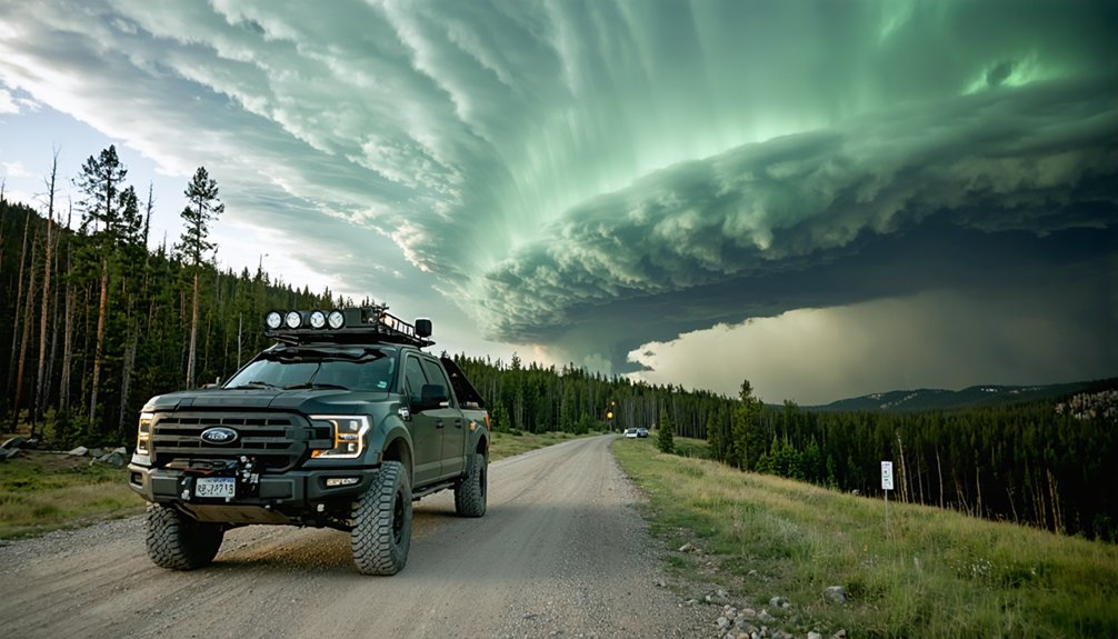
The Black Hills of South Dakota deliver some of the Northern Plains’ most structurally intense supercells, where orographic lift along the eastern slopes combines with northwest flow aloft to generate wind shear exceeding 50 knots. You’ll find peak activity from mid-June through mid-July, with ideal positioning southwest of Spearfish and along Rapid City’s northern corridor. Storms can produce baseball-sized hail and shift direction unpredictably, so safety protocols aren’t optional. There’s considerably more to understand before you head out.
Key Takeaways
- The Black Hills’ unique topography triggers supercell formation, with moisture-driven updrafts and intense wind shear producing large hail and dangerous lightning.
- Peak storm chasing season runs mid-June through mid-July, with late-day convective initiation offering the most productive storm development opportunities.
- Southwest Spearfish and Mount Coolidge provide ideal positioning, offering photogenic supercells and elevated vantage points for observing multiple storm cells.
- Safety protocols require 1.5-mile buffer zones from wall clouds, GPS logging every 10 minutes, and clear escape routes through unpredictable terrain.
- Historical chase data from documented events, including notable June and July supercells, directly informs strategic positioning and modern chasing methodologies.
Why the Black Hills Produce World-Class Supercells
The Black Hills’ unique topography acts as a natural catalyst for supercell development, forcing moisture-laden air upward along its eastern slopes and triggering explosive convective initiation.
When you’re tracking storm dynamics across western South Dakota, you’ll notice how northwest flow aloft combines with surface moisture to generate intense wind shear — the critical ingredient fueling rotating updrafts.
Storms drifting in from northeast Wyoming encounter the Hills’ elevated terrain, intensifying dramatically as they track toward Spearfish and Rapid City.
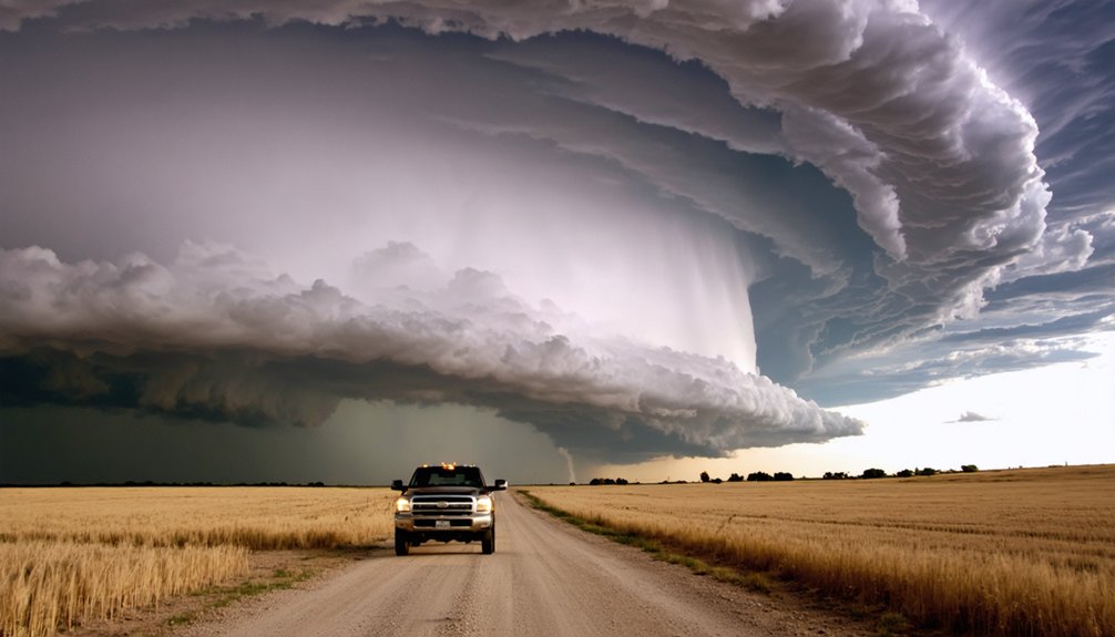
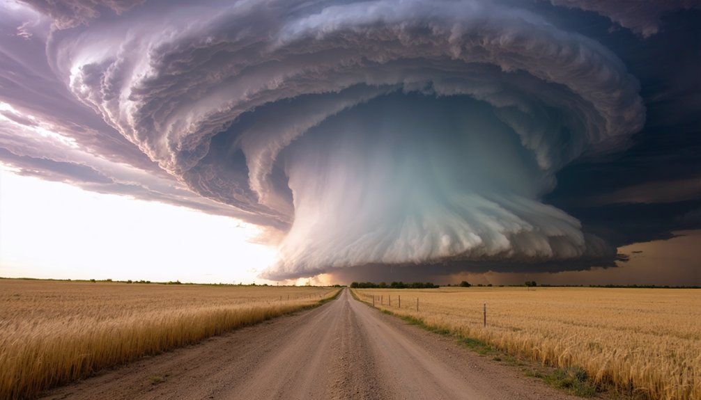
You’re witnessing atmospheric mechanics operating at peak efficiency. The result? Photogenic supercells that develop over yellow sweet clover fields, producing violent wind shear columns, very large hail, and dangerous lightning.
These aren’t ordinary thunderstorms — they’re precision atmospheric engines capable of catastrophic destruction.
Best Locations to Chase Storms in the Black Hills
Knowing where to position yourself separates a productive chase from a wasted fuel run. Four locations consistently deliver results.
Southwest of Spearfish produces the most photogenic supercells, particularly over yellow sweet clover fields during July. Your storm photography will peak here when Wyoming cells track eastward.
Mount Coolidge gives you elevation advantage, letting you observe multiple storm cells simultaneously and adjust chase strategies before committing to a target.
Northwest South Dakota clusters require early positioning, as these primary targets develop fast and punish late arrivals.
Rapid City’s northern corridor launches westward-drifting supercells that become increasingly dangerous over terrain.
Northeast Wyoming serves as your early-warning zone — storms entering near Spearfish give you a critical intercept window before they consume the Hills entirely.
Peak Season: When to Plan Your Black Hills Chase
If you’re planning a Black Hills storm chase, you’ll want to target June and July, when supercell activity peaks across western South Dakota and northeast Wyoming.
June delivers classic supercells north of Rapid City alongside intense lightning events, while July tracks large, photogenic cells southwest of Spearfish over sweet clover fields.
You’ll find late-day convective initiation most productive, with storms frequently developing or entering the region from northwest South Dakota and Wyoming by mid-to-late afternoon.
Summer Storm Season Timing
Summer storm season in the Black Hills peaks between mid-June and mid-July, giving you the tightest window for productive chasing. During this period, storm patterns shift predictably—supercells develop north of Rapid City in early June, while July pushes activity westward through northeast Wyoming before cells track into South Dakota near Spearfish.
Your chasing techniques must adapt accordingly. Early June favors positioning north of Rapid City, where westward-drifting supercells offer clean intercept angles.
By mid-July, you’ll want to anchor southwest of Spearfish, targeting storms rolling in from Wyoming. Late-day convection intensifies rapidly during both months, so establish your vantage early.
Mount Coolidge remains a reliable elevated option throughout the window, letting you monitor multiple cells simultaneously without compromising your exit routes.
Prime Chasing Month Breakdown
Breaking that window into month-by-month specifics sharpens your planning considerably.
June delivers supercell development north of Rapid City, with mid-month storm patterns producing intense lightning events directly over the city. Your chase strategies should prioritize northeast positioning during this period.
July shifts the action westward. Supercells originating over northeast Wyoming track into South Dakota near Spearfish, making that corridor your primary operational zone. The July 11th event demonstrated exactly how photogenic these cells become over sweet clover fields southwest of Spearfish.
Both months carry serious hazard profiles — damaging winds, large hail, and tornado potential demand disciplined positioning.
Mount Coolidge remains a reliable elevated observation point throughout both periods. Structure your chase calendar around these two months and you’ll maximize productive contact with Black Hills convection.
Supercells, Hail, and the Real Dangers You’ll Face
When you chase supercells across the Black Hills, you’re facing storms capable of producing very large hail and damaging winds simultaneously, with tornado potential that can turn a photogenic cell into a lethal threat within minutes.
You’ll need to track storm motion carefully, as cells drifting westward from north of Rapid City or entering from northeast Wyoming can accelerate and shift direction unpredictably over elevated terrain.
Staying safe requires maintaining a clear escape route, monitoring rotation continuously, and never positioning yourself directly under a supercell’s updraft base where hail cores can exceed baseball size.
Supercell And Hail Threats
Supercells in South Dakota aren’t just dramatic—they’re genuinely dangerous, and you’ll need to understand the specific threat profile before you consider chasing them.
Supercell dynamics here involve rotating mesocyclones capable of producing tornadoes with minimal warning. These storms drift westward from north of Rapid City or track northeast from Wyoming directly into the Black Hills corridor, compressing your reaction time considerably.
Hail formation within these systems reaches destructive sizes. Large hail accompanies damaging winds, creating compound hazard zones that can overwhelm unprepared chasers quickly.
Southwest of Spearfish, photogenic supercells develop over open terrain, offering visibility—but visibility cuts both ways. You’ll see the storm clearly, and it’ll be moving toward you.
Respect the threat profile, position strategically, and never assume distance equals safety.
Staying Safe While Chasing
Understanding the threat profile is only half the equation—surviving it requires deliberate, practiced decision-making before you’re anywhere near a rotating mesocyclone.
Storm preparedness isn’t optional in the Black Hills; it’s your margin between a successful chase and a catastrophic outcome.
Establish your escape routes before convection initiates. Supercells near Spearfish and northwest South Dakota can accelerate unpredictably, cutting off eastward retreats within minutes.
Never position yourself north or northeast of a mesocyclone—that’s where large hail cores and potential tornadoes concentrate.
Your safety measures must include real-time radar access, a reliable vehicle with full fuel, and a predetermined bail-out corridor.
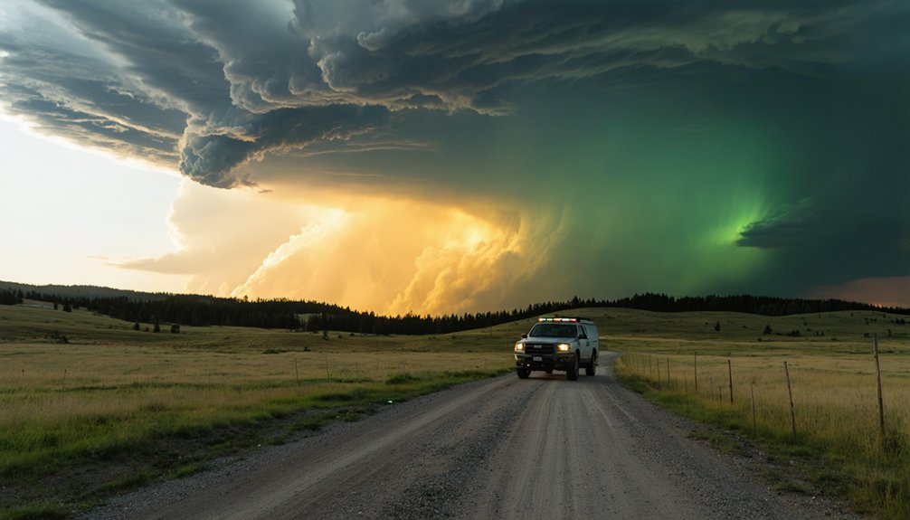
Lightning threats intensify over elevated terrain like Mount Coolidge, adding overhead danger beyond rotation.
Respect the storm’s autonomy—it doesn’t negotiate.
Gear, Routes, and Field Protocols for Black Hills Chasers
Chasing storms across the Black Hills demands specialized gear, deliberate route planning, and strict field protocols that account for the region’s rugged terrain and rapidly evolving convective threats.
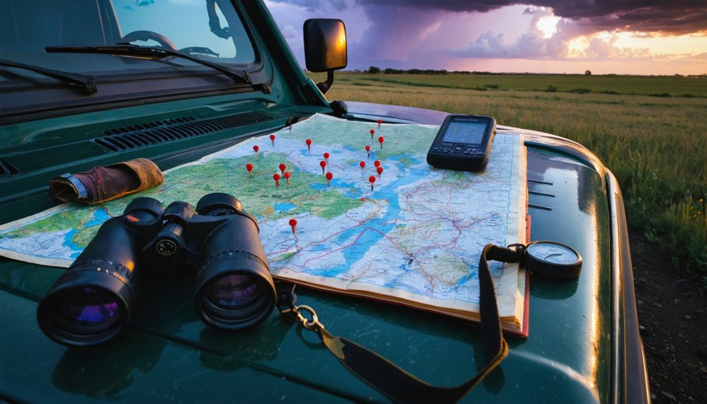
Your chaser essentials should include a calibrated GPS unit, dual-band radio, mobile radar app with sub-five-minute refresh rates, and reinforced hail protection for your vehicle.
Route planning must prioritize paved escape corridors—U.S. 385 and SD-79 offer reliable egress when supercells accelerate eastward from northeast Wyoming toward Spearfish.
Mount Coolidge provides an elevated intercept position, but you’ll need to pre-calculate descent times against storm motion vectors.
Maintain a 1.5-mile minimum buffer from wall clouds, log GPS coordinates every 10 minutes, and never reposition blind through ridge terrain during active lightning cycles.
The Storms That Put Black Hills Chasing on the Map
Few events define a region’s storm chasing legacy more sharply than the documented supercells that have repeatedly targeted the Black Hills corridor.
On June 1st, a supercell drifted westward into the Black Hills from north of Rapid City, confirming established storm patterns that chasers now actively exploit.
July 11th delivered a photogenic supercell southwest of Spearfish, tracking across northeast Wyoming before producing damaging winds and large hail over sweet clover fields.
June 16th’s Rapid City timelapse documented intense lightning sequences, adding measurable data to regional archives.
These events collectively shaped chase strategies still deployed today — positioning along northwest South Dakota clusters, monitoring Wyoming entry points, and staging near Mount Coolidge for elevated observation.
You’re chasing documented corridors, not guesswork. The data exists; use it.
Frequently Asked Questions
Can Beginners Legally Chase Storms in South Dakota Without Special Permits?
You don’t need special permits to legally chase storms in South Dakota. However, you’ll uphold storm chasing ethics and legal responsibilities by avoiding road obstruction, respecting private property, and following all traffic laws precisely.
How Do Black Hills Storms Compare to Great Plains Supercells in Intensity?
Black Hills storms are David to the Great Plains’ Goliath—you’ll find weaker storm dynamics here. Supercell characteristics lack the open-shear environment, making intensity comparatively modest, though damaging winds and large hail still threaten you considerably.
Are There Guided Storm Chasing Tours Available Specifically for the Black Hills?
The knowledge base doesn’t confirm guided tours specifically for the Black Hills, but you can independently pursue storm photography by targeting Spearfish, Mount Coolidge, and Rapid City, where supercells frequently develop during June and July peak seasons.
What Local Emergency Resources Exist for Storm Chasers Needing Immediate Help?
Ironically, you’re chasing danger yet need a safety net. You’ll contact Pennington County Sheriff (605-394-6115) for emergencies. Follow safety protocols, save local emergency contacts, and you’re free to chase storms responsibly.
How Does Black Hills Terrain Affect Storm Chaser Vehicle Requirements and Modifications?
You’ll need vehicle modifications like high-clearance suspension and all-terrain tires to handle Black Hills terrain challenges. Four-wheel drive, reinforced skid plates, and upgraded brakes guarantee you’re maneuvering steep, unpaved mountain roads safely and efficiently.
References
- https://www.youtube.com/watch?v=5jGQCUrmkTo
- https://www.youtube.com/watch?v=VDXm-jIzEu0
- https://www.silverliningtours.com/july-11th-black-hills-of-south-dakota-severe-storm/
- https://www.benholcomb.com/black-hills-south-dakota/
- https://www.quincyvagell.com/2015/06/01/black-hills-supercell/