America’s storm spotter networks trace back to 1848, when Joseph Henry’s Smithsonian volunteers proved distributed reporting could outperform centralized observation. World War II formalized the concept, with nearly 200 military-linked networks operating by 1945. After the war, civilian programs expanded, and SKYWARN launched in 1965 to standardize training. Today, over 300,000 trained spotters provide GPS-tagged, real-time ground-truth data that radar alone can’t deliver. The full evolution reveals how each era reshaped the system you rely on now.
Key Takeaways
- Joseph Henry established the first U.S. observation network in 1848, using volunteers and telegraph communication as an early storm reporting foundation.
- During 1942–1943, the Weather Bureau partnered with the military to create volunteer spotter networks protecting ammunition plants and airfields nationwide.
- Post-WWII, spotter networks shifted toward civilian public safety, with public tornado forecasting resuming in 1948 and community training expanding throughout the 1950s.
- SKYWARN launched in 1965, formalizing civilian volunteer storm spotting under the National Weather Service with structured training standardized in the 1970s.
- Today, over 300,000 trained SKYWARN spotters provide GPS-tagged, real-time ground-truth reports integrated with radar data to enhance warning accuracy.
The Earliest Roots of Storm Spotting in America
Before modern storm spotter networks existed, the United States had already begun experimenting with distributed weather observation systems. In 1848, Joseph Henry established the first U.S. observation network at the Smithsonian Institution, combining volunteer coordination with telegraph communication to track advancing storms.
Cleveland Abbe expanded this approach in 1869, synchronizing simultaneous observations across a telegraph-linked observer network.
The most structured historical meteorological effort came between 1883 and 1887, when researcher John Park Finley organized over 2,000 “tornado reporters” east of the Rockies. These observers documented tornado activity and surrounding weather conditions, creating one of the earliest systematic severe weather datasets.
None of these systems qualify as modern spotter networks, but they established the foundational framework of distributed, volunteer-based reporting you see operating across the country today.
How World War II Created the First Storm Spotter Networks
When you trace the origins of organized storm spotting in the U.S., you’ll find them rooted not in public safety campaigns but in wartime military necessity. Starting in 1942 and 1943, the Weather Bureau partnered with the military to establish volunteer spotter networks around ammunition plants, airfields, and other high-value wartime installations vulnerable to lightning and tornadoes.
Nearly 200 such networks operated by June 1945. After the war ended, you can see a clear pivot in how these networks were used—shifting from protecting military assets to serving civilian warning systems.
This shift was formalized by the resumption of public tornado forecasting in 1948.
Wartime Weather Protection Origins
Though storm spotting today is closely associated with civilian volunteers, its organized origins trace directly to wartime military necessity. During the early 1940s, the Weather Bureau partnered with the military to shield ammunition plants, airfields, and other strategic installations from tornado and lightning threats.
This required rapid meteorological instrumentation deployment and systematic volunteer coordination across geographically dispersed sites.
Military Volunteer Network Formation
As wartime infrastructure demands escalated in 1942 and 1943, the Weather Bureau moved quickly to establish volunteer storm spotter networks near high-priority military installations. Without aerial reconnaissance or satellite imagery available for domestic severe weather monitoring, ground-based human observation was your only reliable data source.
Trained military personnel, aviation specialists, and law-enforcement officers staffed these early networks, prioritizing precision over broad public participation. By June 1945, nearly 200 networks were operating across the country, each positioned strategically to protect ammunition plants, airfields, and critical wartime facilities from lightning and tornado threats.
These networks functioned as distributed sensor arrays, feeding real-time observational data upward through command structures. This decentralized, volunteer-driven architecture proved operationally effective and established a replicable model that would outlast the war itself.
Shifting Toward Public Warnings
Once the war ended, the operational logic driving storm spotter networks shifted from protecting military assets to warning civilian populations.
Public tornado forecasting resumed in 1948, directly integrating spotter reports into civilian warning dissemination.
The first successful modern tornado forecast, issued at Tinker Air Force Base on March 25, 1948, validated this meteorological evolution and demonstrated that structured observation networks could protect communities, not just installations.
From Military Defense to Public Tornado Warnings
While storm spotter networks first took shape as wartime infrastructure, their purpose shifted decisively toward public safety after World War II ended. Meteorological history records this change as a defining realignment — networks built to protect munitions plants began serving civilian communities instead.
The resumption of public tornado forecasting in 1948 formalized this shift, and the first successful modern tornado forecast, issued at Tinker Air Force Base on March 25, 1948, accelerated it further.
How Civilian Volunteers Took Over Storm Spotting
The shift toward public tornado warnings created demand that military and law-enforcement spotters alone couldn’t meet. The 1947 Texas tornado outbreaks forced local weather offices to expand community engagement beyond trained personnel, launching basic civilian training programs.
Three developments accelerated civilian takeover:
- Texas offices opened spotter training to the general public post-1947, establishing volunteer participation as standard practice.
- Civilian networks became commonplace throughout the 1950s, extending coverage beyond military installations to tornado-exposed communities.
- SKYWARN launched in 1965, formalizing civilian participation and eventually reaching 300,000+ active trained spotters.
Technological innovations, particularly dedicated weather radars introduced in the 1950s, made civilian reports more actionable and precise.
You’re now looking at a system where distributed volunteer observers, not military personnel, form the operational backbone of severe weather reporting.
How SKYWARN Turned Spotting Into a Real Program
If you trace the formalization of storm spotting in the U.S., you’ll find SKYWARN at the center of it, launched in 1965 as a civilian-based volunteer program under the National Weather Service.
The NWS built a structured training system starting in the 1970s, giving spotters standardized methods to identify and report tornadoes, wall clouds, hail, and flash flooding with precision.
That trained spotter network feeds directly into local emergency management offices and NWS forecast offices, transforming raw field observations into actionable warning data during active severe weather events.
SKYWARN’s Origins And Launch
By 1965, volunteer storm spotting had operated informally for nearly two decades, but it lacked a unified national framework—SKYWARN changed that.
The NWS launched SKYWARN to standardize volunteer engagement and integrate meteorological innovations into a coordinated reporting structure. Three core elements defined its foundation:
- Standardized training — Local NWS offices delivered consistent instruction on identifying tornadoes, wall clouds, and severe phenomena.
- Defined reporting protocols — Spotters followed structured communication channels directly supporting NWS forecast offices.
- Civilian authority — Participation remained voluntary and community-driven, keeping decision-making power distributed rather than centralized.
These principles gave you, as a trained spotter, clear responsibilities without bureaucratic overreach. SKYWARN transformed decentralized reporting into a reliable national asset, eventually growing to over 300,000 active trained spotters across the country.
Formal Training For Spotters
Before SKYWARN, volunteer spotters received inconsistent instruction—or none at all—depending on their location and the priorities of their local weather office. That changed when the National Weather Service formalized spotter training in the 1970s, establishing standardized curricula designed to build genuine meteorological literacy across the network.
You’re now dealing with a program that treats volunteer coordination as a structural priority, not an afterthought. Trained spotters learn to identify wall clouds, mesocyclones, funnel clouds, and flash flood indicators—distinguishing observable phenomena from radar-invisible threats.
That ground-truth data directly supports NWS forecast offices during active severe weather events.
The result is a disciplined, decentralized reporting system with over 300,000 active trained spotters—individuals who operate independently yet feed verified, precise observations into a nationally coordinated warning infrastructure.
Supporting Emergency Management Offices
Most storm spotter programs before SKYWARN operated in isolation—volunteers reported observations locally, but no standardized channel connected those reports to emergency managers who needed them. SKYWARN changed that by building a structured pipeline between you, the trained spotter, and NWS forecast offices.
The program formalized three critical functions:
- Standardized reporting protocols ensuring spotter data reached NWS offices in actionable formats
- Direct coordination with local emergency management offices, enabling faster public warnings
- Community engagement infrastructure that sustained volunteer participation across jurisdictions
Technological advancements—dedicated radio nets, digital reporting platforms, and eventually Spotter Network after 2006—amplified these connections.
What had been fragmented local efforts became a unified, data-driven system. You’re no longer just observing; you’re feeding verified ground-truth reports directly into the warning decision process.
How Weather Radar Transformed What Spotters Could Do
The arrival of dedicated weather radars in the 1950s fundamentally changed what spotters could contribute to a warning operation. Radar gave forecasters a broad spatial picture, but it couldn’t confirm what was actually reaching the ground. That’s where you, as a trained spotter, became indispensable. You provided ground-truth data that radar alone couldn’t deliver—confirming rotation, identifying debris signatures, and validating precipitation type.
As meteorological satellites entered operational use and climate modeling advanced storm-behavior understanding, forecasters could better direct spotters toward high-probability threat zones. Rather than blanket deployment, you could be positioned strategically, maximizing reporting efficiency.
Radar basically transformed spotting from reactive observation into a coordinated, intelligence-driven function. Your reports stopped being supplementary and became critical verification tools within an increasingly data-integrated severe weather warning system.
The Technology Behind Modern Storm Spotter Networks
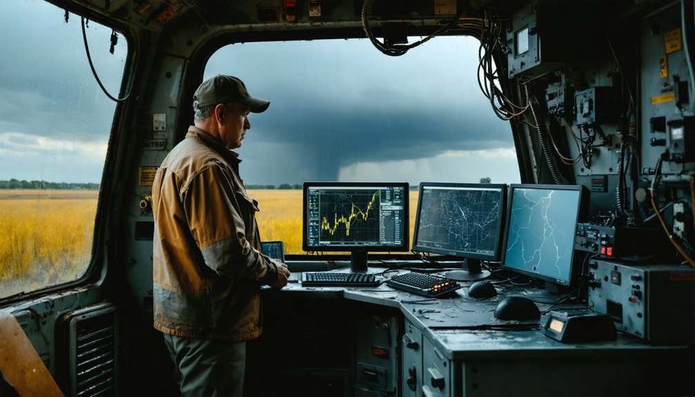
Since the 1960s, spotter communication and reporting infrastructure has evolved from basic radio relay into a multi-layered digital architecture.
You’re now operating within systems that merge ground-truth observations with satellite imagery and automated sensor feeds through real-time data integration pipelines.
Modern spotter networks merge ground-truth observations with satellite imagery and automated sensor feeds through real-time data integration pipelines.
Three core technologies define today’s networks:
- Spotter Network (2006): GPS-tagged reports transmitted digitally to NWS forecast offices within seconds of submission.
- Satellite imagery overlays: Allow spotters and forecasters to cross-reference surface observations against mesoscale convective signatures simultaneously.
- Data integration platforms: Consolidate radar, surface reports, and atmospheric soundings into unified operational displays.
These systems transformed spotters from isolated observers into nodes within a distributed sensing architecture, giving decentralized volunteers direct influence over official severe weather decisions.
How SKYWARN’s 300,000 Spotters Operate Today
Built on a foundation laid by volunteer programs dating back to the 1940s, SKYWARN now coordinates over 300,000 trained civilian spotters across NWS forecast offices jurisdictions nationwide.
You train directly through your regional NWS office, learning to identify wall clouds, mesocyclones, hail size thresholds, and flash flood indicators.
Volunteer coordination operates at the local level, with Emergency Managers and NWS meteorologists activating spotter nets during active severe weather watches.
You report observations via ham radio, phone, or digital platforms like Spotter Network.
Meteorological innovations have expanded your reporting capabilities, allowing GPS-tagged, timestamped submissions that forecasters integrate with radar data in real time.
Your ground-truth reports remain critical because radar can’t confirm every tornado or hail event without independent human verification from trained eyes on the ground.
Frequently Asked Questions
How Long Does It Typically Take to Become a Certified SKYWARN Spotter?
You’ll typically complete SKYWARN’s certification process in a single session—training requirements demand just 2–3 hours of NWS-led instruction, after which you’re an active, qualified spotter ready to report severe weather independently.
Can Storm Spotters Legally Enter Private Property During Severe Weather Events?
Like a fence standing firm in a storm, legal boundaries don’t bend—you can’t enter private property without permission. Property rights remain intact, so you must always secure consent before crossing onto someone’s land.
Do Storm Spotters Receive Any Financial Compensation for Their Volunteer Work?
You don’t receive financial incentives as a SKYWARN spotter — it’s purely voluntary. Your volunteer recognition comes through training certifications and community impact, reinforcing that over 300,000 active spotters freely contribute their time without monetary compensation.
What Personal Safety Equipment Do Trained Storm Spotters Typically Carry?
As a trained spotter, you’ll prioritize personal safety gear including a weather radio, first aid kit, and flashlight. Emergency preparedness demands you carry backup power, maps, and protective clothing to guarantee operational independence during severe weather deployments.
Are There Age Restrictions for Joining a Storm Spotter Network?
The knowledge doesn’t specify age restrictions or volunteer requirements for joining. You’d need to contact SKYWARN or your local NWS office directly to confirm eligibility criteria, as individual network policies may vary by region.
References
- https://en.wikipedia.org/wiki/Storm_spotting
- https://www.nssl.noaa.gov/users/brooks/public_html/papers/doswellmollerbrooks.pdf
- https://en.wikipedia.org/wiki/Skywarn
- https://journals.ametsoc.org/view/journals/wefo/14/4/1520-0434_1999_014_0507_tbaeyo_2_0_co_2.xml
- https://www.celebrating200years.noaa.gov/foundations/severe_weather/welcome.html
- http://weather.ou.edu/~metr4633/Files/early_severe_thunderstorm.pdf
- https://en.wikipedia.org/wiki/National_Weather_Service
- https://www.spc.noaa.gov/history/timeline.html
- https://www.academia.edu/85317000/The_History_and_Future_of_Tornado_Warning_Dissemination_in_the_United_States
- https://ams.confex.com/ams/92Annual/webprogram/Manuscript/Paper202392/AMS2012_StormSpotter.pdf