Storm formation depends on three precise variables you need to understand: moisture, atmospheric instability, and a lifting mechanism. Forecasters measure these through CAPE indices, wind shear profiles, and vertical balloon soundings. High CAPE values above 2,500 J/kg signal explosive storm potential, while directional wind shear determines whether a storm organizes into something dangerous. Radar, satellites, and numerical models then translate raw atmospheric data into accurate predictions. There’s considerably more science driving each of these processes.
Key Takeaways
- Storm formation requires three core ingredients: moisture from oceanic evaporation, unstable air with temperature gradients, and a lifting mechanism.
- Instability indices like CAPE and CIN measure storm severity potential, with values above 2,500 J/kg signaling explosive storm dynamics.
- Wind shear organizes storms by tilting updrafts, sustaining energy, and transforming horizontal rotation into vertical patterns essential for tornado formation.
- Radar, geostationary satellites, and weather balloon soundings collectively provide real-time atmospheric data that continuously refines storm prediction accuracy.
- Climate change shifts baseline atmospheric conditions, challenging older forecasting models while advances in supercomputing improve predictive precision and responsiveness.
What Makes a Storm Form in the First Place?
Thunderstorms don’t form randomly — they require three core ingredients: moisture, unstable air, and a lifting mechanism. Understanding the storm lifecycle starts with recognizing how moisture dynamics fuel cloud formation.
Solar heating warms surface air across atmospheric layers, triggering convective lift — a primary storm trigger. As air rises, it cools, condenses, and initiates precipitation processes that can escalate storm intensity rapidly.
Solar heating ignites convective lift, sending air skyward — cooling, condensing, and rapidly escalating storm intensity.
Temperature role is critical here. Warm, moist air feeding upward creates sharp instability, while cooler air aloft amplifies vertical motion.
These environmental factors interact with broader weather patterns to determine whether a storm stays weak or explosively grows. You can’t isolate one variable — moisture, thermal gradient, and lift must align precisely.
When they do, atmospheric energy converts into organized, potentially dangerous storm systems within minutes.
The Three Core Ingredients Every Storm Needs
Every storm you see building on the horizon traces back to three non-negotiable atmospheric requirements: moisture, unstable air, and a lifting mechanism.
These storm ingredients operate as interdependent variables — remove one, and storm growth stalls completely.
Moisture sources, primarily oceanic evaporation and moisture transport from low-level wind patterns, fuel energy transfer through latent heat release during condensation.
Without sufficient humidity, atmospheric patterns can’t sustain convective development.
Unstable air exists when surface temperatures create sharp temperature-height gradients, allowing rising parcels to stay warmer than surrounding air.
Heat influence accelerates this vertical acceleration dramatically.
Lifting mechanisms — frontal boundaries, terrain, or surface convergence zones — force air upward, triggering the entire storm dynamics sequence.
You can’t have explosive convection without all three elements working simultaneously and synergistically.
How Atmospheric Instability Determines Storm Severity
When you assess atmospheric instability, you’re analyzing vertical profiles of temperature, humidity, and wind to quantify how aggressively air parcels will accelerate upward once lifted.
Wind shear—the change in wind speed or direction with altitude—determines whether that rising air organizes into discrete cells, squall lines, or rotating supercells capable of producing tornadoes.
You can measure instability indices like CAPE (Convective Available Potential Energy) and combine them with shear data to predict not just whether storms will fire, but how severe and structurally organized they’ll become.
Measuring Atmospheric Instability Levels
Atmospheric instability is the engine that drives storm severity, and forecasters measure it using a set of thermodynamic indices derived from vertical profile data collected by weather balloons.
You can track instability indicators like CAPE (Convective Available Potential Energy) and CIN (Convective Inhibition) to quantify how much energy’s available for storm dynamics.
Moisture profiles reveal how humidity varies across atmospheric layers, while temperature gradients expose where instability concentrates.
Forecasters feed this data into predictive models that simulate convective behavior before storms develop. High CAPE values combined with strong wind shear signal elevated severe weather potential.
These forecasting techniques let analysts assess storm triggering thresholds precisely, giving you actionable intelligence rather than vague outlooks.
Independent access to this data means you’re not relying solely on institutional forecasts.
Wind Shear And Storm Rotation
Wind shear doesn’t just shape how storms look—it determines whether they survive, organize, or produce violent rotation. When wind speed and direction change with altitude, the atmosphere tilts a storm’s updraft, preventing rain-cooled air from choking off its energy source. That tilt is what separates short-lived convection from sustained, organized systems.
Directional wind shear impacts are especially critical. When low-level winds shift from southerly to westerly with height, horizontal spin gets converted into vertical rotation—the mechanical foundation of supercell development.
Storm rotation dynamics intensify when this process aligns with strong instability. You’re fundamentally watching two independent atmospheric layers interact. The stronger that interaction, the greater the tornadic potential.
Understanding wind shear gives you real predictive leverage over which storms escalate and which collapse.
Vertical Profiles Predicting Severity
Wind shear tells you how storms organize—but vertical profiles tell you how severe they’ll get. By analyzing atmospheric layers from surface to upper levels, forecasters decode storm intensity before it happens.
Four vertical profile factors drive convective patterns:
- Instability indices — CAPE values above 2,500 J/kg signal explosive storm dynamics.
- Moisture gradients — Sharp humidity shifts between atmospheric layers fuel rapid updraft intensification.
- Temperature inversions — Capping layers suppress convection until pressure breaks, releasing concentrated energy.
- Wind profiles — Directional and speed changes across heights determine rotational potential.
Predictive modeling ingests these vertical measurements continuously, refining storm intensity forecasts in real time.
Weather balloons deliver this critical data, giving you the atmospheric intelligence needed to anticipate severe conditions before radar even detects developing threats.
Why Wind Shear Creates the Most Dangerous Storms

When you examine wind shear—the change in wind speed or direction with altitude—you’ll find it’s the single most critical factor separating an ordinary thunderstorm from a tornadic supercell.
Directional shear causes rising air to rotate, organizing storms into structured systems capable of producing long-track tornadoes and extreme surface winds.
Forecasters analyze vertical wind profiles using weather balloon data and model output to identify shear signatures that signal the highest-risk storm environments before convection even initiates.
Wind Shear Explained Simply
Among the atmospheric variables that forecasters analyze, wind shear consistently ranks as one of the most critical drivers of severe storm development. It’s the change in wind speed or direction across atmospheric layers that determines whether storm intensity escalates dangerously.
Understanding shear effects helps you grasp storm dynamics quickly:
- Directional shear tilts updrafts, separating inflow from outfall and sustaining longer storm cycles.
- Speed shear stretches horizontal rotation into vertical rotational patterns, triggering supercell development.
- Shear profiles measured from weather balloons reveal instability factors across multiple atmospheric layers simultaneously.
- Low-level shear concentrated below 1 km dramatically increases tornadic potential within existing storm structures.
When you analyze shear alongside moisture and temperature data, you’re identifying the precise combination that transforms ordinary thunderstorms into organized, high-impact severe weather systems.
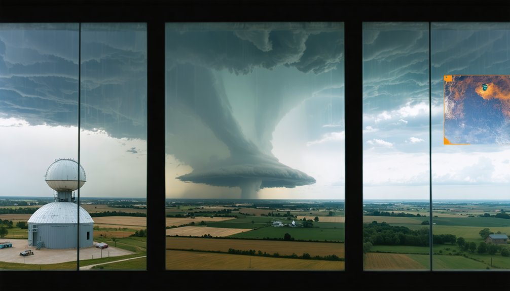
Rotating Storms and Tornadoes
The most dangerous storms on Earth trace their origins directly to wind shear‘s ability to generate atmospheric rotation. When wind patterns shift both speed and direction with altitude, horizontal rotation develops in the lower atmosphere.
Thunderstorm updrafts tilt this rotation vertically, embedding it within the supercell structure itself.
You’re now dealing with a storm lifecycle driven by rotational influence at its core. This rotating mesocyclone defines tornado dynamics by concentrating atmospheric rotation into increasingly tight columns.
Storm intensity escalates as rotation tightens, pressure drops sharply, and surface convergence strengthens.
Storm tracking data confirms supercells produce roughly 90% of significant tornadoes. Directional shear—not just speed shear—correlates most strongly with tornado formation.
Understanding this distinction lets you accurately assess which developing supercells carry genuine tornadic potential.
Forecasting Wind Shear Dangers
Wind shear doesn’t just influence storm organization—it determines whether a storm becomes genuinely lethal. When wind speed or direction changes with altitude, it directly controls storm intensity and structural behavior. You’re looking at atmospheric mechanics that separate ordinary rainfall from catastrophic events.
Wind shear impacts manifest across four critical dimensions:
- Rotation enhancement — directional shear tilts updrafts, generating mesocyclone development.
- Vertical organization — strong shear separates updraft and downdraft zones, sustaining storm longevity.
- Supercell formation — moderate-to-strong shear environments produce rotating supercells with tornadic potential.
- Rapid intensification suppression — excessive shear disrupts hurricane structure, limiting intensification.
Forecasters analyze vertical wind profiles using radiosonde balloon data to quantify shear gradients. Recognizing these patterns early gives you the advantage of acting before conditions become dangerous.
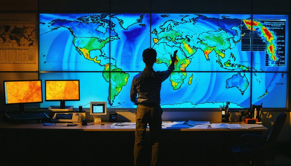
How Forecasters Map the Atmosphere Before a Storm Hits
Before a storm hits, forecasters rely on 4 key atmospheric variables—temperature, pressure, humidity, and wind—to build a picture of what’s developing overhead.
They’re not guessing; they’re systematically analyzing atmospheric layers from the surface upward to detect storm triggers before they activate.
Weather balloons launch twice daily, transmitting vertical data on temperature gradients, moisture content, and wind profiles at multiple altitudes.
Satellites simultaneously scan broad moisture patterns, while numerical models ingest all incoming data and simulate atmospheric behavior at computational scale.
You’re fundamentally watching forecasters reverse-engineer the atmosphere—identifying where instability concentrates, where lift mechanisms exist, and where energy will release.
When model output aligns with observational data, forecast confidence increases.
That precision directly translates into earlier, more accurate warnings reaching you before conditions deteriorate.
The Tools Behind Modern Storm Prediction
When you track a developing storm, you’ll rely on radar to measure precipitation density, detect hail or moisture concentration through reflectivity data, and extract storm motion via Doppler frequency shifts.
Geostationary satellites complement radar by delivering continuous, large-scale cloud and moisture imagery across regions where ground-based sensors can’t reach.
You’ll also incorporate weather balloon soundings to build vertical atmospheric profiles, feeding that observational data into numerical models running on supercomputers to simulate and refine storm behavior before it unfolds.
Radar And Satellite Monitoring
Radar and satellites form the backbone of real-time storm monitoring, giving forecasters continuous, multi-layered data on developing weather systems. Together, they deliver independent yet complementary storm tracking capabilities you can’t afford to ignore.
Here’s what each tool contributes to storm evolution analysis:
- Radar technology measures precipitation analysis through reflectivity, detecting moisture density, hail, and snow concentrations.
- Doppler radar reveals directional storm motion, identifying rotation signatures tied to tornadic development.
- Satellite imagery monitors cloud formations and moisture detection across vast regions, independent of ground infrastructure.
- Geostationary satellites provide uninterrupted data integration, capturing continuous atmospheric changes over storm-prone zones.
These systems don’t operate in isolation.
Cross-referencing radar returns with satellite-derived moisture fields sharpens your understanding of developing threats before they reach critical intensity.
Weather Balloons And Models
While radar and satellites capture horizontal storm structure across broad regions, weather balloons and numerical models give you the vertical and predictive dimensions that surface observations alone can’t provide.
Weather balloon advancements now deliver high-resolution vertical profiles of temperature, humidity, and wind across multiple atmospheric layers. That data feeds directly into supercomputer-driven numerical modeling innovations, where algorithms simulate atmospheric behavior forward in time.
You’re basically receiving a four-dimensional reconstruction of conditions that no single surface instrument could detect.
When balloon-measured instability indices align with model-predicted wind shear profiles, forecasters gain sharper, earlier warnings.
Repeatedly updating model runs against real-time observations tightens forecast accuracy considerably. Without this vertical intelligence, you’d be predicting storms using only partial information—and partial information costs lives.
How Radar and Satellites Predict Storms Together
Modern storm prediction relies on radar and satellites working in tandem, each filling gaps the other can’t address alone. Radar technology captures precipitation patterns and internal storm motion, while satellite imagery monitors broad atmospheric analysis across weather systems you can’t fully resolve at ground level.
Together, they enable real-time monitoring through data integration that sharpens storm tracking accuracy markedly. Here’s what each tool delivers:
- Radar measures reflectivity and Doppler shifts to detect hail, rotation, and storm intensity.
- Satellites track moisture movement, cloud development, and temperature gradients across large regions.
- Combined data reveals storm prediction timelines by correlating surface and upper-level atmospheric behavior.
- Continuous updates let forecasters adjust models as conditions evolve rapidly.
You get sharper warnings when both systems operate simultaneously.
How Hurricane Forecasting Differs From Thunderstorm Prediction
Hurricane forecasting and thunderstorm prediction differ fundamentally in scale, data collection methods, and lead time.
Hurricane dynamics evolve over days across ocean basins, allowing forecasters to track storm lifecycle changes using satellite imagery, aircraft reconnaissance, and dropsonde data. You’re dealing with sustained moisture sources, warm sea-surface temperatures, and complex storm intensification patterns requiring extended modeling runs.
Thunderstorm characteristics, by contrast, demand hyperlocal precision. Atmospheric conditions shift within minutes, compressing your forecasting window dramatically.
Prediction techniques for thunderstorms rely heavily on real-time radar, surface observations, and soil moisture analysis to identify triggering mechanisms.
Forecasting challenges differ sharply between both systems. Hurricanes demand large-scale steering current analysis, while thunderstorms require resolving fine-scale instability gradients.
Understanding these distinctions helps you appreciate why each storm type demands entirely separate forecasting frameworks.
Why Soil Moisture Is the Next Frontier in Storm Forecasting
Soil moisture has emerged as a critical variable in storm initiation forecasting, and a UKCEH-led analysis of 2.2 million thunderstorms explains why.
Satellite technology now captures moisture patterns at resolutions that reveal how local influences trigger rapid initiation within 30 minutes of cloud development.
Satellite technology now resolves moisture patterns precise enough to reveal what triggers a thunderstorm before it fully forms.
Here’s what the data shows about these storm triggers:
- Favorable soil moisture alignment increases explosive thunderstorm dynamics by 68%.
- Low-level wind interactions with environmental factors determine precise initiation zones.
- Predictive analytics applied to moisture patterns sharpen location-specific forecasting advancements.
- High-resolution soil-wetness monitoring strengthens warnings for flash flooding, lightning, and severe wind.
You’re looking at a forecasting shift where ground-level data directly informs storm prediction models, particularly in regions where radar coverage remains insufficient.
How Storm Prediction Keeps Getting More Accurate
Ground-level soil moisture data has sharpened where storms form, but forecasting accuracy also depends on how well the entire atmospheric column is measured and modeled.
Storm prediction advances when atmospheric research combines radar, weather balloons, satellites, and supercomputer-driven predictive models into unified data integration pipelines. You’re seeing technology advancements push forecast resolution finer, letting models detect instability triggers hours earlier.
Environmental factors like wind shear, jet-stream positioning, and sea surface temperatures feed directly into storm tracking systems, improving output reliability. Climate impact adds complexity, shifting baseline atmospheric conditions that older model assumptions don’t fully capture.
Each observational update refines the model’s next run, compounding accuracy over time. The result is a forecasting framework that’s faster, more precise, and increasingly responsive to real atmospheric behavior.
Frequently Asked Questions
Can Animals Sense Storm Formation Before Modern Instruments Detect It?
Yes, animals detect storm signals before modern instruments do. You’ll notice their animal behavior shifts as they sense pressure drops, infrasound, and electromagnetic changes—biological cues that often precede radar detection by critical minutes.
How Do Storms Behave Differently Over Mountains Versus Flat Terrain?
“What goes up must come down” — mountain effects force air upward, intensifying storms rapidly, while flat terrain allows you to see gradual development. Terrain influence shapes wind shear, moisture distribution, and storm rotation differently across each landscape.
What Role Does Air Pollution Play in Altering Storm Development Patterns?
Air pollution’s aerosols alter droplet formation, suppressing or intensifying precipitation. You’ll notice urban heat amplifies instability, creating stronger updrafts. Pollution impact reshapes moisture dynamics, disrupting natural storm patterns and complicating your ability to predict severe weather accurately.
How Long Does a Typical Thunderstorm Last Before Dissipating Completely?
You’ll find that brief calm follows fierce intensity — a typical thunderstorm lifecycle spans 30–60 minutes, though storm duration varies. Single-cell storms dissipate fastest, while multicell clusters sustain themselves considerably longer through continuous atmospheric regeneration.
Do Storms on Other Planets Follow the Same Formation Principles as Earth?
You’ll find storm dynamics share core similarities across planetary atmospheres—moisture, instability, and lifting mechanisms drive them. However, extraterrestrial weather differs considerably; Jupiter’s ammonia clouds and Venus’s sulfuric acid cycles reveal unique storm similarities and stark contrasts.
References
- https://phys.org/news/2026-03-satellite-million-thunderstorms-formation.html
- https://www.livescience.com/39135-incredible-technology-how-to-forecast-severe-storms.html
- https://gpm.nasa.gov/education/articles/how-do-hurricanes-form
- https://sotm.osta.fsu.edu/investigations/stormy-weather
- https://courses.ems.psu.edu/earth107/node/1632
- https://www.youtube.com/watch?v=TfJj2WjgHA4
- https://climateandlife.columbia.edu/news/understanding-and-predicting-hurricanes-warmer-world
- https://www.nssl.noaa.gov/education/svrwx101/thunderstorms/
- https://blogs.nature.com/blog/the-science-of-predicting-the-path-of-a-hurricane/
- https://www.reddit.com/r/weather/comments/1orbmyy/how_hurricanes_form_the_science_behind_cyclones/


